|
Observatorielunden
Observatorielunden is a park in the Vasastaden district of Stockholm, Sweden. Location It stretches over the steep hill ''Observatoriekullen'', one of the last remnants of Brunkebergsåsen, the esker that once reached across much of the district of Norrmalm but was mostly levelled during the development of that district. Observatorielunden is bordered by the streets Odengatan to the north, Sveavägen to the east, Kungstensgatan to the south, Drottninggatan to the southwest, and Norrtullsgatan, Sandåsgatan and Gyldéngatan to the west. The Old Stockholm Observatory, which dates from 1753, sits on top of the hill. Stockholm Public Library and the Stockholm School of Economics' main building lie at its edges. On the northeastern corner of the hill stands the bronze sculpture ''Kentauren'' from 1936 by Sigrid Fridman (1879-1963). At the Old Stockholm Observatory there's also a meteorological station which has measured temperature daily since 1756. This is the oldest contin ... [...More Info...] [...Related Items...] OR: [Wikipedia] [Google] [Baidu] |
Vasastan, Stockholm
Vasastaden, or colloquially Vasastan, (Swedish for "Vasa town") is a 3.00 km2 large city district in central Stockholm, Sweden, being a part of Norrmalm borough. The major parks in Vasastaden are Vasaparken and Observatorielunden near the centre and Vanadislunden and Bellevueparken in the north. History Vasastaden proper The city district, most likely named after the street Vasagatan, in its turn named after King Gustav Vasa in 1885, was still a peripheral part of the city in the early 1880s. Before the end of that decade, however, some 150 buildings had been built and only the properties along Odengatan remained vacant. The expansion was preceded by a city plan established in 1879, a slightly more modest edition of the 1866 intentions of city planner Albert Lindhagen, in its turn largely a continuation north of an original 17th-century plan. Like the Baroque plan, the new plan took little or no account of local topographic variations, and where the two failed ... [...More Info...] [...Related Items...] OR: [Wikipedia] [Google] [Baidu] |
Stockholm
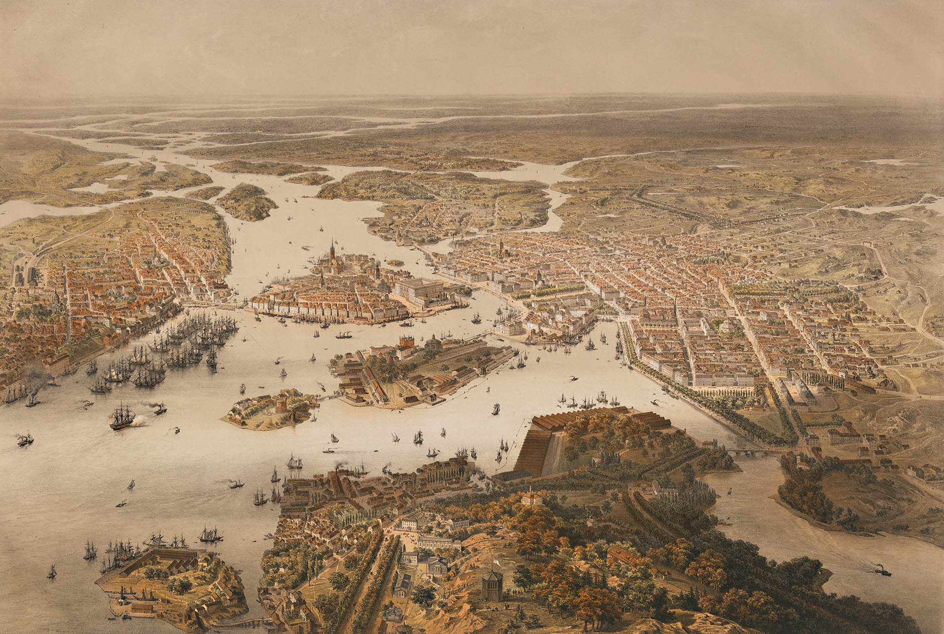
Stockholm () is the Capital city, capital and List of urban areas in Sweden by population, most populous city of Sweden as well as the List of urban areas in the Nordic countries, largest urban area in the Nordic countries. Approximately 1 million people live in the Stockholm Municipality, municipality, with 1.6 million in the Stockholm urban area, urban area, and 2.4 million in the Metropolitan Stockholm, metropolitan area. The city stretches across fourteen islands where Mälaren, Lake Mälaren flows into the Baltic Sea. Outside the city to the east, and along the coast, is the island chain of the Stockholm archipelago. The area has been settled since the Stone Age, in the 6th millennium BC, and was founded as a city in 1252 by Swedish statesman Birger Jarl. The city serves as the county seat of Stockholm County. Stockholm is the cultural, media, political, and economic centre of Sweden. The Stockholm region alone accounts for over a third of the country's Gross d ... [...More Info...] [...Related Items...] OR: [Wikipedia] [Google] [Baidu] |
Vasastaden, Stockholm
Vasastaden, or colloquially Vasastan, ( Swedish for "Vasa town") is a 3.00 km2 large city district in central Stockholm, Sweden, being a part of Norrmalm borough. The major parks in Vasastaden are Vasaparken and Observatorielunden near the centre and Vanadislunden and Bellevueparken in the north. History Vasastaden proper The city district, most likely named after the street Vasagatan, in its turn named after King Gustav Vasa in 1885, was still a peripheral part of the city in the early 1880s. Before the end of that decade, however, some 150 buildings had been built and only the properties along Odengatan remained vacant. The expansion was preceded by a city plan established in 1879, a slightly more modest edition of the 1866 intentions of city planner Albert Lindhagen, in its turn largely a continuation north of an original 17th-century plan. Like the Baroque plan, the new plan took little or no account of local topographic variations, and where the two fail ... [...More Info...] [...Related Items...] OR: [Wikipedia] [Google] [Baidu] |
Brunkebergsåsen
Brunkebergsåsen was an esker that once reached over much of Stockholm's Norrmalm district. Geologically, it is a part of the much larger Stockholmsåsen. It formed a considerable obstacle to traffic, effectively dividing Norrmalm into a western and an eastern part. Consequently, most of it has been dug away over the centuries to make room for the development of that district. The pedestrian tunnel Brunkebergstunneln and, since the 1910s, the eastern part of Kungsgatan cut through Brunkebergsåsen's southern part. Conspicuous remnants of the esker can be seen in the vicinity of Johannes kyrka, at Observatorielunden, and Vanadislunden. See also *Battle of Brunkeberg Further reading Essay, with several maps, on the city's development in Stockholm City Museum The Stockholm City Museum ( sv, Stadsmuseet i Stockholm) is a museum documenting, preserving and exhibiting the history of Stockholm. The museum is housed in Södra Stadshuset at Slussen on Södermalm. The building was ... [...More Info...] [...Related Items...] OR: [Wikipedia] [Google] [Baidu] |
Drottninggatan, Stockholm
Drottninggatan (''Queen Street'') in Stockholm, Sweden, is a major pedestrian street. It stretches north from the bridge Riksbron at Norrström, in the district of Norrmalm, to Observatorielunden in the district of Vasastaden. Composition Forming a parallel street to Vasagatan and Sveavägen, Drottninggatan is intersected by (south to north) Fredsgatan, Jakobsgatan Jakobsgatan is a street at Norrmalm in central Stockholm, Sweden. The street stretches from west-east Tegelbacken Tegelbacken is a junction at Norrmalm in Central Stockholm and the name of several streets that contains the junction. At Tegelba ..., Herkulesgatan, Vattugatan, Klarabergsgatan, Mäster Samuelsgatan, Bryggargatan, Gamla Brogatan, Kungsgatan, Stockholm, Kungsgatan, Apelbergsgatan, Olof Palmes Gata, Stockholm, Olof Palmes Gata, Barnhusgatan, Adolf Fredriks Kyrkogata, Wallingatan, Kammakargatan, Tegnérgatan, Rådmansgatan, Stockholm, Rådmansgatan, Kungstensgatan and Observatoriegatan. The maj ... [...More Info...] [...Related Items...] OR: [Wikipedia] [Google] [Baidu] |
Stockholm Observatory
The Stockholm Observatory ( sv, Stockholms observatorium, 050) is an astronomical observatory and institution in Stockholm, Sweden, founded in the 18th century and today part of Stockholm University. In 1931, the new Stockholm Observatory ( sv, Saltsjöbaden Observatory, 052), nicknamed "Saltis", was inaugurated on the Karlsbaderberget at Saltsjöbaden, near Stockholm, and operated until 2001. There are records of daily weather observations from the observatory going back to 1754. The Stockholm Observatory site at Saltsjöbaden was established with a 40-inch (102 cm) reflecting telescope from Grubb, built in 1931. Also of historical interest is a double telescope by Grubb, the 24/20-inch refractor, with has one 24-inch aperture another 20-inch on the same mount established in 1931. The old observatory is in modern times a museum (Observatory Museum) and because it is on a hill is known for a good view of city of Stockholm from the dome, and it also has some sculptures a ... [...More Info...] [...Related Items...] OR: [Wikipedia] [Google] [Baidu] |
Stockholm Public Library
Stockholm Public Library ( Swedish: ''Stockholms stadsbibliotek'' or ''Stadsbiblioteket'') is a library building in Stockholm, Sweden, designed by Swedish architect Gunnar Asplund, and one of the city's most notable structures. The name is today used for both the main library itself as well as the municipal library system of Stockholm. Architecture Discussed by a committee of which Asplund himself was a member from 1918, a design scheme was proposed in 1922, and construction began in 1924. Partly inspired by the ''Barrière Saint-Martin (Rotonde de la Villette)'' by Claude Nicolas Ledoux, Asplund abandoned earlier ideas for a dome in favour of a rotunda whose tall cylinder gives the exterior some monumentality. In the course of its planning, he reduced elements of the classical order to their most abstract geometrical forms, for the most part eliminating architectural decor. Stockholm Public Library was Sweden's first public library to apply the principle of open shelves where ... [...More Info...] [...Related Items...] OR: [Wikipedia] [Google] [Baidu] |
Norrmalm
Norrmalm is a city district in Stockholm, Sweden. History Norrmalm is part of the larger borough of Norrmalm (''Norrmalms stadsdelsområde''). The southern part of the district, Lower Norrmalm (''Nedre Norrmalm''), also known as City, constitutes the most central part of Stockholm, while Upper Norrmalm (''Övre Norrmalm'') is more residential. The name Norrmalm is first mentioned in 1288. In 1602 Norrmalm became an independent city with its own mayor and administration called the Northern Suburb (''Norra Förstaden''). The town was short-lived and in 1635 it was incorporated with Stockholm again. Norrmalm is today considered to be the central part of Stockholm. Redevelopment of Norrmalm In the 1950s and 1960s, large parts of lower Norrmalm were torn down to build a new and modern city. The demolitions were carried out swiftly and many Stockholmers still miss "old Klara" (Klara is a part of lower Norrmalm). Among the new features created as a result of the clearances w ... [...More Info...] [...Related Items...] OR: [Wikipedia] [Google] [Baidu] |
Sweden
Sweden, ; fi, Ruotsi; fit, Ruotti; se, Ruoŧŧa; smj, Svierik; sje, Sverji; sju, Sverje; sma, Sveerje or ; yi, שוועדן, Shvedn; rmu, Svedikko; rmf, Sveittiko. formally the Kingdom of Sweden, is a Nordic countries, Nordic country located on the Scandinavian Peninsula in Northern Europe. It borders Norway to the west and north, and Finland to the east. At , Sweden is the largest Nordic country and the List of European countries by area, fifth-largest country in Europe. The Capital city, capital and largest city is Stockholm. Sweden has a population of 10.5 million, and a low population density of ; around 87% of Swedes reside in urban areas in the central and southern half of the country. Sweden’s urban areas together cover 1.5% of its land area. Because the country is so long, ranging from 55th parallel north, 55°N to 69th parallel north, 69°N, the climate of Sweden is diverse. Sweden has been inhabited since Prehistoric Sweden, prehistoric times, . T ... [...More Info...] [...Related Items...] OR: [Wikipedia] [Google] [Baidu] |
Esker
An esker, eskar, eschar, or os, sometimes called an ''asar'', ''osar'', or ''serpent kame'', is a long, winding ridge of stratified sand and gravel, examples of which occur in glaciated and formerly glaciated regions of Europe and North America. Eskers are frequently several kilometres long and, because of their uniform shape, look like railway embankments. Etymology The term ''esker'' is derived from the Irish word ''eiscir'' ( Old Irish: ''escir''), which means "ridge or elevation, especially one separating two plains or depressed surfaces". The Irish word was and is used particularly to describe long sinuous ridges, which are now known to be deposits of fluvio-glacial material. The best-known example of such an ''eiscir'' is the '' Eiscir Riada'', which runs nearly the whole width of Ireland from Dublin to Galway, a distance of , and is still closely followed by the main Dublin-Galway road The synonym ''os'' comes from the Swedish word ''ås'', "ridge". Geology M ... [...More Info...] [...Related Items...] OR: [Wikipedia] [Google] [Baidu] |
Odengatan
Odengatan is a major street in the districts Vasastan and Östermalm in central Stockholm. It is connected to Vallhallavägen, from where it passes Stockholm Public Library, Odenplan, Gustaf Vasa Church and Vasaparken up to S:t Eriksplan. The street's width is about 30 metres and its length is about 1850 metres. Buildings at Odengatan *Stockholm Public Library * Gustaf Vasa Church * Latvian Embassy See also * Geography of Stockholm The City of Stockholm is situated on fourteen islands and on the banks to the archipelago where Lake Mälaren meets the Baltic Sea. The city centre is virtually situated on the water. The area of Stockholm is one of several places in Sweden wit ... Streets in Stockholm {{Stockholm-road-stub ... [...More Info...] [...Related Items...] OR: [Wikipedia] [Google] [Baidu] |


