|
Nystuen
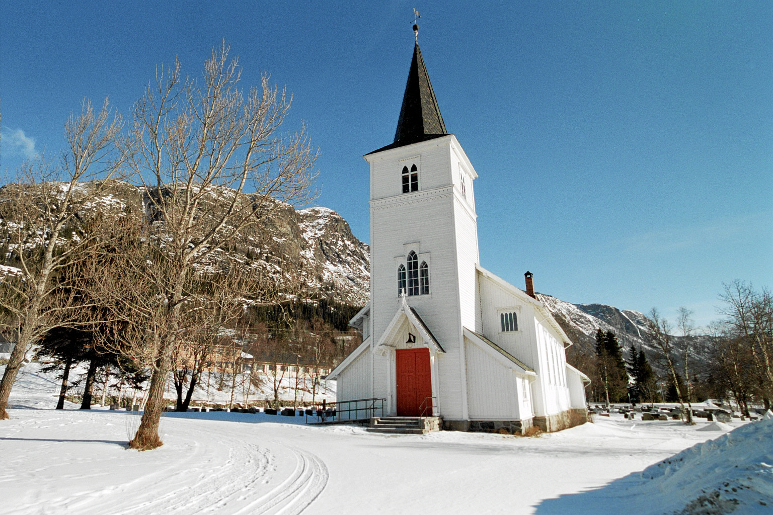
Nystuen is a village in Vang Municipality in Innlandet county, Norway. The village is located at an elevation of about above sea level. The village area sits at the western end of the lake Otrøvatnet in the Filefjell mountain area. The village is the site of an old state hotel. History From time immemorial, there has been a road through Nystuen over the Filefjell mountain area connecting Oppland in Eastern Norway with Lærdal in Western Norway. The old road followed the south side of the lake Otrøvatnet and there was an old inn where the village now sits. Traffic through the area increased during the 17th century. In 1627, the St. Thomas Church was built just west of the village. A new "modern" road was built through the area in the 1790s and this road was built to accommodate the increased use of horse and buggy transportation. This new road was built along the north side of the lake. During this time the mountain lodge in Nystuen became one of the most important in all of ... [...More Info...] [...Related Items...] OR: [Wikipedia] [Google] [Baidu] |
Vang, Innlandet
Vang is a municipality in Innlandet county, Norway. It is located in the traditional district of Valdres. The administrative centre of the municipality is the village of Vang i Valdres. Other villages in Vang include Hænsgardane, Nystuen, Øye, Ryfoss, and Tyinkrysset. The municipality is the 55th largest by area out of the 356 municipalities in Norway. Vang is the 298th most populous municipality in Norway with a population of 1,587. The municipality's population density is and its population has decreased by 1.9% over the previous 10-year period. General information On 1 January 1838, the prestegjeld of Vang was established as a civil municipality (see formannskapsdistrikt law). On 1 January 1882, a small area of Vang (population: 31) was transferred into the neighboring Øystre Slidre Municipality. The municipal boundaries have not changed since that time. Name The municipality (originally the parish) is named after the old ''Vang'' farm ( non, Vangr) since the ... [...More Info...] [...Related Items...] OR: [Wikipedia] [Google] [Baidu] |
Vang Municipality
Vang is a List of municipalities of Norway, municipality in Innlandet county, Norway. It is located in the Traditional districts of Norway, traditional district of Valdres. The administrative centre of the municipality is the village of Vang i Valdres. Other villages in Vang include Hænsgardane, Nystuen, Øye, Innlandet, Øye, Ryfoss, and Tyinkrysset. The municipality is the 55th largest by area out of the 356 municipalities in Norway. Vang is the 298th most populous municipality in Norway with a population of 1,587. The municipality's population density is and its population has decreased by 1.9% over the previous 10-year period. General information On 1 January 1838, the prestegjeld of Vang was established as a civil municipality (see formannskapsdistrikt law). On 1 January 1882, a small area of Vang (population: 31) was transferred into the neighboring Øystre Slidre Municipality. The municipal boundaries have not changed since that time. Name The municipality (origi ... [...More Info...] [...Related Items...] OR: [Wikipedia] [Google] [Baidu] |
Filefjell
Filefjell is a mountainous area in Norway. It is located between Lærdal in the Vestland county and Valdres in Innlandet county. It is the historical, as well as modern, main route, linking Western Norway and Eastern Norway. The European route E16 highway passes through Filefjell. Etymology Filefjell or sometimes Fillefjell, might be a double-name as "file" is thought to be derived from Old Norse word ''Fjáll'', the same root that evolved into the modern word "fjell". Thus Filefjell in English would be "Mountain-Mountain". Geography Filefjell stretches from Lærdal Municipality in the eastern part of Vestland county, at the innermost part of the Sognefjorden, to Vang Municipality in Valdres in the western part of Innlandet county. In the north, it borders the western part of the Jotunheimen mountain range. To the south, it meets with the Buskerud county border. The European route E16 crosses the mountain and reaches its highest point at the Varden. The road fol ... [...More Info...] [...Related Items...] OR: [Wikipedia] [Google] [Baidu] |
Counties Of Norway
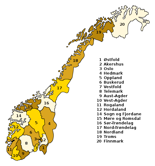
Norway is divided into 11 administrative regions, called counties (singular no, fylke, plural nb, fylker; nn, fylke from Old Norse: ''fylki'' from the word "folk", sme, fylka, sma, fylhke, smj, fylkka, fkv, fylkki) which until 1918 were known as '' amter''. The counties form the first-level administrative divisions of Norway and are further subdivided into 356 municipalities (''kommune'', pl. ''kommuner'' / ''kommunar''). The island territories of Svalbard and Jan Mayen are outside the county division and ruled directly at the national level. The capital Oslo is both a county and a municipality. In 2017, the Solberg government decided to abolish some of the counties and to merge them with other counties to form larger ones, reducing the number of counties from 19 to 11, which was implemented on 1 January 2020. This sparked popular opposition, with some calling for the reform to be reversed. The Storting voted to partly undo the reform on 14 June 2022, ... [...More Info...] [...Related Items...] OR: [Wikipedia] [Google] [Baidu] |
Lærdal
Lærdal is a municipality in Vestland county, Norway. It is located on the south side of the Sognefjorden in the traditional district of Sogn. The administrative center of the municipality is the village of Lærdalsøyri. The old Filefjell Kongevegen road passes through Lærdal on its way to Valdres and later to Oslo. The municipality is the 71st largest by area out of the 356 municipalities in Norway (with over half of this area consisting of mountains). Lærdal is the 274th most populous municipality in Norway with a population of 2,117. The municipality's population density is and its population has decreased by 4% over the previous 10-year period. The Lærdal river valley is long, running from Hemsedal ( Høgeloft mountain) and the Filefjell mountains in the east to the Sognefjorden in the west. About half of the municipal residents live in the main village of Lærdalsøyri; the rest in the small villages in the surrounding valleys such as Borgund, Ljøsne, Tønju ... [...More Info...] [...Related Items...] OR: [Wikipedia] [Google] [Baidu] |
Kunnskapsforlaget
Kunnskapsforlaget () is a Norwegian publishing company based in Oslo. Kunnskapsforlaget was established in 1975, as a partnership between H. Aschehoug & Co. (W. Nygaard) and Gyldendal Norsk Forlag. The purpose was to co-operate on publishing encyclopaedias and dictionaries. The first volume of Store norske leksikon The ''Great Norwegian Encyclopedia'' ( no, Store Norske Leksikon, abbreviated ''SNL''), is a Norwegian-language online encyclopedia. The online encyclopedia is among the most-read Norwegian published sites, with more than two million unique vis ... (SNL) was published in 1978. A total of four editions was published (the last one in 2004), before the online version was transferred to Institusjonen Fritt Ord og Sparebankstiftelsen DnB in 2011. Kunnskapsforlaget is the largest dictionary publisher in Norway. They publish both printed books, and digital dictionaries that are available through the online service Ordnett (launched in 2004). Their main languages a ... [...More Info...] [...Related Items...] OR: [Wikipedia] [Google] [Baidu] |
Store Norske Leksikon
The ''Great Norwegian Encyclopedia'' ( no, Store Norske Leksikon, abbreviated ''SNL''), is a Norwegian-language online encyclopedia. The online encyclopedia is among the most-read Norwegian published sites, with more than two million unique visitors per month. Paper editions 1978–2007 The ''SNL'' was created in 1978, when the two publishing houses Aschehoug and Gyldendal merged their encyclopedias and created the company Kunnskapsforlaget. Up until 1978 the two publishing houses of Aschehoug and Gyldendal, Norway's two largest, had published ' and ', respectively. The respective first editions were published in 1907–1913 (Aschehoug) and 1933–1934 (Gyldendal). The slump in sales for paper-based encyclopedias around the turn of the 21st century hit Kunnskapsforlaget hard, but a fourth edition of the paper encyclopedia was secured by a grant of ten million Norwegian kroner from the foundation Fritt Ord in 2003. The fourth edition consisted of 16 volumes, a ... [...More Info...] [...Related Items...] OR: [Wikipedia] [Google] [Baidu] |
Holiday Cottages
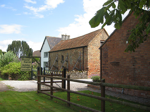
A holiday cottage, holiday home, vacation home, or vacation property is accommodation used for holiday vacations, corporate travel, and temporary housing often for less than 30 days. Such properties are typically small homes, such as cottages, that travelers can rent and enjoy as if it were their own home for the duration of their stay. The properties may be owned by those using them for a vacation, in which case the term second home applies; or may be rented out to holidaymakers through an agency. Terminology varies among countries. In the United Kingdom this type of property is usually termed a ''holiday home'' or ''holiday cottage''; in Australia, a ''holiday house/home'', or ''weekender''; in New Zealand, a ''bach'' or ''crib''. Characteristics and advantages Today's global short-term vacation property rental market is estimated to be worth $100 billion. The holiday cottage market in both Canada and the UK is highly competitive – and big business. Numbers United ... [...More Info...] [...Related Items...] OR: [Wikipedia] [Google] [Baidu] |
Widerøe
Widerøes Flyveselskap AS, trading as Widerøe, is a Norwegian airline, and is the largest regional airline operating in the Nordic countries. The airline's fleet of 40 Bombardier Dash 8 aircraft, and 3 Embraer E190-E2 aircraft, serves over 40 domestic and international destinations. Widerøe has a turnover of ; carries 2.8 million annual passengers; has 3,500 employees and performs 450 take-offs and landings each day. Public service obligation services to regional airports make up slightly less than half of Widerøe's operations. The remaining services are to primary airports in Northern Norway, and services from Sandefjord Airport, Torp and Bergen Airport, Flesland to other primary airports, and some international services from Oslo/Gardermoen, Sandefjord/Torp, Kristiansand/Kjevik, Stavanger/Sola, Bergen/Flesland and Trondheim/Værnes. The company's head offices are in Bodø, although it retains a large administrative center in Lysaker, Oslo. The main bases are Sandefjo ... [...More Info...] [...Related Items...] OR: [Wikipedia] [Google] [Baidu] |
Hemsedal
Hemsedal is a municipality in Viken county, Norway. It is part of the traditional region of Hallingdal. The administrative centre of the municipality is the village of Trøym. Hemsedal lies on the Norwegian National Road 52 (Rv 52). Hemsedal is located northwest of Oslo and from Bergen. In 1897, Hemsedal was separated from the municipality of Gol to become a municipality of its own. General information Name The Old Norse form of the name was ''Hemsudalr''. The second element is ''dalr'', which means "dale" or "valley"; the first element is usually taken as the genitive case of the river name ''Hemsa'' (now Hemsil) of unknown derivation, although Sophus Bugge believed that it might derive from the Old Norse ''hemsa'', ''hefnsa'' or ''hofn'', meaning "going to pasture". The Norwegian word ''hems'' ("bed built in a small loft room") is named after the valley of Hemsedal. Coat-of-arms The coat-of-arms is from modern times. The arms were granted on 2 October 1992 and wer ... [...More Info...] [...Related Items...] OR: [Wikipedia] [Google] [Baidu] |
Jotunheimen
Jotunheimen (; "the home of the Jötunn") is a mountainous area of roughly in southern Norway and is part of the long range known as the Scandinavian Mountains. The 29 highest mountains in Norway are all located in the Jotunheimen mountains, including the tall mountain Galdhøpiggen (the highest point in Norway). The Jotunheimen mountains straddle the border between Innlandet and Vestland counties (historically part of the old Oppland and Sogn og Fjordane counties). Tourism Jotunheimen is very popular with hikers and climbers, and the Norwegian Mountain Touring Association maintains a number of mountain lodges in the area, as well as marked trails that run between the lodges and others that run up to some of the peaks. The area has more than 50 marked trails, ranging from shorter hikes to multi day trails. The image from Gjende shows a cliff trailing down into the lake. At its base there is a popular guest house called Memurubu. The picture is taken from Gjendesheim, ... [...More Info...] [...Related Items...] OR: [Wikipedia] [Google] [Baidu] |
Ã…rdal
Årdal is a municipality in Vestland county, Norway. It is located at the end of the Årdalsfjorden in the traditional district of Sogn. The village of Årdalstangen is the administrative center of the municipality. The other main village is Øvre Årdal. The municipality of Årdal was created in 1863 when it was separated from the municipality of Lærdal. Årdal is a modern industrial community, with ties to the old society of farming and fishing. It is surrounded by dramatic nature with high mountains and waterfalls. The climate is rather mild and with less rain than normal in the west part of Norway. Årdal is a good starting point to explore the wild nature of Jotunheimen National Park, and with summer and winter activities within its boundaries. The Vettisfossen waterfall (highest in Norway) is located within the municipality. The municipality is the 119th largest by area out of the 356 municipalities in Norway. Årdal is the 178th most populous municipality in Norw ... [...More Info...] [...Related Items...] OR: [Wikipedia] [Google] [Baidu] |


