|
Nyaung U
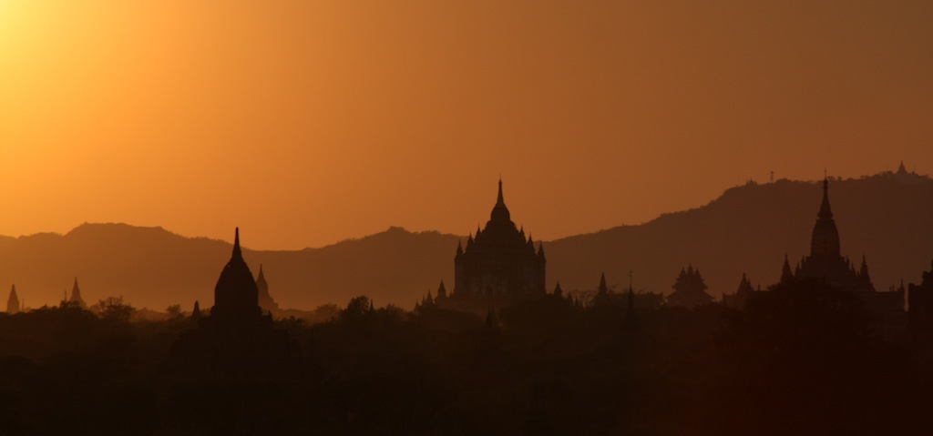
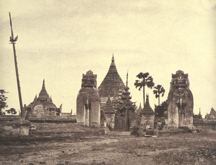
Nyaung-U () is the administrative town of Nyaung-U Township of Nyaung-U District in the Mandalay Region of central Myanmar. It lies on the eastern bank of Ayeyarwady River. It is just 4 kilometers away from old Bagan Bagan ( ; ; formerly Pagan) is an ancient city and a UNESCO World Heritage Site in the Mandalay Region of Myanmar. From the 9th to 13th centuries, the city was the capital of the Pagan Kingdom, the first kingdom that unified the regions that w ..., a popular tourist attraction. The Shwezigon Pagoda is located there. The other popular places in and around Nyaung-U were * Htilominlo Pagoda * Gubyaukgyi Pagoda * Ahlodawpyae Pagoda and * Hgnet Pyit Taung Hill It is the home of Nyaung U Airport. It can be reached by air, by railway, by bus and by boat. The 8.10 inches (203 mm) rainfall of 19 Oct 2011 was the record breaking one for past 47 years. The previous record was 5.67 inches (144 mm) of 9 Oct 1989. It has a population of 48,528. Climate Ref ... [...More Info...] [...Related Items...] OR: [Wikipedia] [Google] [Baidu] |
Administrative Divisions Of Burma
Myanmar is divided into 21 administrative divisions, which include #Regions, States, and Union Territory, seven regions, #Regions, States, and Union Territory, seven states, Naypyidaw Union Territory, one union territory, Wa Self-Administered Division, one self-administered division, and self-administered zone, five self-administered zones. Table Following is the table of government subdivisions and its organizational structure based on different regions, states, the union territory, the self-administered division, and the self-administered zones: The regions were called divisions prior to August 2010, and four of them are named after their capital city, the exceptions being Sagaing Region, Ayeyarwady Region and Tanintharyi Region. The regions can be described as ethnically predominantly Bamar people, Burman (Bamar), while the states, the zones and Wa Division are dominated by ethnic minorities. Yangon Region has the largest population and is the most densely populated. ... [...More Info...] [...Related Items...] OR: [Wikipedia] [Google] [Baidu] |
Districts Of Burma
Districts (; ) are the second-level administrative divisions of Myanmar. They are the subdivisions of the administrative divisions of Myanmar, regions and states of Myanmar. Districts are in turn are subdivided into Townships of Myanmar, townships, then towns, wards and villages. Prior to 2022, there were 76 districts in Myanmar. The number of districts was expanded to a total of 121 on 30 April 2022 through Notification 319/2022 through 333/2022 under the authority of the Ministry of Home Affairs (Myanmar), Ministry of Home Affairs with the most new districts going to Shan State and Yangon Region. The district's role is more supervisory as the townships of Myanmar, townships are the basic administrative unit of local governance. A district is led by a district administrator, a civil servant appointed through the General Administration Department, General Administration Department (GAD) of the Ministry of Home Affairs (Myanmar), Ministry of Home Affairs (MOHA). The minister of ho ... [...More Info...] [...Related Items...] OR: [Wikipedia] [Google] [Baidu] |
Nyaung-U District
Nyaung-U is a districts of Myanmar, district of Mandalay Region in central Myanmar. Townships The district contains the following two townships of Myanmar, townships: * Kyaukpadaung Township * Nyaung-U Township Districts of Myanmar Mandalay Region {{Burma-geo-stub ... [...More Info...] [...Related Items...] OR: [Wikipedia] [Google] [Baidu] |
Nyaung-U Township
Nyaung-U Township is a township of Nyaung-U District in Mandalay Region of Myanmar Myanmar, officially the Republic of the Union of Myanmar; and also referred to as Burma (the official English name until 1989), is a country in northwest Southeast Asia. It is the largest country by area in Mainland Southeast Asia and has .... Its administrative town is Nyaung-U. Notes Townships of Mandalay Region {{Mandalay-geo-stub ... [...More Info...] [...Related Items...] OR: [Wikipedia] [Google] [Baidu] |
Buddhism
Buddhism, also known as Buddhadharma and Dharmavinaya, is an Indian religion and List of philosophies, philosophical tradition based on Pre-sectarian Buddhism, teachings attributed to the Buddha, a wandering teacher who lived in the 6th or 5th century Before the Common Era, BCE. It is the Major religious groups, world's fourth-largest religion, with about 500 million followers, known as Buddhists, who comprise four percent of the global population. It arose in the eastern Gangetic plain as a movement in the 5th century BCE, and gradually spread throughout much of Asia. Buddhism has subsequently played a major role in Asian culture and spirituality, eventually spreading to Western world, the West in the 20th century. According to tradition, the Buddha instructed his followers in a path of bhavana, development which leads to Enlightenment in Buddhism, awakening and moksha, full liberation from ''Duḥkha, dukkha'' (). He regarded this path as a Middle Way between extremes su ... [...More Info...] [...Related Items...] OR: [Wikipedia] [Google] [Baidu] |
Time In Burma
Myanmar Standard Time (, ), formerly Burma Standard Time (BST), is the standard time in Myanmar, 6.5 hours ahead of UTC. Myanmar Standard Time (MMT) is calculated on the basis of 97°30′E longitude.MFF 2002: 1 MMT is used all year round, as Myanmar does not observe daylight saving time.USNAO 2013: 262 History Pre-colonial period Myanmar did not have a standard time before the British colonial period. Each region kept its own local mean time, according to the Burmese calendar rules: sunrise, noon, sunset and midnight.(Clancy 1906: 57): The Burmese calendar recognizes two types of day: astronomical and civil. The mean Burmese astronomical day is from midnight to midnight, and represents 1/30th of a synodic month or 23 hours, 37 minutes and 28.08 seconds. The civil day comprises two halves, the first half beginning at sunrise and the second half at sunset. The day was divided into eight 3-hour segments called ''baho'' (ဗဟို), or sixty 24-minute segments called ''n ... [...More Info...] [...Related Items...] OR: [Wikipedia] [Google] [Baidu] |
Mandalay Region
Mandalay Region (, ; formerly Mandalay Division) is an administrative divisions of Myanmar, administrative division of Myanmar. It is located in the center of the country, bordering Sagaing Region and Magway Region to the west, Shan State to the east, and Bago Region and Kayin State to the south. The regional capital is Mandalay. To the south of the region lies the national capital of Naypyidaw. The division consists of eleven districts, which are subdivided into 28 townships and 2,320 wards and village-tracts. Mandalay Region is important in Economy of Myanmar, Myanmar's economy, accounting for 15% of the national economy. It is under the administration of the Mandalay Region Government. History The history of Mandalay Region is the same as that of much of Upper Myanmar except that for much of Burmese history, the political power emanated out of royal capitals located in Mandalay Region. The country's present capital, Naypyidaw, and most former royal capitals of the Burmese nati ... [...More Info...] [...Related Items...] OR: [Wikipedia] [Google] [Baidu] |
Myanmar
Myanmar, officially the Republic of the Union of Myanmar; and also referred to as Burma (the official English name until 1989), is a country in northwest Southeast Asia. It is the largest country by area in Mainland Southeast Asia and has a population of about 55 million. It is bordered by India and Bangladesh to its northwest, China to its northeast, Laos and Thailand to its east and southeast, and the Andaman Sea and the Bay of Bengal to its south and southwest. The country's capital city is Naypyidaw, and its largest city is Yangon (formerly Rangoon). Early civilisations in the area included the Tibeto-Burman-speaking Pyu city-states in Upper Myanmar and the Mon kingdoms in Lower Myanmar. In the 9th century, the Bamar people entered the upper Irrawaddy River, Irrawaddy valley, and following the establishment of the Pagan Kingdom in the 1050s, the Burmese language and Culture of Myanmar, culture and Buddhism in Myanmar, Theravada Buddhism slowly became dominant in the co ... [...More Info...] [...Related Items...] OR: [Wikipedia] [Google] [Baidu] |
Ayeyarwady River
The Irrawaddy River (, , Ayeyarwady) is the principal river of Myanmar, running through the centre of the country. Myanmar’s most important commercial waterway, it is about 1,350 miles (2,170 km) long. Originating from the confluence of the N'mai and Mali rivers, it flows from north to south before emptying through the Irrawaddy Delta in the Ayeyarwady Region into the Andaman Sea. Its drainage basin of about covers 61% of the land area of Burma, and contains five of its largest cities. As early as the sixth century, the river was used for trade and transport, and an extensive network of irrigation canals was developed to support agriculture. The river is still of great importance as the largest commercial waterway of Myanmar. It also provides important ecosystem services to different communities and economic sectors, including agriculture, fisheries, and tourism. In 2007, Myanmar's military dictatorship signed an agreement for the construction of seven hydroelectric d ... [...More Info...] [...Related Items...] OR: [Wikipedia] [Google] [Baidu] |
Bagan
Bagan ( ; ; formerly Pagan) is an ancient city and a UNESCO World Heritage Site in the Mandalay Region of Myanmar. From the 9th to 13th centuries, the city was the capital of the Pagan Kingdom, the first kingdom that unified the regions that would later constitute Myanmar. During the kingdom's height between the 11th and 13th centuries, more than 10,000 Buddhist temples, Burmese pagoda, pagodas and Kyaung, monasteries were constructed in the Bagan plains alone, of which the remains of over 2200 temples and pagodas survive. The Bagan Archaeological Zone is a main attraction for Tourism in Myanmar, the country's nascent tourism industry. Etymology Bagan is the present-day Burmese dialects#Dialects, standard Burmese pronunciation of the Burmese word ''Pugan'' ( my-Mymr, ပုဂံ), derived from Old Burmese ''Pukam'' ( my-Mymr, ပုကမ်). Its classical Pali name is ''Arimaddanapura'' ( my-Mymr, အရိမဒ္ဒနာပူရ, lit. "the City that Tramples on Enemies ... [...More Info...] [...Related Items...] OR: [Wikipedia] [Google] [Baidu] |
Shwezigon Pagoda
The royal Shwezigon Pagoda or Shwezigon Paya ( my-Mymr, ရွှေစည်းခုံဘုရား ) is a Buddhist stupa located in Nyaung-U, Myanmar. A prototype of Burmese stupas, it consists of a circular gold leaf-gilded stupa surrounded by smaller temples and shrines. Construction of the Shwezigon Pagoda began during the reign of King Anawrahta (r. 1044–1077), the founder of the Pagan Empire, in 1059–1060 and was completed in 1102, during the reign of his son King Kyansittha. Over the centuries the pagoda had been damaged by many earthquakes and other natural calamities, and has been refurbished several times. In recent renovations it has been covered by more than 30,000 copper plates. However, the lowest level terraces have remained as they were. This pagoda, a sacred Buddhist religious place, is believed to enshrine a bone and tooth of Gautama Buddha.Some believe it is a replica of the Tooth Relic sent as a gift by the King of Sri Lanka. The pagoda is in the ... [...More Info...] [...Related Items...] OR: [Wikipedia] [Google] [Baidu] |
Nyaung U Airport
Nyaung U Airport () is an airport located in Nyaung-U (or Nyaung Oo), a town in the Mandalay Region, Myanmar. It is the primary air gateway to the ancient sites of Bagan and surrounding areas. It also known as Nyaung Oo Airport or Bagan Nyaung Oo Airport. Facilities The airport is at an elevation of above mean sea level. It has one runway designated 18/36 with an asphalt Asphalt most often refers to: * Bitumen, also known as "liquid asphalt cement" or simply "asphalt", a viscous form of petroleum mainly used as a binder in asphalt concrete * Asphalt concrete, a mixture of bitumen with coarse and fine aggregates, u ... surface measuring . Airlines and destinations References External links * {{authority control Airports in Myanmar Mandalay Region Bagan ... [...More Info...] [...Related Items...] OR: [Wikipedia] [Google] [Baidu] |


