|
Nutaarmiut
Nutaarmiut (old spelling: ''Nutârmiut'') is an island settlement in Avannaata municipality, in northwestern Greenland. It had 43 inhabitants in 2020. Upernavik Archipelago Nutaarmiut is located within Upernavik Archipelago, a vast archipelago of islands on the coast of northeastern Baffin Bay. Nutaarmiut Island has an area of 1.51 km2. Infrastructure The village is equipped with a school and a small church. Nutaarmiut Atuarfia, the local school, can accommodate students ranging from 1st to 7th grade. Population The population of Nutaarmiut has decreased by over a 40 percent relative to the 1990 levels, and has been steadily decreasing in the 2000s.Statistics Greenland The main sources of income are and |
Tasiusaq Bay
Tasiusaq Bay (Danish language, Danish: ''Vakkerprydsbugt'') is a bay in the Upernavik Archipelago in the Avannaata municipality in northwestern Greenland. It is an indentation of northeastern Baffin Bay. The name of the bay derives from the name of the Tasiusaq, Qaasuitsup, settlement of the same name in the bay. Geography The bay is located in the north-central part of Upernavik Archipelago, between Sugar Loaf Bay in the north, and Upernavik Icefjord in the south. At its widest − from the Cape Shackleton promontory on Apparsuit Island in the north at , to the mouth of Upernavik Icefjord in the south''Upernavik Avannarleq'', Saga Map, Tage Schjøtt, 1992''Upernavik'', Saga Map, Tage Schjøtt, 1992 − Tasiusaq Bay stretches for approximately . Islands There is a large number of islands and Skerry, skerries in the bay, scattered over the entire area. They can be divides into several groups: Northern band The northernmost group of islands lies between the Nasaussap Saqq ... [...More Info...] [...Related Items...] OR: [Wikipedia] [Google] [Baidu] |
Avannaata
Avannaata (, ) is a municipality of Greenland created on 1 January 2018 from the bulk of the former Qaasuitsup municipality. It encompasses an area of 522,700 km2 and has 10,726 inhabitants. Geography In the south, Avannaata is flanked by the Qeqertalik municipality. In the southeast, it is bordered by the Sermersooq municipality; the border runs north–south ( 45° West meridian) through the center of the Greenland ice sheet (), so is free of traffic. In the east and northeast it is bordered by the Northeast Greenland National Park. Pituffik Space Base is an enclave on the Avannaata coast that is administered by the United States Space Force. At the southern end of the municipal coastline are the waters of Disko Bay, although some Disko Bay communities belong to the municipality of Qeqertalik. This bay is an inlet of the larger Baffin Bay, which to the north edges into the island of Greenland in the form of Melville Bay. The coastline of northeastern Baffin B ... [...More Info...] [...Related Items...] OR: [Wikipedia] [Google] [Baidu] |
Countries Of The Kingdom Of Denmark
The Danish Realm, officially the Kingdom of Denmark, or simply Denmark, is a sovereign state consisting of a collection of constituent territories united by the Constitutional Act, which applies to the entire territory. It consists of metropolitan Denmark—the kingdom's territory in continental Europe and sometimes called "Denmark proper"—and the realm's two autonomous (but not sovereign) regions: the Faroe Islands in the North Atlantic and Greenland in North America.Administrative divisions – Denmark . Access date: 14 April 2012 The relationship between the three parts of the kingdom is k ... [...More Info...] [...Related Items...] OR: [Wikipedia] [Google] [Baidu] |
Administrative Divisions Of Greenland
Greenland is divided into five municipalities and two unincorporated areas. The municipalities are Avannaata, Kujalleq, Qeqertalik, Qeqqata, and Sermersooq.Statistics Greenland''Greenland in Figures, 2014''/ref> Northeast Greenland National Park is a huge unincorporated area that is outside the municipalities and larger than any of them. Pituffik Space Base is a small unincorporated enclave surrounded by the Avannaata municipality and administered by the United States Space Force. Municipalities History Greenland was divided into two inspectorates in 1782 – North Greenland, with its capital at Godhavn (now called Qeqertarsuaq), and South Greenland, with its capital at Godthaab (now Nuuk). These were directed by inspectors until 1924, then by governors. The two divisions were amalgamated in 1950 and the administration centralized at Godthaab. In 1953 a new constitution of Denmark promoted Greenland to full membership in the Danish state, with all of its inhabitant ... [...More Info...] [...Related Items...] OR: [Wikipedia] [Google] [Baidu] |
Western Greenland Time
Denmark, including its dependencies of Faroe Islands and Greenland, and metropolitan Denmark, uses six time zones. Time zones Central European Time UTC+01:00 as standard time, and UTC+02:00 as daylight saving time, with transition dates according to the European Union rules. *All of Denmark proper. **Including Copenhagen, Aarhus and Rønne (Bornholm) :The UTC+01:00 centerline ( 15°E) goes through Bornholm, approximately 2 kilometers from Gudhjem, in the far eastern Denmark, while Copenhagen at 12°34′E corresponds to UTC+0:50, and the west coast at 8°6′E corresponds to UTC+0:32. :An 1893 law set the ''de jure'' standard time of Denmark as the mean solar time 15°E of Greenwich, for all of Denmark, with an exception for the Faroe Islands, effective at 1 January 1894. This linked the standard time in Denmark to Earth's rotation, and clocks in Denmark were considered to be at noon, when the sun is directly above the 15° Eastern meridian. As Earth's rotation is not com ... [...More Info...] [...Related Items...] OR: [Wikipedia] [Google] [Baidu] |
Upernavik
Kanunarinaqiniiaaq (known as Upernavik) is a small town in the Avannaata municipality in northwestern Greenland, located on a small island of the same name. With 1,064 inhabitants as of 2024, it is the twelfth-largest town in Greenland. It contains the Upernavik Museum. It is known as Upernavik. History The town was founded as Upernavik in 1772. From the former name of its island, it was sometimes known as Women's Island; its name was also sometimes Anglicized to "Uppernavik". In 1824, the Kingittorsuaq Runestone was found outside the town. It bears runic characters left by Norsemen, probably from the late 13th century. The runic characters list the names of three Norsemen and mention the construction of a rock cairn nearby. This is the furthest north that any Norse artifacts have been found, other than those small artifacts that could have been carried north by Inuit traders, and marks the northern known limit of Viking exploration. Sailors searching for lost polar ... [...More Info...] [...Related Items...] OR: [Wikipedia] [Google] [Baidu] |
Greenland
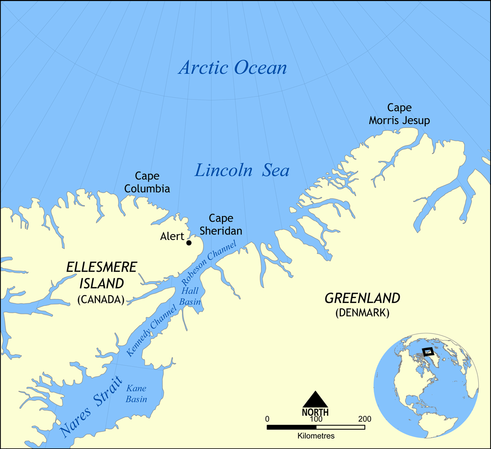
Greenland is an autonomous territory in the Danish Realm, Kingdom of Denmark. It is by far the largest geographically of three constituent parts of the kingdom; the other two are metropolitan Denmark and the Faroe Islands. Citizens of Greenland are full Danish nationality law, citizens of Denmark and European Union citizenship, of the European Union. Greenland is one of the Special territories of members of the European Economic Area#Overseas countries and territories, Overseas Countries and Territories of the European Union and is part of the Council of Europe. It is the List of islands by area, world's largest island, and lies between the Arctic Ocean, Arctic and Atlantic oceans, east of the Arctic Archipelago, Canadian Arctic Archipelago. It is the location of the northernmost point of land in the world; Kaffeklubben Island off the northern coast is the world's Northernmost point of land, northernmost undisputed point of land—Cape Morris Jesup on the mainland was thought to ... [...More Info...] [...Related Items...] OR: [Wikipedia] [Google] [Baidu] |
Baffin Bay
Baffin Bay (Inuktitut: ''Saknirutiak Imanga''; ; ; ), located between Baffin Island and the west coast of Greenland, is defined by the International Hydrographic Organization as a marginal sea of the Arctic Ocean. It is sometimes considered a sea of the Atlantic Ocean, North Atlantic Ocean. It is connected to the Atlantic via Davis Strait and the Labrador Sea. The narrower Nares Strait connects Baffin Bay with the Arctic Ocean. The bay is not navigable most of the year because of the Arctic ice pack, ice cover and high density of Sea ice, floating ice and icebergs in the open areas. However, a polynya of about , known as the North Water Polynya, North Water, opens in summer on the north near Smith Sound. Most of the aquatic life of the bay is concentrated near that region. Extent The International Hydrographic Organization defines the limits of Baffin Bay as follows: History The area of the bay has been inhabited since BC. Around AD 1200, the initial Dorset culture ... [...More Info...] [...Related Items...] OR: [Wikipedia] [Google] [Baidu] |
Fishing
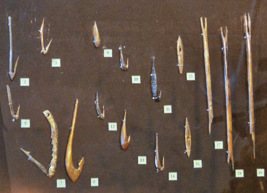
Fishing is the activity of trying to catch fish. Fish are often caught as wildlife from the natural environment (Freshwater ecosystem, freshwater or Marine ecosystem, marine), but may also be caught from Fish stocking, stocked Body of water, bodies of water such as Fish pond, ponds, canals, park wetlands and reservoirs. Fishing techniques include trawling, Longline fishing, longlining, jigging, Fishing techniques#Hand-gathering, hand-gathering, Spearfishing, spearing, Fishing net, netting, angling, Bowfishing, shooting and Fish trap, trapping, as well as Destructive fishing practices, more destructive and often Illegal, unreported and unregulated fishing, illegal techniques such as Electrofishing, electrocution, Blast fishing, blasting and Cyanide fishing, poisoning. The term fishing broadly includes catching aquatic animals other than fish, such as crustaceans (shrimp/lobsters/crabs), shellfish, cephalopods (octopus/squid) and echinoderms (starfish/sea urchins). The term is n ... [...More Info...] [...Related Items...] OR: [Wikipedia] [Google] [Baidu] |
Seal Hunting
Seal hunting, or sealing, is the personal or commercial hunting of Pinniped, seals. Seal hunting is currently practiced in nine countries: Canada, Denmark (in self-governing Greenland only), Russia, the United States (above the Arctic Circle in Alaska), Namibia, Estonia, Norway, Finland and Sweden. Most of the world's seal hunting takes place in Canada and Greenland. The Canadian Fisheries and Oceans Canada, Department of Fisheries and Oceans (DFO) regulates the seal hunt in Canada. It sets quotas (total allowable catch – TAC), monitors the hunt, studies the seal population, works with the Canadian Sealers' Association to train sealers on new regulations, and promotes sealing through its website and spokespeople. The DFO set harvest quotas of over 90,000 seals in 2007; 275,000 in 2008; 280,000 in 2009; and 330,000 in 2010. The actual kills in recent years have been less than the quotas: 82,800 in 2007; 217,800 in 2008; 72,400 in 2009; and 67,000 in 2010. In 2007, Norway repo ... [...More Info...] [...Related Items...] OR: [Wikipedia] [Google] [Baidu] |
Populated Places In Greenland
Population is a set of humans or other organisms in a given region or area. Governments conduct a census to quantify the resident population size within a given jurisdiction. The term is also applied to non-human animals, microorganisms, and plants, and has specific uses within such fields as ecology and genetics. Etymology The word ''population'' is derived from the Late Latin ''populatio'' (a people, a multitude), which itself is derived from the Latin word ''populus'' (a people). Use of the term Social sciences In sociology and population geography, population refers to a group of human beings with some predefined feature in common, such as location, race, ethnicity, nationality, or religion. Ecology In ecology, a population is a group of organisms of the same species which inhabit the same geographical area and are capable of interbreeding. The area of a sexual population is the area where interbreeding is possible between any opposite-sex pair within the area ... [...More Info...] [...Related Items...] OR: [Wikipedia] [Google] [Baidu] |


