|
Novalesa
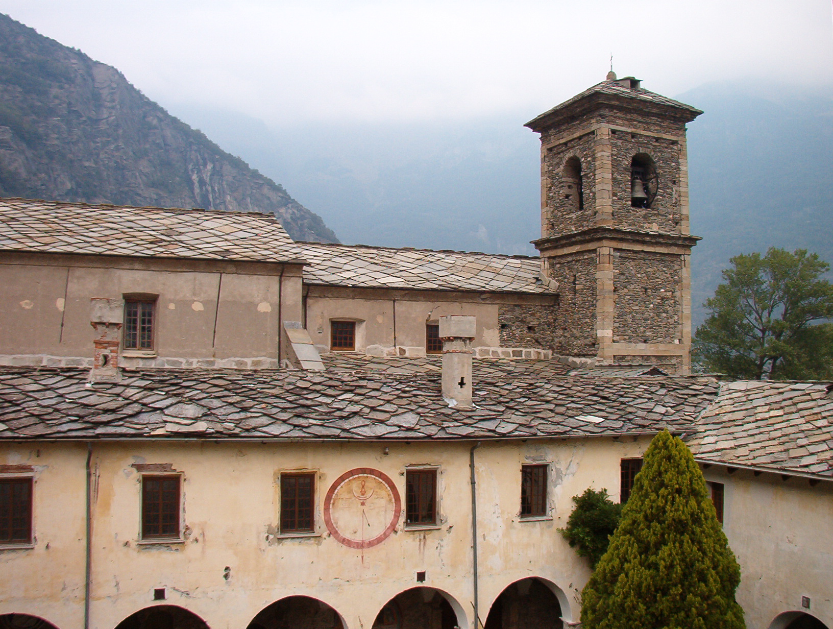
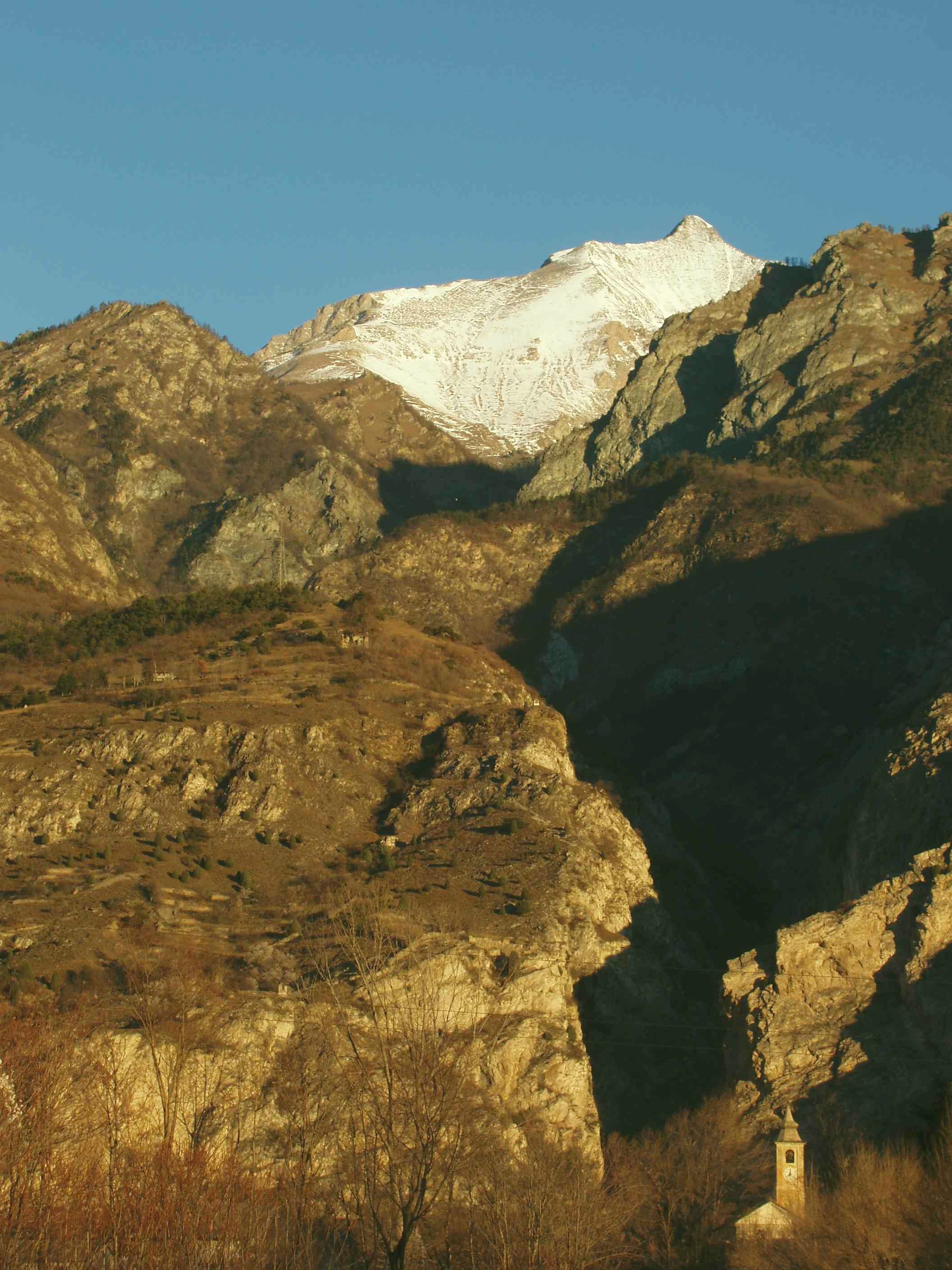
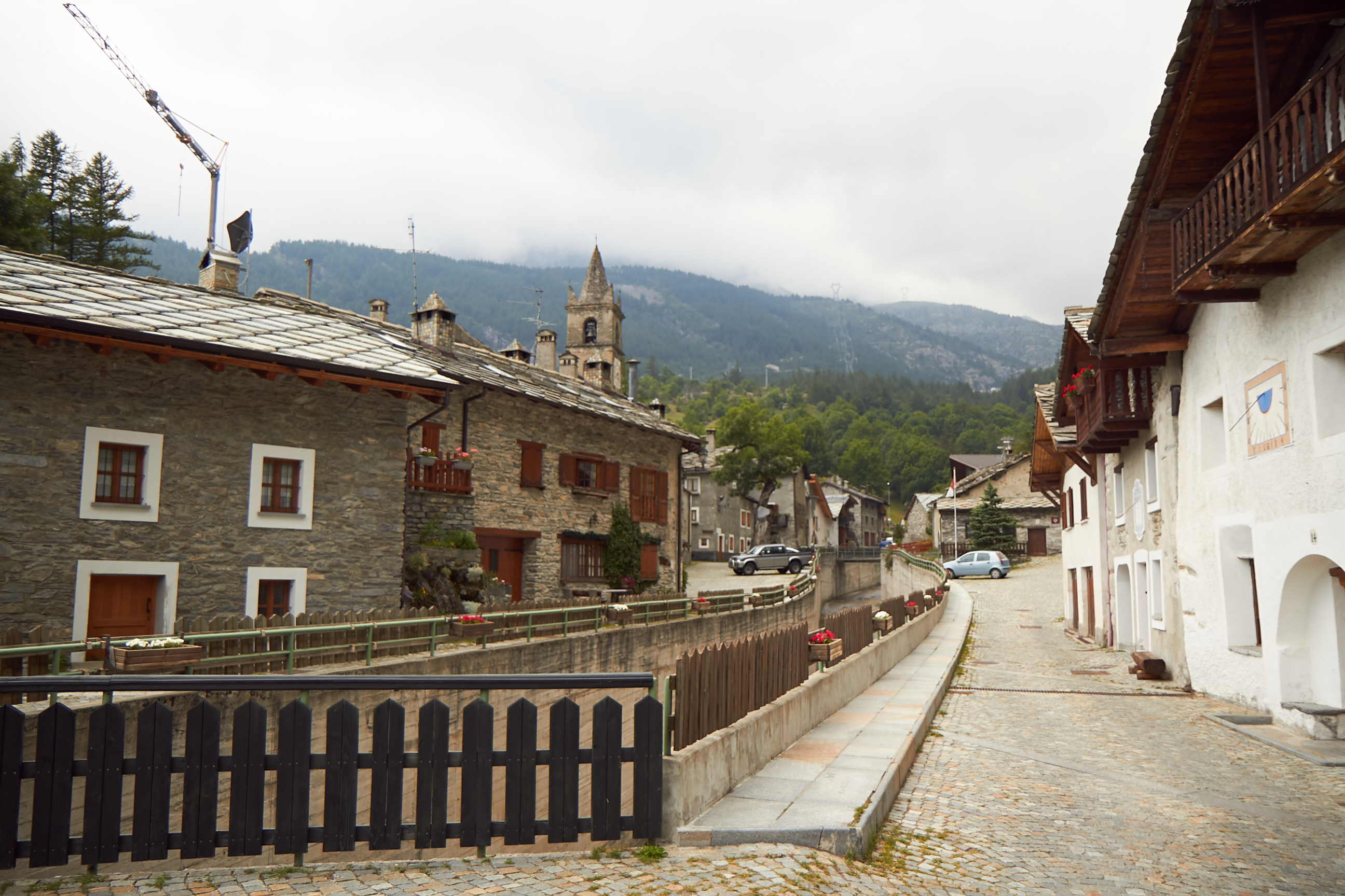
Novalesa (, , ) is a ''comune'' (municipality) in the Metropolitan City of Turin in the Italian region Piedmont, located about 60 km west of Turin, on the border with France. Novalesa borders the following municipalities: Bessans (France), Lanslebourg-Mont-Cenis (France), Mompantero, Moncenisio, Usseglio, and Venaus. Near the village is Novalesa Abbey, a Benedictine monastery founded in 726. Acting in effect as a forward position for the Franks near their border with the territory of the Lombards, the abbey was strategically placed to control the Via Francigena. The parish church constitutes a site of the Museum of Alpine Religious Art (part of the Diocesan Museum System of Susa). Near the village there are very high waterfalls, formed by the streams coming from Rocciamelone mountain. Twin towns * Le Monêtier-les-Bains, France France, officially the French Republic, is a country located primarily in Western Europe. Overseas France, Its overseas regions and te ... [...More Info...] [...Related Items...] OR: [Wikipedia] [Google] [Baidu] |
Novalesa Abbey
Novalesa Abbey () is a Benedictine monastery in the Metropolitan City of Turin, Piedmont, Italy. It was founded in 726, and dedicated to Saint Peter and Saint Andrew. Novalesa is in the Val di Susa, on the route to the Mont Cenis Pass, and on the former Via Francigena, a major pilgrimage road. The abbey is still in operation as an active Benedictine monastery. History The abbey was officially founded in a position commanding the Mont Cenis Pass on 30 January 726, by a Frankish lord Abbo of Provence, whose parchment deed of gift is still preserved in the State Archives of Turin. The founding monks, Benedictines, are thought to have come from the Grenoble region. It became an important monastery with Charlemagne, who stayed there. The abbey enriched its possessions through donations and privileges from the Frankish rulers Pepin the Short, Charlemagne and Louis the Pious until its possessions reached the western Ligurian mainland. In 817 it adopted the Benedictine rule. The ... [...More Info...] [...Related Items...] OR: [Wikipedia] [Google] [Baidu] |
Metropolitan City Of Turin
The Metropolitan City of Turin (; Piedmontese language, Piedmontese: ''sità metropolitan-a 'd Turin'') is a Metropolitan cities of Italy, metropolitan city in the Piedmont region of Italy. Its capital is the city of Turin. It replaced the province of Turin and comprises 312 ''comuni'' (: ''comune''). It was created by the Metropolitan cities of Italy, reform of local authorities (Law 142/1990) and established by the Law 56/2014. It has been officially operating since 1 January 2015. It has 2,207,873 inhabitants. The Metropolitan City of Turin is headed by the Metropolitan Mayor (''sindaco metropolitano'') and by the Metropolitan Council (''consiglio metropolitano''). Since 27 October 2021, Stefano Lo Russo has served as the mayor of the capital city, succeeding Chiara Appendino. The largest Metropolitan City of Italy, it is the only one to border a foreign state, France. Geography It has an area of , and a total population of 2,211,114. There are 312 ''comuni'' (: ''comune'') ... [...More Info...] [...Related Items...] OR: [Wikipedia] [Google] [Baidu] |
Rocciamelone
Rocciamelone (, or ''Roche Melon'') is a 3,538 m high mountain in Piedmont, Italy, near the border between Italy and France. Geography Rocciamelone is located between Val di Susa and Maurienne, 50 km west of Turin. Its summit is the tripoint where the comunes of Usseglio, Novalesa and Mompantero meet. The international border crosses the ''Glacier de Rochemelon'' 1 kilometer north of the summit, making it appear that the border is not following the watershed precisely in this sector. However, the glacier is draped over a ridge that is the true watershed and is precisely followed by the borderline. SOIUSA classification According to the SOIUSA (''International Standardized Mountain Subdivision of the Alps'') the mountain can be classified in the following way: * main part = Western Alps * major sector = North Western Alps * section = Graian Alps * subsection = Southern Graian Alps * supergroup = catena Rocciamelone-Charbonnel * group = gruppo del Rocciam ... [...More Info...] [...Related Items...] OR: [Wikipedia] [Google] [Baidu] |
Roman Catholic Diocese Of Susa
The Diocese of Susa () is a Latin diocese of the Catholic Church in Piedmont (Italy) that was established in 1772. It is a suffragan of the archdiocese of Turin. The diocese and the city of Susa lie on the main route that leads to Italy from the Mont Cenis Pass and the Col de Montgenèvre. History In early medieval days, Susa seems to have belonged to the Diocese of Maurienne, and was not separated from it until after the conquest of Italy by Charlemagne in 784. The Abbey of St. Justus having been erected in 1029, the abbot had quasi-episcopal jurisdiction. The Benedictines were succeeded by the Canons Regular, and under Pope Benedict XIV the Canons Regular were replaced by secular canons. He ordered that they form a Collegiate Chapter, consisting of four dignities (Archdeacon, Archpriest, Provost, and Treasurer) and fourteen Canons. On 3 August 1772 a diocese was created by Pope Clement XIV in the bull ''Quod nobis'' out of this prelacy nullius, ''ex monasterio abbatia nunc ... [...More Info...] [...Related Items...] OR: [Wikipedia] [Google] [Baidu] |
Moncenisio (commune)
Moncenisio (, , ) is the smallest ''comune'' (municipality) in the Metropolitan City of Turin in the Italy, Italian region of Piedmont, located about west of Turin, on the border with France, in Val Cenischia. Moncenisio borders the following municipalities: Val-Cenis (France), Novalesa, and Venaus. References External links Official website Cities and towns in Piedmont {{Turin-geo-stub ... [...More Info...] [...Related Items...] OR: [Wikipedia] [Google] [Baidu] |
Usseglio
Usseglio (, , ) is a ''comune'' (municipality) in the Metropolitan City of Turin in the Italian region Piedmont, located about northwest of Turin, on the border with France. It borders with the following municipalities: Balme, Bessans (France), Bruzolo, Bussoleno, Chianocco, Condove, Lemie, Mompantero, Novalesa. What to do Usseglio hosts the only Miniature golf 18-hole course in the area with night-time lighting and table tennis tables. See also * Punta Sulè * Rocciamelone * Lago di Malciaussia *Viù Viù is a ''comune'' (municipality) in the Metropolitan City of Turin in the Italian region Piedmont, located about northwest of Turin. Viù's central square used to feature a wooden statue of Pinocchio, which is 6.53 meters tall and weighs ab ... References Cities and towns in Piedmont {{Turin-geo-stub ... [...More Info...] [...Related Items...] OR: [Wikipedia] [Google] [Baidu] |
Venaus
Venaus is a ''comune'' (municipality) in Cenischia Valley (Metropolitan City of Turin) in the Italian region Piedmont, located about 50 km west of Turin, on the border with France. Venaus borders the following municipalities: Bramans (France), Giaglione, Lanslebourg-Mont-Cenis (France), Mompantero, Moncenisio, and Novalesa Novalesa (, , ) is a ''comune'' (municipality) in the Metropolitan City of Turin in the Italian region Piedmont, located about 60 km west of Turin, on the border with France. Novalesa borders the following municipalities: Bessans (France), .... File:Spadonaro di Venaus scorta la statua del patrono San Biagio durante la processione.jpg, Procession of the statue of the patron St. Blaise accompanied by a traditional ''spadonaro'' File:Spadonaro di Venaus durante la danza delle spade.jpg, One of the four traditional ''spadonari'' during "sword dance" References Cities and towns in Piedmont {{Turin-geo-stub ... [...More Info...] [...Related Items...] OR: [Wikipedia] [Google] [Baidu] |
Franks
file:Frankish arms.JPG, Aristocratic Frankish burial items from the Merovingian dynasty The Franks ( or ; ; ) were originally a group of Germanic peoples who lived near the Rhine river, Rhine-river military border of Germania Inferior, which was the most northerly province of the Roman Empire in continental Europe. These Frankish tribes lived for centuries under varying degrees of Roman hegemony and influence, but after the collapse of Roman institutions in western Europe they took control of a large empire including areas which had been ruled by Rome, and what it meant to be a Frank began to evolve. Once they were deeply established in Gaul, the Franks became a multilingual, Catholic Christian people, who subsequently came to rule over several other post-Roman kingdoms both inside and outside the old empire. In a broader sense much of the population of western Europe could eventually described as Franks in some contexts. The term "Frank" itself first appeared in the third cent ... [...More Info...] [...Related Items...] OR: [Wikipedia] [Google] [Baidu] |
Le Monêtier-les-Bains
Le Monêtier-les-Bains (; ) is a Communes of France, commune in the Hautes-Alpes Departments of France, department in southeastern France. Geography Le Monêtier-les-Bains is the highest village of the French ski resort of Serre Chevalier at 1,500m. It is situated in the Guisane Valley. Le Monêtier-Les-Bains has two hot-water springs, one at and one at , and the village has been a thermal spa since Roman times. The village is on the periphery of the Ecrins National Park. Climate Le Monêtier-les-Bains has a humid continental climate (Köppen climate classification ''Dfb''). The average annual temperature in Le Monêtier-les-Bains is . The average annual rainfall is with October as the wettest month. The temperatures are highest on average in July, at around , and lowest in January, at around . The highest temperature ever recorded in Le Monêtier-les-Bains was on 3 August 1947; the coldest temperature ever recorded was on 10 January 1945. Population Skiing Monetier's s ... [...More Info...] [...Related Items...] OR: [Wikipedia] [Google] [Baidu] |
Waterfall
A waterfall is any point in a river or stream where water flows over a vertical drop or a series of steep drops. Waterfalls also occur where meltwater drops over the edge of a tabular iceberg or ice shelf. Waterfalls can be formed in several ways, but the most common method of formation is that a river courses over a top layer of resistant bedrock before falling onto softer rock, which erodes faster, leading to an increasingly high fall. Waterfalls have been studied for their impact on species living in and around them. Humans have had a distinct relationship with waterfalls since prehistory, travelling to see them, exploring and naming them. They can present formidable barriers to navigation along rivers. Waterfalls are religious sites in many cultures. Since the 18th century, they have received increased attention as tourist destinations, sources of hydropower, andparticularly since the mid-20th centuryas subjects of research. Definition and terminology A waterfal ... [...More Info...] [...Related Items...] OR: [Wikipedia] [Google] [Baidu] |
Via Francigena
The Via Francigena (), also known as Francisca or Romea, is an ancient road and Christian pilgrimage, pilgrimage route running from the City status in the United Kingdom#Cathedral towns, cathedral city of Canterbury in England, through France and Switzerland, to Rome and then to Apulia, Italy, where there were ports of embarkation for the Holy Land. It was known in Italy as the Via Francigena ("the road that comes from France") or the Via Romea Francigena ("the road to Rome that comes from France"). In Middle Ages, medieval times it was an important road and pilgrimage route for those wishing to visit the Holy See and the tombs of the Apostles in the New Testament, apostles Saint Peter, Peter and Paul the Apostle, Paul. History of the pilgrimage to Rome In the Middle Ages, Via Francigena was the major pilgrimage route to Rome from the north. The route was first documented as the "Lombard Way", and was first called the ''Iter Francorum'' (the "Frankish Route") in the ''Itinerari ... [...More Info...] [...Related Items...] OR: [Wikipedia] [Google] [Baidu] |
Lombards
The Lombards () or Longobards () were a Germanic peoples, Germanic people who conquered most of the Italian Peninsula between 568 and 774. The medieval Lombard historian Paul the Deacon wrote in the ''History of the Lombards'' (written between 787 and 796) that the Lombards descended from a small tribe called the Winnili,: "From Proto-Germanic language, Proto-Germanic ''wikt:Reconstruction:Proto-Germanic/winnaną, winna-'', meaning "to fight, win" who dwelt in northern Germany before migrating to seek new lands. Earlier Roman-era historians wrote of the Lombards in the first century AD as being one of the Suebian peoples, also from what is now northern Germany, near the Elbe river. They migrated south, and by the end of the fifth century, the Lombards had moved into the area roughly coinciding with modern Austria and Slovakia north of the Danube. Here they subdued the Heruls and later fought frequent wars with the Gepids. The Lombard king Audoin defeated the Gepid leader Thuris ... [...More Info...] [...Related Items...] OR: [Wikipedia] [Google] [Baidu] |


