|
Nova Scotia Trunk 7
Nova Scotia Trunk 7 is part of the Canadian province of Nova Scotia's system of Trunk Highways. The route runs from Bedford to Antigonish, along the Eastern Shore for a distance of . Part of Trunk 7 is known as the Marine Drive. Route description Bedford Historically, Trunk 7 traveled from Main Road (now the Bedford Highway) to Hatchery Lane to Wardour Drive to Dartmouth Road. The route originally ran for approximately 280 kilometers. It became shorter when a new section between Wardour Drive and the future Bedford Highway was created, concurrently with when Trunk 1 ended in Halifax (until 1970). The Chickenburger was relocated when the original location was torn down, due to the creation of this new highway section. Trunk 7 was a two-lane highway between Bedford and Dartmouth until the 1960s. Dartmouth From Bedford at the intersection of Trunk 2, Trunk 7 leaves to the southeast along the eastern shore of the Bedford Basin, then climbs Magazine Hill next to the Canadian F ... [...More Info...] [...Related Items...] OR: [Wikipedia] [Google] [Baidu] |
Bedford, Nova Scotia
Bedford (pop. 36,354 ) is a former town and now a district of Halifax Regional Municipality, Halifax, Nova Scotia, Canada. It is situated on the north west shore of the Bedford Basin in the central area of the municipality. It borders the neighbouring communities of Hammonds Plains, Nova Scotia, Hammonds Plains to the west, Lower Sackville, Nova Scotia, Sackville to the north, Dartmouth, Nova Scotia, Dartmouth to the east, and Halifax, Nova Scotia, mainland Halifax to the south. Bedford was named in honour of John Russell, 4th Duke of Bedford, Secretary of State for the colonies in 1749. History The area of Bedford has evidence of Indigenous peoples dating back thousands of years. Petroglyphs are found at Bedford Petroglyphs National Historic Site. The Bedford area is known as Kwipek to the Mi'kmaq First Nation. On 21 July 1749, Father Le Loutre's War began when Edward Cornwallis arrived to establish Halifax Regional Municipality, Halifax with 13 transports. The British qui ... [...More Info...] [...Related Items...] OR: [Wikipedia] [Google] [Baidu] |
Nova Scotia Trunk 2
Trunk 2 is part of the Canadian province of Nova Scotia's system of Trunk Highways. The route runs from Halifax to Fort Lawrence on the New Brunswick border. Until the 1960s, Trunk 2 was the Halifax area's most important highway link to other provinces, and was part of a longer Interprovincial Highway 2 which ended in Windsor, Ontario. The controlled access Highway 102 and Highway 104 now carry most arterial traffic in the area, while Trunk 2 serves regional and local traffic. This highway forms part of the Glooscap Trail signed tourist route. Route description Trunk 2 begins at intersection of Connaught Avenue and Bayers Road on the Halifax Peninsula in the Halifax Regional Municipality, and travels north along Connaught Avenue and Windsor Street to Lady Hammond Road. This short section has minimal Trunk 2 signage, instead being signed as the main connection between Highway 102 and Highway 111. At the intersection of Lady Hammond Road and Windsor Street, route heads no ... [...More Info...] [...Related Items...] OR: [Wikipedia] [Google] [Baidu] |
Preston, Nova Scotia
Preston is an area in central Nova Scotia, Canada in the Halifax Regional Municipality, Nova Scotia, Halifax Regional Municipality, located on Nova Scotia Trunk 7, Trunk 7. Preston includes the subdivisions of East Preston, Nova Scotia, East Preston, North Preston, Nova Scotia, North Preston, Lake Major, Nova Scotia, Lake Major, Cherry Brook, Nova Scotia, Cherry Brook and Loon Lake, Nova Scotia, Loon Lake. The definition sometimes extends to include Lake Echo, Nova Scotia, Lake Echo. The population in 2016 was 3,223. This is a decline from 2006, when Preston had a population of 3,536. Background Preston, once known as Preston Township, previously was geographically much larger. The community's boundaries stretched westward past Westphal to Nova Scotia Highway 111, Highway 111, and eastward through what is now Lake Echo, Nova Scotia, Lake Echo and Porters Lake, Nova Scotia, Porter's Lake to Myra Road (including through East Preston, Nova Scotia, East Preston), north to North Prest ... [...More Info...] [...Related Items...] OR: [Wikipedia] [Google] [Baidu] |
Lawrencetown, Halifax County, Nova Scotia
Lawrencetown (1986 population: 2,680) is a Canadian rural community in the Halifax Regional Municipality in Nova Scotia, Canada. The settlement was established during the eve of Father Le Loutre's War and at the beginning of the French and Indian War. History Father Le Loutre's War began when Edward Cornwallis arrived to establish Halifax with 13 transports on June 21, 1749. To guard against Mi'kmaq, Acadian and French attacks on the new Protestant settlements, British fortifications were erected in Halifax (1749), Bedford ( Fort Sackville) (1749), Dartmouth (1750), Lunenburg (1753) and Lawrencetown (1754). In 1754, Nova Scotia's Lieutenant Governor Charles Lawrence, offered land grants to twenty families, who referred to their settlement as Lawrence's Town, which became Lawrencetown. The Acadians and natives resisted the British occupation of Nova Scotia and Acadia by raiding the various communities. In late April 1754, at the outbreak of the French and Indian War, Jos ... [...More Info...] [...Related Items...] OR: [Wikipedia] [Google] [Baidu] |
Nova Scotia Route 207
Route 207 is a collector road in the Canadian province of Nova Scotia. It is located in the Halifax Regional Municipality and connects Dartmouth to Porters Lake on the Eastern Shore. Route description Dartmouth Called Portland Street at its western end, the route starts at Alderney Drive ( Trunk 7) across from the city hall of the former city of Dartmouth. There it proceeds where it intersects with Prince Albert Road (Trunk 7), Alderney Drive and Canal Street. Further along, Portland Street junctions with Route 322 at Pleasant Street, and Albert Street, an area in Dartmouth called "The five corners" . It passes through the Southdale area of Dartmouth, then expands to a four-lane street where it crosses the Circumferential Highway Circumferential Highway may refer to one of the following beltways/orbital roads/ring roads: Barbados *The ABC Highway, roughly defines the boundary of metropolitan capital city Bridgetown. Canada * Nova Scotia Highway 111, known as the ''D ... [...More Info...] [...Related Items...] OR: [Wikipedia] [Google] [Baidu] |
Cole Harbour, Nova Scotia
Cole Harbour is a former village and current community located in Nova Scotia, Canada, that is part of the Halifax Regional Municipality. Geography It is situated 6 kilometres east of the central business district of Dartmouth, Nova Scotia, Dartmouth and takes its name from Cole Harbour (natural harbour), Cole Harbour, a natural harbour fronting the Atlantic Ocean. Cole Harbour is adjacent to and immediately east of the former city boundary of Dartmouth; prior to municipal amalgamation and the creation of the Halifax Regional Municipality in 1995, Cole Harbour was an unincorporated village within the Halifax County, Nova Scotia, Municipality of the County of Halifax. Because of amalgamation in the Halifax region, Canada Post recognizes most of Cole Harbour's residents as living in neighbouring Dartmouth. Transportation The centre of Cole Harbour is at the intersection of Forest Hills Parkway and Nova Scotia Route 207, Route 207 (Cole Harbour Road). A small business district ... [...More Info...] [...Related Items...] OR: [Wikipedia] [Google] [Baidu] |
Westphal, Nova Scotia
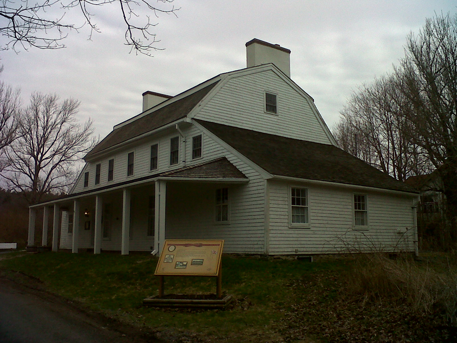
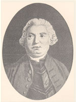
Westphal is an unincorporated community located in and adjacent to Dartmouth, Nova Scotia. Some of Westphal is considered part of Dartmouth, while some of it is considered separate from Dartmouth. The area is bound by Port Wallace in the north, Waverley Road ( Route 318) in the west, Lake Major Road in the east, and Main Street ( Trunk 7) in the south. The area also includes the watershed and water filtration plant for the Halifax Regional Water Commission that supplies drinking water for the residents of Dartmouth and surrounding communities east of Halifax Harbour. History Westphal was originally settled by farmers in the late 1700s. Its original name was Preston Road. In 1935, the Women's Institute petitioned to rename the area after George and Philip Westphal, two brothers born near Salmon River who eventually became Royal Navy admirals and who returned to the area from time to time. Like Woodlawn, Westphal was mostly a rural community until the building boom of the lat ... [...More Info...] [...Related Items...] OR: [Wikipedia] [Google] [Baidu] |
Nova Scotia Highway 111
Highway 111 is a controlled-access highway in Halifax Regional Municipality, Nova Scotia, Canada. Highway 111 varies in width from 4-12 lanes and is known colloquially as the Circumferential Highway, or, more recently, "the Circ", because it forms a partial orbital road around Dartmouth, Nova Scotia, Dartmouth. The highway runs from Pleasant Street in the neighbourhood of Woodside in the south to the A. Murray MacKay Bridge in the north. It serves as a key transportation link for Dartmouth and Halifax, Nova Scotia, Halifax. The section from Highway 118 (Woodland Avenue) to the MacKay Bridge was constructed at the same time as the bridge, opening in 1970. The portion from Pleasant Street to Woodland Avenue was built in 1960 and was twinned in 1977. Micmac Rotary The Micmac (or Mic Mac) Rotary was a traffic circle located at the intersection of Hwy 111 with Nova Scotia Route 318, Route 318 (Braemar Drive) and Nova Scotia Trunk 7, Trunk 7 (Main Street/Prince Albert Road/Grahams Gr ... [...More Info...] [...Related Items...] OR: [Wikipedia] [Google] [Baidu] |
Lake Banook
Lake Banook is a freshwater lake located in Dartmouth within the Halifax Regional Municipality in Nova Scotia, Canada. It is home to three sprint canoe and kayak clubs, two rowing clubs, and a dragon boat club. It also has a claim to be the birthplace of ice hockey. Location Lake Banook's eastern shore is bordered by Prince Albert Road (part of Trunk 7) and its western shore fronts Crichton Park, a residential neighbourhood. At the south end of the lake is a lock mechanism leading to Sullivan's Pond. At the north end of the lake a bridge carries the Highway 111 expressway, informally known as the Dartmouth Circumferential Highway over its waters. The bridge also serves as a dividing line between Lake Micmac, also referred to as Second Lake. Birch Cove Beach is the only beach on the lake that is currently supervised. Another beach, Graham's Grove, was closed in the early-1990s, as a result of poor water quality stemming from the construction of the nearby "Mic Mac Par-c ... [...More Info...] [...Related Items...] OR: [Wikipedia] [Google] [Baidu] |
Sullivan's Pond
Sullivan's Pond is an artificial lake and recreation area located in Dartmouth in Halifax Regional Municipality. It formed part of the Shubenacadie Canal. Shubenacadie Canal The pond is located northeast of Halifax Harbour at Dartmouth Cove as part of the Shubenacadie Canal system. It is the first water body in the canal system when heading from the harbour to the Bay of Fundy and was constructed as a holding pond for southbound vessels wishing to transit the remaining distance to the harbour. With an elevation several dozen metres (about 50 ft) higher than the harbour to the south, the pond was linked to the ocean by small inclined marine railway which was used to haul boats to and from Dartmouth Cove. A lock lifted boats from the pond into Lake Banook to the north. After the Shubenacadie Canal was abandoned due to unsustainable competition from the Nova Scotia Railway in the 1860s, Sullivan's Pond fell into disrepair and homes began to surround the pond. The area a ... [...More Info...] [...Related Items...] OR: [Wikipedia] [Google] [Baidu] |
Downtown Dartmouth
Downtown Dartmouth is the main central business district of Dartmouth in Halifax, Nova Scotia, Canada. It is part of the Capital District of the Province. Business and buildings Located in downtown Dartmouth are Alderney Gate which houses a branch of the Halifax Public Libraries and other municipal office space, the Alderney Landing market, gallery and theatre building, the 19-story highrise office building Queen Square, as well as the main branches of the Royal Bank of Canada and CIBC. Also in the area there several condominium highrise buildings. The "Restaurant 73" building on 73 Alderney Drive is the oldest commercial brick building on the Dartmouth side of the harbour. Downtown Dartmouth also features historic landmarks such as the Quaker Whaler House, one of the oldest buildings in Halifax Regional Municipality (open to the public seasonally) and Evergreen House, Victorian home to nationally acclaimed folklorist, Helen Creighton (open year-round). Geography Downto ... [...More Info...] [...Related Items...] OR: [Wikipedia] [Google] [Baidu] |
Magazine (artillery)
A magazine is an item or place within which ammunition or other explosive material is stored. The word is taken originally from the Arabic word ''makhāzin'' (مخازن), meaning "storehouses", via Italian and Middle French. The term is also used for an ammunition dump, a place where large quantities of ammunition are stored for later distribution. This usage is less common. Field magazines In the early history of tube artillery drawn by horses (and later by mechanized vehicles), ammunition was carried in separate unarmored wagons or vehicles. These soft-skinned vehicles were extremely vulnerable to enemy fire and to explosions caused by a weapons malfunction. Therefore, as part of setting up an artillery battery, a designated place would be used to shelter the ready ammunition. In the case of batteries of towed artillery the temporary magazine would be placed, if possible, in a pit, or natural declivity, or surrounded by sandbags or earthworks. Circumstances might requ ... [...More Info...] [...Related Items...] OR: [Wikipedia] [Google] [Baidu] |


