|
North Azov
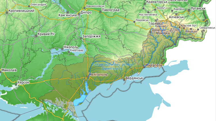
Pryazovia (, sometimes spelled , ''Pryozivia''; ) or literally Cis-Azov region is usually used to refer to the geographic area of the north coast of the Sea of Azov, mostly located in south-eastern Ukraine, with a small part in Russia. It is located in the southern part of the Azov-Kuban Lowland within the East European Plain, which surrounds the Sea of Azov for most of the stretch of coastline. In a more general sense it may mean the Azov Sea littoral, and conversely, to be more specific, it may also be referred to as the Northern Priazovye. Geography The (Northern) Priazovye consists of the southern parts of Donetsk Oblast and Zaporizhzhia Oblast and the eastern part of Kherson Oblast - parts of Ukraine and the western part of Rostov Oblast of Russia. It is a small part in the south of the vast East European Plain. The southern edge of the Ukrainian Shield overlaps with Eastern Pryazovia. The natural Northern borders of Northwestern Pryazovia are the Azov Upland and the Don ... [...More Info...] [...Related Items...] OR: [Wikipedia] [Google] [Baidu] |
Mariupol
Mariupol is a city in Donetsk Oblast, Ukraine. It is situated on the northern coast (Pryazovia) of the Sea of Azov, at the mouth of the Kalmius, Kalmius River. Prior to the Russian invasion of Ukraine, it was the tenth-largest city in the country and the second-largest city in Donetsk Oblast, with an estimated population of 425,681 people in January 2022; as of August 2023, Ukrainian authorities estimate the population of Mariupol at approximately 120,000. Mariupol has been occupied by Russian forces since May 2022. Historically, the city of Mariupol was a centre for trade and manufacturing, and played a key role in the development of higher education and many businesses and also served as a coastal resort on the Sea of Azov. In 1948, Mariupol was renamed Zhdanov () after Andrei Zhdanov, a native of the city who had become a high-ranking official of the Communist Party of the Soviet Union and a close ally to Joseph Stalin. The name was part of a larger effort to rename cities a ... [...More Info...] [...Related Items...] OR: [Wikipedia] [Google] [Baidu] |
Donetsk Oblast
Donetsk Oblast, also referred to as Donechchyna (, ), is an Oblasts of Ukraine, oblast in eastern Ukraine. It is Ukraine's most populous province, with around 4.1 million residents. Its capital city, administrative centre is Donetsk, though due to the ongoing Russo-Ukrainian War, the regional administration was moved to Kramatorsk. Historically, the region has been an important part of the Donbas region. From its creation in 1938 until November 1961, it bore the name ''Stalino Oblast'', in honour of Joseph Stalin. As part of the de-Stalinization process, it was renamed after the Donets river, the main artery of Eastern Ukraine. Its population is estimated at The oblast is known for its urban sprawl of Donetsk–Makiivka and Horlivka–Yenakiieve and it is often associated with the coal mining industry. In 2014, parts of the oblast, including Donetsk, came under the control of Russian-backed separatists who declared the Donetsk People's Republic, leading to a War in Donbas (2 ... [...More Info...] [...Related Items...] OR: [Wikipedia] [Google] [Baidu] |
Kipchaks
The Kipchaks, also spelled Qipchaqs, known as Polovtsians (''Polovtsy'') in Russian annals, were Turkic nomads and then a confederation that existed in the Middle Ages inhabiting parts of the Eurasian Steppe. First mentioned in the eighth century as part of the Second Turkic Khaganate, they most likely inhabited the Altai region from where they expanded over the following centuries, first as part of the Kimek–Kipchak confederation and later as part of a confederation with the Cumans. There were groups of Kipchaks in the Pontic–Caspian steppe, China, Syr Darya, and Siberia. Cumania was conquered by the Mongol Empire in the early 13th century. Terminology The Kipchaks interpreted their name as meaning "hollow tree" (cf. Middle Turkic: ''kuv ağaç''); according to them, inside a hollow tree, their original human ancestress gave birth to her son. Németh points to the Siberian ''qıpčaq'' "angry, quick-tempered" attested only in the Siberian Sağay dialect (a dialect o ... [...More Info...] [...Related Items...] OR: [Wikipedia] [Google] [Baidu] |
Khazars
The Khazars ; 突厥可薩 ''Tūjué Kěsà'', () were a nomadic Turkic people who, in the late 6th century CE, established a major commercial empire covering the southeastern section of modern European Russia, southern Ukraine, Crimea, and Kazakhstan. They created what, for its duration, was the most powerful polity to emerge from the break-up of the Western Turkic Khaganate. Astride a major artery of commerce between Eastern Europe and Southwestern Asia, Khazaria became one of the foremost trading empires of the early medieval world, commanding the western marches of the Silk Road and playing a key commercial role as a crossroad between China, the Middle East, and Kievan Rus'. For some three centuries (–965), the Khazars dominated the vast area extending from the Volga-Don steppes to the eastern Crimea and the northern Caucasus. Khazaria long served as a buffer state between the Byzantine Empire, the nomads of the northern steppes, and the Umayyad and Abbasid Caliph ... [...More Info...] [...Related Items...] OR: [Wikipedia] [Google] [Baidu] |
Old Great Bulgaria
Old Great Bulgaria (Medieval Greek: Παλαιά Μεγάλη Βουλγαρία, ''Palaiá Megálē Voulgaría''), also often known by the Latin names ''Magna Bulgaria'' and ''Patria Onoguria'' (" Onogur land"), was a 7th-century Turkic nomadic empire formed by the Onogur-Bulgars on the western Pontic–Caspian steppe (modern southern Ukraine and southwest Russia). Great Bulgaria was originally centered between the Dniester and lower Volga. The original capital was Phanagoria on the Taman Peninsula between the Black and Azov seas. In the mid-7th century, Great Bulgaria expanded west to include Avar territory and was centered on Poltava. During the late 7th century, however, an Avar-Slavic alliance in the west, and Khazars in the east, defeated the Bulgars, and Great Bulgaria disintegrated. Successor states are the First Bulgarian Empire and Volga Bulgaria. Origins The etymology of the ethnonym '' Bulgar'' is not completely understood; it is difficult to trace the n ... [...More Info...] [...Related Items...] OR: [Wikipedia] [Google] [Baidu] |
Scythia
Scythia (, ) or Scythica (, ) was a geographic region defined in the ancient Graeco-Roman world that encompassed the Pontic steppe. It was inhabited by Scythians, an ancient Eastern Iranian equestrian nomadic people. Etymology The names and are themselves Latinisations of the Ancient Greek names () and (), which were themselves derived from the ancient Greek names for the Scythians, () and (), derived from the Scythian endonym . Geography Scythia proper The territory of the Scythian kingdom of the Pontic steppe extended from the Don river in the east to the Danube river in the west, and covered the territory of the treeless steppe immediately north of the Black Sea's coastline, which was inhabited by nomadic pastoralists, as well as the fertile black-earth forest-steppe area to the north of the treeless steppe, which was inhabited by an agricultural population. The northern border of this Scythian kingdom were the deciduous woodlands, while several rivers, incl ... [...More Info...] [...Related Items...] OR: [Wikipedia] [Google] [Baidu] |
Rostov-on-Don
Rostov-on-Don is a port city and the administrative centre of Rostov Oblast and the Southern Federal District of Russia. It lies in the southeastern part of the East European Plain on the Don River, from the Sea of Azov, directly north of the North Caucasus. The southwestern suburbs of the city lie above the Don river delta. Rostov-on-Don has a population of over one million people and is an important cultural, educational, economic and logistical centre of Southern Russia. History Early history From ancient times, the area around the mouth of the Don River has held cultural and commercial importance. Ancient indigenous inhabitants included the Scythian and Sarmatian tribes. It was the site of Tanais, an ancient Greek colony, Fort Tana under the Genoese, and Fort Azak in the time of the Ottoman Empire. In 1749, a custom house was established on the Temernik River, a tributary of the Don, by edict of the Empress Elizabeth, the daughter of Peter the Great, in orde ... [...More Info...] [...Related Items...] OR: [Wikipedia] [Google] [Baidu] |
Kalmius
The Kalmius (, ) is a river flowing through Donetsk Oblast, Ukraine. Its source is near the Ukrainian city of Yasynuvata, and its mouth is in Mariupol. The Kalmius is one of two rivers flowing through Mariupol. The other is the Kalchyk, which flows into the Kalmius. The Kalmius flows into the Sea of Azov near the Azovstal Iron and Steel Works in Mariupol. Major cities along the Kalmius are Yasynuvata, Donetsk, Kalmiuske, and Mariupol. History Kalmius is said to be the name of a 16th-century Cossack encampment where the town of Pavlovsk was founded, later renamed Mariupol. The Kalmius Trail was a Tatar raiding trail, one of the branches of the Muravsky Trail. After an offensive by the separatist forces of the Donetsk People's Republic in August 2014 during the war in Donbas The war in Donbas, or the Donbas war, was a phase of the Russo-Ukrainian War in the eastern Donbas region of Ukraine. The war Timeline of the war in Donbas (2014), began in April 2014, when R ... [...More Info...] [...Related Items...] OR: [Wikipedia] [Google] [Baidu] |
Donets Ridge
The Donets Ridge is a highland that is the highest north-eastern part of the Donets upland. The ridge is in the Donetsk and Luhansk Oblasts of Ukraine and partially in the Rostov Oblast of Russia. The highest point on the ridge is a hill — Mohyla Mechetna, . Another hill, Savur-Mohyla (), was a notable site in the War in Donbass. Name The name derives from the river Seversky (Siversky) Donets. References External links Donets Ridgeat the Great Soviet Encyclopedia The ''Great Soviet Encyclopedia'' (GSE; , ''BSE'') is one of the largest Russian-language encyclopedias, published in the Soviet Union from 1926 to 1990. After 2002, the encyclopedia's data was partially included into the later ''Great Russian Enc ... Plateaus of Ukraine Donbas Geography of Donetsk Oblast Geography of Luhansk Oblast Landforms of Rostov Oblast Plateaus of Russia {{Russia-geo-stub ... [...More Info...] [...Related Items...] OR: [Wikipedia] [Google] [Baidu] |
Azov Upland
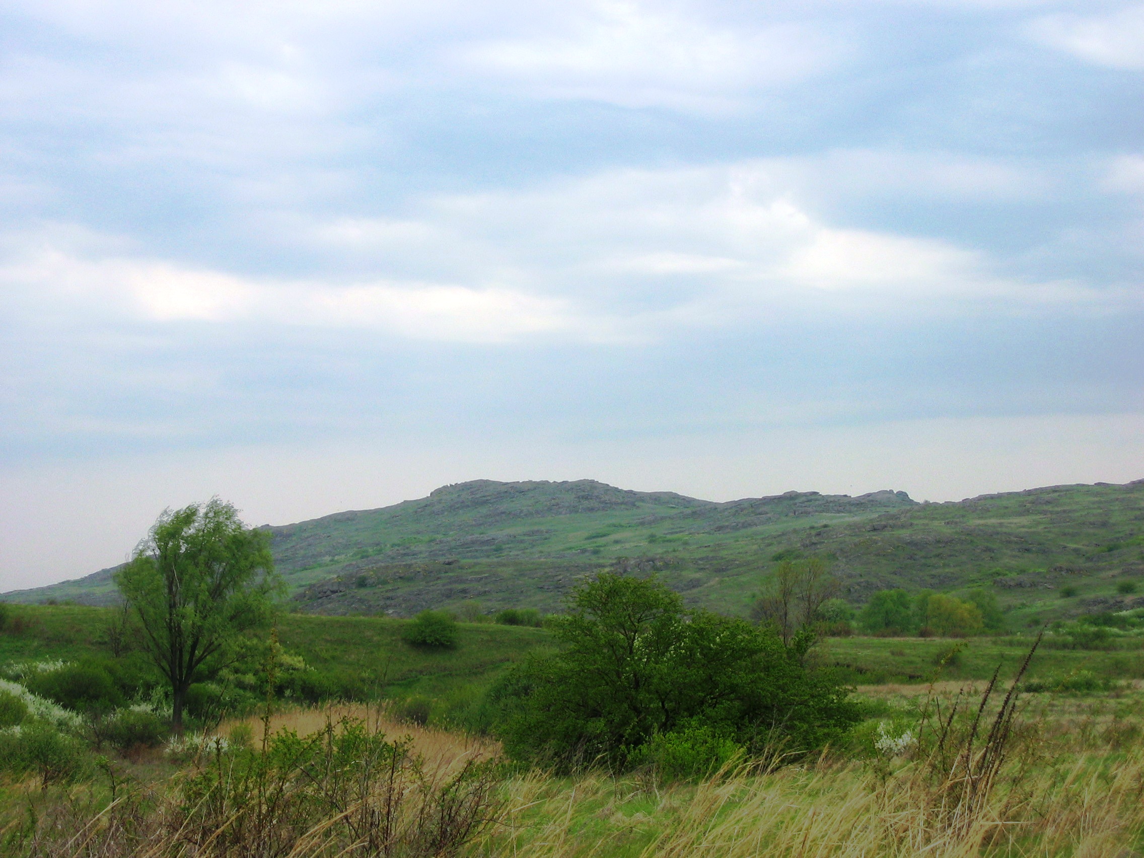
Azov Upland or Cisazov Upland is a plateau or range of hills in East Ukraine within the Donetsk and Zaporizhia oblasts. To the north it borders Dnieper Lowland, to northeast – Donets Ridge, southwest – Black Sea Lowland, south – Azov Lowland. Elevation varies between . Interesting features are mounds locally known as ' similar to Russian equivalent of kurgan. The highest hill is Belmak-Mohyla (Horyla) that rises at . The climate is similar to Donets Ridge. Soils are categorized as chernozem of poor or medium humus. Vegetation is a fescue-feather-grass steppe. References External links Azov Uplandat the Encyclopedia of Ukraine Azov Uplandat the Encyclopædia Britannica Azov Uplandat the Great Soviet Encyclopedia The ''Great Soviet Encyclopedia'' (GSE; , ''BSE'') is one of the largest Russian-language encyclopedias, published in the Soviet Union from 1926 to 1990. After 2002, the encyclopedia's data was partially included into the later ''Great Russia ... [...More Info...] [...Related Items...] OR: [Wikipedia] [Google] [Baidu] |
Ukrainian Shield
In geology, the Ukrainian Shield or the Ukrainian Crystalline Massif is the southwest shield of the East European craton. It has an area of about Ukrainian Crystalline Shield translated from the '''' and is approximately long and up to wide. It is a which can be divided into the following megastructures: Middle [...More Info...] [...Related Items...] OR: [Wikipedia] [Google] [Baidu] |


