|
NorthGRIP
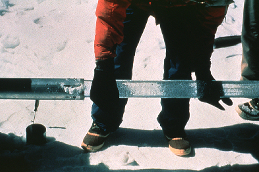
The drilling site of the North Greenland Ice Core Project (NGRIP or NorthGRIP) is near the center of Greenland (75.1 N, 42.32 W, 2917 m, ice thickness 3085). Drilling began in 1999 and was completed at bedrock in 2003. The cores are cylinders of ice 11 centimeters in diameter that were brought to the surface in 3.5-meter lengths. The NGRIP site was chosen to extract a long and undisturbed record stretching into the last glacial, and it succeeded. The site was chosen for a flat basal topography to avoid the flow distortions that render the bottom of the GRIP and GISP cores unreliable. Unusually, there is melting at the bottom of the NGRIP core – believed to be due to a high geothermal heat flux locally. This has the advantage that the bottom layers are less compressed by thinning than they would otherwise be: NGRIP annual layers at 10.5 kyr age are 1.1 cm thick, twice the GRIP thicknesses at equal age. The NGRIP record helps to resolve a problem with the GRIP and ... [...More Info...] [...Related Items...] OR: [Wikipedia] [Google] [Baidu] |
Greenland Ice Core Project
The Greenland Ice Core Project (GRIP) was a research project organized through the European Science Foundation (ESF). The project ran from 1989 to 1995, with drilling seasons from 1990 to 1992. In 1988, the project was accepted as an ESF-associated program, and the fieldwork was started in Greenland in the summer of 1989. GRIP aimed to collect and investigate 3000-meter-long ice cores drilled at the apex of the Greenland ice sheet, also known as Summit Camp. The Greenland ice sheet comprises more than 90% of the total ice sheet and glacier ice outside Antarctica. The project was managed by a Steering Committee of the University of Bern's Physics Institute, chaired by Professor Bernhard Stauffer. Funding came from eight European nations (Belgium, Denmark, France, Germany, Iceland, Italy, Switzerland, and the United Kingdom), and from the European Union. Studies of nuclear isotopes and various atmospheric constituents provided by the cores allowed the team to construct detailed r ... [...More Info...] [...Related Items...] OR: [Wikipedia] [Google] [Baidu] |
Ice Core
An ice core is a core sample that is typically removed from an ice sheet or a high mountain glacier A glacier (; or ) is a persistent body of dense ice, a form of rock, that is constantly moving downhill under its own weight. A glacier forms where the accumulation of snow exceeds its ablation over many years, often centuries. It acquires .... Since the ice forms from the incremental buildup of annual layers of snow, lower layers are older than upper ones, and an ice core contains ice formed over a range of years. Cores are Ice drilling, drilled with hand Auger (drill), augers (for shallow holes) or powered drills; they can reach depths of over two miles (3.2 km), and contain ice up to 800,000 years old. The physical properties of the ice and of material trapped in it can be used to reconstruct the climate over the age range of the core. The proportions of different oxygen and hydrogen isotopes provide information about Paleothermometer, ancient temperatures, a ... [...More Info...] [...Related Items...] OR: [Wikipedia] [Google] [Baidu] |
Northgrippian
In the geologic time scale, the Northgrippian is the middle one of three age (geology), ages or stage (stratigraphy), stages of the Holocene Epoch (geology), Epoch or series (stratigraphy), Series. It was officially ratified by the International Commission on Stratigraphy in June 2018 along with the earlier Greenlandian and later Meghalayan ages/stages. The age takes its name from the North Greenland Ice Core Project (NorthGRIP). The age began 8,276 Before Present, BP (6326 BCE or 3854 Holocene calendar, HE), near the 8.2-kiloyear event, and goes up to the start of the Meghalayan, which began 4,200 BP (2250 BCE or 7750 HE), near the 4.2-kiloyear event. See also * Geologic time scale * North Greenland Ice Core Project * 5th millennium BC References 7th millennium BC Cenozoic, *01 Geological epochs Holocene, * Quaternary geochronology, *03 Quaternary, * {{geochronology-stub ... [...More Info...] [...Related Items...] OR: [Wikipedia] [Google] [Baidu] |
Holocene
The Holocene () is the current geologic time scale, geological epoch, beginning approximately 11,700 years ago. It follows the Last Glacial Period, which concluded with the Holocene glacial retreat. The Holocene and the preceding Pleistocene together form the Quaternary period. The Holocene is an interglacial period within the ongoing Ice age, glacial cycles of the Quaternary, and is equivalent to Marine isotope stages, Marine Isotope Stage 1. The Holocene correlates with the last maximum axial tilt towards the Sun of the Earth#Axial tilt and seasons, Earth's obliquity. The Holocene corresponds with the rapid proliferation, growth, and impacts of the human species worldwide, including Recorded history, all of its written history, technological revolutions, development of major civilizations, and overall significant transition towards urban culture, urban living in the present. The human impact on modern-era Earth and its ecosystems may be considered of global significance for th ... [...More Info...] [...Related Items...] OR: [Wikipedia] [Google] [Baidu] |
Arctic Research
The Arctic (; . ) is the polar regions of Earth, polar region of Earth that surrounds the North Pole, lying within the Arctic Circle. The Arctic region, from the IERS Reference Meridian travelling east, consists of parts of northern Norway (Nordland, Troms, Finnmark, Svalbard and Jan Mayen), northernmost Sweden (Västerbotten, Norrbotten and Lapland (Sweden), Lappland), northern Finland (North Ostrobothnia, Kainuu and Lapland (Finland), Lappi), Russia (Murmansk Oblast, Murmansk, Siberia, Nenets Autonomous Okrug, Nenets Okrug, Novaya Zemlya), the United States (Alaska), Canada (Yukon, Northwest Territories, Nunavut), Danish Realm (Greenland), and northern Iceland (Grímsey and Kolbeinsey), along with the Arctic Ocean and adjacent seas. Land within the Arctic region has seasonally varying cryosphere, snow and ice cover, with predominantly treeless permafrost under the tundra. Arctic seas contain seasonal sea ice in many places. The Arctic region is a unique area among Earth's ... [...More Info...] [...Related Items...] OR: [Wikipedia] [Google] [Baidu] |
Natural History Of Greenland
Nature is an inherent character or constitution, particularly of the ecosphere or the universe as a whole. In this general sense nature refers to the laws, elements and phenomena of the physical world, including life. Although humans are part of nature, human activity or humans as a whole are often described as at times at odds, or outright separate and even superior to nature. During the advent of modern scientific method in the last several centuries, nature became the passive reality, organized and moved by divine laws. With the Industrial Revolution, nature increasingly became seen as the part of reality deprived from intentional intervention: it was hence considered as sacred by some traditions ( Rousseau, American transcendentalism) or a mere decorum for divine providence or human history (Hegel, Marx). However, a vitalist vision of nature, closer to the pre-Socratic one, got reborn at the same time, especially after Charles Darwin. Within the various uses of the word ... [...More Info...] [...Related Items...] OR: [Wikipedia] [Google] [Baidu] |
Geochronological Institutions And Organizations
Geochronology is the science of determining the age of rocks, fossils, and sediments using signatures inherent in the rocks themselves. Absolute geochronology can be accomplished through radioactive isotopes, whereas relative geochronology is provided by tools such as paleomagnetism and stable isotope ratios. By combining multiple geochronological (and biostratigraphic) indicators the precision of the recovered age can be improved. Geochronology is different in application from biostratigraphy, which is the science of assigning sedimentary rocks to a known geological period via describing, cataloging and comparing fossil floral and faunal assemblages. Biostratigraphy does not ''directly'' provide an absolute age determination of a rock, but merely places it within an ''interval'' of time at which that fossil assemblage is known to have coexisted. Both disciplines work together hand in hand, however, to the point where they share the same system of naming strata (rock layers) an ... [...More Info...] [...Related Items...] OR: [Wikipedia] [Google] [Baidu] |
Greenlandian
In the geologic time scale, the Greenlandian is the earliest age or lowest stage of the Holocene Epoch or Series, part of the Quaternary. Beginning in 11,650 BP (9701 BCE or 300 HE) and ending with the 8.2-kiloyear event (c. 8200–8300 BP, 6200–6300 BCE, 3600–3700 HE), it is the earliest of three sub-divisions of the Holocene. It was officially ratified by the International Commission on Stratigraphy in June 2018 with the later Northgrippian and Meghalayan Ages/Stages. The lower boundary of the Greenlandian Age is the GSSP sample from the North Greenland Ice Core Project in central Greenland (75.1000°N 42.3200°W). The Greenlandian GSSP has been correlated with the end of Younger Dryas The Younger Dryas (YD, Greenland Stadial GS-1) was a period in Earth's geologic history that occurred circa 12,900 to 11,700 years Before Present (BP). It is primarily known for the sudden or "abrupt" cooling in the Northern Hemisphere, when the ... (from near-glacial to in ... [...More Info...] [...Related Items...] OR: [Wikipedia] [Google] [Baidu] |
Sediment
Sediment is a solid material that is transported to a new location where it is deposited. It occurs naturally and, through the processes of weathering and erosion, is broken down and subsequently sediment transport, transported by the action of wind, water, or ice or by the force of gravity acting on the particles. For example, sand and silt can be carried in suspension (chemistry), suspension in river water and on reaching the sea bed deposited by sedimentation; if buried, they may eventually become sandstone and siltstone (sedimentary rocks) through lithification. Sediments are most often transported by water (fluvial, fluvial processes), but also wind (aeolian processes) and glaciers. Beach sands and stream channel, river channel deposits are examples of fluvial transport and deposition (geology), deposition, though sediment also often settles out of slow-moving or standing water in lakes and oceans. Desert sand dunes and loess are examples of aeolian transport and deposition. ... [...More Info...] [...Related Items...] OR: [Wikipedia] [Google] [Baidu] |
Geothermal Activity
Geothermal activity is a group of natural heat transfer processes, occurring on Earth's surface, caused by the presence of excess heat in the subsurface of the affected area, usually caused by the presence of an igneous intrusion underground. Geothermal activity can manifest itself in a variety of different phenomena, including, among others, elevated surface temperatures, various forms of hydrothermal activity, and the presence of Fumarole, fumaroles that emit hot Volcanic gas, volcanic gases. Background physics Geothermal activity mostly appears in volcanic provinces, where it is fueled by the presence of a magma chamber. In some rare cases it can be caused by Coal-seam fire, underground fires or by large deposits of radioactive elements. Other sources of internal heating can be Planetary differentiation, gravitational differentiation of substances, tidal friction, metamorphism, or phase transitions. The release of heat to the surface occurs either in the form of a conductive h ... [...More Info...] [...Related Items...] OR: [Wikipedia] [Google] [Baidu] |


