|
NorthConnex
NorthConnex is a twin-tube motorway tunnel in northern Sydney, New South Wales, Australia, signposted as the M11 Tunnel. It acts as a tunnel bypass of the congested Pennant Hills Road, extending or connecting the M1 Pacific Motorway to the M2 Hills Motorway. Owned by NorthWestern Roads (NWR) Group, it is one of the longest road tunnels in Australia, along with the WestConnex Tunnel. It is also the deepest road tunnel in Australia, with more than half of the tunnel deep or more, and the deepest point is underneath the Sydney Metro Northwest, about below ground. NorthConnex was first known as the F3 to M2 link, with F3 referring to the F3 Sydney–Newcastle Freeway, the previous name of the M1 Pacific Motorway. It was then renamed the M1 to M2 link in 2013 when the F3 was renamed the M1 Pacific Motorway. The NorthConnex name was announced in March 2014. In 2023, the motorway, which was previously not part of a road route, was assigned the route number M11. Design NorthConn ... [...More Info...] [...Related Items...] OR: [Wikipedia] [Google] [Baidu] |
Pennant Hills Road
Pennant Hills Road is a arterial road located in Sydney, New South Wales, Australia. The road links the suburb of Wahroonga in the northeast, to the major central business district of Parramatta in the southwest. Apart from a small section at its southwestern end, it is a constituent part of Cumberland Highway, and is designated part of route A28. In 2015 NRMA members voted the Pennant Hills Road as the second worst road in New South Wales and the Australian Capital Territory, with approximately 5,000 heavy vehicle movements per day. NorthConnex, a motorway tunnel opened on 31 October 2020, runs parallel to Pennant Hills Road and links M2 Hills Motorway at with Pacific Highway and Pacific Motorway at Wahroonga. NorthConnex aims to reduce congestion and improve traffic flow along part of the Pennant Hills Road, reducing air and traffic pollution. Route Pennant Hills Road commences at Pearce's Corner, the intersection with Pacific Highway in Wahroonga, and heads in a s ... [...More Info...] [...Related Items...] OR: [Wikipedia] [Google] [Baidu] |
M2 Hills Motorway
M2 Hills Motorway is a tolled urban motorway in Sydney, New South Wales that is part of the Sydney Orbital Network and the National Highway west of Pennant Hills Road. Owned by toll road operator Transurban, it forms majority of Sydney's M2 route, with the Lane Cove Tunnel constituting the rest of the M2 route. Route M2 Hills Motorway connects directly with the Westlink M7 in Seven Hills and heads southeast as a four-lane dual-carriageway road through Baulkham Hills, widening to six lanes past the interchange with Windsor Road, and then in an easterly direction to Beecroft, where it meets an interchange with both Pennant Hills Road and the NorthConnex tunnel. It continues south-east past Epping and through Macquarie Park, narrowing back to four lanes past the interchange with Lane Cove Road, to eventually dive under Epping Road and cross the Lane Cove River in North Ryde, where it connects directly to the Lane Cove Tunnel. The motorway runs underneath the ... [...More Info...] [...Related Items...] OR: [Wikipedia] [Google] [Baidu] |
Pacific Motorway (Sydney–Newcastle)
M1 Pacific Motorway is a 127-kilometre (79 mi) Motorway#Australia, motorway linking Sydney to Newcastle, New South Wales, Newcastle via the Central Coast, New South Wales, Central Coast and Hunter Region, Hunter regions of New South Wales. Formerly known but still commonly referred to by both the public and the government as the F3 Freeway, Sydney–Newcastle Freeway, and Sydney–Newcastle Expressway, it is part of the AusLink road corridor between Sydney and Brisbane. Route Pacific Motorway commences at its southern end at an intersection with Pennant Hills Road in Wahroonga partially shared with ramps from NorthConnex, Northconnex, then heads in a northerly direction, immediately passing under the interchange with Pacific Highway (Australia), Pacific Highway and then another interchange with NorthConnex in Sydney's north. It continues north, skirting the western edge of Ku-ring-gai Chase National Park, running parallel with the Main North railway line, New South Wales, railw ... [...More Info...] [...Related Items...] OR: [Wikipedia] [Google] [Baidu] |
List Of Road Routes In New South Wales
Road routes in New South Wales assist drivers navigating roads in urban, rural, and scenic areas of the state. Today all numbered routes in the state are allocated a letter (M, A, B or D) in addition to a one- or -two digit number, with 'M' routes denoting motorways, 'A' routes denoting routes of national significance, 'B' routes denoting routes of state significance, and 'D' for Detour routes of a major motorway. The route system includes the officially designated highways, urban and intercity motorways and arterial roads, and important cross-state roads that have not been declared highways. History Route numbers have been allocated to New South Wales' roads since 1954, with the introduction of National Routes across all states and territories in Australia, symbolised by a white shield with black writing; National Route 1 (' Highway 1') was one of the best-known numbered nation routes, likely due to its fame for circumnavigating the continent. To supplement the National Ro ... [...More Info...] [...Related Items...] OR: [Wikipedia] [Google] [Baidu] |
Sydney Orbital Network
The Sydney Orbital Network is a 110 kilometre motorway standard ring road around and through Sydney, the capital of New South Wales in Australia. It runs north from Sydney Airport, underneath the CBD to the North Shore, west to the Hills District, south to Prestons and then east to connect with the airport. Much of the road is privately owned and financed by tolls. History Planning for this beltway, orbital or ring road began as early as 1962 under the "County of Cumberland scheme" (CCS) and was talked about as far back as 1944. Then, from 1973 to 1989, things started to take shape with new sections opening-up and then further advancing by 1999. In 2007, the Lane Cove Tunnel opened, completing the orbital network. Motorways that make up the orbital road The 110 km Sydney orbital consists of several motorways and freeways, they are listed below: * Eastern Distributor * Southern Cross Drive * General Holmes Drive * M5 Motorway (both M5 South-West and M5 East motorwa ... [...More Info...] [...Related Items...] OR: [Wikipedia] [Google] [Baidu] |
Wahroonga, New South Wales
Wahroonga is a suburb on the Upper North Shore of Sydney, in the state of New South Wales, Australia, 18 kilometres north-west of the Sydney central business district, in the local government areas of Ku-ring-gai Council and Hornsby Shire. North Wahroonga is an adjacent separate suburb of the same postcode. History Wahroonga is an Aboriginal word meaning ''our home'', likely originating from the Kuringgai language group. Early British colonists of New South Wales utilized the area for its tall trees. Wahroonga was first colonised by the British in 1822 by Thomas Hyndes, a convict who later became a wealthy landowner. Hyndes's land was later acquired by John Brown, a merchant and timber-getter. After Brown had cleared the land of timber, he planted orchards. Later, Ada, Lucinda and Roland Avenues were named after three of his children. His name is in Browns Road, Browns Field and Browns Waterhole on the Lane Cove River. The last member of the Brown family was Gertrude Mary ... [...More Info...] [...Related Items...] OR: [Wikipedia] [Google] [Baidu] |
North Western Expressway
The North Western Expressway and the Lane Cove Valley Expressway was a planned but later cancelled freeway route in Sydney, New South Wales, Australia, intended to link the Sydney central business district to its north-western suburbs, and ultimately the Sydney–Newcastle Freeway to Newcastle. The entirety of the Sydney to Newcastle route was to be known as the F3 Freeway, a name that remains as a common name of the Sydney–Newcastle Freeway. The North Western Expressway refers to the section between the Western Distributor and Victoria Road at Huntleys Point, while the Lane Cove Valley Expressway refers to the section between Huntleys Point and Wahroonga, passing through Lane Cove Valley. History The route was planned as early as 1962 (even providing a proposed freeway "dotted line" in the UBD street directories of the 1970s). The original route was to start at the Western Distributor, connecting to Gladesville Bridge via a new elevated freeway. The route would continue ap ... [...More Info...] [...Related Items...] OR: [Wikipedia] [Google] [Baidu] |
Pacific Highway (Australia)
Pacific Highway is a Highways in Australia, national highway and major transport route of along the east coast of Australia from Sydney to Brisbane. It is an integral part of Highway 1 (Australia), Highway 1 which circumnavigates the Australian continent. At its inception, the highway was a single carriageway between Sydney and Brisbane. In Australian culture and as a tourist drive, it remains so. Over time, segments of the highway have been relegated from the route and, or, renamed and between 1996 and 2020, the highway was upgraded to the standards of a controlled-access highway (motorway). Location Pacific Highway can be broken into the following sections: * Brisbane to New South Wales / Queensland border: completely replaced by Pacific Motorway (Brisbane–Brunswick Heads), Pacific Motorway * New South Wales / Queensland border to Brunswick Heads, New South Wales, Brunswick Heads: upgraded to motorway standard as part of the 1996 Upgrade Masterplan and renamed Pacif ... [...More Info...] [...Related Items...] OR: [Wikipedia] [Google] [Baidu] |
Wedge-tailed Eagle
The wedge-tailed eagle (''Aquila audax'') also known as the eaglehawk, is the largest bird of prey in the continent of Australia. It is also found in southern New Guinea to the north and is distributed as far south as the state of Tasmania. Adults of the species have long, broad wings, fully feathered legs, an unmistakable wedge-shaped tail, an elongated upper mandible, a strong beak and powerful feet. The wedge-tailed eagle is one of 12 species of large, predominantly dark-coloured booted eagles in the genus ''Aquila (bird), Aquila'' found worldwide. Genetic research has clearly indicated that the wedge-tailed eagle is fairly closely related to other, generally large members of the ''Aquila'' genus.Lerner, H., Christidis, L., Gamauf, A., Griffiths, C., Haring, E., Huddleston, C.J., Kabra, S., Kocum, A., Krosby, M., Kvaloy, K., Mindell, D., Rasmussen, P., Rov, N., Wadleigh, R., Wink, M. & Gjershaug, J.O. (2017). ''Phylogeny and new taxonomy of the Booted Eagles (Accipitriformes ... [...More Info...] [...Related Items...] OR: [Wikipedia] [Google] [Baidu] |
Cockatoos
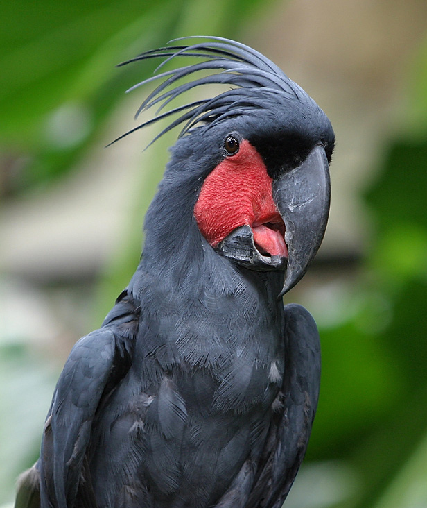
A cockatoo is any of the 21 species of parrots belonging to the family Cacatuidae, the only family in the superfamily Cacatuoidea. Along with the Psittacoidea (true parrots) and the Strigopoidea (large New Zealand parrots), they make up the order Psittaciformes. The family has a mainly Australasian distribution, ranging from the Philippines and the eastern Indonesian islands of Wallacea to New Guinea, the Solomon Islands and Australia. Cockatoos are recognisable by their prominent crests and curved bills. Their plumage is generally less colourful than that of other parrots, being mainly white, grey, or black and often with coloured features in the crest, cheeks, or tail. On average, they are larger than other parrots; however, the cockatiel, the smallest cockatoo species, is medium-sized. The phylogenetic position of the cockatiel remains unresolved, except that it is one of the earliest offshoots of the cockatoo lineage. The remaining species are in two main clades. Th ... [...More Info...] [...Related Items...] OR: [Wikipedia] [Google] [Baidu] |


