|
Norristown Transit Center
Norristown Transit Center is a two-level multimodal public transportation regional hub located in Norristown, Pennsylvania and operated by SEPTA. It opened in 1989, replacing the older M terminus one block away at Main and Swede Streets, and integrated the former Reading Company's DeKalb Street Norristown railroad station (built 1933) into its structure. A plaque embedded in the sidewalk between the bus lane and Lafayette Street commemorates the location of one of the columns of the dismantled segment of the Philadelphia and Western Railroad (P&W) trestle. Regional Rail service The Norristown Transit Center is a stop on the Manayunk/Norristown Regional Rail Line, which offers service to Center City Philadelphia via Conshohocken and Manayunk. In 2017, the regional rail service at Norristown Transit Center had a weekday average of 856 boardings and 781 alightings. Metro service Norristown Transit Center is the final stop on the M, which runs from 69th Street Transit Cente ... [...More Info...] [...Related Items...] OR: [Wikipedia] [Google] [Baidu] |
M (SEPTA Metro)
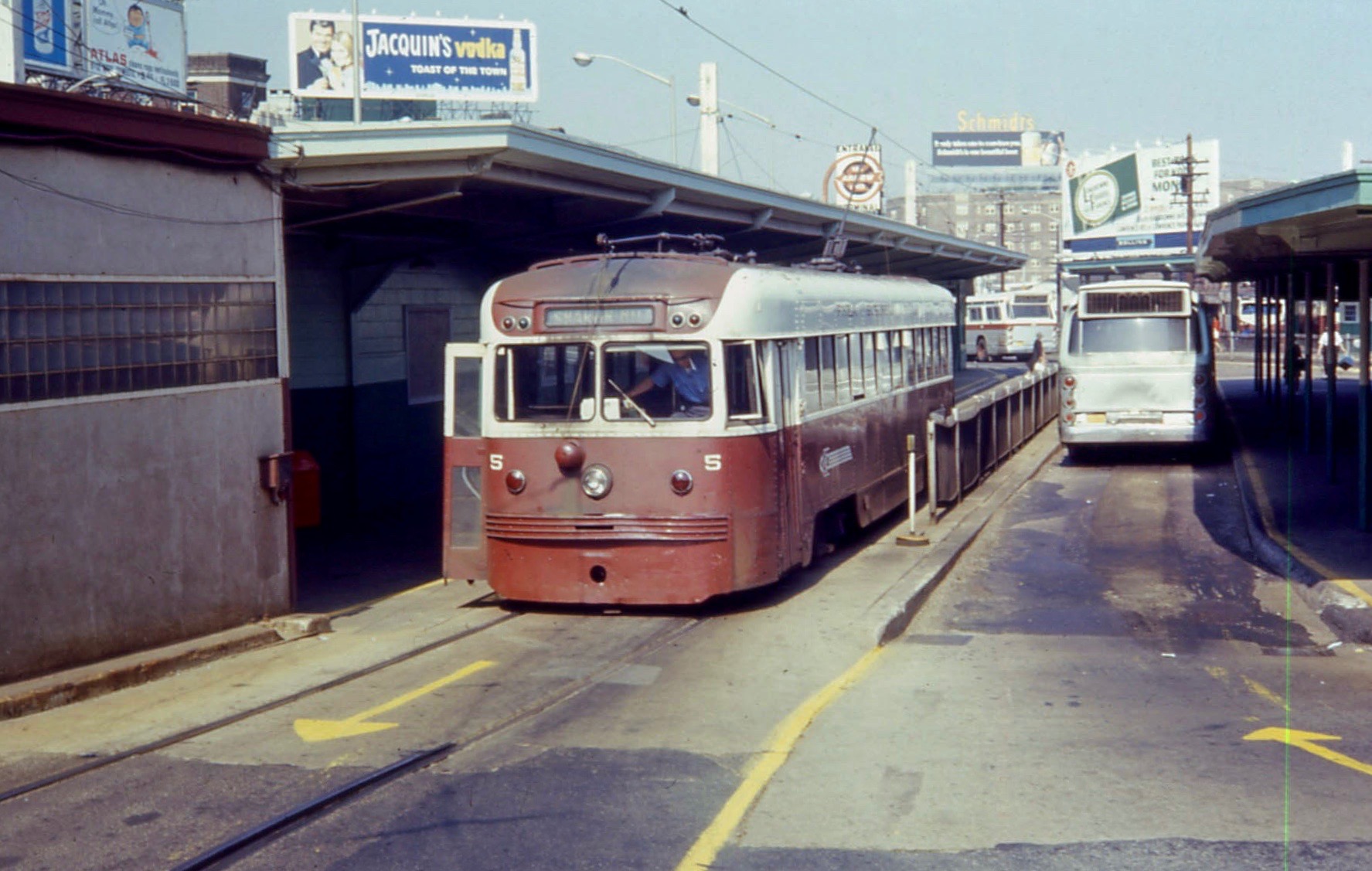
The M, formerly known as the Norristown High Speed Line (NHSL), is a interurban light rapid transit line in the SEPTA Metro network, running between the 69th Street Transportation Center in Upper Darby and the Norristown Transportation Center in Norristown, Pennsylvania. Service is operated by the Suburban Transit Division of the Southeastern Pennsylvania Transportation Authority. Originally the Philadelphia and Western Railroad line (which is why the line is referred to by locals as "the P&W"), the line runs entirely on its own right-of-way. By 2020, the M had an average weekday ridership approaching 11,000 passengers. The M is unique in its combination of transportation technologies. Originally chartered as a Class I (steam) railroad, the line is fully grade separated, collects power from a third rail, and has high-level platforms common to rapid transit systems or commuter rail systems such as New York City's Long Island Rail Road and Metro-North Railroad, but has onboard ... [...More Info...] [...Related Items...] OR: [Wikipedia] [Google] [Baidu] |
Reading Company
The Reading Company ( ) was a Philadelphia-headquartered railroad that provided passenger and freight transport in eastern Pennsylvania and neighboring states from 1924 until its acquisition by Conrail in 1976. Commonly called the Reading Railroad and logotyped as Reading Lines, the Reading Company was a railroad holding company for most of its existence, and a single railroad in its later years. It operated service as Reading Railway System and was a successor to the Philadelphia and Reading Railway Company, founded in 1833. Until the decline in anthracite shipments from the Coal Region in Northeastern Pennsylvania following World War II, it was one of the most prosperous corporations in the United States. Enactment of the federally-funded Interstate Highway System in 1956 led to competition from the modern trucking industry. They used the Interstates for short-distance transportation of goods, which compounded the company's competition for freight business, forcing it into ba ... [...More Info...] [...Related Items...] OR: [Wikipedia] [Google] [Baidu] |
Pottstown, Pennsylvania
Pottstown is a Borough (Pennsylvania), borough in Montgomery County, Pennsylvania, United States. Pottstown was laid out in 1752–53 and named Pottsgrove in honor of its founder, John Potts (Pennsylvanian), John Potts. The old name was abandoned at the time of the incorporation as a borough in 1815. In 1888, the limits of the borough were considerably extended. Pottstown is the center of a productive farming and dairying region. Pottstown is located on the Schuylkill River. It is south of Allentown, Pennsylvania, Allentown and northwest of Philadelphia. It is generally considered part of the Delaware Valley, Delaware Valley or Philadelphia metropolitan area. History Modern-day Pottstown is on land originally deeded to William Penn. Germans, Swedes and English were among the area's first European settlers. After establishment of the first iron forge in 1714, Pottstown's fortunes became tied to the iron industry, and blast furnaces for production of iron and later steel ev ... [...More Info...] [...Related Items...] OR: [Wikipedia] [Google] [Baidu] |
Eagleville, Montgomery County, Pennsylvania
Eagleville is a census-designated place (CDP) in Montgomery County, Pennsylvania, Montgomery County, Pennsylvania, United States. The population was 4,800 at the 2010 United States Census, 2010 census. It is within Lower Providence Township, Pennsylvania, Lower Providence Township.2010 CENSUS - CENSUS BLOCK MAP: Eagleville CDP, PA " U.S. Census Bureau. Retrieved on September 26, 2018. See in th Census index map for Lower Providence Township and page [...More Info...] [...Related Items...] OR: [Wikipedia] [Google] [Baidu] |
State Correctional Institution - Phoenix
State most commonly refers to: * State (polity), a centralized political organization that regulates law and society within a territory **Sovereign state, a sovereign polity in international law, commonly referred to as a country **Nation state, a state where the majority identify with a single nation (with shared culture or ethnic group) ** Constituent state, a political subdivision of a state ** Federated state, constituent states part of a federation *** U.S. state * State of nature, a concept within philosophy that describes the way humans acted before forming societies or civilizations State may also refer to: Arts, entertainment, and media Literature * '' State Magazine'', a monthly magazine published by the U.S. Department of State * ''The State'' (newspaper), a daily newspaper in Columbia, South Carolina, United States * '' Our State'', a monthly magazine published in North Carolina and formerly called ''The State'' * The State (Larry Niven), a fictional future gover ... [...More Info...] [...Related Items...] OR: [Wikipedia] [Google] [Baidu] |
Plymouth Meeting Mall
The Plymouth Meeting Mall is a shopping mall that is located in the community of Plymouth Meeting in Plymouth Township, Pennsylvania, approximately northwest of Center City, Philadelphia. It is situated at the intersection Germantown Pike and Hickory Road, near the Mid-County Interchange between the Pennsylvania Turnpike ( I-276) and the Northeast Extension/Blue Route (I-476). This mall, which was built by The Rouse Company in 1966, features a fountain and a carousel. It was also one of the first malls in North America which, among its mixture of various stores, offered a church within the mall. It is owned and managed by PREIT. History The Plymouth Meeting Mall was designed by Victor Gruen and built by The Rouse Company in 1966, it was the third fully enclosed shopping mall in the Philadelphia area. The original two anchor stores were Strawbridge & Clothier and Lit Brothers. The One Plymouth Meeting office tower was added on an outparcel in 1969. The mall suffered a m ... [...More Info...] [...Related Items...] OR: [Wikipedia] [Google] [Baidu] |
Montgomery County, Pennsylvania
Montgomery County, colloquially referred to as Montco, is a county in the Commonwealth of Pennsylvania. As of the 2020 census, the population of the county was 856,553, making it the third-most populous county in Pennsylvania after Philadelphia and Allegheny counties and the most populous county in Pennsylvania without a major city. The county seat and largest city is Norristown. The county is part of the Philadelphia– Camden– Wilmington PA- NJ– DE– MD metropolitan statistical area, known as the Delaware Valley, and marks the Delaware Valley's northern border with the Lehigh Valley region of eastern Pennsylvania. The county borders Philadelphia, the nation's sixth-largest city, to its southeast, Bucks County to its east, Berks and Lehigh counties to its north, Delaware County to its south, and Chester County to its southwest. The county was created on September 10, 1784, out of land originally part of Philadelphia County. The first courthouse was housed i ... [...More Info...] [...Related Items...] OR: [Wikipedia] [Google] [Baidu] |
Upper Darby Township, Pennsylvania
Upper Darby Township, often shortened to Upper Darby, is a Home Rule Municipality (Pennsylvania), home rule Township (Pennsylvania), township in Delaware County, Pennsylvania, United States. As of the 2020 census, the township had a total population of 85,681, making it the state's List of municipalities in Pennsylvania, sixth-most populated municipality after Philadelphia, Pittsburgh, Allentown, Pennsylvania, Allentown, Reading, Pennsylvania, Reading, and Erie, Pennsylvania, Erie. Upper Darby borders Philadelphia, the nation's List of United States cities by population, sixth-most populous city, and constitutes part of the Delaware Valley, also known as the Philadelphia metropolitan area, the nation's Metropolitan statistical area, seventh-largest metropolitan area. Upper Darby is home to the Tower Theater (Pennsylvania), Tower Theater, a historic music venue on 69th Street built in the 1920s, and to several Underground Railroad sites. In August 2019, the radio tower on top of ... [...More Info...] [...Related Items...] OR: [Wikipedia] [Google] [Baidu] |
69th Street Transit Center
69th Street Transit Center is a SEPTA terminal in the Terminal Square area of Upper Darby Township, Pennsylvania. It serves the SEPTA Metro L, M, D, and multiple SEPTA bus routes. It is located at the end of 69th Street, a major retail corridor in Upper Darby Township across Market Street ( Route 3) from the Tower Theater. 69th Street is the second-busiest SEPTA transfer point, after its 15th Street/City Hall station, serving 35,000 passengers daily during the week. History 20th century 69th Street is one of the original Market Street Elevated stations built by the Philadelphia Rapid Transit Company; the line opened for service on March 4, 1907, running between the 69th Street and stations. The same year, on May 22, the Philadelphia and Western Railroad opened the first segment of what is now the Norristown High-Speed Line, running from 69th Street to a farm on Sugartown Road in Strafford. By 1931, the P&W was operating Bullet electric multiple units between 69th Stree ... [...More Info...] [...Related Items...] OR: [Wikipedia] [Google] [Baidu] |
Manayunk, Philadelphia, Pennsylvania
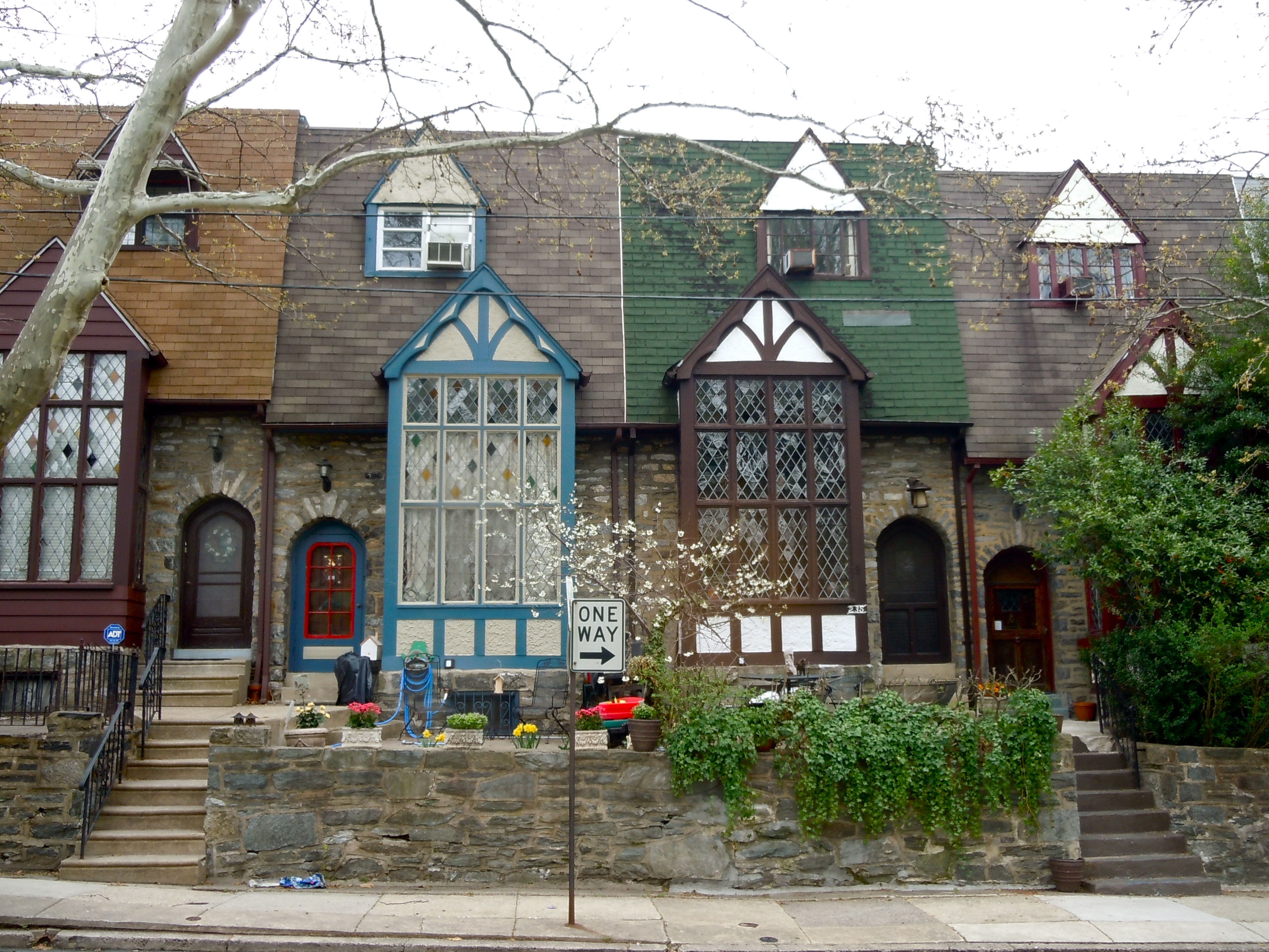
Manayunk ( ) is a neighborhood in the section of Lower Northwest Philadelphia in the state of Pennsylvania. Located adjacent to the neighborhoods of Roxborough and Wissahickon and also on the banks of the Schuylkill River, Manayunk contains the first canal begun in the United States (although not the first completed, due to budget problems). The area's name is derived from the language of the Lenape Native American tribe. In 1686, in documents between William Penn and the Lenape, the Lenape referred to the Schuylkill River as "Manaiung", their word for "river", which literally translates as "place to drink"; the word was later altered and adopted as the town's name. Although historically a working class community, in recent years the neighborhood has been substantially gentrified. History Pre-industrial Manayunk Borough was originally a community in Roxborough Township, Philadelphia County, situated near the Schuylkill River, south of the Wissahickon Creek. The land that w ... [...More Info...] [...Related Items...] OR: [Wikipedia] [Google] [Baidu] |
Conshohocken, Pennsylvania
Conshohocken ( ; ) is a Borough (Pennsylvania), borough on the Schuylkill River in Montgomery County, Pennsylvania in suburban Philadelphia. Historically a large mill town and industrial and manufacturing center, after the decline of industry in recent years Conshohocken has developed into a center of riverfront commerce, commercial and residential development.Fact Sheets-CONSHOHOCKEN BOROUGH In the Philadelphia accent, regional slang, it is sometimes referred to by the colloquialism, colloquial nickname Conshy ( ).ALL ABOUT Conshy, Conshohocken Pa /ref> The sister community of West Conshohocken, Pennsylvania, ... [...More Info...] [...Related Items...] OR: [Wikipedia] [Google] [Baidu] |
Center City, Philadelphia
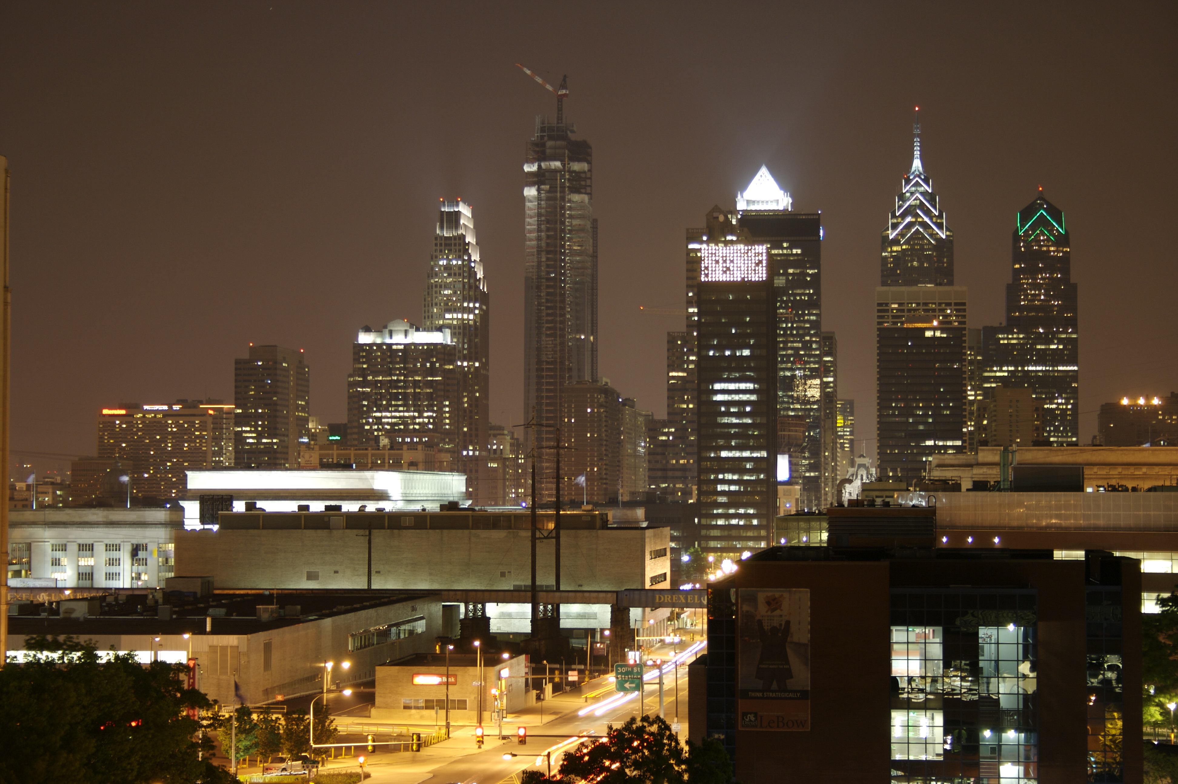
Center City includes the central business district and central neighborhoods of Philadelphia, Pennsylvania, United States. It comprises the area that made up the City of Philadelphia prior to the Act of Consolidation, 1854, which extended the city borders to be coterminous with Philadelphia County, Pennsylvania, Philadelphia County. The area has grown to the second-most densely populated downtown area in the United States (after Midtown Manhattan in New York City), with an estimated 202,000 residents in 2020 and a population density of 26,234 per square mile. Geography Boundaries Center City is bounded by South Street (Philadelphia), South Street to the south, the Delaware River to the east, the Schuylkill River to the west, and Vine Street to the north. The district occupies the old boundaries of the City of Philadelphia before Act of Consolidation, 1854, the city was made coterminous with Philadelphia County in 1854. The Center City District, which has special powers of taxa ... [...More Info...] [...Related Items...] OR: [Wikipedia] [Google] [Baidu] |


