|
Nordens
Nordens is a suburban area of Chadderton in the Metropolitan Borough of Oldham, Greater Manchester. Lying in a valley archaically known as Hunt Clough, Nordens is located around the junction of Middleton Road and Hunt Lane, around 0.7 miles to the west of Chadderton's commercial centre on Middleton Road and is contiguous with the Chadderton Park, Firwood Park and Stock Brook areas of the town. Semi-rural Foxdenton lies to the south. The name Nordens derives from North Dene or Valley and is commemorated in the name North Dene Park, a street name in the district. Nordens Lane (later Nordens Road), a short stretch of which still exists as Nordens Street, was one of Chadderton's oldest roads and was one of the main routes leading to the nearby Chadderton Hall manor house. Suburban housing now lies on the land the lane went through. Between the mid-1960s and 1992 Nordens Road was the home ground of the now-defunct Oldham Town Football Club (previously known as Oldham Dew) w ... [...More Info...] [...Related Items...] OR: [Wikipedia] [Google] [Baidu] |
Chadderton Cemetery (geograph 2124096)
Chadderton is a town in the Metropolitan Borough of Oldham, Greater Manchester, England, on the River Irk and Rochdale Canal. It is located in the foothills of the Pennines, west of Oldham, south of Rochdale and north-east of Manchester. Historically part of Lancashire, Chadderton's early history is marked by its status as a manorial township, with its own lords, who included the Asshetons, Chethams, Radclyffes and Traffords. Chadderton in the Middle Ages was chiefly distinguished by its two mansions, Foxdenton Hall and Chadderton Hall, and by the prestigious families who occupied them. Farming was the main industry of the area, with locals supplementing their incomes by hand-loom woollen weaving in the domestic system. Chadderton's urbanisation and expansion coincided largely with developments in textile manufacture during the Industrial Revolution and the Victorian era. A late-19th century factory-building boom transformed Chadderton from a rural township into a major mil ... [...More Info...] [...Related Items...] OR: [Wikipedia] [Google] [Baidu] |
Stock Brook
Stock Brook is a residential and industrial area in the town of Chadderton in the Metropolitan Borough of Oldham, Greater Manchester, England. It is contiguous with Chadderton's town centre area and with Nimble Nook, Cowhill and Nordens. The area takes its name from a local stream, the Stock Brook. The brook itself has been culverted through most of the area since the 19th century, emerging at a point near Broadway at the site of the former Bank Mill. The area is served by St Luke's (Church of England) Primary School. History One of Chadderton's oldest districts, Stock Brook was the location of the town's oldest water-powered cotton mill, The Bank, which dates from 1776, being demolished c1885. Stock Brook Mill dated from 1791, the mill being demolished in 1895. In common with other areas of the town Stock Brook saw significant expansion during the late 19th century cotton boom. Most of these mills have now been demolished but the Stockfield Mill, dating from 1862, is st ... [...More Info...] [...Related Items...] OR: [Wikipedia] [Google] [Baidu] |
Whitebank Stadium
Whitebank Stadium, currently also known as the Vestacare Stadium for sponsorship purposes, is a rugby league and association football stadium which forms part of Limeside in Oldham, England. It is the home stadium of Oldham R.L.F.C. and Avro F.C. In 2017, following a sponsorship from Vestacare, a service provider for people with learning disabilities, the stadium was renamed Vestacare Stadium. Structure Over 350 seats were acquired from Wilderspool Stadium in Warrington and were installed by volunteers. Timber used in the construction of the new Wembley Stadium was also reused in the stadium developments in 2010. On 13 September 2016, plans were announced for further improvements to the stadium site. It is envisaged that the planning application will seek consent for levelling and upgrading the main pitch into a new artificial grass surface. In additional to a range of ancillary work, an area of land to the North of the existing social club would also be upgraded to form an ... [...More Info...] [...Related Items...] OR: [Wikipedia] [Google] [Baidu] |
Firwood Park
Firwood Park is a suburban area of Chadderton in the Metropolitan Borough of Oldham, Greater Manchester. It is located a little over one mile to the west of Chadderton's commercial centre on Middleton Road and is contiguous with the Mills Hill, Chadderton Park and Middleton Junction areas of the town. A development of 749 houses, Firwood Park was built in 1990 on a vast tract of land, which at one time was claimed to be the largest private residential development in Europe. History In 1844 James Cheetham built the Firwood Mill at the side of the Rochdale Canal close to Mills Hill. His family lived at Firwood House which was set in its own grounds on the other side of the canal, close to the industrial hamlet of Drummer Hill. This house was demolished many decades ago but its name is perpetuated in the Firwood Park estate. Firwood Mill was demolished in 1960. Transport Stotts Tours (Oldham) operates service 396 to Middleton and to Ashton-under-Lyne via Chadderton town cent ... [...More Info...] [...Related Items...] OR: [Wikipedia] [Google] [Baidu] |
Foxdenton
Foxdenton is a semi rural locality in Chadderton in the Metropolitan Borough of Oldham, Greater Manchester. It is located in the west of Chadderton. Middleton Junction, Greater Manchester, Middleton Junction lies to the west with Nimble Nook to the east. It is the location of the manorial Chadderton#Landmarks, Foxdenton Hall and its grounds, Foxdenton Park. There were several working farms remaining in Foxdenton until the late 2010s. The commencement of the Broadway Green housing development will, however, see the area become more suburban in character. The farmhouse at Foxdenton Farm is a grade II listed building. Early 19th century gazetteers described Foxdenton as a village in the township of Chadderton. Foxdenton Hall Foxdenton Hall is a Grade II* listed country house which stands in Foxdenton Park. It is a two storey Georgian house with an English garden wall bond exterior and its own private gardens. It was built between 1710 and 1730 for Alexander Radclyffe on ... [...More Info...] [...Related Items...] OR: [Wikipedia] [Google] [Baidu] |
Chadderton Park
Chadderton Park is a suburban area of Chadderton in the Metropolitan Borough of Oldham, Greater Manchester. It is located a little under one mile to the west of Chadderton's commercial centre on Middleton Road and is contiguous with the Mills Hill and Firwood Park areas of the town. Semi-rural Chadderton Fold lies to the north. History Now a suburban area of Chadderton, Chadderton Park was an area of extensive parkland lying to the south of the now demolished Chadderton Hall manor house and was an area that stretched south as far as Middleton Road. Archery contests were a frequent event on the parkland in the 18th and early 19th centuries. The parkland also drew large crowds of spectators for cavalry reviews during this period. In 1912 the land was used by the now defunct Chadderton Golf Club, a nine-hole course. The course lay opposite what later became Chadderton Hall Park. After the First World War the club moved to a new course at Acres near Mills Hill. The club's affair ... [...More Info...] [...Related Items...] OR: [Wikipedia] [Google] [Baidu] |
Werneth, Greater Manchester
Werneth (; ) is an area of Oldham, Greater Manchester, England. The population at the United Kingdom Census 2011, 2011 census was 12,348. It is west-southwest of Oldham's commercial centre and one of its most ancient localities. It is contiguous with Westwood, Greater Manchester, Westwood, Hollinwood, Greater Manchester, Hollinwood, Hollins, Oldham, Hollins and Chadderton. Werneth includes Freehold, Greater Manchester, Freehold between Werneth Park and Oldham's border with Chadderton at Block Lane. In 2017 more than three quarters (76.6%) of Werneth's population were members of an ethnic minority group, with the Pakistani population being largest (48.6%). History Etymology The name ''Werneth'' is ancient and derives from a Common Brittonic, Brittonic personal name identical to the Gaulish ''Vernetum'', derived from ''*verno-'' meaning "alder" (Welsh language, Welsh ''gwern''). The survival of place-names derived from Celtic languages, Celtic personal names is rare in Engl ... [...More Info...] [...Related Items...] OR: [Wikipedia] [Google] [Baidu] |
Bardsley, Greater Manchester
Bardsley is a suburb, suburban area of Oldham, in Greater Manchester, England. It lies on undulating land by the River Medlock, on Oldham's southern boundary with Ashton-under-Lyne in the Tameside, Metropolitan Borough of Tameside. History The place name itself is derived from the Old English language, Anglo-Saxon given name ''"Beornraëd"'' plus the Anglo-Saxon word ''"leah"'' which means wood clearing, therefore meaning "a woodland clearing of a man called Beornraëd". Governance Lying within the Historic counties of England, historic county boundaries of Lancashire from a very early time, Bardsley anciently formed a hamlet within the township and parish of Ashton-under-Lyne. Following the Local Government Act 1894, Bardsley constituted a civil parish within the Limehurst Rural District and Administrative counties of England, administrative county of Lancashire. Limehurst was included in the Ashton-under-Lyne Poor Law Union. In 1951, owing to urbanisation, part of Bardsley w ... [...More Info...] [...Related Items...] OR: [Wikipedia] [Google] [Baidu] |
Rochdale
Rochdale ( ) is a large town in Greater Manchester, England, at the foothills of the South Pennines in the dale on the River Roch, northwest of Oldham and northeast of Manchester. It is the administrative centre of the Metropolitan Borough of Rochdale, which had a population of 211,699 in the 2011 census. Located within the historic boundaries of the county of Lancashire. Rochdale's recorded history begins with an entry in the Domesday Book of 1086 under "Recedham Manor". The ancient parish of Rochdale was a division of the hundred of Salford and one of the largest ecclesiastical parishes in England, comprising several townships. By 1251, Rochdale had become important enough to have been granted a Royal charter. Rochdale flourished into a centre of northern England's woollen trade, and by the early 18th century was described as being "remarkable for many wealthy merchants". Rochdale rose to prominence in the 19th century as a mill town and centre for textile manufactur ... [...More Info...] [...Related Items...] OR: [Wikipedia] [Google] [Baidu] |
Ashton-under-Lyne
Ashton-under-Lyne is a market town in Tameside, Greater Manchester, England. The population was 45,198 at the 2011 census. Historically in Lancashire, it is on the north bank of the River Tame, in the foothills of the Pennines, east of Manchester. Evidence of Stone Age, Bronze Age, and Viking activity has been discovered in Ashton-under-Lyne. The "Ashton" part of the town's name probably dates from the Anglo-Saxon period, and derives from Old English meaning "settlement by ash trees". The origin of the "under-Lyne" suffix is less clear; it possibly derives from the Brittonic-originating word ''lemo'' meaning elm or from Ashton's proximity to the Pennines. In the Middle Ages, Ashton-under-Lyne was a parish and township and Ashton Old Hall was held by the de Asshetons, lords of the manor. Granted a Royal Charter in 1414, the manor spanned a rural area consisting of marshland, moorland, and a number of villages and hamlets. Until the introduction of the cotton trade in 176 ... [...More Info...] [...Related Items...] OR: [Wikipedia] [Google] [Baidu] |
Shaw And Crompton
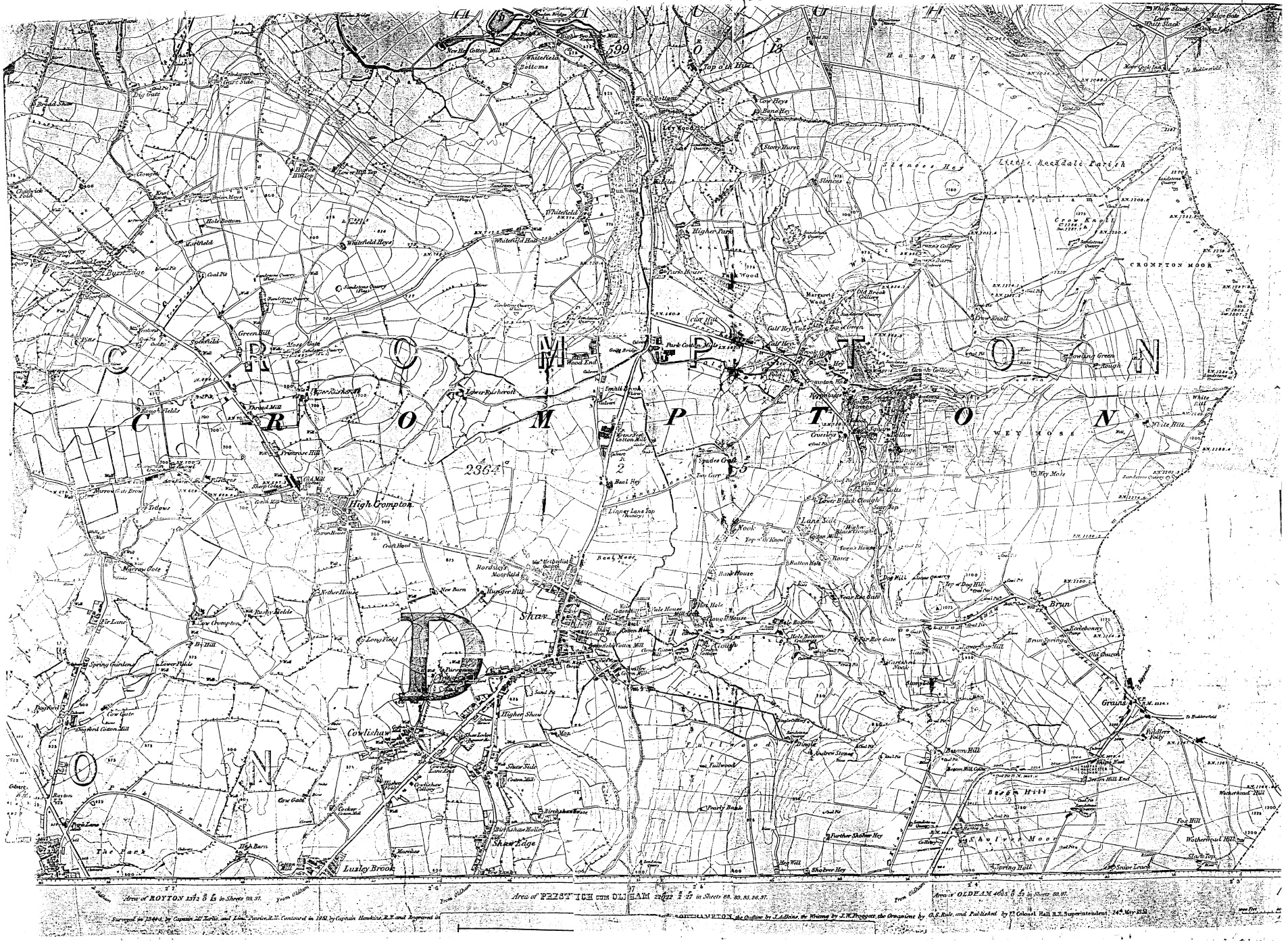
Shaw and Crompton is a civil parish in the Metropolitan Borough of Oldham, Greater Manchester, England, which contains the town of Shaw and lies on the River Beal at the foothills of the South Pennines. It is located north of Oldham, south-east of Rochdale and north-east of Manchester. Historically in Lancashire, the area shows evidence of ancient British and Anglian activity. In the Middle Ages, Crompton formed a small township of scattered woods, farmsteads, moorland and swamp. The local lordship was weak or absent, and so Crompton failed to emerge as a manor with its own lord and court. Farming was the main industry of this rural area, with locals supplementing their incomes by hand-loom woollen weaving in the domestic system. The introduction of textile manufacture during the Industrial Revolution initiated a process of rapid and unplanned urbanisation. A building boom began in Crompton in the mid-19th century, when suitable land for factories in Oldham was b ... [...More Info...] [...Related Items...] OR: [Wikipedia] [Google] [Baidu] |
.jpg)


