|
Nibok
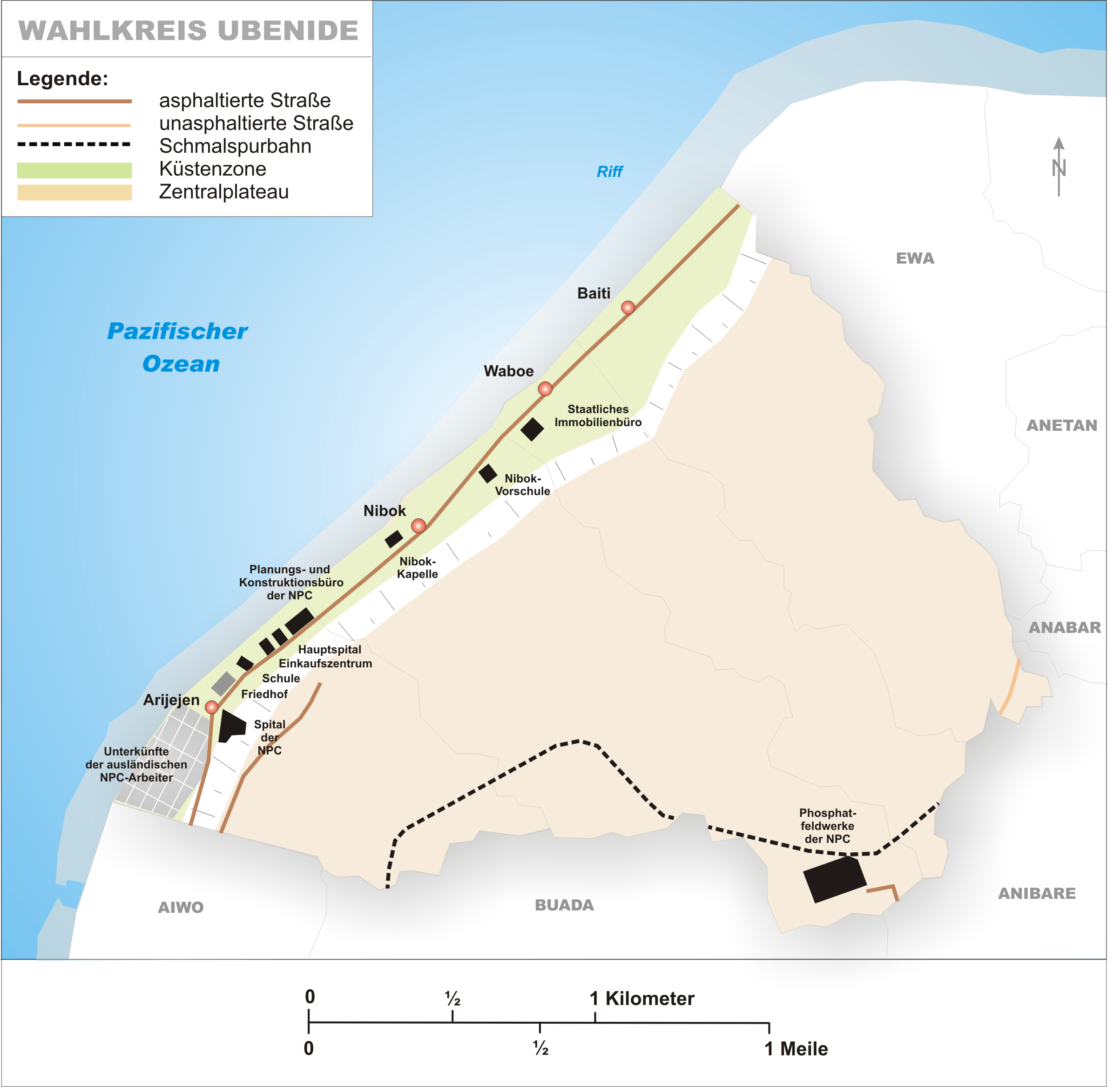
Nibok is a district in the island nation of Nauru in the Micronesian South Pacific. It is located in the west of the island and covers an area of 1.6 square kilometres (395 acres). Nibok is a part of the Ubenide Constituency. As of 2021, the population was 724. The NPC field workshops are located in Nibok. Education Nibok Infant School is in Nibok.Education Statistics Digest 2015 " Department of Education (Nauru). Retrieved on July 8, 2018. p. 47 (PDF p. 47). The primary and secondary schools serving all of Nauru are Yaren Primary School in |
List Of Settlements In Nauru
The Nauru, Republic of Nauru originally consisted of 169 villages; by 1900 these were already partly abandoned, uninhabited or destroyed. With the increasing population growth the single villages merged into a single connected settlement, which today is spread out around the entire coastal strip. The village names are from the book :File:Hambruch Nauru Band1.pdf, Nauru - Ergebnisse der Südseeexpedition by Paul Hambruch, who researched on the island during the Hamburger Südsee-Expedition 1908–1910. The village names were changed following the orthographic reform of the Nauruan language of 1939. List See also * Geography of Nauru {{Nauru topics Populated places in Nauru, Lists of cities by country, Nauru Nauru-related lists, Cities ... [...More Info...] [...Related Items...] OR: [Wikipedia] [Google] [Baidu] |
Ubenide Constituency
Ubenide is a constituency of Nauru made up of four districts: Baitsi, Denigomodu, Nibok, and Uaboe. It covers an area of 4.5 km2 (1.73 mi2), making it the second largest constituency by area, and is the most populous constituency with a population of 3,300. It returns four members to the Parliament of Nauru in Yaren, being the only district to return four. Geography "Ubenide" is an acronym, named after the 4 districts that comprise the constituency - Uaboe, Beidi (the old name of Baiti), Nibok, and Denigomodu. Ubenide is located along the northeast coast of Nauru, and shares borders with the constituencies of Anetan, Anabar, Buada and Aiwo. The phosphate railway crosses through the constituency in the hills. Members of Parliament Election results Notable people * Derog Gioura, who represented Ubenide in the Parliament of Nauru and served as President of Nauru in 2003. * Russell Kun, who has served as the Republic of Nauru's Justice Minister and as the Speaker ... [...More Info...] [...Related Items...] OR: [Wikipedia] [Google] [Baidu] |
Denigomodu District
Denigomodu is a district in the western part of the island of Nauru. It is the most populous district in Nauru. It houses the expatriate housing compound "The Location". This makes it Nauru's largest settlement by population. , 16% of the people in Nauru (around 1,900 people) live in Denigomodu. Geography The district, part of the constituency of Ubenide, covers an area of 1.18 km², and has a population of 1,874, making it the most populous of the fourteen Nauruan districts. Local features In this district is the laborers' settlement for the phosphate mining workers of the Nauru Phosphate Corporation (NPC). Also located in Denigomodu are: * Republic of Nauru Hospital * NPC planning and construction offices * Eigigu Supermarket Education The primary and secondary schools serving all of Nauru are Yaren Primary School in Yaren District (years 1-3), Nauru Primary School in Meneng District (years 4-6), Nauru College in Denigomodu District (years 7-9), and Nauru Secondary ... [...More Info...] [...Related Items...] OR: [Wikipedia] [Google] [Baidu] |
Rail Transport In Nauru
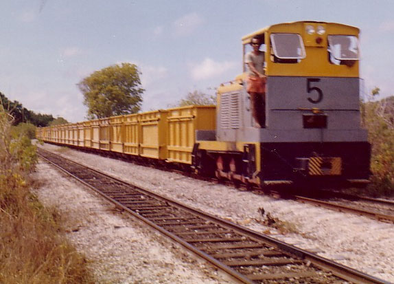
In Nauru, rail transport is used for moving calcium pyrophosphate from the island's interior to the cantilever jetty, jetties on the island's western coast. For this purpose, a long, gauge was built by the Pacific Phosphate Company in 1907. The line passes through the districts of Aiwo District, Aiwo, Buada District, Buada, Denigomodu District, Denigomodu, Nibok District, Nibok, Uaboe District, Uaboe and Anibare District, Anibare. History The railway at Aiwo jetty was electrified in 1912, but replaced by a conveyor belt between the storage bins and the jetty head. The gauge was upgraded to by the British Phosphate Commission in 1920. In the past, steam engines were used to power the trains, later worked by diesel engines, though occasionally, a tractor is used. With Nauru's phosphate deposits almost depleted, the future of the railway is uncertain. The trains were still running as of 2008, although operations are believed to have ceased after 2011. Nauru's phosphate tr ... [...More Info...] [...Related Items...] OR: [Wikipedia] [Google] [Baidu] |
Constituencies Of Nauru
Nauru has 8 electoral district, constituencies, and each of them includes one or more districts. Ubenide sends 4 members to the Parliament of Nauru and Meneng sends 3; the others all send 2.Constituencies of Nauru (naurugov.nr) List See also * Nauru#Administrative divisions, Districts of NauruReferences External links {{Nauru topics Constituencies of Nauru, Subdivisions of Nauru Lists of constituencies, Nauru ...[...More Info...] [...Related Items...] OR: [Wikipedia] [Google] [Baidu] |
Nauru
Nauru, officially the Republic of Nauru, formerly known as Pleasant Island, is an island country and microstate in the South Pacific Ocean. It lies within the Micronesia subregion of Oceania, with its nearest neighbour being Banaba (part of Kiribati) about to the east. With an area of only , Nauru is the List of countries and dependencies by area, third-smallest country in the world, larger than only Vatican City and Monaco, making it the smallest republic and island nation, as well as the smallest member state of the Commonwealth of Nations by area. Demographics of Nauru, Its population of about 10,800 is the world's List of countries and dependencies by population, third-smallest (not including colonies or overseas territories). Nauru is a member of the United Nations, the Commonwealth of Nations, and the Organisation of African, Caribbean and Pacific States. Settled by Micronesians circa 1000 Common Era, BCE, Nauru was annexation, annexed and claimed as a colony by the G ... [...More Info...] [...Related Items...] OR: [Wikipedia] [Google] [Baidu] |
Micronesia
Micronesia (, ) is a subregion of Oceania, consisting of approximately 2,000 small islands in the Northwestern Pacific Ocean. It has a close shared cultural history with three other island regions: Maritime Southeast Asia to the west, Polynesia to the east, and Melanesia to the south—as well as with the wider community of Austronesian peoples. The region has a tropical marine climate and is part of the Oceanian realm. It includes four main archipelagos—the Caroline Islands, the Gilbert Islands, the Mariana Islands, and the Marshall Islands — as well as numerous islands that are not part of any archipelago. Political control of areas within Micronesia varies depending on the island, and is distributed among six sovereign nations. Some of the Caroline Islands are part of the Republic of Palau and some are part of the Federated States of Micronesia (often shortened to "FSM" or "Micronesia"—not to be confused with the identical name for the overall region). The Gi ... [...More Info...] [...Related Items...] OR: [Wikipedia] [Google] [Baidu] |
Yaren District
Yaren (in earlier times Makwa/Moqua) is a district of the Pacific island country of Nauru. It is the '' de facto'' capital of Nauru and is coextensive with Yaren Constituency. It is also the fourth-least-populated capital in the world.Constituencies of Nauru naurugov.nr) History The district was created in 1968. Its original name, Makwa (or Moqua), refers to Moqua Well, an and primary source of drinking water for the Nauruan people.[...More Info...] [...Related Items...] OR: [Wikipedia] [Google] [Baidu] |
Geography Of Nauru
Nauru is a tiny phosphate rock island nation located in the South Pacific Ocean south of the Marshall Islands in Oceania. It is only south of the Equator at Geographic coordinate system, coordinates . Nauru is one of the three great phosphate rock islands in the Pacific Ocean—the others are Banaba Island, Banaba (Ocean Island) in Kiribati and Makatea in French Polynesia. Its land area is , and it has a . Maritime claims are an Exclusive Economic Zone of with 200-nautical-miles (370 km), and a 12-nautical-mile (22 km) territorial sea. The climate is tropical with a monsoon rainy season from November to February. A sandy beach rises to the fertile ring around raised fringing coral reefs. The raised phosphate plateau ('Topside') takes up the central portion of the island. The highest point is 213 ft (65 m) above sea level, along the plateau rim. Nauru's only economically significant natural resources are phosphates, formed from guano deposits by seabirds, and ... [...More Info...] [...Related Items...] OR: [Wikipedia] [Google] [Baidu] |
OHCHR
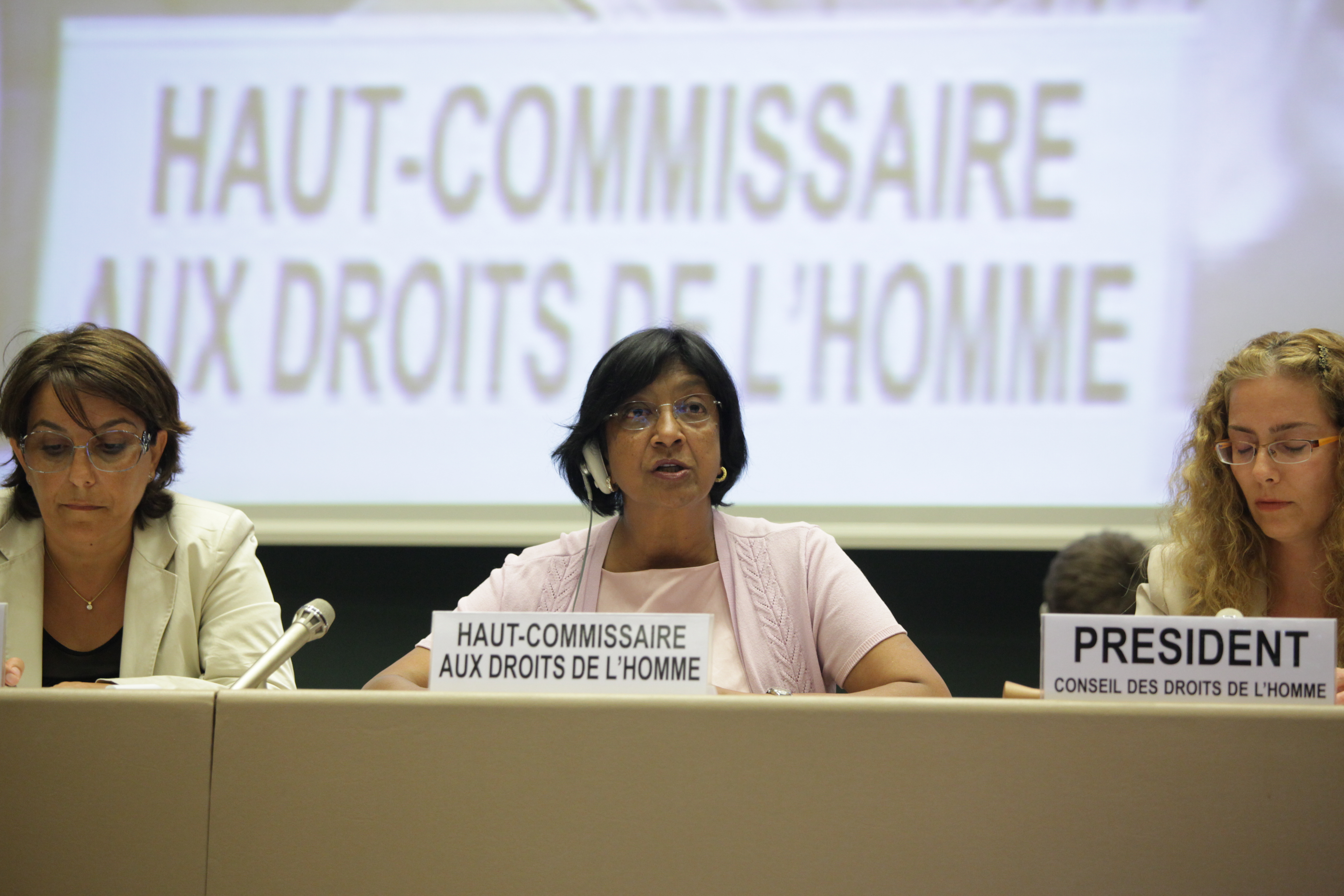
The Office of the United Nations High Commissioner for Human Rights (OHCHR) is a department of the United Nations Secretariat that works to promote and protect human rights that are guaranteed under international law and stipulated in the Universal Declaration of Human Rights of 1948. The office was established by the United Nations General Assembly on 20 December 1993 in the wake of the 1993 World Conference on Human Rights. The office is headed by the high commissioner for human rights, who co-ordinates human rights activities throughout the United Nations System and acts as the secretariat of the Human Rights Council in Geneva, Switzerland. The eighth and current high commissioner is Volker Türk of Austria, who succeeded Michelle Bachelet of Chile on 8 September 2022. In 2018–2019, the department had a budget of US$201.6 million (3.7 per cent of the United Nations regular budget), and approximately 1,300 employees based in Geneva and New York City. It is an ex officio mem ... [...More Info...] [...Related Items...] OR: [Wikipedia] [Google] [Baidu] |
Nauru Secondary School
Nauru Secondary School (abbreviated as NSS) is an upper public secondary school in the Yaren District, Nauru, located in the Nauru Learning Village, along with the University of the South Pacific Nauru Campus and the Nauru Technical & Vocational Education Training Centre. The school served years 10-12 and had the final stages of secondary education in Nauru. it served years 8 through 12. It uses the curriculum of Queensland, Australia.Teachers for Nauru " . Retrieved on July 5, 2018. In the 1950s it served grades 4 and 5, and a new building opened in 1954. Reuben Kun, who wrote an article about Nauru's university system, stated that in that period t ... [...More Info...] [...Related Items...] OR: [Wikipedia] [Google] [Baidu] |
Meneng District
Meneng (or Menen) is a district located in the Meneng Constituency in the country of Nauru. The constituency elects 2 members to the Parliament of Nauru in Yaren. Geography The district is located in the southeast of the island, covering an area of 3.1 km². It has a population of 1,797. Meneng District has 18 villages, the most of any district in Nauru. Local features Features in Meneng include: * The Menen Hotel, one of the island's four hotels * the wireless station * the State House (presidential residence; recently burned down) * the Government Printing Office * the Meneng Stadium * Australian Nauru Detention Centre Education Meneng Infant School is in Meneng.Education Statistics Digest 2015 " [...More Info...] [...Related Items...] OR: [Wikipedia] [Google] [Baidu] |


