|
Nhamatanda
Nhamatanda is a town in the Sofala Province of Mozambique. It is the administrative center of Nhamatanda District Nhamatanda District is a Districts of Mozambique, district of Sofala Province in Mozambique. The principal town is Nhamatanda. The district is located in the center of the province, and borders with Gorongosa District in the north, Muanza District .... It lies along the Beira Corridor between Harare in Zimbabwe and Beira, Mozambique's second-largest city. It was largely destroyed by Cyclone Idai in March 2019. Name Nhamatanda has had many names. Early in its history, it was known as "Bambu Crick". In the local dialect of Chisena, this means "Mr. Crick" - a reference to a British landowner in the area. English-speakers, however, referred to the place as "Bamboo Creek", a reference to a small river near the town. Which name came first is unknown, and many residents of the area refer variously to these different stories. Nova Fontesvila, the name given to the sa ... [...More Info...] [...Related Items...] OR: [Wikipedia] [Google] [Baidu] |
Nhamatanda District
Nhamatanda District is a Districts of Mozambique, district of Sofala Province in Mozambique. The principal town is Nhamatanda. The district is located in the center of the province, and borders with Gorongosa District in the north, Muanza District in the northeast, Dondo District in the east, Buzi District in the south, and with Gondola District of Manica Province in the west. The area of the district is . It has a population of 210,757 as of 2007. Geography The principal rivers in the district are the Muda River (Mozambique), Muda River, the Mecuzi River, the Nhamatanda River, the Tsengudza River, the Nhamissenguere Metuchira River, the Mecuzi Manguena River, the Mítua River, the Mussicavo River, the Mutarara River, and the Pungwe River. According to the Köppen climate classification, in the east the district has tropical wet and dry climate (Aw), and in the east tropical humid climate (Cw). The annual rainfall is . History Until colonial times, the area was scarcely populated ... [...More Info...] [...Related Items...] OR: [Wikipedia] [Google] [Baidu] |
Cyclone Idai
Intense Tropical Cyclone Idai () was one of the worst tropical cyclones on record to affect Africa and the Southern Hemisphere. The long-lived storm caused catastrophic damage, and a humanitarian crisis in Mozambique, Zimbabwe, and Malawi, leaving more than 1,500 people dead and many more missing. Idai is the deadliest tropical cyclone recorded in the South-West Indian Ocean basin. In the Southern Hemisphere, which includes the Australian, South Pacific, and South Atlantic basins, Idai ranks as the second-deadliest tropical cyclone on record. The only system with a higher death toll is the 1973 Flores cyclone that killed 1,650 off the coast of Indonesia. The tenth named storm, seventh tropical cyclone, and seventh intense tropical cyclone of the 2018–19 South-West Indian Ocean cyclone season, Idai originated from a tropical depression that formed off the east coast of Mozambique on 4 March. The storm, Tropical Depression 11, made landfall in Mozambique later in the day ... [...More Info...] [...Related Items...] OR: [Wikipedia] [Google] [Baidu] |
Mozambique
Mozambique (), officially the Republic of Mozambique ( pt, Moçambique or , ; ny, Mozambiki; sw, Msumbiji; ts, Muzambhiki), is a country located in southeastern Africa bordered by the Indian Ocean to the east, Tanzania to the north, Malawi and Zambia to the northwest, Zimbabwe to the west, and Eswatini and South Africa to the southwest. The sovereign state is separated from the Comoros, Mayotte and Madagascar by the Mozambique Channel to the east. The capital and largest city is Maputo. Notably Northern Mozambique lies within the monsoon trade winds of the Indian Ocean and is frequentely affected by disruptive weather. Between the 7th and 11th centuries, a series of Swahili port towns developed on that area, which contributed to the development of a distinct Swahili culture and language. In the late medieval period, these towns were frequented by traders from Somalia, Ethiopia, Egypt, Arabia, Persia, and India. The voyage of Vasco da Gama in 1498 marked the arr ... [...More Info...] [...Related Items...] OR: [Wikipedia] [Google] [Baidu] |
Harare
Harare (; formerly Salisbury ) is the Capital city, capital and most populous city of Zimbabwe. The city proper has an area of 940 km2 (371 mi2) and a population of 2.12 million in the 2012 census and an estimated 3.12 million in its metropolitan area in 2019. Situated in north-eastern Zimbabwe in the country's Mashonaland region, Harare is a metropolitan Harare Province, province, which also incorporates the municipalities of Chitungwiza and Epworth, Zimbabwe, Epworth. The city sits on a plateau at an elevation of above sea level and its climate falls into the subtropical highland category. The city was founded in 1890 by the Pioneer Column, a small military force of the British South Africa Company, and named Fort Salisbury after the UK Prime Minister Robert Gascoyne-Cecil, 3rd Marquess of Salisbury, Lord Salisbury. Company Company rule in Rhodesia, administrators demarcated the city and ran it until Southern Rhodesia achieved responsible government in 1923. Salisb ... [...More Info...] [...Related Items...] OR: [Wikipedia] [Google] [Baidu] |
Zimbabwe
Zimbabwe (), officially the Republic of Zimbabwe, is a landlocked country located in Southeast Africa, between the Zambezi and Limpopo Rivers, bordered by South Africa to the south, Botswana to the south-west, Zambia to the north, and Mozambique to the east. The capital and largest city is Harare. The second largest city is Bulawayo. A country of roughly 15 million people, Zimbabwe has 16 official languages, with English, Shona language, Shona, and Northern Ndebele language, Ndebele the most common. Beginning in the 9th century, during its late Iron Age, the Bantu peoples, Bantu people (who would become the ethnic Shona people, Shona) built the city-state of Great Zimbabwe which became one of the major African trade centres by the 11th century, controlling the gold, ivory and copper trades with the Swahili coast, which were connected to Arab and Indian states. By the mid 15th century, the city-state had been abandoned. From there, the Kingdom of Zimbabwe was established, fol ... [...More Info...] [...Related Items...] OR: [Wikipedia] [Google] [Baidu] |
Beira, Mozambique
Beira is the capital and largest city of Sofala Province, where the Pungwe River meets the Indian Ocean, in the central region of Mozambique. It is the fourth-largest city by population in Mozambique, after Maputo, Matola and Nampula. Beira had a population of 397,368 in 1997, which grew to 530,604 in 2019. A coastal city, it holds the regionally significant Port of Beira, which acts as a gateway for both the central interior portion of the country as well as the land-locked nations of Zimbabwe, Zambia and Malawi. Originally called Chiveve after a local river, it was renamed Beira to honour the Portuguese Crown prince Dom Luís Filipe (titled Prince of Beira, itself referring to the traditional Portuguese province of Beira), who had visited Mozambique in the early 1900s. It was first developed by the Portuguese Mozambique Company in the 19th century, supplanting Sofala as the country's main port. It was then directly developed by the Portuguese colonial government ... [...More Info...] [...Related Items...] OR: [Wikipedia] [Google] [Baidu] |
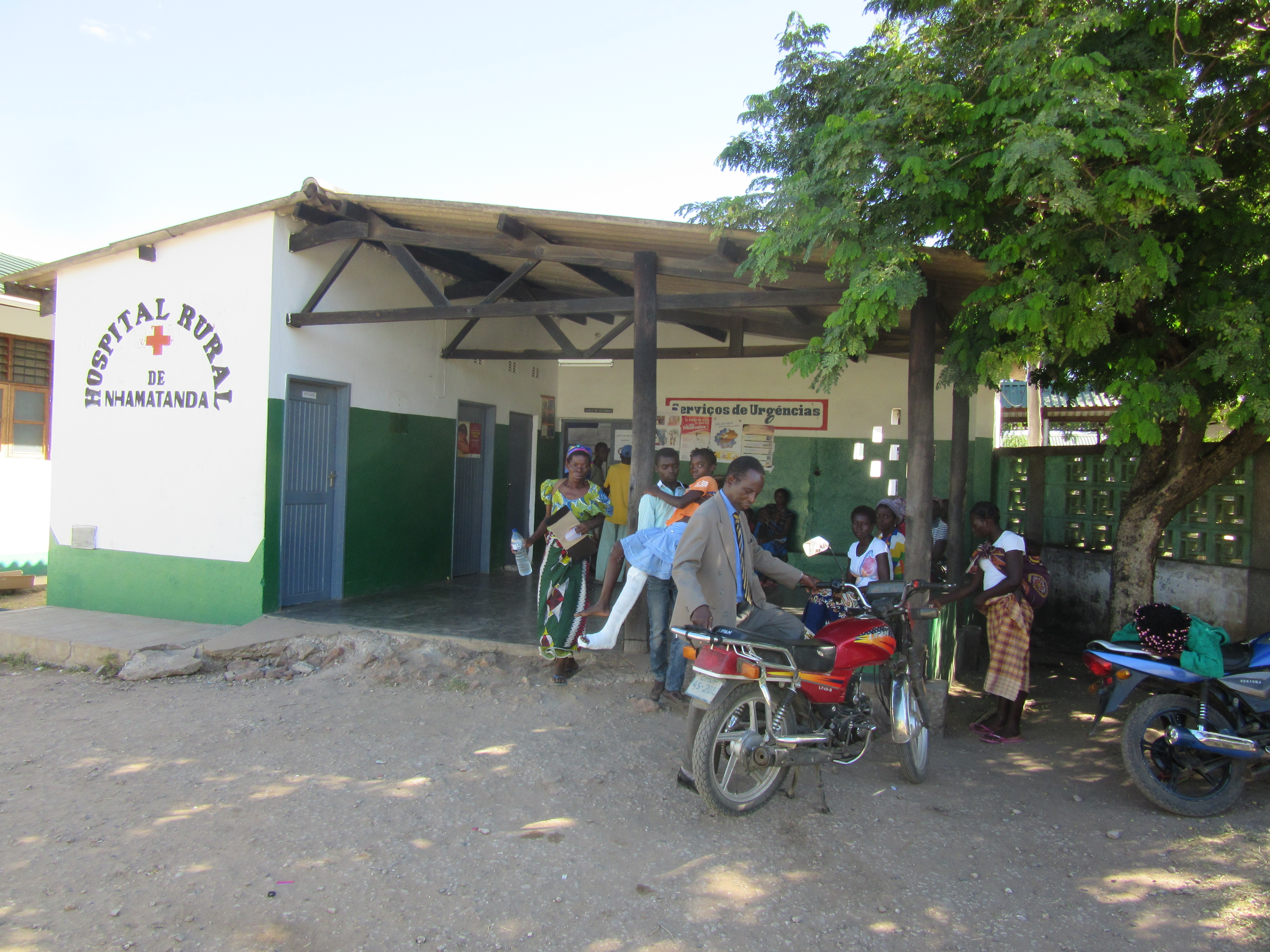
Hospital Rural De Nhamatanda, Sofala, Mozambique, VOA
A hospital is a health care institution providing patient treatment with specialized health science and auxiliary healthcare staff and medical equipment. The best-known type of hospital is the general hospital, which typically has an emergency department to treat urgent health problems ranging from fire and accident victims to a sudden illness. A district hospital typically is the major health care facility in its region, with many beds for intensive care and additional beds for patients who need long-term care. Specialized hospitals include trauma centers, rehabilitation hospitals, children's hospitals, seniors' ( geriatric) hospitals, and hospitals for dealing with specific medical needs such as psychiatric treatment (see psychiatric hospital) and certain disease categories. Specialized hospitals can help reduce health care costs compared to general hospitals. Hospitals are classified as general, specialty, or government depending on the sources of income received. A ... [...More Info...] [...Related Items...] OR: [Wikipedia] [Google] [Baidu] |
Sena Language
Sena is a Bantu language spoken in the four provinces of central Mozambique (Zambezi valley): Tete, Sofala, Zambezia and Manica. There were an estimated 900,000 native Sena speakers in Mozambique in 1997, with at least 1.5 million if including those who speak it as a second language. It is one of the Nyasa languages. Sena is spoken in several dialects, of which Rue (also called Barwe or Cibalke) and Podzo are divergent. The Sena of Malawi may be a distinct language. Barwe (Chibarwe) has official recognition in Zimbabwe Zimbabwe (), officially the Republic of Zimbabwe, is a landlocked country located in Southeast Africa, between the Zambezi and Limpopo Rivers, bordered by South Africa to the south, Botswana to the south-west, Zambia to the north, and Mozam .... Some remarks on Sena tenses can be found in Funnell (2004), Barnes & Funnell (2005) and in Kiso (2012). Phonology Vowels Consonants * Labialized sounds can also be heard as retroflex among diffe ... [...More Info...] [...Related Items...] OR: [Wikipedia] [Google] [Baidu] |
Fontes Pereira De Melo
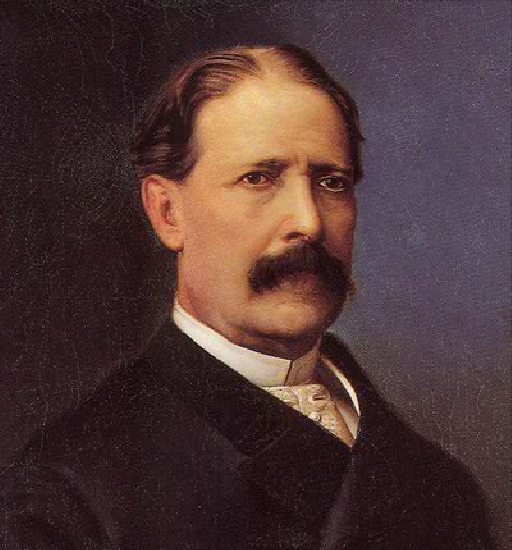
António Maria de Fontes Pereira de Melo GCTE KGF (; Lisbon, 8 September 1819 – 22 January 1887) was a Portuguese statesman and engineer. He was a leading parliamentarian and political figure of his time. Among other posts held, he was six times minister of finance and minister of public works. From 1871 to 1886, he served three times as prime minister of Portugal, for a total of 11 years. Fontes Pereira de Melo is mostly remembered for implementing dynamic industrial and public infrastructure policy, which became known as ''Fontismo'' (after his name). He also implemented educational reforms in accordance with the industrialization process he initiated (see Instituto Industrial de Lisboa and Escola Industrial do Porto). Early life Born on 8 September 1819 in Lisbon, António Maria de Fontes Pereira de Melo was the son of João de Fontes Pereira de Melo, a Portuguese Navy officer, later governor of Cape Verde and minister of state, and his wife Jacinta Venância Ro ... [...More Info...] [...Related Items...] OR: [Wikipedia] [Google] [Baidu] |


