|
Ngo Mei Chau
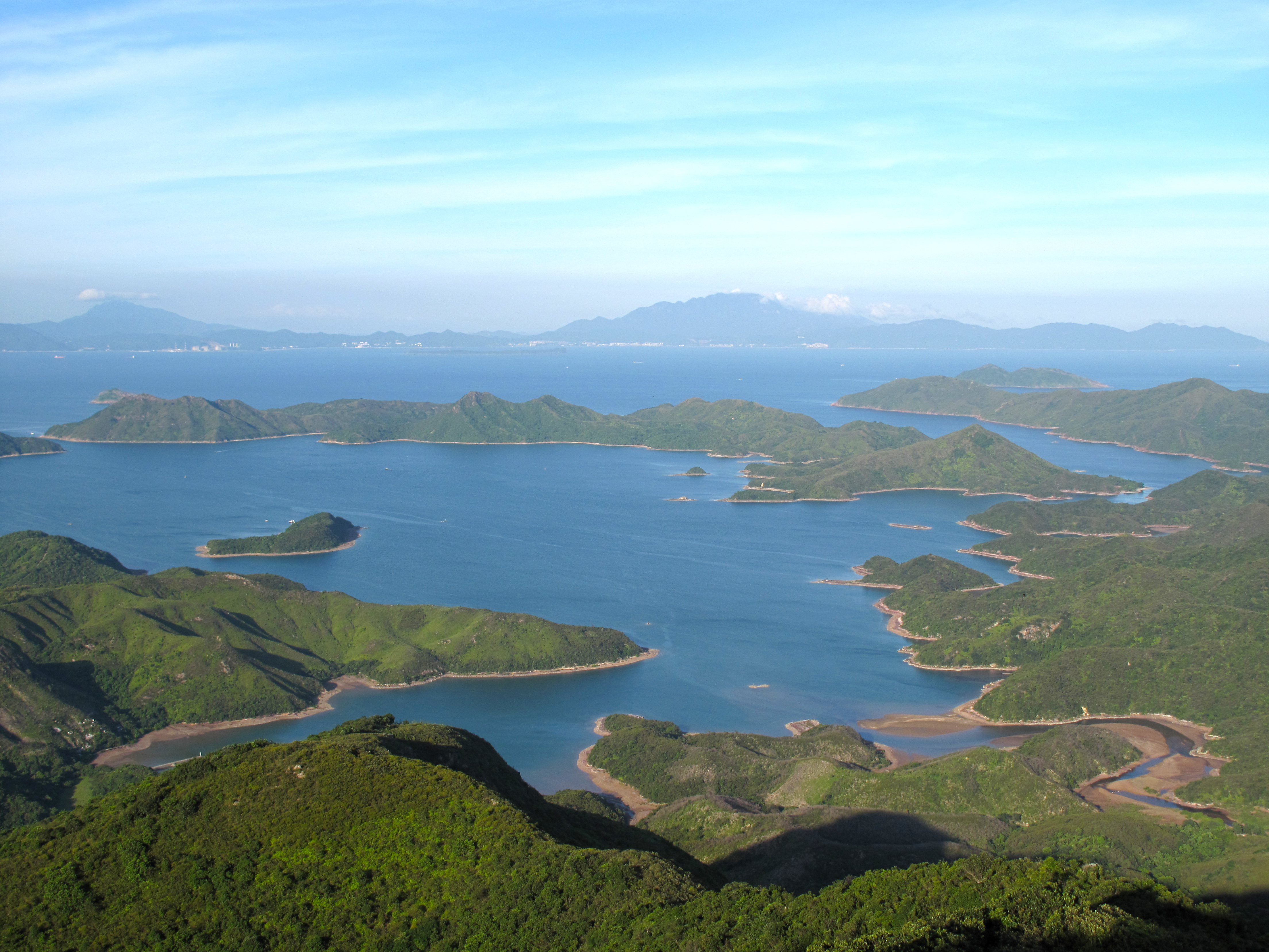
Crescent Island or Ngo Mei Chau () is an island of Hong Kong, located southeast of Crooked Island (Kat O) and northeast of Double Island (Wong Wan Chau). Administratively, it is part of North District. Conservation Crescent Island has been part of the Plover Cove (Extension) Country Park since 1979. See also * Double Haven * Mirs Bay * Beaches of Hong Kong Hong Kong has a long and jagged coastline with many bays and beaches. The shelter provided by adjacent mountains keeps wave sizes generally small, and most beaches are thus suitable for swimming and recreation, if they can be reached. About h ... References North District, Hong Kong Hong Kong UNESCO Global Geopark Uninhabited islands of Hong Kong {{NorthDistrictHK-geo-stub ... [...More Info...] [...Related Items...] OR: [Wikipedia] [Google] [Baidu] |
Tung Wan, Double Island 02 Double Island & Crescent Island, Chik Mun Tau
Tung may refer to: People * Madison Tung, a U.S. Air Force Officer, wrestler, and Rhodes Scholar * Ho-Pin Tung, a dutch race car driver of Chinese descent. * Lola Tung, an actress known for her acting debut on drama series ''The Summer I Turned Pretty'' Places * Tung Fort, a hill fort in Maharashtra, India * Tung, a village in Bar Kham, Cambodia * Tung (Mawal), a village in Maharashtra, India * Tung, Sikkim, a village in India * Tung, West Bengal, India, on the Darjeeling Himalayan Railway Other uses * ''Vernicia fordii'' or Tung tree, a deciduous tree native to China ** Tung oil, a furniture finish made from the seeds of the tung tree * Tung (surname), a Cantonese Romanization of Chinese family names 董, commonly used in Hong Kong * Tung, the original Webster spelling of tongue * Tunng, an experimental folk band from the United Kingdom * Lê Quang Tung (1923–1963), Vietnamese military leader under Ngô Đình Diệm See also * * Tongue (other) The tongue is a mu ... [...More Info...] [...Related Items...] OR: [Wikipedia] [Google] [Baidu] |
Kat O
Kat O (), also named Crooked Island, is an island in northeast Hong Kong. Administration Administratively, Kat O is part of North District, Hong Kong, North District. It is a recognized village under the New Territories Small House Policy. Geography Kat O is located in the west of Mirs Bay.Hong Kong GeoparkKat O Nature Trail/ref> With an area of 2.35 km², it is the largest island in North District, the second largest being Double Island, Hong Kong, Wong Wan Chau (Double Island). Neighbouring islands include Ap Chau, Ngo Mei Chau (Crescent Island), and Pak Sha Chau (North District), Pak Sha Chau (Round Island). The village of Tung O () is located on its northwest coast. Its highest point is Kai Kung Leng (), which is 122 m above sea level. O Pui Tong () is a bay surrounded by the crook-shaped Crooked Island and Yeung Chau, North District, Yeung Chau. O Pui Tong, together with the northwestern waters of Kat O, are two of the 26 designated Agriculture and aquaculture in Hon ... [...More Info...] [...Related Items...] OR: [Wikipedia] [Google] [Baidu] |
Double Island, Hong Kong
Double Island or Wong Wan Chau () is an island located in the north-eastern part of Hong Kong. Administratively, it is part of North District, Hong Kong, North District. Geography Double Island has an area of 2.13 km². It is the second largest island in North District, the largest being Kat O, Crooked Island. Its highest point is at 139 m. Its western coast is facing Double Haven. Wong Wan () is a bay of Double Island. It is one of the 26 designated Agriculture and aquaculture in Hong Kong, marine fish culture zones in Hong Kong. Conservation Double Island became part of the Plover Cove (Extension) Country Park in 1979. Facilities * Outward Bound Hong Kong Adventure Base History Typhoon of 1858 It is wrongly suggested that it was the Double Island in Hong Kong's Double Haven (Yan Chau Tong, ) where the September Typhoon of 1858 destroyed several well-known opium clippers, including the ''Anonyma'', ''Gazelle'', ''Pantaloon'', and ''Mazeppa''. Basil Lubbock's ''The Opi ... [...More Info...] [...Related Items...] OR: [Wikipedia] [Google] [Baidu] |
North District, Hong Kong
North District () is the northernmost district of the districts of Hong Kong, 18 districts of Hong Kong. It is located in the northeastern part of the New Territories. The new town of Fanling–Sheung Shui New Town, Fanling–Sheung Shui is within this district. It had a population of 298,657 in 2001. The district has the second lowest population density in Hong Kong. It borders with Shenzhen city with the Sham Chun River. Most major access points to mainland China from Hong Kong lie in this district. The North District is about in area. Demographics According to statistics, 70% of the district population lives in the Public housing, public estates in the Fanling–Sheung Shui New Town. 40,000 villagers living around the two town centres and the main rural towns (Sha Tau Kok and Ta Kwu Ling) account for most residents in the district. Islands of the district * A Chau () * Ap Chau Mei Pak Tun Pai () * Ap Chau Pak Tun Pai () * Ap Chau (, Robinson Island) * Ap Lo Chun () * Ap ... [...More Info...] [...Related Items...] OR: [Wikipedia] [Google] [Baidu] |
Plover Cove (Extension) Country Park
Plover Cove, also known by its Chinese names Shuen Wan Hoi () or Shuen Wan (), is a cove in the Tai Po District of Hong Kong, near Tolo Channel and Tolo Harbour. Geography It is encircled by the hills Pat Sin Leng and Wan Leng (), the Yim Tin Tsai, Ma Shi Chau and Tung Tau Chau () island ranges, and a long peninsula extending from Fu Tau Sha (). A major part of the cove has been dammed to form the fresh water Plover Cove Reservoir. A land area between Sha Lan Tsuen and Ting Kok is also known as Shuen Wan. The community of Shuen Wan Heung is made up of the eleven villages of A Shan, Tung Tsz, Wai Ha, Ha Tei Ha, Tseng Tau, San Tau Kok, Wong Yue Tan, Chim Uk, Chan Uk, Lei Uk and Sha Lan. An administrative organ for Shuen Wan Heung was established in 1992. Historically, Ting Kok, together with the nearby Hakka villages of Shan Liu, Lai Pik Shan, Lo Tsz Tin, Lung Mei and Tai Mei Tuk belonged to the Ting Kok Yeuk () alliance. Cross Tolo Harbour Open Race The annual ... [...More Info...] [...Related Items...] OR: [Wikipedia] [Google] [Baidu] |
Double Haven
Double Haven or Yan Chau Tong () is a harbour enclosed by Double Island, Crescent Island and Crooked Island within the north-eastern New Territories of Hong Kong. It is known for its scenery and natural environment, and for the calm seas from which its English name derives. Double Haven contains many deep red coloured rocks because of iron oxide. Villages in Double Haven * Lai Chi Wo () * Sam A Tsuen () * Kat O () Islands Islands within Double Haven include: * Chap Mo Chau * Double Island (Wong Wan Chau) * Fu Wong Chau * Kat O (Crooked Island) * Ngo Mei Chau (Crescent Island) * Pak Ka Chau * Yan Chau Conservation Parts of the haven fall within Yan Chau Tong Marine Park () to protect the wildlife of the marine creatures. Plover Cove (Extension) Country Park was designated in 1979 to protect the ecology of Double Haven. It also forms a major part of Hong Kong Global Geopark, Northeast New Territories Sedimentary Rock Region.The two main ecological features of this ... [...More Info...] [...Related Items...] OR: [Wikipedia] [Google] [Baidu] |
Mirs Bay
Mirs Bay (also known as Tai Pang Wan, Dapeng Wan, Dapeng Bay or Mers Bay; ) is a bay in the northeast of Kat O and Sai Kung Peninsula of Hong Kong. The north and east shores are surrounded by Yantian and Dapeng New District of Shenzhen. Ping Chau stands in the midst of the bay. History Mirs Bay, along with other waterways near Hong Kong, was once was home to various coastal defences (e.g. Dapeng Fortress) used against pirates during the Ming Dynasty. Mirs Bay was used by then American Commodore (later Admiral) George Washington Dewey during the Spanish–American War as a refuge and repair facility for the US Navy. In 1949, the colonial government imposed a curfew under the Public Order Ordinance forbidding movement of watercraft in Mirs Bay between 10 PM and 6 AM without written permission of the Hong Kong Police Force. For purposes of the order, the dividing line between Tolo Channel and Mirs Bay runs from Wong Chuk Kok Tsui to Ngo Keng Tsui (; ). Features With ... [...More Info...] [...Related Items...] OR: [Wikipedia] [Google] [Baidu] |
Beaches Of Hong Kong
Hong Kong has a long and jagged coastline with many bays and beaches. The shelter provided by adjacent mountains keeps wave sizes generally small, and most beaches are thus suitable for swimming and recreation, if they can be reached. About half of Hong Kong's more accessible beaches are gazetted and thus managed by the Leisure and Cultural Services Department (LCSD). Many that are not gazetted are also popular, and some privately owned beaches are publicly accessible. With the increasing development and urbanisation of Hong Kong, water quality has worsened resulting in the closure of several beaches previously suitable for swimming. These include Approach Beach, Ting Kau Beach, Anglers' Beach, Gemini Beaches, Hoi Mei Wan Beach, Casam Beach and Lido Beach in Tsuen Wan. In 2011, Lido Beach, Casam Beach, Approach Beach and Hoi Mei Wan Beach were reopened following an improvement in water quality. Gazetted beaches A total of forty-two beaches in Hong Kong are gazetted and man ... [...More Info...] [...Related Items...] OR: [Wikipedia] [Google] [Baidu] |
Hong Kong UNESCO Global Geopark
Hong Kong UNESCO Global Geopark (), formerly Hong Kong National Geopark (), was inaugurated on 3 November 2009. It is a single entity of land area over 150 km2 across parts of the eastern and northeastern New Territories. On 18 September 2011, UNESCO listed the geopark as part of its Global Geoparks Network. The Hong Kong UNESCO Global Geopark consists of two geological regions: * the Sai Kung District, Sai Kung Volcanic Rock Region, with its widely distributed tuff volcanic rocks displaying Prism (geometry), prismatic columnar jointing, which are of international geological significance * the Northeast New Territories Sedimentary Rock Region, which comprises sedimentary rocks formed in different geologic periods, showcasing the complete Geology of Hong Kong, geological history of Hong Kong. History In 2008, the Hong Kong government commissioned a study to investigate the feasibility of establishing a geopark. The study identified two suitable regions, namely the north-eas ... [...More Info...] [...Related Items...] OR: [Wikipedia] [Google] [Baidu] |


