|
Newark–World Trade Center (PATH Service)
Newark–World Trade Center is a rapid transit service operated by the Port Authority Trans-Hudson (PATH). It is colored red on the PATH service map and trains on this service display red marker lights. This service operates from Pennsylvania Station in Newark, New Jersey, by way of the Downtown Hudson Tubes to the World Trade Center in Lower Manhattan, New York City, New York. Operating 24 hours a day, the trip takes minutes to complete. Much of the service's Newark-Jersey City leg is in very close proximity to the Northeast Corridor used by Amtrak intercity trains and NJ Transit commuter trains; the route crosses over the Newark Dock Bridge used by intercity and commuter trains traveling between Newark and New York. For these reasons, PATH is legally reckoned as a commuter railroad under the jurisdiction of the Federal Railroad Administration even though it has long operated as a rapid transit system. This is the only PATH route with significant above-ground sections; the N ... [...More Info...] [...Related Items...] OR: [Wikipedia] [Google] [Baidu] |
Pennsylvania Station (Newark)
Newark Penn Station is an intermodal passenger station in Newark, New Jersey. One of the New York metropolitan area's major transportation hubs, Newark Penn Station is served by multiple rail and bus carriers, making it the seventh busiest rail station in the United States, and the fourth busiest in the New York City metropolitan area. Located at Raymond Plaza between Market Street and Raymond Boulevard, the station is served by three NJ Transit commuter rail lines, the Newark Light Rail, the PATH rapid transit system, and all 10 of Amtrak's Northeast Corridor services, including the '' Acela''. The station is also Newark's main intercity bus terminal; it is served by carriers Greyhound, Bolt, and Fullington Trailways. Additionally, it is served by 33 local and regional bus lines operated by NJ Transit Bus Operations. History Designed by the renowned architectural firm McKim, Mead & White, the same team behind the Pennsylvania Railroad's original New York Penn St ... [...More Info...] [...Related Items...] OR: [Wikipedia] [Google] [Baidu] |
NJ Transit
New Jersey Transit Corporation, branded as NJ Transit or NJTransit and often shortened to NJT, is a state-owned public transportation system that serves the U.S. state of New Jersey and portions of the states of New York and Pennsylvania. It operates buses, light rail, and commuter rail services throughout the state, connecting to major commercial and employment centers both within the state and in its two adjacent major cities, New York City and Philadelphia. In , the system had a ridership of . Covering a service area of , NJT is the largest statewide public transit system and the third-largest provider of bus, rail, and light rail transit by ridership in the United States. NJT also acts as a purchasing agency for many private operators in the state; in particular, buses to serve routes not served by the transit agency. History NJT was founded on July 17, 1979, an offspring of the New Jersey Department of Transportation (NJDOT), mandated by the state government to a ... [...More Info...] [...Related Items...] OR: [Wikipedia] [Google] [Baidu] |
Harrison Station (PATH)
The Harrison station is a metro station, station on the PATH (rail system), PATH system. Located on Frank E. Rodgers Boulevard (List of county routes in Hudson County, New Jersey#697, County Route 697) between Interstate 280 (New Jersey), I-280 and the Passaic River in Harrison, New Jersey, Harrison, New Jersey, it is served by the Newark–World Trade Center line at all times. The station's two side platforms are on the outside of the Northeast Corridor's three tracks. The station opened in 1911 as part of the extension of the Hudson and Manhattan Railroad to Park Place (H&M station), Newark–Park Place, and was relocated in 1937. It was rebuilt in the late 2010s and early 2020s. History On November 26, 1911, the Hudson and Manhattan Railroad (H&M) began running from Manhattan Transfer (PRR station), Manhattan Transfer to Park Place (H&M station), Newark–Park Place, stopping at Harrison station at the intersection of Fourth Street (now Frank E. Rodgers Boulevard Sout ... [...More Info...] [...Related Items...] OR: [Wikipedia] [Google] [Baidu] |
Infill Station
An infill station (sometimes in-fill station) is a train station built on an existing passenger rail, rapid transit, or light rail line to address demand in a location between existing stations. Such stations take advantage of existing train service and encourage new riders by providing a more convenient location. Many older transit systems have widely spaced stations and can benefit from infill stations. In some cases, new infill stations are built at sites where a station had once existed many years ago, for example the station on the Chicago 'L''s Green Line. Examples The Americas Canada *Montreal ** Griffintown–Bernard-Landry station, 2027 *Ottawa ** Corso Italia station, 2025 ** Walkley station, 2025 *Toronto ** North York Centre station, 1987 *Vancouver ** Lake City Way station, 2003 ** Capstan station, 2024 Chile *Santiago ** San José de la Estrella metro station, 2009 United States * Atlanta ** Peachtree Center station, 1982 * Phoenix ** 50th Street/Washingto ... [...More Info...] [...Related Items...] OR: [Wikipedia] [Google] [Baidu] |
Journal Square Transportation Center
The Journal Square Transportation Center is a multi-modal transportation hub located on Magnolia Avenue and Kennedy Boulevard at Journal Square in Jersey City, New Jersey, United States. Owned and operated by the Port Authority of New York and New Jersey, the complex includes a ten-story tower, a retail plaza, a bus terminal, a two-level parking facility, and the Journal Square station of the PATH rail transit system. The underground station has a high ceiling and a mezzanine level connecting the platforms. History The transportation center is built over a cut through Bergen Hill. The Bergen Hill cut was originally excavated in 1834–1838 by the New Jersey Rail Road and Transportation Company, later part of the Pennsylvania Railroad (PRR), to access the Hudson River waterfront. Passenger trains traveled to what became Exchange Place, while freight trains on the Harsimus Branch continued to the Harsimus Stem Embankment. The center began as the Summit Avenue stati ... [...More Info...] [...Related Items...] OR: [Wikipedia] [Google] [Baidu] |
Park Place Station (H&M)
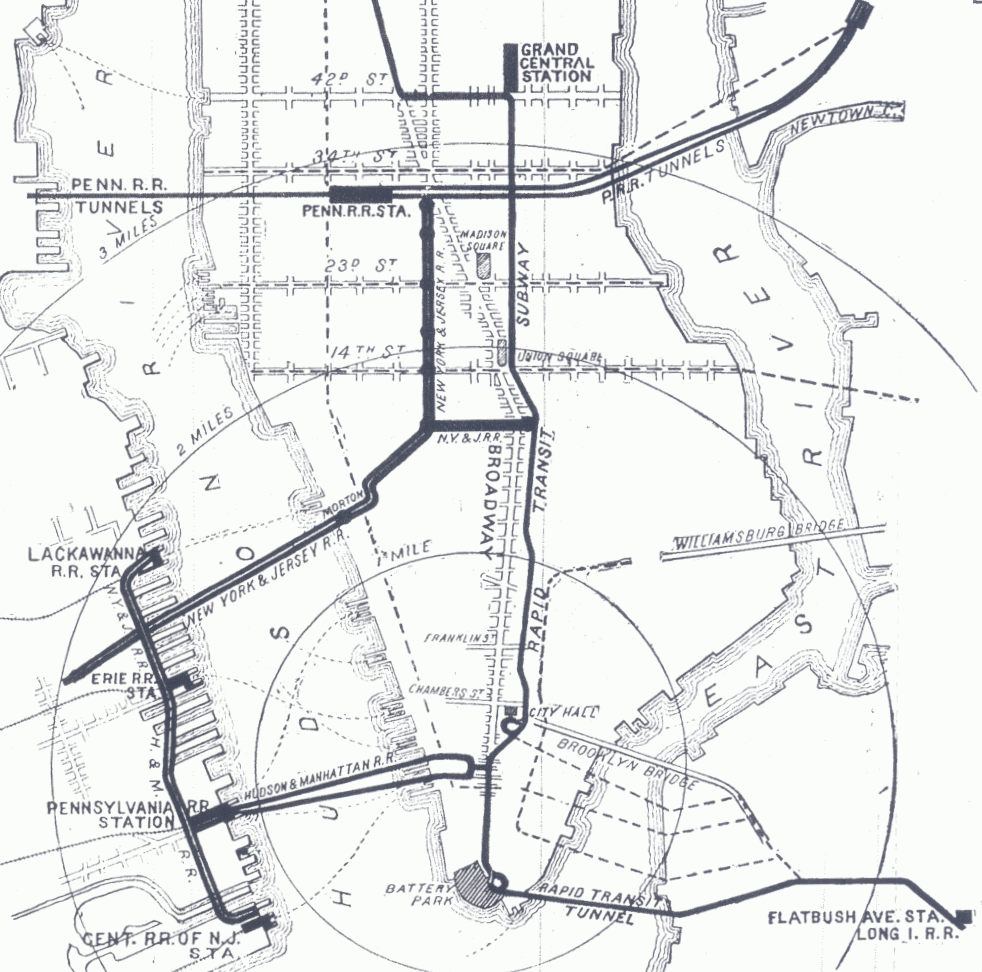
The Park Place station was a terminal of the Hudson and Manhattan Railroad (H&M) located at the intersection of Park Place and Centre Street in Newark, New Jersey, across the street from Military Park nearby Newark Public Service Terminal. The terminal opened on November 26, 1911, after the H&M extended its line westward from Grove Street in Jersey City to Summit Avenue, Manhattan Transfer, and over the Centre Street Bridge to Newark. The terminal closed on June 20, 1937, after the H&M tracks were realigned to serve the new Newark Penn Station. The H&M was taken over by the Port Authority of New York and New Jersey in 1962, the system becoming the Port Authority Trans-Hudson (PATH). The New Jersey Performing Arts Center is sited on the location of the terminal adjacent to the Newark Light Rail's NJPAC/Center Street station. See also *New Jersey Railroad *Four Corners (Newark) *Newark and New York Branch The Newark and New York Branch was a railway line that ran between ... [...More Info...] [...Related Items...] OR: [Wikipedia] [Google] [Baidu] |
Harrison, New Jersey
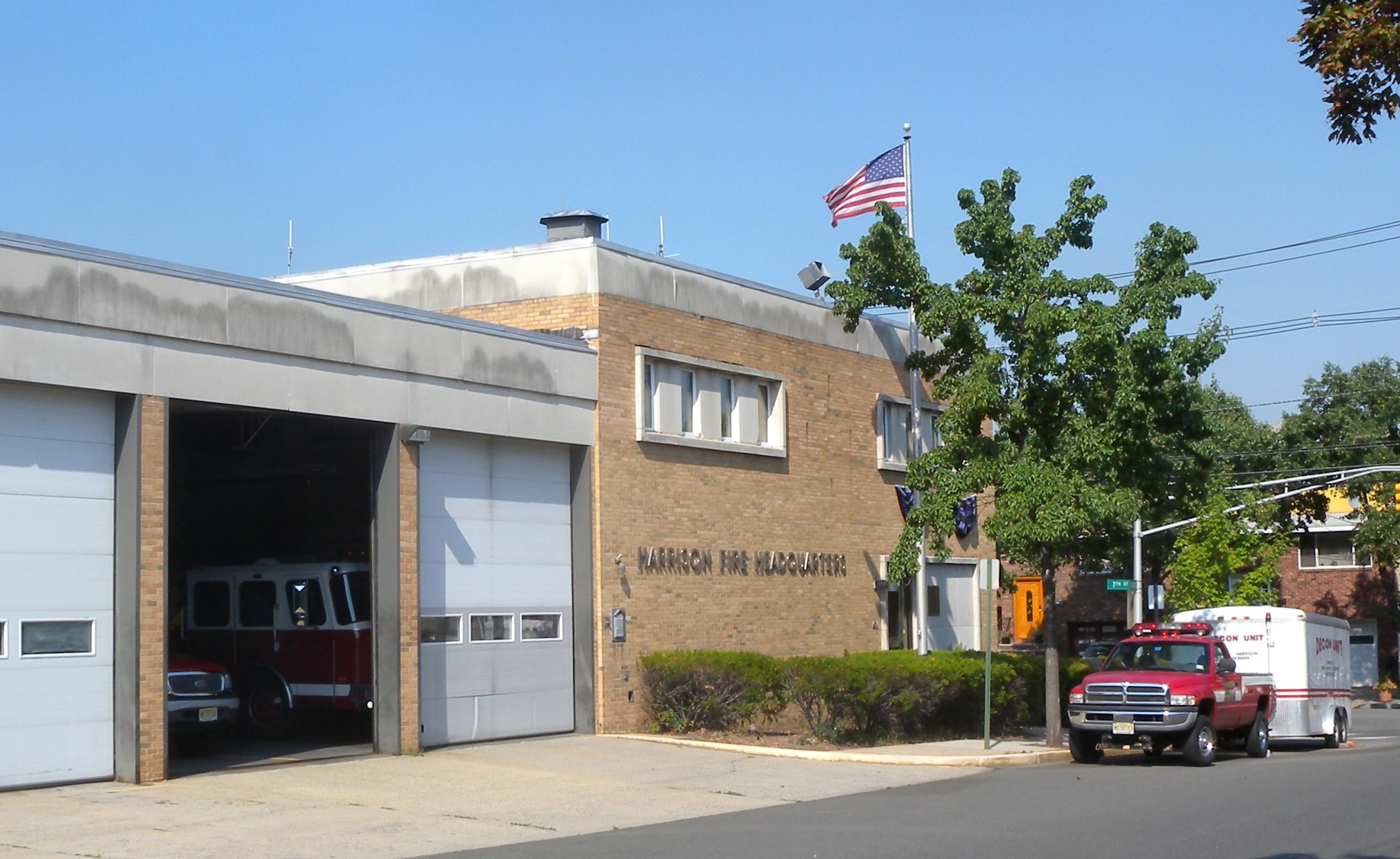
Harrison is a town in the western part of Hudson County in the U.S. state of New Jersey. It is part of the New York metropolitan area. It is a suburb of the nearby city of Newark, and is located from New York City. Once considered "the beehive of industry", the town is undergoing a residential and economic renewal, particularly along the Passaic River. As of the 2020 United States census, the town's population was 19,450, an increase of 5,830 (+42.8%) from the 2010 census count of 13,620, which in turn reflected a decrease of 804 (−5.6%) from the 14,424 counted in the 2000 census. The Population Estimates Program calculated a population of 22,182 for 2024. History Colonial era to 19th century The area that is now Harrison was the southernmost part of the land grant awarded to William Sandford in 1668. When that grant was divided in 1671 between Sandford and his uncle, Nathaniel Kingsland of Barbados, Sandford's share included Harrison. While Sandford and his famil ... [...More Info...] [...Related Items...] OR: [Wikipedia] [Google] [Baidu] |
Manhattan Transfer Station
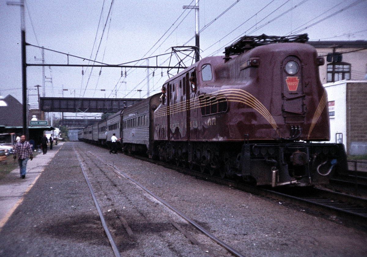
The Manhattan Transfer station was a passenger station, passenger interchange station, transfer station in Harrison, New Jersey, east of Newark (New Jersey), Newark, west of New York Penn Station on the Pennsylvania Railroad (PRR) main line, now Amtrak's Northeast Corridor. It operated from 1910 to 1937 and consisted of two car-floor-level platforms, one on each side of the PRR line. It was also served by the Hudson and Manhattan Railroad. There were no pedestrian entrances or exits to the station, as its sole purpose was for passengers to change trains, or for trains to have their locomotives changed. History Need and operation Until 1910, none of the railroads that crossed New Jersey to reach New York City crossed the North River (Hudson River), Hudson River. Instead, passengers rode to Railroad terminals serving New York City, terminals on the Hudson Waterfront, where they boarded List of ferries across the Hudson River to New York City, ferries. The dominant Pennsylva ... [...More Info...] [...Related Items...] OR: [Wikipedia] [Google] [Baidu] |
Hudson Terminal
Hudson Terminal was a rapid transit station and office-tower complex in the Radio Row neighborhood of Lower Manhattan in New York City. Opened during 1908 and 1909, it was composed of a Railway terminal, terminal station for the Hudson & Manhattan Railroad (H&M), as well as two 22-story office skyscrapers and three basement stories. The complex occupied much of a two-block site bounded by Greenwich Street, Greenwich, Cortlandt Street (Manhattan), Cortlandt, Church Street (Manhattan), Church, and Fulton Street (Manhattan), Fulton Streets, which later became the World Trade Center site. The railroad terminal contained five tracks and six railway platform, platforms serving H&M trains to and from New Jersey; these trains traveled via the Downtown Hudson Tubes, under the Hudson River, to the west. The two 22-story office skyscrapers above the terminal, the Fulton Building to the north and the Cortlandt Building to the south, were designed by architect James Hollis Wells of the firm ... [...More Info...] [...Related Items...] OR: [Wikipedia] [Google] [Baidu] |
Jersey City, New Jersey
Jersey City is the List of municipalities in New Jersey, second-most populousTable1. New Jersey Counties and Most Populous Cities and Townships: 2020 and 2010 Censuses New Jersey Department of Labor and Workforce Development. Accessed December 1, 2022. city (New Jersey), city in the U.S. state of New Jersey, after Newark, New Jersey, Newark.The Counties and Most Populous Cities and Townships in 2010 in New Jersey: 2000 and 2010 , United States ... [...More Info...] [...Related Items...] OR: [Wikipedia] [Google] [Baidu] |
Grove Street Station (PATH)
The Grove Street station (originally Grove–Henderson Streets) is a station on the PATH system. Located at the intersection of Grove Street, Newark Avenue and Railroad Avenue in the Downtown neighborhood of Jersey City, New Jersey, it is served by the Newark–World Trade Center line at all times, the Journal Square–33rd Street line on weekdays (except for during the late-evening and early-morning hours), and the Journal Square–33rd Street (via Hoboken) line on weekends and during late-evening and early-morning weekday hours. History The station opened on September 6, 1910. Originally, the station had exits at either end. The western stair led to the intersection of Grove Street and Newark Avenue and a simple kiosk underneath the Pennsylvania Railroad's mainline viaduct, which ran above what is now Christopher Columbus Drive. The station's easterly end exited to Henderson Street (now Marín Boulevard). The railroad viaduct was taken down in the late 1960s, and the sta ... [...More Info...] [...Related Items...] OR: [Wikipedia] [Google] [Baidu] |
Federal Railroad Administration
The Federal Railroad Administration (FRA) is an agency in the United States Department of Transportation (DOT). The agency was created by the Department of Transportation Act of 1966. The purpose of the FRA is to promulgate and enforce railroad, rail safety regulations, administer railroad assistance programs, conduct research and development in support of improved railroad safety and national rail transportation policy, provide for the rehabilitation of Northeast Corridor rail passenger service, and consolidate government support of rail transportation activities. The FRA is one of ten agencies within DOT concerned with intermodal freight transport, intermodal transportation. It operates through seven divisions under the offices of the Administrator and Deputy Administrator. These divisions are Financial Management and Administration, Chief Counsel, Civil Rights, Public Affairs, Public Engagement, Railroad Policy and Development, and Safety. It has a staff of about 850. Func ... [...More Info...] [...Related Items...] OR: [Wikipedia] [Google] [Baidu] |


