|
Ned Point Light
Ned Point Light is a historic lighthouse on Ned's Point Road in Mattapoisett, Massachusetts. The lighthouse was built in 1838 at a cost of approximately $5,000, and named after Ned Dexter, a local farmer. Under the supervision of a local builder, Leonard Hammond, the lighthouse was constructed with a birdcage-style lantern similar to Bird Island Light found in Marion, Massachusetts. The stone used for the lighthouse was all locally sourced, with most of it originating from nearby beaches. Inside, there are 32 granite steps that are cantilevered to the outside wall without the use of mortar. The original lantern used 11 whale oil lamps, each with its own parabolic reflector. The lamps and reflectors were replaced by a fifth order Fresnel lens in 1857, along with a change to an octagonal lantern. The Great Blizzard of 1888 significantly damaged the keeper's stone house, resulting in it being demolished and the building of a wooden replacement. Following the lighthouse's automation in ... [...More Info...] [...Related Items...] OR: [Wikipedia] [Google] [Baidu] |
Mattapoisett, Massachusetts
Mattapoisett is a town in Plymouth County, Massachusetts, United States. The population was 6,508 at the 2020 census. For geographic and demographic information on the village of Mattapoisett Center, please see the article Mattapoisett Center, Massachusetts. History The Mattapoisett area was originally purchased by Governor William Brenton from the Wampanoag chief Metacomet, also referred to as King Philip, in 1664. Brenton left it to his son Ebenezer, who sold it. The town of Mattapoisett was settled in 1750 and officially incorporated in 1857. Originally a part of Rochester, the area had most likely been visited by European traders and sailors. There is also evidence of prior Wampanoag Indian settlements, including burial grounds, throughout the town. In fact, the word ''Mattapoisett'' is Wampanoag for "a place of resting". Early industry included logging and farming, but Mattapoisett became best known for its role in the history of whaling. Some 400 ships were built in ... [...More Info...] [...Related Items...] OR: [Wikipedia] [Google] [Baidu] |
Bourne, Massachusetts
Bourne ( ) is a town in Barnstable County, Massachusetts, United States. The population was 20,452 at the 2020 census. For geographic and demographic information on specific parts of the town of Bourne, please see the articles on Bourne (CDP), Buzzards Bay, Monument Beach, Pocasset, Sagamore, and Sagamore Beach. History Bourne was first settled in 1640 by Ezra Perry as a part of the town of Sandwich. Prior to its separation from Sandwich, the area was referred to as West Sandwich. It was officially incorporated in 1884, the last town to be incorporated in Barnstable County. It was named for Jonathan Bourne Sr. (1811–1889), whose ancestor Richard Bourne represented Sandwich in the first Massachusetts General Court and was the first preacher to the Mashpee Wampanoag on Cape Cod. The town lies at the northeast corner of Buzzards Bay and is the site of Aptucxet Trading Post, the nation's oldest store. It was founded by the Pilgrims in 1627 at a site halfway between the two r ... [...More Info...] [...Related Items...] OR: [Wikipedia] [Google] [Baidu] |
Lighthouses In Plymouth County, Massachusetts
A lighthouse is a tower, building, or other type of physical structure designed to emit light from a system of lamps and lenses and to serve as a beacon for navigational aid, for maritime pilots at sea or on inland waterways. Lighthouses mark dangerous coastlines, hazardous shoals, reefs, rocks, and safe entries to harbors; they also assist in aerial navigation. Once widely used, the number of operational lighthouses has declined due to the expense of maintenance and has become uneconomical since the advent of much cheaper, more sophisticated and effective electronic navigational systems. History Ancient lighthouses Before the development of clearly defined ports, mariners were guided by fires built on hilltops. Since elevating the fire would improve the visibility, placing the fire on a platform became a practice that led to the development of the lighthouse. In antiquity, the lighthouse functioned more as an entrance marker to ports than as a warning signal for reefs and ... [...More Info...] [...Related Items...] OR: [Wikipedia] [Google] [Baidu] |
National Register Of Historic Places Listings In Plymouth County, Massachusetts
__NOTOC__ This is a list of the National Register of Historic Places listings in Plymouth County, Massachusetts. This is intended to be a complete list of the properties and districts on the National Register of Historic Places in Plymouth County, Massachusetts, United States. The locations of National Register properties and districts for which the latitude and longitude coordinates are included below, may be seen in a map. There are 140 properties and districts listed on the National Register in the county, including 5 National Historic Landmarks. Current listings Former listings See also * List of National Historic Landmarks in Massachusetts * National Register of Historic Places listings in Massachusetts References {{National Register of Historic Places in Massachusetts * . Plymouth Plymouth () is a port city and ... [...More Info...] [...Related Items...] OR: [Wikipedia] [Google] [Baidu] |
National Register Of Historic Places
The National Register of Historic Places (NRHP) is the United States federal government's official list of districts, sites, buildings, structures and objects deemed worthy of preservation for their historical significance or "great artistic value". A property listed in the National Register, or located within a National Register Historic District, may qualify for tax incentives derived from the total value of expenses incurred in preserving the property. The passage of the National Historic Preservation Act (NHPA) in 1966 established the National Register and the process for adding properties to it. Of the more than one and a half million properties on the National Register, 95,000 are listed individually. The remainder are contributing resources within historic districts. For most of its history, the National Register has been administered by the National Park Service (NPS), an agency within the U.S. Department of the Interior. Its goals are to help property owners a ... [...More Info...] [...Related Items...] OR: [Wikipedia] [Google] [Baidu] |
United States Coast Guard
The United States Coast Guard (USCG) is the maritime security, search and rescue, and law enforcement service branch of the United States Armed Forces and one of the country's eight uniformed services. The service is a maritime, military, multi-mission service unique among the United States military branches for having a maritime law enforcement mission with jurisdiction in both domestic and international waters and a federal regulatory agency mission as part of its duties. It is the largest and most powerful coast guard in the world, rivaling the capabilities and size of most navies. The U.S. Coast Guard is a humanitarian and security service. It protects the United States' borders and economic and security interests abroad; and defends its sovereignty by safeguarding sea lines of communication and commerce across vast territorial waters spanning 95,000 miles of coastline and its Exclusive Economic Zone. With national and economic security depending upon open global t ... [...More Info...] [...Related Items...] OR: [Wikipedia] [Google] [Baidu] |
Wing's Neck Light
The Wing's Neck Light is a historic lighthouse in the Pocasset village of Bourne, Massachusetts. It is located on Wing's Neck Road at the end of Wing's Neck, a peninsula between Pocasset Harbor and the Hog Island Channel, which provides access to the Cape Cod Canal. The first lighthouse was built in the site in 1849; it was a stone keeper's house with a wood-frame tower above, and was destroyed by fire in 1878. The present lighthouse and keeper's house were built in 1889; it is the only extant wood-frame light and keeper's house connected by a covered way from that period. The lighthouse was listed on the National Register of Historic Places in 1987. See also * National Register of Historic Places listings in Barnstable County, Massachusetts References External links * Wing’s Neck Lightat the National Park Service The National Park Service (NPS) is an List of federal agencies in the United States, agency of the Federal government of the United States, United States ... [...More Info...] [...Related Items...] OR: [Wikipedia] [Google] [Baidu] |
Fresnel Lens
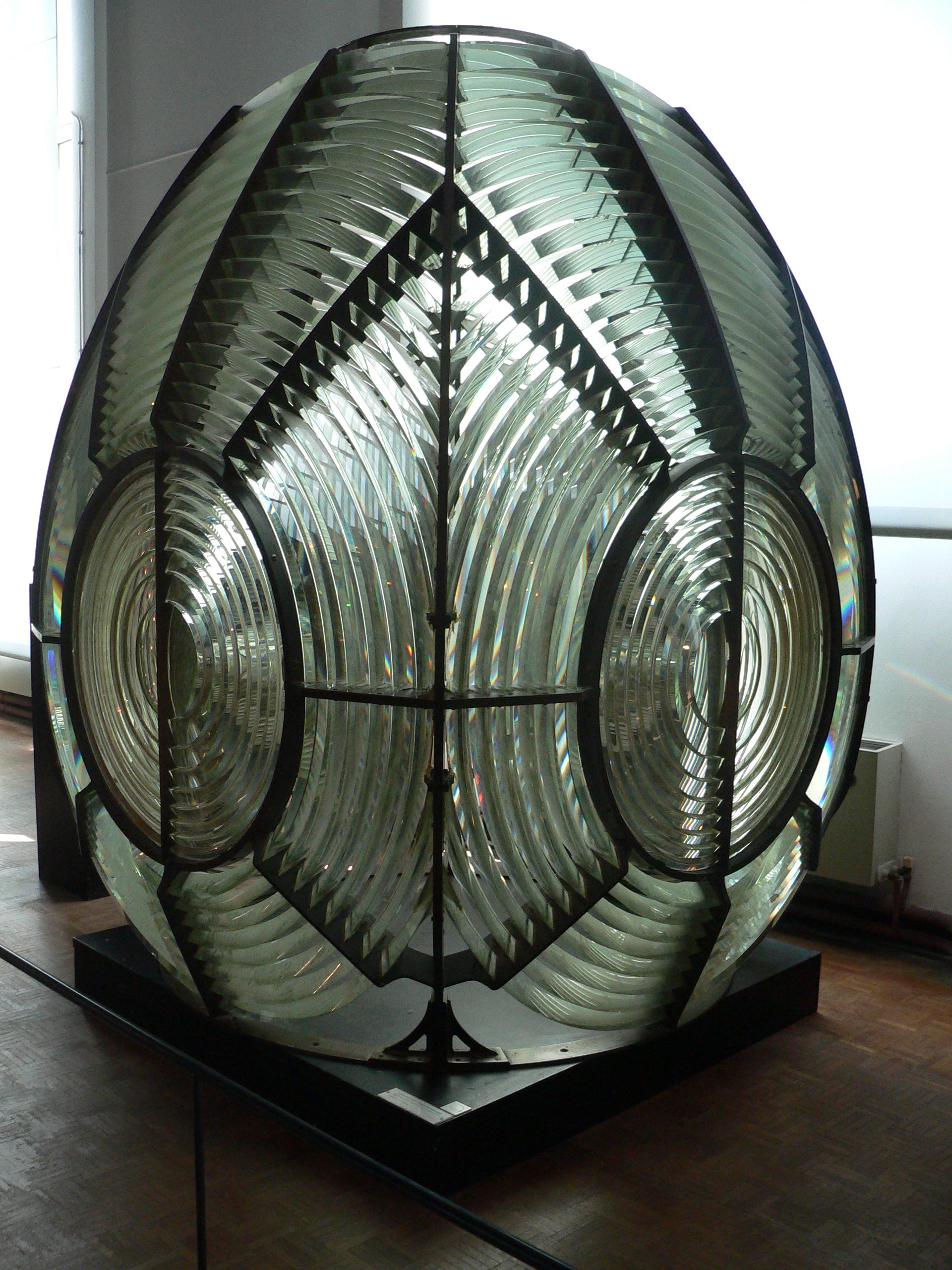
A Fresnel lens ( ; ; or ) is a type of composite compact lens developed by the French physicist Augustin-Jean Fresnel (1788–1827) for use in lighthouses. It has been called "the invention that saved a million ships." The design allows the construction of lenses of large aperture and short focal length without the mass and volume of material that would be required by a lens of conventional design. A Fresnel lens can be made much thinner than a comparable conventional lens, in some cases taking the form of a flat sheet. The simpler dioptric (purely refractive) form of the lens was first proposed by Count Buffon and independently reinvented by Fresnel. The '' catadioptric'' form of the lens, entirely invented by Fresnel, has outer elements that use total internal reflection as well as refraction; it can capture more oblique light from a light source and add it to the beam of a lighthouse, making the light visible from greater distances. Description The Fresnel len ... [...More Info...] [...Related Items...] OR: [Wikipedia] [Google] [Baidu] |
Great Blizzard Of 1888
The Great Blizzard of 1888, also known as the Great Blizzard of '88 or the Great White Hurricane (March 11–14, 1888), was one of the most severe recorded blizzards in American history. The storm paralyzed the East Coast from the Chesapeake Bay to Maine, as well as the Atlantic provinces of Canada. Snow fell from in parts of New Jersey, New York, Massachusetts, Rhode Island, and Connecticut, and sustained winds of more than produced snowdrifts in excess of . Railroads were shut down and people were confined to their homes for up to a week. Railway and telegraph lines were disabled, and this provided the impetus to move these pieces of infrastructure underground. Emergency services were also affected. Storm details The weather was unseasonably mild just before the blizzard, with heavy rains that turned to snow as temperatures dropped rapidly. On March 12, New York City dropped from to , and rain changed to snow at 1am. [...More Info...] [...Related Items...] OR: [Wikipedia] [Google] [Baidu] |


