|
Naval Support Activity Saigon
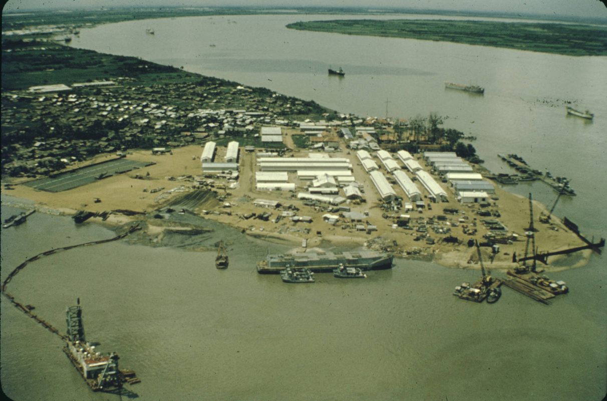
Naval Support Activity Saigon or NSA Saigon was a United States Navy logistics support organization located in Saigon, South Vietnam active from May 1966 to June 1972. History A logistics establishment already existed at Saigon when major U.S. forces came ashore in South Vietnam in 1965. The United States Navy's Headquarters Support Activity, Saigon (HSAS) was responsible for providing countrywide administrative and logistics support to the Military Assistance Advisory Group in South Vietnam. During a single month in 1965 the activity's Saigon port operation offloaded over 330,000 tons of cargo from 96 ships and transshipped 40,000 tons to other coastal centers. Throughout the year HSAS divisions acquired 2.7 million feet of storage space, managed 54 bachelor officer and enlisted quarters, oversaw 318 construction contracts, and distributed 60,000 books and magazines from the library to outlying bases. The Saigon Station Hospital's 109 medical personnel continued to treat thousand ... [...More Info...] [...Related Items...] OR: [Wikipedia] [Google] [Baidu] |
South Vietnam
South Vietnam, officially the Republic of Vietnam ( vi, Việt Nam Cộng hòa), was a state in Southeast Asia that existed from 1955 to 1975, the period when the southern portion of Vietnam was a member of the Western Bloc during part of the Cold War after the 1954 Geneva Conference, 1954 division of Vietnam. It first received Diplomatic recognition, international recognition in 1949 as the State of Vietnam within the French Union, with its capital at Saigon (renamed to Ho Chi Minh City in 1976), before becoming a republic in 1955. South Vietnam was bordered by North Vietnam to the north, Kingdom of Laos, Laos to the northwest, Khmer Republic, Cambodia to the southwest, and Thailand across the Gulf of Thailand to the southwest. Its sovereignty was recognized by the United States and 87 other nations, though it failed to gain admission into the United Nations as a result of a Soviet veto in 1957. It was succeeded by the Provisional Revolutionary Government of the Republic of S ... [...More Info...] [...Related Items...] OR: [Wikipedia] [Google] [Baidu] |
Quy Nhơn Port
Quy Nhơn Port ( vi, Cảng Quy Nhơn, links=no) is the major port of Bình Định Province, Vietnam. It is located in Hai Cang (meaning sea port) ward at the eastern tip of Quy Nhơn city. Quy Nhơn Port is the most accessible major port not only for Bình Định Province, but also for the Central Highlands provinces of Gia Lai and Kon Tum and even parts of Laos and Cambodia such as Attapeu Province and Ratanakiri Province. National Route 19 has its starting point at Quy Nhơn Port and leads up to Gia Lai Province and Lệ Thanh border gate on the border to Cambodia Cambodia (; also Kampuchea ; km, កម្ពុជា, UNGEGN: ), officially the Kingdom of Cambodia, is a country located in the southern portion of the Indochinese Peninsula in Southeast Asia, spanning an area of , bordered by Thailand t ... (247 km from Quy Nhơn Port).''Vietnam Road Atlas'' (Tập Bản đồ Giao thông Đường bộ Việt Nam). Cartographic Publishing House (Vietnam), 2004 T ... [...More Info...] [...Related Items...] OR: [Wikipedia] [Google] [Baidu] |
Long Xuyên
Long Xuyên () is the capital city of An Giang province, in the Mekong Delta region of south-western Vietnam. History In 1789, a group of explorers established a small outpost in the Tam Khe canal, naming it Dong Xuyen. Sooner after a marketplace was created and named Long Xuyen, but by the 1860s the area become more well known by the Long Xuyen market than the official outpost's name. From 1877, the reach of Long Xuyen grew as the city's administration become responsible for an increasing number of neighborhoods and wards. It would not be until 1999 would Long Xuyen be designated as a formal city. Geography It is located approximately 1,950 km south of Hanoi, 189 km from Ho Chi Minh City, and 45 km from the Cambodian border. The population of Long Xuyên city is over 368,376 (2013), with an area of approximately 106.87 km². The city is subdivided to 13 commune-level subdivisions, including the wards of: Mỹ Bình, Mỹ Long, Mỹ Xuyên, Bình Kh ... [...More Info...] [...Related Items...] OR: [Wikipedia] [Google] [Baidu] |
Tân Châu District, Tây Ninh
Tan or TAN may refer to: Businesses and organisations * Black and Tans, a nickname for British special constables during the Irish War of Independence. By extension "Tans" can now also colloquially refer to English or British people in general, especially disparagingly. * TAN Books, a Catholic publishing company * FC Rubin-TAN Kazan, a Russian professional ice hockey club in Kazan in 1991-94 * Transportes Aereos Nacionales, an airline based in Honduras known as TAN Airlines People * Tan (surname) (譚), a Chinese surname * Chen (surname) (陳), a Chinese surname, pronounced "Tan" in Min Nan languages * Laozi, posthumous name "Tan" or "Dān" (聃), philosopher of ancient China * Leborgne, nicknamed Tan, a patient of Paul Broca's, on whose autopsy he identified Broca's area * TAN (musician) (born 1990), Malaysian pop singer * Tan Sağtürk (born 1969), Turkish ballet Places China * Tan (state), an ancient viscountcy in eastern Shandong Province, China * Tai'an railway stat ... [...More Info...] [...Related Items...] OR: [Wikipedia] [Google] [Baidu] |
Mỹ Tho
Mỹ Tho () is a city in the Tiền Giang province in the Mekong Delta region of South Vietnam. It has a population of approximately 169,000 in 2006 and 220,000 in 2012. It is the regional center of economics, education and technology. The majority ethnic group is the Kinh; minority groups include the Hoa, the Cham and the Khmer. Boat rides on the Mỹ Tho River are popular with tourists, and the city is known for '' hủ tiếu Mỹ Tho'', a type of rice noodle soup. History Mỹ Tho was founded in the 1680s by Chinese refugees fleeing China after the fall of remnants of the Southern Ming to the Qing dynasty in 1683. The area, at the time, was once part of the former Khmer Empire and it was annexed to Vietnam in the 18th century. The city is named after the Mỹ Tho River. In Sino-Vietnamese script, the name is given as (beautiful tree). Due to its proximity to Saigon, Mỹ Tho was the traditional gateway to the Mekong Delta. In the 17th century, the city had become o ... [...More Info...] [...Related Items...] OR: [Wikipedia] [Google] [Baidu] |
Sa Đéc Base
Sa Đéc Base (also known as Sa Đéc Naval Support Activity or simply Sa Đéc) is a former U.S. Navy and Republic of Vietnam Navy (RVNN) base near Sa Đéc in the Mekong Delta of Vietnam. History The base was located in Sa Đéc on the upper Mỹ Tho River in the Mekong Delta. The base was established by the US Navy in 1966 as a base for Patrol Boat, River Patrol Boat, Riverine, or PBR, is the United States Navy designation for a small rigid-hulled patrol boat used in the Vietnam War from March 1966 until 1975. They were deployed in a force that grew to 250 boats, the most common craft in the ... (PBR)s taking part in Operation Game Warden. Ten PBRs of River Division 52 moved to the base in mid-1966. The original facilities at Sa Đéc were relatively primitive with the sailors living in tents on a soccer field until Seabees constructed more permanent accommodation. In 1967 a Naval Support Activity detachment was established at the base. In March 1970, the headquarte ... [...More Info...] [...Related Items...] OR: [Wikipedia] [Google] [Baidu] |
Vĩnh Long
Vĩnh Long () is a city and the capital of Vĩnh Long Province in Vietnam's Mekong Delta. Vĩnh Long covers and has a population of 147,039 (as of 2009). The name was spelled 永 隆 ("eternal prosperity") in the former Hán Nôm writing system. Location Vĩnh Long is on the Cổ Chiên River, which branches out from the Mekong River at the narrows of Mỹ Thuận about upstream, only to meet it later downstream. Across the Cổ Chiên river from Vĩnh Long are the An Binh and Bình Hòa Phước islands, some across, with the Mekong River on the other side. A number of canals run through Vĩnh Long, with tall vehicular bridges crossing them. Transport by boat is possible, although parts of the town, particularly An Binh, become unreachable at low tide. Vĩnh Long is about two hours from the large city of Cần Thơ in the adjacent Hậu Giang Province, and about three hours from Saigon , population_density_km2 = 4,292 , population_density_metro_km2 = 697.2 , ... [...More Info...] [...Related Items...] OR: [Wikipedia] [Google] [Baidu] |
Nhà Bè Base
Nhà Bè Base (also known as Nhà Bè Naval Support Activity or Nhà Bè Logistics Support Base) is a former U.S. Navy and Republic of Vietnam Navy (RVNN) base in Nhà Bè District in Saigon (now Ho Chi Minh City) of Vietnam now used as a base by the Vietnam Coast Guard. History The base is located in Nhà Bè District approximately south southeast of Saigon at the junction of the Soài Rạp and Lòng Tàu Rivers. The base was first established by the US Navy in May 1966 to support Operation Game Warden and particularly patrolling of the Rung Sat Special Zone. Mine Squadron 11, Detachment Alpha equipped with 12 minesweeping boats (MSBs) ( long, wooden-hulled boats) were the first Navy vessels deployed there Construction of the base first involved the dredging of 300,000 cubic yards of sand, filling and compacting of the marshland, following which construction included barracks for 400 men, storage for 3,000 barrels of petrol, oil and lubricants (POL), a storage warehouse o ... [...More Info...] [...Related Items...] OR: [Wikipedia] [Google] [Baidu] |
Binh Thuy Air Base
Binh Thuy Air Base (also known as Can Tho Air Base and Trà Nóc Air Base) was a United States Air Force (USAF), United States Navy, Republic of Vietnam Air Force (RVNAF) and Vietnam People's Air Force (VPAF) ''(Khong Quan Nhan Dan Viet Nam)'' military airfield used during the Vietnam War. It is located 7 km northwest of Cần Thơ in the Mekong Delta. Construction Since June 1962 USAF units had supported RVNAF operations at Cần Thơ Airfield. In mid-1963 Military Assistance Command, Vietnam (MACV) proposed the construction of a runway at Cần Thơ to replace the existing runway at Sóc Trăng Airfield which was unsuitable for night and wet weather operations with a projected US$4.5 million construction cost and a 2-year construction period. In January 1964 given the need for heavier aircraft to be available for quick reaction air support in the Mekong Delta, CINCPAC approved the construction of a new airfield at Cần Thơ for a cost of US$2.5 million to be ... [...More Info...] [...Related Items...] OR: [Wikipedia] [Google] [Baidu] |
Cần Thơ
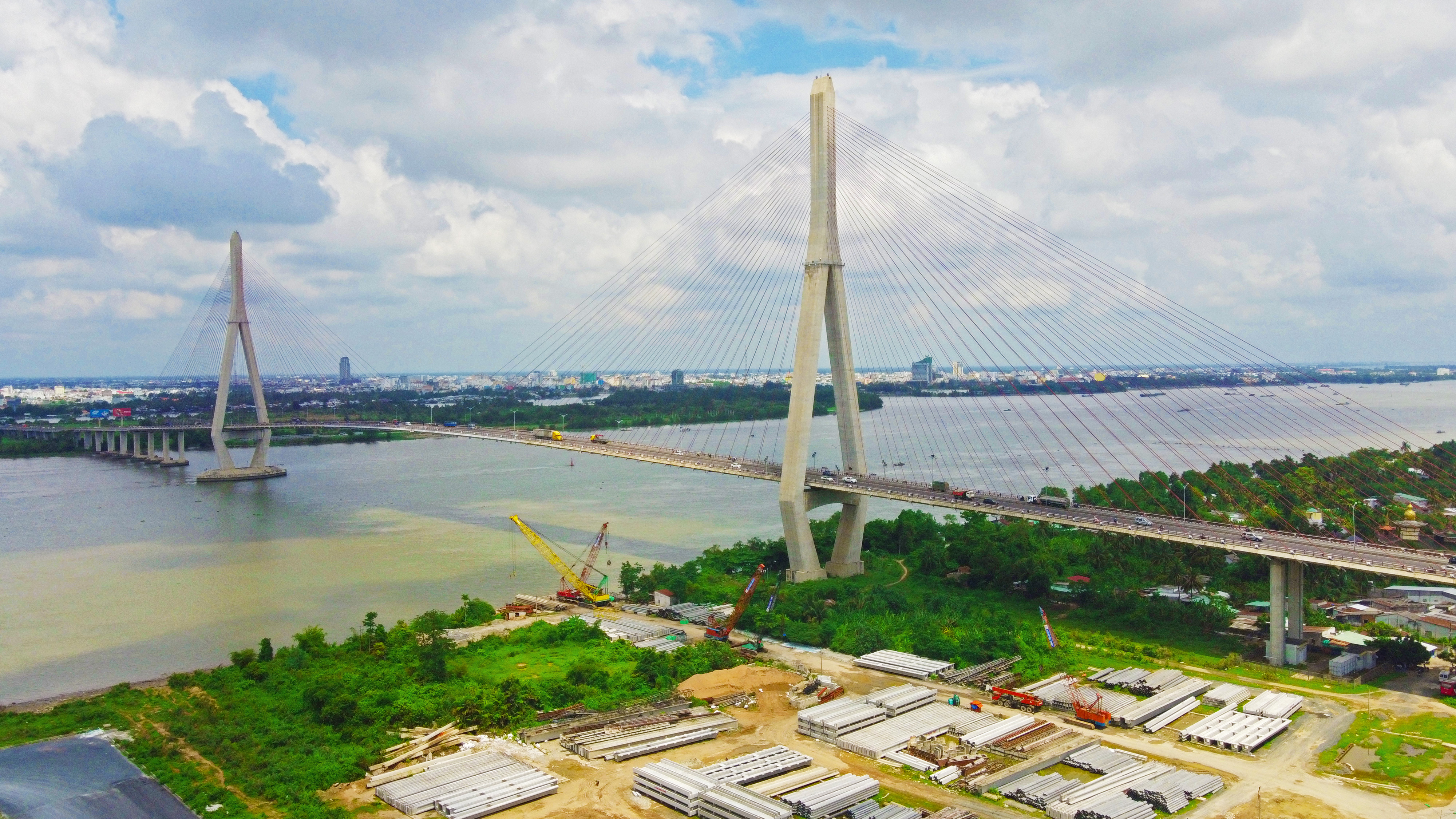
Cần Thơ, also written as Can Tho or Cantho (: , : ), is the fourth-largest city in Vietnam, and the largest city along the Mekong Delta region in Vietnam. It is noted for its floating markets, rice paper-making village, and picturesque rural canals. It has a population of around 1,282,300 as of 2018, and is located on the south bank of the Hậu River, a distributary of the Mekong River. In 2007, about 50 people died when the Cần Thơ Bridge collapsed, causing Vietnam's worst engineering disaster. In 2011, Cần Thơ International Airport opened. The city is nicknamed the "western capital" ( Vietnamese is ), and is located from Hồ Chí Minh City. History During the Vietnam War, Cần Thơ was the home of the ARVN IV Corps capital. The ARVN 21st division was dedicated to protect the city of Cần Thơ, including the provinces of Chương Thiện (now in Hậu Giang), Bạc Liêu, An Xuyen (Cà Mau), Ba Xuyen (Soc Trang), and Kiên Giang. Before 1975, Cần ... [...More Info...] [...Related Items...] OR: [Wikipedia] [Google] [Baidu] |
Vũng Tàu Port
Vung Tau Port is a group of seaports, one of the sea transport hubs of Vietnam. Vung Tau Port is located in Bà Rịa–Vũng Tàu province, Southeast region, Vietnam. Vung Tau port includes the following component ports: *Cai Mep - Thi Vai Port, Sao Mai-Ben Dinh: This is the main port for container transport. Currently, the port is capable of receiving ships up to 200,000 DWT. The main container terminals are TCTT/TCIT, CMIT, TCTT, SSIT and Gemalink (expected to officially open January 2020). *Ports of Phu My, My Xuan: a general port, a container port capable of receiving ships up to 30,000 DWT. As planned by the government of Vietnam, this port will be capable of receiving ships up to 80,000 DWT. *Port on Dinh river: is capable of receiving ships up to 20,000 DWT, and will be capable to handle ships up to 30,000 DWT. *Port of Ben Dam, Con Dao Island. According to the approved plan, from now to 2020, two more harbors will be built, one is the Long Son Port serving the oil re ... [...More Info...] [...Related Items...] OR: [Wikipedia] [Google] [Baidu] |
Cat Lo Naval Base
Cat Lo Naval Base is a former United States Navy, U.S. Coast Guard, and Republic of Vietnam Navy (RVNN) base approximately northeast of Vũng Tàu in southern Vietnam that was used during the Vietnam War. History In October 1965, the U.S. Navy selected Cat Lo as the base for Swift Boat Squadron 1, Division 103 with 14 Swift Boats to be based there with berthing, messing and basic repair facilities. Dredging to build the base facilities eventually took 3 years and it housed over 600 personnel. Construction Battalion Maintenance Unit 302 Detachment C was based at Cat Lo during the base construction. On 22 February 1966, the newly established Division 13, Coast Guard Squadron One began operations from Cat Lo. In early 1966 PBRs of River Divisions 53 and 54 began operations from Cat Lo. PACV Division 107 operating the experimental Patrol Air Cushion Vehicle The Patrol Air Cushion Vehicle (PACV), also known as the Air Cushion Vehicle (ACV) in Army and Coast Guard service, ... [...More Info...] [...Related Items...] OR: [Wikipedia] [Google] [Baidu] |


