|
Narraguinnep Natural Area
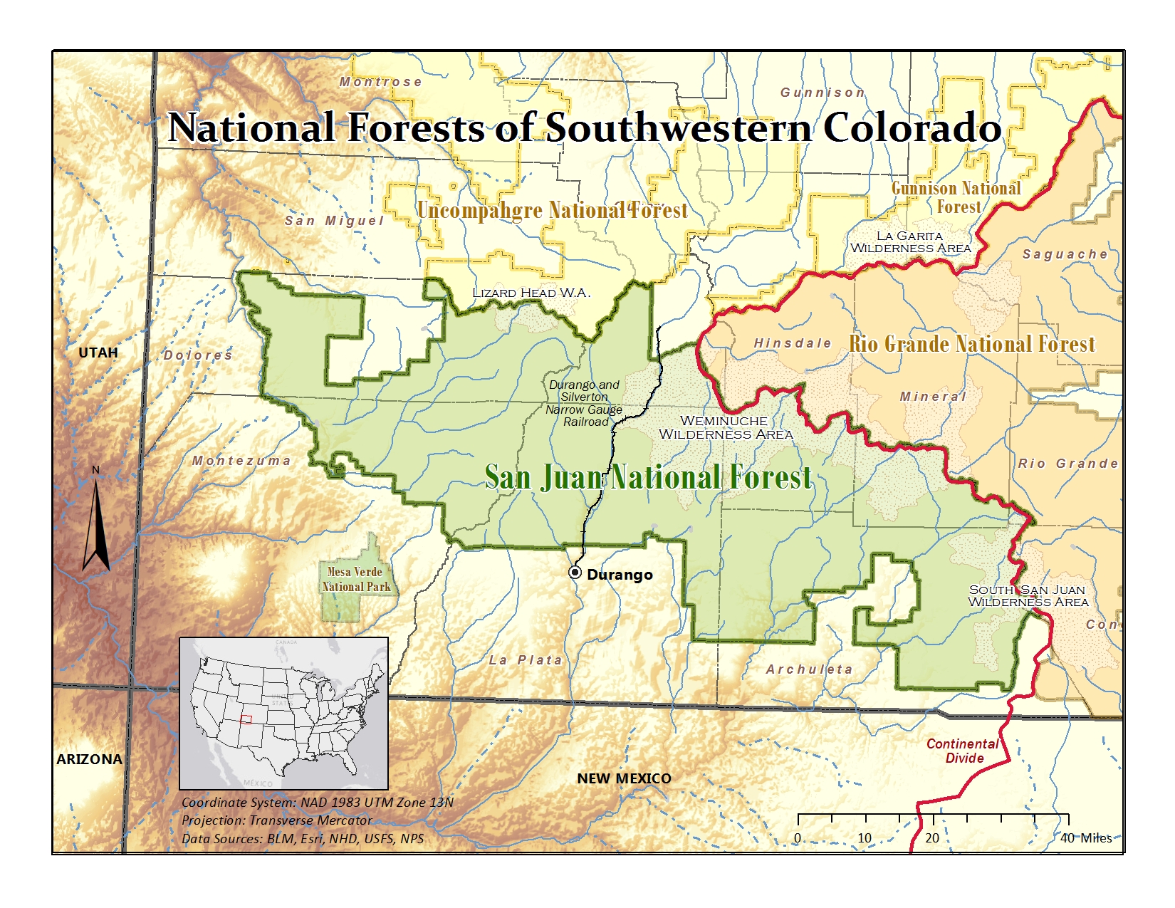
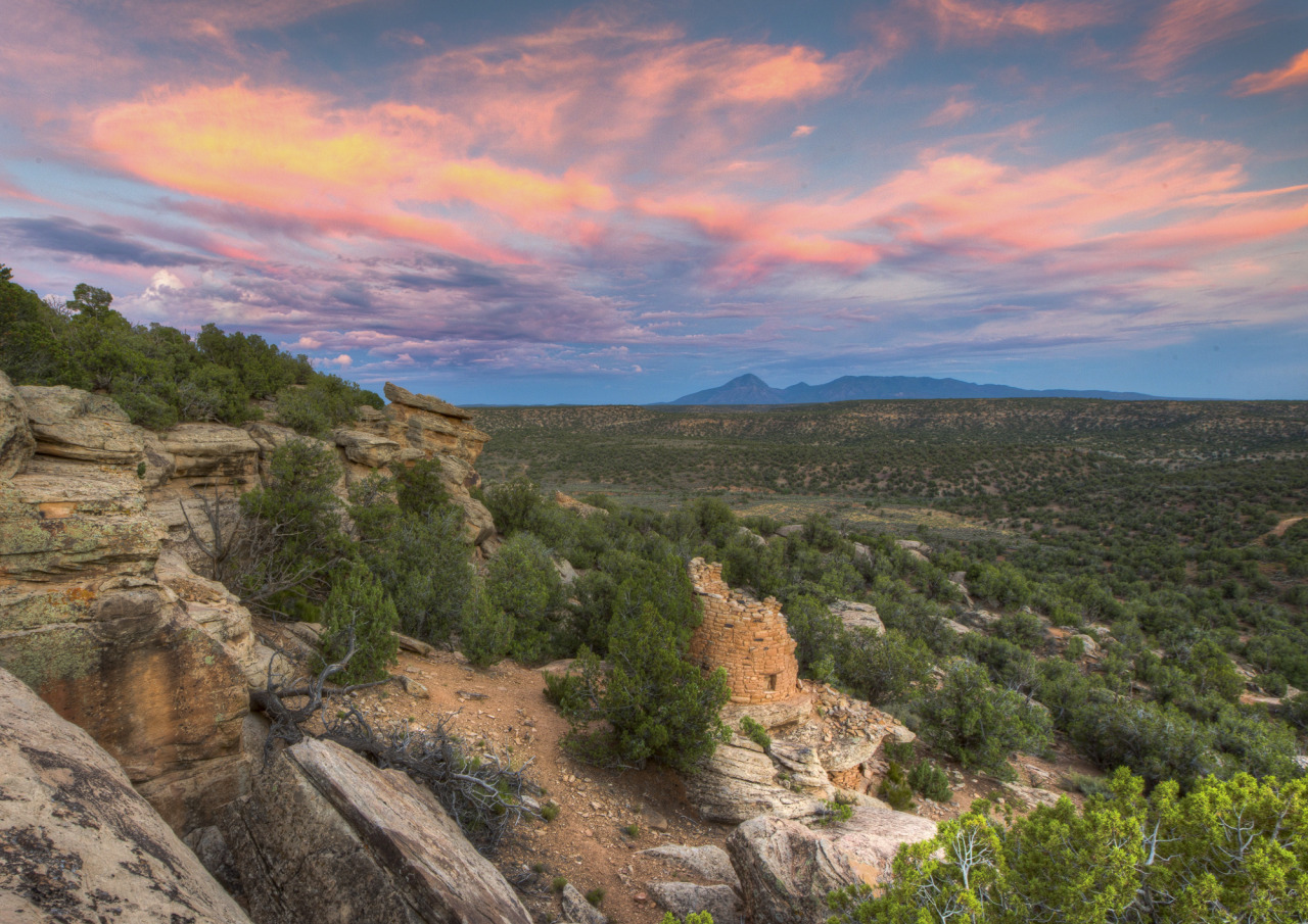
Narraguinnep Natural Area is a 2,922 acre natural area in Dolores County, Colorado that is owned by the United States Forest Service. It was designated a natural area in 1980. The Colorado Natural Area includes Narraguinnep Canyon, which is located within Dolores Ranger District of the San Juan National Forest and extends southwest into Montezuma County, Colorado. It is near the Canyons of the Ancients National Monument. Oakbrush, juniper, and pinon and ponderosa pine trees grow in the natural area. In 2009, a wildfire burned most of the natural area. Since then, Gambel oak thickets have returned in the main area. The old-growth pine, located in the northwest corner of the natural area, was not damaged during the fire. The Domínguez–Escalante expedition (1776) passed through the Dolores area and then east of present-day Cahone and Dove Creek Dove Creek is a statutory town that is the county seat and the most populous municipality of Dolores County, Colorado, United ... [...More Info...] [...Related Items...] OR: [Wikipedia] [Google] [Baidu] |
Cortez, Colorado
Cortez () is a List of municipalities in Colorado#Home rule municipality, home-rule municipality that is the county seat and the List of municipalities in Colorado, most populous municipality of Montezuma County, Colorado, United States. The city's population was 8,766 at the 2020 United States census. History In 1886, the town was built to provide housing for the men working on the tunnels and irrigation ditches required to divert water out of the Dolores River and into Montezuma Valley. The town was named for Spanish conquistador Hernán Cortés. It is a popular stop for tourists, who stay there because of its central location among surrounding attractions, such as Mesa Verde National Park, Monument Valley, and the Four Corners. Prehistoric sites Many Prehistory of Colorado#Indigenous peoples' sites in Colorado, prehistoric sites in the Cortez area are listed on the Colorado State Register of Historic Properties or both the state register and the National Register of Historic ... [...More Info...] [...Related Items...] OR: [Wikipedia] [Google] [Baidu] |
Dolores County, Colorado
Dolores County is a county located in the U.S. state of Colorado. As of the 2020 census, the population was 2,326. The county seat is Dove Creek. History It is thought that the area has been the site of human habitation since at least 2500 B.C. Dolores County's western portions were densely populated between 900 and 1300 AD. Population estimates of as many as 10,000 inhabitants, with villages containing hundreds of rooms, have been discovered by archaeologists and other researchers. But this population was destroyed or migrated elsewhere, apparently following a drought and severe societal upheaval in the 14th century, and for centuries thereafter, both the western and eastern mountainous areas of the county were occupied mostly by nomads, including the Ute and the Navajo Indians. Like much of southwestern Colorado, Dolores County is rich in Indian ruins and sites of the Anasazi. According to the Anasazi Heritage Center, Dolores County contains at least 816 recorded archaeol ... [...More Info...] [...Related Items...] OR: [Wikipedia] [Google] [Baidu] |
United States Forest Service
The United States Forest Service (USFS) is an agency within the United States Department of Agriculture, U.S. Department of Agriculture. It administers the nation's 154 United States National Forest, national forests and 20 United States National Grassland, national grasslands covering of land. The major divisions of the agency are the Chief's Office, National Forest System, State and Private Forestry, Business Operations, as well as Research and Development. The agency manages about 25% of federal lands and is the sole major national land management agency not part of the United States Department of the Interior, U.S. Department of the Interior (which manages the National Park Service, the U.S. Fish and Wildlife Service and the Bureau of Land Management). History In 1876, Congress formed the office of Special Agent in the Department of Agriculture to assess the quality and conditions of forests in the United States. Franklin B. Hough was appointed the head of the office. ... [...More Info...] [...Related Items...] OR: [Wikipedia] [Google] [Baidu] |
List Of Colorado Natural Areas
The U.S. State of Colorado has designated 96 natural areas of the state for special protection, as of 2023. The Colorado Natural Areas Program was established in 1977 to preserve and protect special areas of the state with distinctive flora, fauna, ecological, geological, and paleontologic features. It is a program of Colorado Parks and Wildlife that identifies and protects public, and in some cases private, areas with at least one unique or high-quality natural feature of statewide significance. Land management agreements are made with landowners concerning private property. __TOC__ Natural areas The Colorado Natural Areas are: * Aiken Canyon Natural Area * Antero-Salt Creek Natural Area * Arikaree River Natural Area * Badger Wash Natural Area * Blacks Gulch Natural Area * Blue Mountain-Little Thompson Fault Natural Area *Bonny Prairie Natural Area * Boulder Mountain Park Natural Area in Boulder Mountain Park *Brush Creek Fen Natural Area * California Park Natural Area * Castlew ... [...More Info...] [...Related Items...] OR: [Wikipedia] [Google] [Baidu] |
San Juan National Forest
The San Juan National Forest is a U.S. National Forest covering over 1,878,846 acres (2,935.7 sq mi, or 7,603.42 km²) in western Colorado. The forest occupies land in Archuleta, Conejos, Dolores, Hinsdale, La Plata, Mineral, Montezuma, Rio Grande, San Miguel and San Juan Counties. It borders the Uncompahgre National Forest to the north and the Rio Grande National Forest to the east. The forest covers most of the southern portion of the San Juan Mountains west of the Continental Divide. The forest contains two alpine wilderness areas; the Weminuche and South San Juan, as well as the Piedra Area. The Durango and Silverton Narrow Gauge Railroad passes through the National Forest. The name of the forest comes from the San Juan River, which was originally called the Rio San Juan, after Saint John the Baptist (San Juan Bautista in Spanish). History Theodore Roosevelt created the forest by proclamation on June 3, 1905. Forest headquarters are located in D ... [...More Info...] [...Related Items...] OR: [Wikipedia] [Google] [Baidu] |
Montezuma County, Colorado
Montezuma County is a county located in the southwest corner of the U.S. state of Colorado. As of the 2020 United States census, 2020 census, the population was 25,849. The county seat is Cortez, Colorado, Cortez. Montezuma County contains many archaeologically significant Amerindian structures, which notably can be found in Mesa Verde National Park, Canyons of the Ancients National Monument, Yucca House National Monument, and Hovenweep National Monument. Montezuma County is also home to most of the Ute Mountain Indian Reservation, home of the Weeminuche Band of the Ute Nation, known as the Ute Mountain Ute Tribe, with its headquarters at Towaoc, Colorado, Towaoc. History Montezuma County has been settled since approximately AD 600, and had an estimated population of approximately 100,000, four times its current population, in the 12th century. However, a series of events caused virtually all permanent settlements to be abandoned between 1200 and 1300, and the area was contes ... [...More Info...] [...Related Items...] OR: [Wikipedia] [Google] [Baidu] |
Canyons Of The Ancients National Monument
Canyons of the Ancients National Monument is a national monument protecting an archaeologically significant landscape located in the southwestern region of the U.S. state of Colorado. The monument's are managed by the Bureau of Land Management, as directed in the presidential proclamation which created the site on June 9, 2000. Canyons of the Ancients National Monument is part of the National Landscape Conservation System, better known as the National Conservation Lands. This system comprises managed by the Bureau of Land Management to conserve, protect, and restore these nationally significant landscapes recognized for their outstanding cultural, ecological, and scientific values. Canyons of the Ancients encompasses and surrounds three of the four separate sections of Hovenweep National Monument, which is administered by the National Park Service. The monument was proclaimed in order to preserve the largest concentration of archaeological sites in the United States, primari ... [...More Info...] [...Related Items...] OR: [Wikipedia] [Google] [Baidu] |
Domínguez–Escalante Expedition
The Domínguez–Escalante Expedition was a Spanish journey of exploration conducted in 1776 by two Franciscan priests, Atanasio Domínguez and Silvestre Vélez de Escalante, to find an overland route from Santa Fe, New Mexico, to their Roman Catholic mission in Monterey, on the coast of modern day central California. Domínguez, Vélez de Escalante, and Bernardo de Miera y Pacheco, acting as the expedition's cartographer, traveled with ten men from Santa Fe through many unexplored portions of the American West, including present-day western Colorado, Utah, and northern Arizona. Along part of the journey, they were aided by three indigenous guides of the Timpanogos tribe (Ute people). The land was harsh and unforgiving, and hardships encountered during travel forced the group to return to Santa Fe before reaching Las Californias. Maps and documentation produced by the expedition aided future travelers. The Domínguez–Escalante route eventually became an early template for the ... [...More Info...] [...Related Items...] OR: [Wikipedia] [Google] [Baidu] |
Cahone, Colorado
Cahone is an unincorporated village in western Dolores County, Colorado, United States, about 9 miles southeast of Dove Creek straddling U.S. Highway 491. There is a post office there, and a large bean farm with storage and processing facility, and also a small bar and grill; but no grocery or automobile service facilities or tourist lodgings, or other businesses or services. History The Ansel Hall Ruin, also known as the Cahone Ruin, was a prehistoric North San Juan pueblo from the 1000–1499 AD period which has been listed on the National Register of Historic Places since 1997. American Dreams, Inc. Retrieved 2011-10-7. The town of Cahone was established about 1912. The to ... [...More Info...] [...Related Items...] OR: [Wikipedia] [Google] [Baidu] |
Dove Creek, Colorado
Dove Creek is a statutory town that is the county seat and the most populous municipality of Dolores County, Colorado, United States. The town population was 635 at the 2020 United States census. The community takes its name from the nearby Dove Creek. Dove Creek is the self-proclaimed Pinto Bean Capital of the World. History The Old Spanish Trail trade route passed through the area of Dove Creek from 1829 into the 1850s. A post office at Dove Creek has been in operation since 1915. There are several area prehistoric and historic sites listed on the Colorado State Register of Historic Properties: * Brewer Archaeological District of two large prehistoric settlement sites: Brewer Mesa Pueblo (11th century) and Brewer Canyon Pueblo (13th century) * Glade Ranger Station, dated before 1910 * P.R. Butt & Sons Building, built in 1914, generally considered the town's second building Geography File:DoveCreek2023.jpg, Dove Creek from above in September 2023 File:Dove Creek ... [...More Info...] [...Related Items...] OR: [Wikipedia] [Google] [Baidu] |
Fort Narraguinnep
Beaver Creek Massacre Site, located about Dolores, Colorado, occurred on June 19, 1885 between Ute Mountain Utes and white cattlemen over land use and Native American policies established for Native Americans. The last conflict of its kind in Colorado, it followed the Meeker Massacre (September 29, 1879) and Sand Creek Massacre (November 29, 1864). Six or eleven Ute Mountain Ute Tribe people were killed. Two or three days later, a white man and his family were attacked in Montezuma County. Mr. Genthner was killed and his wife was wounded. The Beaver Creek Massacre site is located along a dirt forest road in the Dolores Ranger District of the San Juan National Forest. It was added to the National Register of Historic Places on October 2, 1986. Background Utes had difficulty getting enough food to eat. They lived on the Ute Mountain Ute Tribe Reservation where they were supposed to hunt. The federal government was supposed to provide food rations for the Native Americans to compens ... [...More Info...] [...Related Items...] OR: [Wikipedia] [Google] [Baidu] |


