|
Nanuet
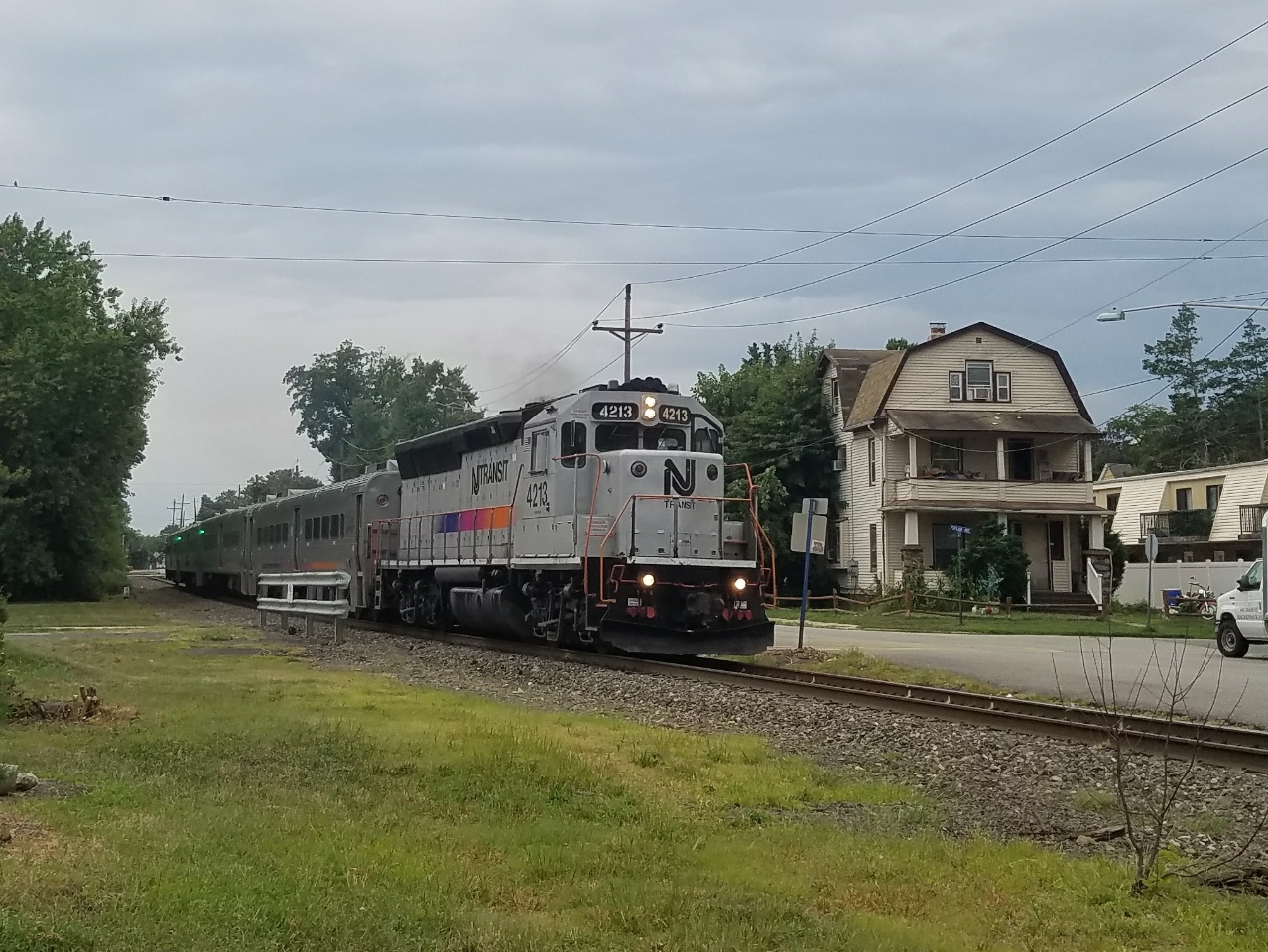
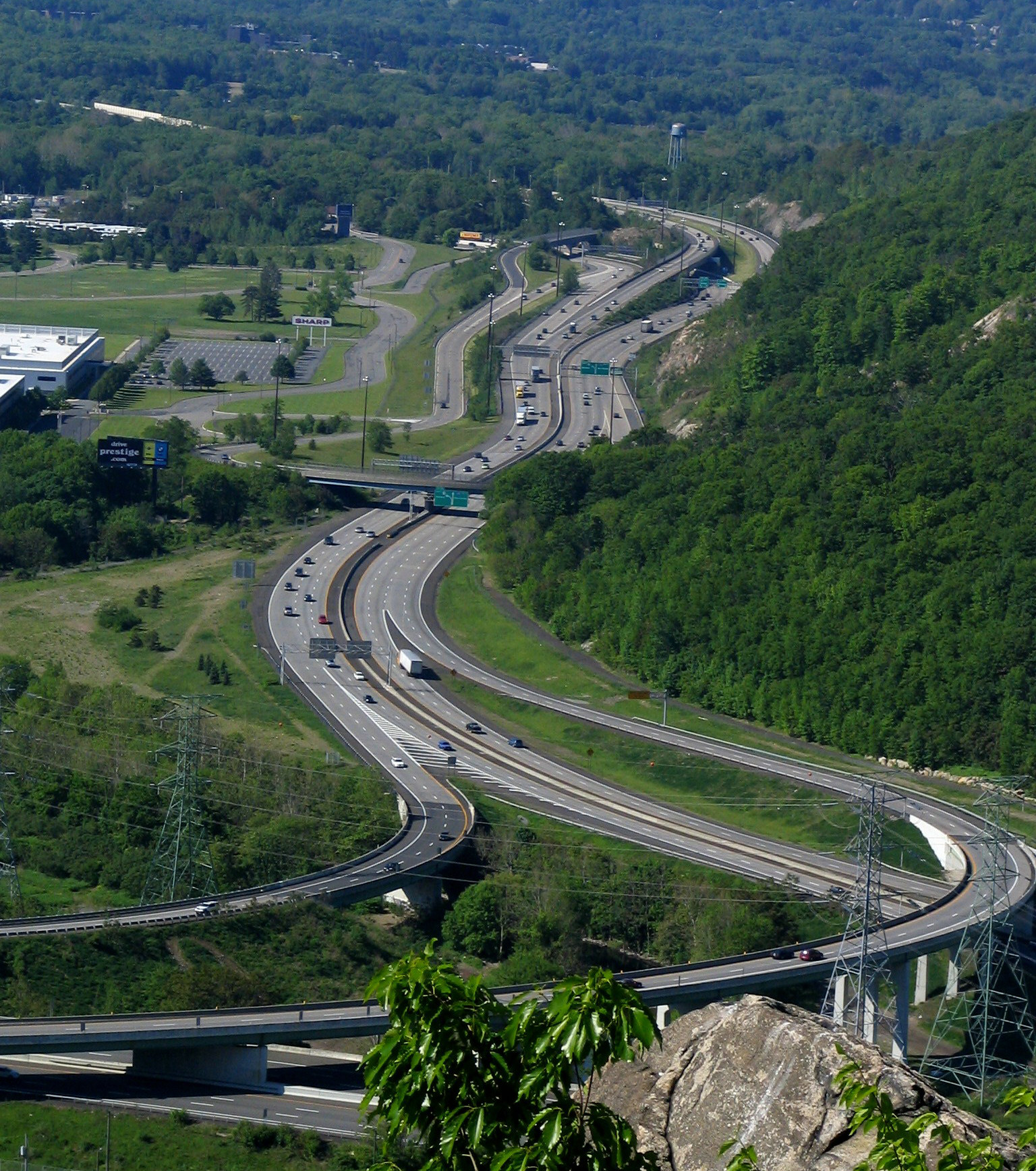
Nanuet is a hamlet and census-designated place in the town of Clarkstown, Rockland County, New York, United States. The third largest hamlet in Clarkstown, it is located north of Pearl River, south of New City, east of Spring Valley, and west of West Nyack. It is located midway between Manhattan and Bear Mountain, north and south of each respectively; and north of the New Jersey border. It has one of three Rockland County stations on New Jersey Transit's Pascack Valley Line. The population of Nanuet was 17,882 at the 2010 census. The opening of the New York State Thruway ( Interstate 87/287), the Tappan Zee Bridge, and the Palisades Interstate Parkway in the mid-1950s helped usher in decades of population growth and real estate development, including the construction of the Nanuet Mall and local shopping centers. In 2011, CNN Money ranked Nanuet 76 on its annual 100 Best Places to Live list, citing its relatively inexpensive housing and the recreation and shopping opportun ... [...More Info...] [...Related Items...] OR: [Wikipedia] [Google] [Baidu] |
Nanuet Mall
The Shops at Nanuet is a lifestyle center located in Nanuet, New York. It is located at the intersection of New York State Route 59 and Middletown Road and is also accessible via exit 14 of the New York State Thruway. Built on the site of the former Nanuet Mall, the Shops at Nanuet debuted in 2013. As of 2022, The mall currently maintains traditional tenants At Home, Stop & Shop, as well as a Regal Cinemas. The mall currently features a handful of classic brands such as White House/Black Market, Coach New York, Ann Inc, LOFT, and Drybar. History The original mall opened in 1969 with the two original anchor stores which were Bamberger's (later became Macy's) and Sears. In 1994, a new wing was built anchored by Abraham & Straus, which became Stern's in 1995. When the Stern's brand was phased out in 2001, (with most other stores becoming Macy's stores) the anchor space became Boscov's in 2002, before the latter closed in May 2008 in preparation for the mall's demolition (Simon Pro ... [...More Info...] [...Related Items...] OR: [Wikipedia] [Google] [Baidu] |
Clarkstown, New York
Clarkstown is a town in Rockland County, New York, United States. The town is on the eastern border of the county, located north of the town of Orangetown, east of the town of Ramapo, south of the town of Haverstraw, and west of the Hudson River. As of the 2010 census, the town had a total population of 84,187. The community of New City, the county seat of Rockland County, is also the seat of town government and of the Clarkstown Police Department, the county sheriff's police office, and the county correctional facility. New City makes up about 41.47% of the town's population. In 2008, Clarkstown became one of 600 municipalities nationwide to sign the United States Mayor's Climate Protection Agreement to reduce carbon dioxide emissions to 7 percent below the 1990 levels by 2012. History The town of Clarkstown was created in 1791 from the town of Haverstraw in Orange County, before Rockland County was formed. Geography The Hudson River defines the eastern border of the to ... [...More Info...] [...Related Items...] OR: [Wikipedia] [Google] [Baidu] |
Rockland County, New York
Rockland County is the southernmost county on the west side of the Hudson River in the U.S. state of New York. It is part of the New York metropolitan area. It is about from the Bronx at their closest points. The county's population, as of the 2020 United States Census, is 338,329, making it the state's third-most densely populated county outside New York City (after Nassau and neighboring Westchester Counties, respectively). The county seat is New City. Rockland County is accessible via the New York State Thruway, which crosses the Hudson to Westchester at the Tappan Zee Bridge ten exits up from the NYC border, as well as the Palisades Parkway five exits up from the George Washington Bridge. The county's name derives from "rocky land", as the area has been aptly described, largely due to the Hudson River Palisades. This county is home to one of the most prominent towns in American history. Congers, NY is home to the stepping grounds of Commander-In-Chief George Washingto ... [...More Info...] [...Related Items...] OR: [Wikipedia] [Google] [Baidu] |
New York State Thruway
{{Infobox road , state = NY , type = NYST , alternate_name = Governor Thomas E. Dewey Thruway , maint = NYSTA , map = {{maplink, frame=yes, plain=yes, frame-align=center, frame-width=290, type=line, stroke-width=2, type2=line, from2=New York State Thruway Spur Routes.map , map_custom = yes , map_notes = Map of New York with the Thruway mainline in red; other components of the Thruway system are in blue , length_mi = 496.00 , length_ref = , length_notes = Mainline only , established = {{Start date, June 24, 1954 , restrictions = No explosives (including in cargo) between exits 9 and 11 No commercial vehicles allowed on the Garden State Parkway Connector , allocation = {{plainlist, 1= * {{jct, state=NY, I-Toll, 87 between The Bronx and Albany * {{jct, state=NY, I-Toll, 287 between Elmsford and Suffern * {{jct, state=NY, I-Toll, 90 between Albany and Ripley and the Berkshire Connector * {{jct, state=NY, I-Toll, 95 on the New England Thruway , direction_a = South , ... [...More Info...] [...Related Items...] OR: [Wikipedia] [Google] [Baidu] |
Pascack Valley Line
The Pascack Valley Line is a commuter rail line operated by the Hoboken Division of New Jersey Transit, in the United States. The line runs north from Hoboken Terminal, through Hudson County and Bergen County in New Jersey, and into Rockland County in New York, terminating at Spring Valley. Service within New York State is operated under contract with Metro-North Railroad. The line is named for the Pascack Valley region that it passes through in northern Bergen County. The line parallels the Pascack Brook for some distance. The line is colored purple on system maps, and its symbol is a pine tree. Description The Pascack Valley Line runs between Spring Valley, New York, and Hoboken Terminal. The line is long, of which the northernmost are in New York State. The entire line is owned by NJ Transit, but the Pearl River, Nanuet and Spring Valley stations are leased to Metro-North Railroad. The line is single tracked, but sidings at points along the line, including the Meadow ... [...More Info...] [...Related Items...] OR: [Wikipedia] [Google] [Baidu] |
New City, New York
New City is a hamlet and census-designated place in the town of Clarkstown, Rockland County, New York, United States, part of the New York Metropolitan Area. An affluent suburb of New York City, the hamlet is located north of the city at its closest point, Riverdale, Bronx. Within Rockland County, New City is located north of Bardonia, northeast of Nanuet, east of New Square and New Hempstead, south of Garnerville and the village of Haverstraw, and west of Congers (across Lake DeForest). New City's population was 35,101 at the 2020 census, making it the 14th most populous CDP/hamlet in the state of New York. New City is the county seat, and most populous community of Rockland County and the location of the Clarkstown Police Department, Sheriff's office and corrections facility. The downtown area is one of the main business districts in the county. The ZIP code of New City is 10956. Geography New City is located at (41.145495, −73.994901). New City is accessible from ... [...More Info...] [...Related Items...] OR: [Wikipedia] [Google] [Baidu] |
Pearl River, New York
Pearl River is a hamlet and census-designated place in the town of Orangetown, Rockland County, New York, United States. It is east of Chestnut Ridge, south of Nanuet, west of Blauvelt, New York, and north of Montvale and Old Tappan, New Jersey. The population was 15,876 at the 2010 census. Pearl River is north of midtown Manhattan and just north of the New Jersey border. It is the first (traveling north) of three New York stops on New Jersey Transit's Pascack Valley Line. History In 1696, Pearl River was part of a larger piece of land known as the Kakiat Patent that was granted to Daniel Honan and Michael Hawdon. In 1713, the land was split into north and south plots. After the Revolutionary War, the land was further divided and sold. Pearl River was a piece of land made up of woods and swamps originally called Muddy Creek. In the early 1870s, the town was divided into five different parts: Middletown, Sickletown, Pascack, Muddy Brook, and Naurashaun. There are con ... [...More Info...] [...Related Items...] OR: [Wikipedia] [Google] [Baidu] |
Interstate 87 (New York)
Interstate 87 (I-87) is a north–south Interstate Highway located entirely within the US state of New York. It is most of the main highway between New York City and Montreal. The highway begins at exit 47 off I-278 in the New York City borough of the Bronx, just north of the Robert F. Kennedy Bridge and Grand Central Parkway. From there, the route runs northward through the Hudson Valley, the Capital District, and the easternmost part of the North Country to the Canadian border in the town of Champlain. At its north end, I-87 continues into Quebec as Autoroute 15 (A-15). I-87 connects with several regionally important roads: I-95 in New York City, New York State Route 17 (NY 17; future I-86) near Harriman, I-84 near Newburgh, and I-90 in Albany. The highway is not contiguous with I-87 in North Carolina. I-87 was assigned in 1957 as part of the establishment of the Interstate Highway System. The portion of I-87 south of Albany follows two c ... [...More Info...] [...Related Items...] OR: [Wikipedia] [Google] [Baidu] |
Interstate 287
Interstate 287 (I-287) is an auxiliary Interstate Highway in the US states of New Jersey and New York. It is a partial beltway around New York City, serving the northern half of New Jersey and the counties of Rockland and Westchester in New York. I-287, which is signed north–south in New Jersey and east–west in New York, follows a roughly horseshoe-shaped route from the New Jersey Turnpike ( I-95) in Edison, New Jersey, clockwise to the New England Thruway ( I-95) in Rye, New York, for . Through New Jersey, I-287 runs west from its southern terminus in Edison through suburban areas. In Bridgewater Township, the freeway takes a more northeasterly course, paralleled by US Route 202 (US 202). The northernmost part of I-287 in New Jersey passes through mountainous surroundings. After crossing into New York at Suffern, I-287 turns east on the New York State Thruway ( I-87) and runs through Rockland County. After crossing the Hudson River on the Tappan Zee ... [...More Info...] [...Related Items...] OR: [Wikipedia] [Google] [Baidu] |
Area Code 845
Area code 845 is a telephone area code in the North American Numbering Plan (NANP) for the U.S. state of New York. The numbering plan area comprises the mid- and lower Hudson Valley, specifically Orange, Putnam, Rockland, and Ulster counties, and parts of Columbia, Delaware, Dutchess, Greene, and Sullivan counties. The area code was created on June 5, 2000, by an area code split from most of the territory of area code 914, which was retained by Westchester County. Prior to October 2021, area code 845 had telephone numbers assigned for the central office code 988. In 2020, ''988'' was designated nationwide as a dialing code for the National Suicide Prevention Lifeline, which created a conflict for exchanges that permit seven-digit dialing. This area code was therefore scheduled to transition to ten-digit dialing by October 24, 2021. In April 2022, the North American Numbering Plan Administrator (NANPA) announced a new area code, 329, was scheduled to overlay 845 on March ... [...More Info...] [...Related Items...] OR: [Wikipedia] [Google] [Baidu] |
Spring Valley, New York
Spring Valley is a Administrative divisions of New York#Village, village in the towns of Ramapo, New York, Ramapo and Clarkstown, New York, Clarkstown in Rockland County, New York, Rockland County, New York (state), New York, United States. It is located north of Chestnut Ridge, New York, Chestnut Ridge, east of Airmont, New York, Airmont and Monsey, New York, Monsey, south of Hillcrest, Rockland County, New York, Hillcrest, and west of Nanuet, New York, Nanuet. The population was 33,066 at the 2020 census, making it the 2nd most populous community in Rockland County, after New City, New York, New City. Spring Valley spans the border of two towns, occupying an eastern portion of the town of Ramapo and a small western portion of the town of Clarkstown, New York, Clarkstown. The village is next to the New York State Thruway (Interstate 87 (New York), Interstate 87) and is served by a New Jersey Transit Spring Valley (Metro-North station), train station at the terminus of the Pascac ... [...More Info...] [...Related Items...] OR: [Wikipedia] [Google] [Baidu] |


