|
Nanticoke River
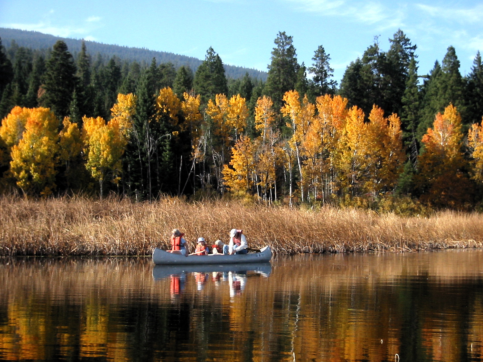
The Nanticoke River is a tributary of the Chesapeake Bay on the Delmarva Peninsula. It rises in southern Kent County, Delaware, Kent County, Delaware, flows through Sussex County, Delaware, Sussex County, Delaware, and forms the boundary between Dorchester County, Maryland, Dorchester County, Maryland and Wicomico County, Maryland, Wicomico County, Maryland. The tidal river course proceeds southwest into the Tangier Sound, Chesapeake Bay. The river is long. A 26-mile ecotourism water trail running along the River was set aside in July 2011 by Delaware state and federal officials, contiguous with a 37-mile water-trail extending through Maryland to the Chesapeake Bay. Some of the main tributaries that feed the Nanticoke on the west-side include: Cow Creek; Jack Creek; Wapremander Creek; Marshyhope Creek; and the east side: Gravelly Fork, Gum Branch (Nanticoke River tributary), Gum Branch, and Broad Creek. Notable towns and communities situated along the river include Nanticoke, ... [...More Info...] [...Related Items...] OR: [Wikipedia] [Google] [Baidu] |
United States
The United States of America (USA), also known as the United States (U.S.) or America, is a country primarily located in North America. It is a federal republic of 50 U.S. state, states and a federal capital district, Washington, D.C. The 48 contiguous states border Canada to the north and Mexico to the south, with the semi-exclave of Alaska in the northwest and the archipelago of Hawaii in the Pacific Ocean. The United States asserts sovereignty over five Territories of the United States, major island territories and United States Minor Outlying Islands, various uninhabited islands in Oceania and the Caribbean. It is a megadiverse country, with the world's List of countries and dependencies by area, third-largest land area and List of countries and dependencies by population, third-largest population, exceeding 340 million. Its three Metropolitan statistical areas by population, largest metropolitan areas are New York metropolitan area, New York, Greater Los Angeles, Los Angel ... [...More Info...] [...Related Items...] OR: [Wikipedia] [Google] [Baidu] |
Tributary
A tributary, or an ''affluent'', is a stream or river that flows into a larger stream (''main stem'' or ''"parent"''), river, or a lake. A tributary does not flow directly into a sea or ocean. Tributaries, and the main stem river into which they flow, drain the surrounding drainage basin of its surface water and groundwater, leading the water out into an ocean, another river, or into an endorheic basin. The Irtysh is a chief tributary of the Ob (river), Ob river and is also the longest tributary river in the world with a length of . The Madeira River is the largest tributary river by volume in the world with an average discharge of . A confluence, where two or more bodies of water meet, usually refers to the joining of tributaries. The opposite to a tributary is a distributary, a river or stream that branches off from and flows away from the main stream. [...More Info...] [...Related Items...] OR: [Wikipedia] [Google] [Baidu] |
Vienna, Maryland
Vienna is a town in Dorchester County, Maryland, United States. The population was 271 at the 2010 census. History Prior to European colonization, a Nanticoke town called "Chicacone" existed where Vienna is now located. The Nanticokes are an Algonquian people. Chicacone was the largest Nanticoke settlement at the time of John Smith's exploration of the Chesapeake Bay in 1608. By 1742, ongoing violations of Indian reservation rights by English colonizers caused the Nanticoke people to abandon Chicacone. In 1768–69, the Colony of Maryland dissolved the Nanticoke reservation. Many of the Nanticokes of Chicacone migrated north to Pennsylvania, New York, and Canada, while others stayed and assimilated into the white or black communities of lower Dorchester and Wicomico counties. Vienna was founded in 1706. It thrived on trade, shipbuilding and tobacco farming. The wreck of a 45-foot cargo ship that was likely built at a small shipyard or plantation in Maryland was found in 2 ... [...More Info...] [...Related Items...] OR: [Wikipedia] [Google] [Baidu] |
Bivalve, Maryland
Bivalve is an unincorporated community and census-designated place along the eastern shore of the lower Nanticoke River, near its mouth on the Chesapeake Bay, in Wicomico County, Maryland Maryland ( ) is a U.S. state, state in the Mid-Atlantic (United States), Mid-Atlantic region of the United States. It borders the states of Virginia to its south, West Virginia to its west, Pennsylvania to its north, and Delaware to its east ..., United States. Its population was 201 as of the 2010 census. Bivalve takes its name from the oyster, upon which the town's economy once depended. It is part of the Salisbury, Maryland-Delaware Metropolitan Statistical Area. The Yellow Brick House was listed on the National Register of Historic Places in 1978. Demographics References External linksHistory of Bivalve Fishing communities in Maryland Census-designated places in Wicomico County, Maryland Census-designated places in Maryland Salisbury metropolitan area Maryland pop ... [...More Info...] [...Related Items...] OR: [Wikipedia] [Google] [Baidu] |
Nanticoke, Maryland
Nanticoke is an unincorporated community and census-designated place A census-designated place (CDP) is a Place (United States Census Bureau), concentration of population defined by the United States Census Bureau for statistical purposes only. CDPs have been used in each decennial census since 1980 as the counte ... in Wicomico County, Maryland, United States. It is part of the Salisbury, Maryland-Delaware Metropolitan Statistical Area. Demographics 2020 Census Per the 2020 census, the population was 228. See also Roaring Point References Census-designated places in Maryland Census-designated places in Wicomico County, Maryland Salisbury metropolitan area Maryland populated places on the Chesapeake Bay {{WicomicoCountyMD-geo-stub ... [...More Info...] [...Related Items...] OR: [Wikipedia] [Google] [Baidu] |
Water Trail
Water trails (also known as blueways) are marked routes on navigable waterway such as rivers, lakes, canals, and coastlines for recreational use. They allow access to waterways for non-motorized boats and sometimes motorized vessels, inner tubes, and other craft. Water trails not only require suitable access points and take-outs for exit but also provide places ashore to camp and picnic or other facilities for boaters. Water trails may be in public or private waters. In the United States, many water trails are assisted by the National Park Service. Local statutes may apply to landowners who steward water trails and the boaters who use them. Much of the Trans Canada Trail will be a network of water trails open to canoes and other small vessels. Recreational use of water trails is a form of ecotourism sometimes called "paddle tourism". Notable water trails and blueways include: * Allagash Wilderness Waterway * Captain John Smith Chesapeake National Historic Trail *Lake Mich ... [...More Info...] [...Related Items...] OR: [Wikipedia] [Google] [Baidu] |
Ecotourism
Ecotourism is a form of nature-oriented tourism intended to contribute to the Ecological conservation, conservation of the natural environment, generally defined as being minimally impactful, and including providing both contributions to conservation and environmental education. The definition sometimes also includes being financially beneficial to the host community or making conservation financially possible. There are a range of different definitions, and the correct definition of the term was an active subject of debate as of 2009. The term is also used more widely by many organizations offering nature tourism, which do not focus on being beneficial to the environment. Since the 1980s, ecotourism has been considered an important endeavor by environmentalists for conservation reasons. Organizations focusing on ecotourism often make direct or indirect contributions to conservation or employ practices or technology that reduce impacts on the environment. However (according to Bu ... [...More Info...] [...Related Items...] OR: [Wikipedia] [Google] [Baidu] |
Tangier Sound
Tangier Sound is a sound of the Chesapeake Bay bounded on the west by Tangier Island in Virginia, and Smith Island and South Marsh Island in Maryland, by Deal Island in Maryland on the north, and the mainland of the Eastern Shore of Maryland and Pocomoke Sound on the east. It stretches into Virginia as far south as Watts Island. The Manokin, Big Annemessex, and Little Annemessex Rivers all flow into Tangier Sound from Somerset County, Maryland. Crisfield, Maryland, located on Tangier Sound, is a center of the shellfish industry. Smith Island, Tangier Island and Deal Island also remain centers of the Chesapeake Bay seafood industry and outposts of Chesapeake culture and history. As in other parts of Chesapeake Bay, the seafood industry on Tangier Sound has declined markedly due to pollution, mismanagement and the growth of recreational fishing. However, the wild oyster industry has seen a strong reemergence in recent years due to shell planting and caretaking method ... [...More Info...] [...Related Items...] OR: [Wikipedia] [Google] [Baidu] |
Wicomico County, Maryland
Wicomico County ( ) is a County (United States), county located in the southeastern part of the U.S. state of Maryland, on the Delmarva Peninsula. As of the 2020 United States census, 2020 census, the population was 103,588. The county seat is Salisbury, Maryland, Salisbury. The county was named for the Wicomico River (Maryland eastern shore), Wicomico River, which in turn derives its name from the Algonquin language, Algonquian language words , meaning "a place where houses are built," apparently referring to a Native American town on the banks. The county is included in the Salisbury, MD-DE Metropolitan Statistical Area. The county is part of the Eastern Shore of Maryland, Lower Eastern Shore region of the state. History Wicomico County was created from Somerset County, Maryland, Somerset and Worcester County, Maryland, Worcester counties in 1867. Politics and government Wicomico County was granted a charter form of government in 1964. In the period after the Reconstruction ... [...More Info...] [...Related Items...] OR: [Wikipedia] [Google] [Baidu] |
Maryland
Maryland ( ) is a U.S. state, state in the Mid-Atlantic (United States), Mid-Atlantic region of the United States. It borders the states of Virginia to its south, West Virginia to its west, Pennsylvania to its north, and Delaware to its east, as well as with the Atlantic Ocean to its east, and the national capital and federal district of Washington, D.C. to the southwest. With a total area of , Maryland is the List of U.S. states and territories by area, ninth-smallest state by land area, and its population of 6,177,224 ranks it the List of U.S. states and territories by population, 18th-most populous state and the List of states and territories of the United States by population density, fifth-most densely populated. Maryland's capital city is Annapolis, Maryland, Annapolis, and the state's most populous city is Baltimore. Maryland's coastline was first explored by Europeans in the 16th century. Prior to that, it was inhabited by several Native Americans in the United States ... [...More Info...] [...Related Items...] OR: [Wikipedia] [Google] [Baidu] |
Dorchester County, Maryland
Dorchester County is a county located in the U.S. state of Maryland. At the 2020 census, the population was 32,531. Its county seat is Cambridge. The county was formed in 1669 and named for the Earl of Dorset, a family friend of the Calverts (the founding family of the Maryland colony). The county is part of the Mid-Eastern Shore region of the state. Dorchester County comprises the Cambridge, MD Micropolitan Statistical Area, which is also included in the Salisbury-Cambridge, MD-DE Combined Statistical Area. Dorchester County is the largest county by total area in Maryland. It is bordered by the Choptank River to the north, Talbot County to the northwest, Caroline County to the northeast, Wicomico County to the southeast, Sussex County, Delaware, to the east, and the Chesapeake Bay to the west. Dorchester County uses the slogan, "The Heart of Chesapeake Country", due to its geographical location and the heart-like shape of the county on a map. History Many resident ... [...More Info...] [...Related Items...] OR: [Wikipedia] [Google] [Baidu] |
Sussex County, Delaware
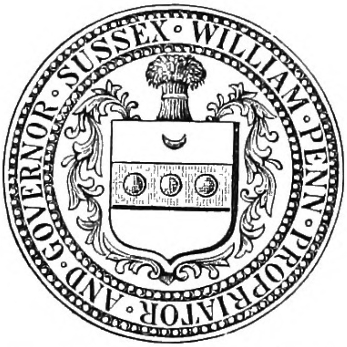
Sussex County is a county in the southern part of the U.S. state of Delaware, on the Delmarva Peninsula. As of the 2020 census, the population was 237,378, making it the state's second most populated county behind New Castle and ahead of Kent. The county seat is Georgetown. The first European settlement in the state of Delaware was founded by the Dutch in 1631 near the present-day town of Lewes on the Atlantic Coast. However, Sussex County was not organized until 1683 under English colonial rule. Sussex County forms the Seaford, Delaware, Micropolitan Statistical Area. History Beginnings Archaeologists estimate that the first inhabitants of Sussex County, the southernmost county in Delaware, arrived between 10,000 and 14,000 years ago. Various indigenous cultures occupied the area, especially along the river and the coast, often having seasonal fishing villages. Historic Native Americans in Sussex County were members of Algonquian-speaking tribes, as were most coastal ... [...More Info...] [...Related Items...] OR: [Wikipedia] [Google] [Baidu] |


