|
Namur Gate
The Namur Gate (, ; , ) was one of the medieval city gates of the second walls of Brussels, Belgium. Built in the 14th century, it was one of the major entry points on the city's south-eastern side to Ixelles. The gatehouse was demolished in 1784 during the construction of the Small Ring (Brussels' inner ring road). Two pavilion-like buildings were built on the site to collect the octroi in 1836. Although redundant since 1860, these pavilions were moved, and now stand at the entrance of the Bois de la Cambre/Ter Kamerenbos. ''Namur Gate'' remains a toponym denoting the site of the former gate on the edge of the City of Brussels and the '' Matongé'' district in Ixelles. This area is served by Porte de Namur/Naamsepoort metro station on lines 2 and 6 of the Brussels Metro. History Built in the 14th century, the Namur Gate was one of the seven city gates of the second set of defensive walls that enclosed Brussels. It was originally known as the New Gate of Coudenberg (), ... [...More Info...] [...Related Items...] OR: [Wikipedia] [Google] [Baidu] |
Fortifications Of Brussels
The Fortifications of Brussels (; ) refers to the Middle Ages, medieval Defensive wall, city walls that surrounded Brussels, Belgium, built primarily to defend the city but also for administrative reasons. There were two stages of fortifications of Brussels: the first walls, built in the early 13th century, and the second walls, built in the late 14th century and later upgraded. In the 19th century, the second walls were torn down and replaced with the Small Ring, Brussels, Small Ring, a series of boulevards bounding the historical city centre. Nowadays, only a few sections of each walls remain, most notably the Halle Gate. First walls The first walls of Brussels (, ) were a series of fortifications erected around Brussels in the early 13th century. The city quickly outgrew them, and starting in 1356, a second, larger set of walls was built to better enclose and defend the city. The now superfluous walls were dismantled between the 16th and 18th centuries. Isolated portions of t ... [...More Info...] [...Related Items...] OR: [Wikipedia] [Google] [Baidu] |
Wallonia
Wallonia ( ; ; or ), officially the Walloon Region ( ; ), is one of the three communities, regions and language areas of Belgium, regions of Belgium—along with Flemish Region, Flanders and Brussels. Covering the southern portion of the country, Wallonia is primarily Geographical distribution of French speakers, French-speaking. It accounts for 55% of Belgium's territory, but only a third of its population. The Walloon Region and the French Community of Belgium, which is the political entity responsible for matters related mainly to culture and education, are independent concepts, because the French Community of Belgium encompasses both Wallonia and the bilingual Brussels-Capital Region but not the German-speaking Community of Belgium, which administers nine municipalities in Eastern Wallonia. During the Industrial Revolution, Wallonia was second only to the United Kingdom in industrialization, capitalizing on its extensive deposits of coal and iron. This brought the regio ... [...More Info...] [...Related Items...] OR: [Wikipedia] [Google] [Baidu] |
Sub-Saharan Africa
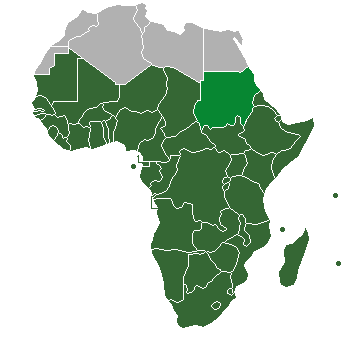
Sub-Saharan Africa is the area and regions of the continent of Africa that lie south of the Sahara. These include Central Africa, East Africa, Southern Africa, and West Africa. Geopolitically, in addition to the list of sovereign states and dependent territories in Africa, African countries and territories that are situated fully in that specified region, the term may also include polities that only have part of their territory located in that region, per the definition of the United Nations geoscheme for Africa, United Nations (UN). This is considered a non-standardised geographical region with the number of countries included varying from 46 to 48 depending on the organisation describing the region (e.g. United Nations, UN, World Health Organization, WHO, World Bank, etc.). The Regions of the African Union, African Union (AU) uses a different regional breakdown, recognising all 55 member states on the continent—grouping them into five distinct and standard regions. The te ... [...More Info...] [...Related Items...] OR: [Wikipedia] [Google] [Baidu] |
Brusselization
In urban planning, Brusselization ( US variant) or Brusselisation ( UK variant) (, ) is "the indiscriminate and careless introduction of modern high-rise buildings into gentrified neighbourhoods" and has become a byword for "haphazard urban development and redevelopment." The notion applies to anywhere whose development follows the pattern of the uncontrolled development of Brussels in the 1960s and 1970s, that resulted from a lack of zoning regulations and the city authorities' ''laissez-faire'' approach to city planning. Brussels Historical precedent and underpinnings for modernization in Brussels The 1950s was not the first time that Brussels had been radically altered by major redevelopment. Two prior sweeping changes to the city's urban fabric were the straight-lined central boulevards modeled after Paris, which were created following the covering and diverting of the river Senne, as well as the North–South railway connection, which took around forty years to finish ... [...More Info...] [...Related Items...] OR: [Wikipedia] [Google] [Baidu] |
Ferraris Map
The Ferraris map or map of the Austrian Netherlands is a historical map created between 1770 and 1778 by Count Joseph de Ferraris and includes 275 sheets published at the original scale of 1/11.5. The map was made in response to a request by Prince Charles Alexander of Lorraine. It is the first systematic, large scale mapping of modern-day Belgium and parts of Western Europe. History The topographic survey was performed on a territory corresponding to today's Belgium and Luxembourg as well as some territories now belonging to Germany and the Netherlands. There are three original versions of the map. The Royal Library of Belgium, the Austrian National Library and National Library of the Netherlands each have one. Importance The Ferraris maps reflect the detailed state of the Southern Netherlands towards the end of the Ancien Régime, just before the start of the Industrial Revolution The Industrial Revolution, sometimes divided into the First Industrial Revolution ... [...More Info...] [...Related Items...] OR: [Wikipedia] [Google] [Baidu] |
Wenceslas Hollar
Wenceslaus Hollar (23 July 1607 – 25 March 1677) was a prolific and accomplished Bohemian graphic artist of the 17th century, who spent much of his life in England. He is known to German speakers as ; and to Czech speakers as (). He is particularly noted for his engravings and etchings. He was born in Prague, died in London, and was buried at St Margaret's Church, Westminster. Early life After his family was ruined by the Battle of White Mountain, Sack of Prague in the Thirty Years' War, the young Hollar, who had been destined for the legal profession, decided to become an artist. The earliest of his works that have come down to us are dated 1625 and 1626; they are small plates, and one of them is a copy of a "Virgin and Child" by Albrecht Dürer, Dürer, whose influence upon Hollar's work was always great. In 1627 he was in Frankfurt where he was apprenticed to the renowned engraver Matthäus Merian. In 1630 he lived in Strasbourg, Mainz and Koblenz, where he portrayed the ... [...More Info...] [...Related Items...] OR: [Wikipedia] [Google] [Baidu] |
King Baudouin Stadium
The King Baudouin Stadium ( ; ) is a sports ground in Brussels, Belgium. Located in the north-western district of the City of Brussels, it was built to embellish the Heysel/Heizel Plateau in view of the 1935 Brussels International Exposition. It was inaugurated on 23 August 1930, with Crown Prince Leopold attending the opening ceremony. The stadium hosted 70,000 at the time. Its name honours King Baudouin, Leopold's successor as King of the Belgians from 1951 to his death in 1993. The stadium is located at 135/2, /, on the border of the Bruparck entertainment park (with the Atomium, Mini-Europe miniature park and Kinepolis cinema). It can be accessed from the metro stations Heysel/Heizel and Roi Baudouin/Koning Boudewijn on line 6. History Early history The first version of the King Baudouin Stadium was built in 1929–30 by the architect Joseph Van Neck, also chief architect of the 1935 Brussels International Exposition, in a classical modernist style. Its origina ... [...More Info...] [...Related Items...] OR: [Wikipedia] [Google] [Baidu] |
Laeken
(French language, French, ) or (Dutch language, Dutch, ) is a residential suburb in the north-western part of the Brussels-Capital Region, Belgium. It belongs to the List of municipalities of the Brussels-Capital Region, municipality of the City of Brussels and is mostly identified by the Belgian postal code: 1020. Prior to 1921, it was a separate municipality. Toponymy Etymology The name ''Laeken'' () derives from the Germanic ''Lacha'' or ''Lache'' ("water", "lake"), because the Molenbeek brook at the time formed a network of ponds at this height. The oldest mention of the village is in a diploma from 1080, where the name ''Gilbert de Lacha'' appears. There is also the mention ''Lachus'' in 1117. Main sights Royal Palace The Palace of Laeken, Royal Palace of Laeken, official home of the Monarchy of Belgium, Belgian royal family, is situated in Laeken. The palace was built in 1782–1784 by the French architect and urbanist Charles de Wailly. It was partly destroyed b ... [...More Info...] [...Related Items...] OR: [Wikipedia] [Google] [Baidu] |
Expo 58
Expo 58, also known as the 1958 Brussels World's Fair (; ), was a world's fair held on the Heysel/Heizel Plateau in Brussels, Belgium, from 17 April to 19 October 1958. It was the first major world's fair registered under the Bureau International des Expositions (BIE) after World War II and the fifth in Brussels overall. Expo 58 left a deep impression on Belgium. It was also the pretext for major upheavals and works in Brussels, whose boulevards were transformed into urban motorways. The Atomium, built for the occasion, has become one of the city's must-see landmarks. Background Expo 58 was the eleventh world's fair hosted by Belgium, and the fifth in Brussels, following the fairs in 1888, 1897, 1910 and 1935. In 1953, Belgium won the bid for the next world's fair, winning out over other European capitals such as Paris and London. Nearly 15,000 workers spent three years building the site on the Heysel/Heizel Plateau, north-west of central Brussels. Many of the building ... [...More Info...] [...Related Items...] OR: [Wikipedia] [Google] [Baidu] |
Henri Beyaert
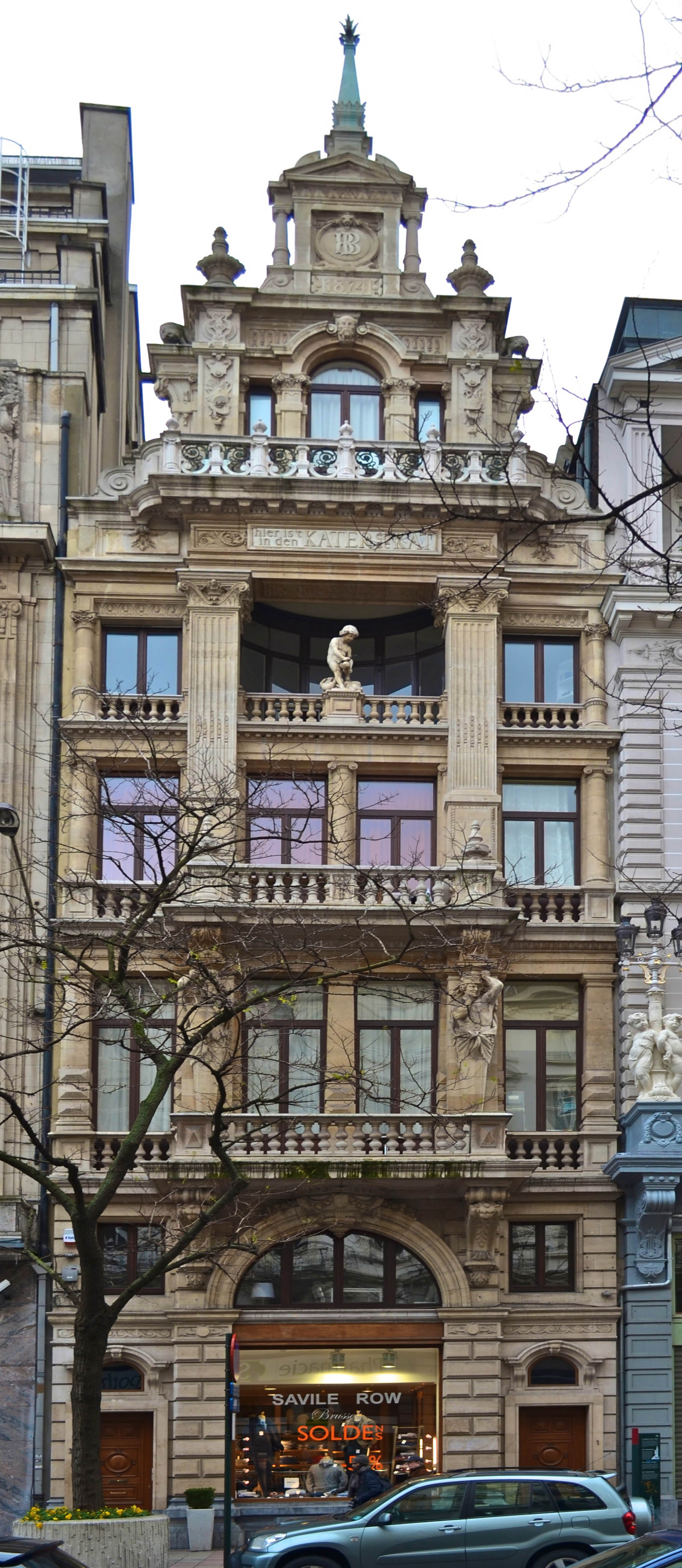
Hendrik Beyaert ( Dutch) or Henri Beyaert ( French) (29 July 1823 – 22 January 1894) was a Belgian architect. He is responsible for the designs of the Palace of the Nation, the National Bank of Belgium and Bornem Castle, among many other significant buildings. Biography Beyaert was of very humble descent. For this reason he had to earn his living from a very young age onwards. Initially he and his family could not afford to finance higher studies. At age 19, Beyaert worked as a bank employee at the National Bank of Belgium's office in his native city, Kortrijk. He found his profession not very indulging and decided to quit the bank. As he had always been fascinated by architecture, he found a post as an apprentice stonemason on the building site of the new railway station of Tournai, a building that would be replaced decades later by a design of Beyaert himself. In 1842, Beyaert went to Brussels where he kept a small bookshop to earn his living and where he enrolled at ... [...More Info...] [...Related Items...] OR: [Wikipedia] [Google] [Baidu] |
Charles De Brouckère
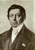
Jonkheer Charles Joseph Marie Ghislain de Brouckère (; 18 January 1796 – 20 April 1860) was a Belgian nobleman, liberal politician and mayor of the City of Brussels. Life Born in Bruges, elder brother of future Prime Minister of Belgium Henri de Brouckère, Charles entered politics in the period when modern Belgium formed the southern part of the United Kingdom of the Netherlands. He worked as a banker in Maastricht and served as a representative for the province of Limburg in the Second Chamber of parliament. During the Belgian Revolution of 1830, De Brouckère was a member of the francophile and francophone party, which favoured annexation by France. In the newly independent Belgium, he served as Finance Minister, Interior Minister, and War Minister, for short periods in 1831. He taught as a professor at the Free University of Brussels, and in 1848 became burgomaster of Brussels, a post he held continuously until his death. He is interred at Brussels Cemetery. Legac ... [...More Info...] [...Related Items...] OR: [Wikipedia] [Google] [Baidu] |
Mayor Of The City Of Brussels
This is a list of mayors or burgomasters of the City of Brussels. Burgundian Netherlands (1384–1482) *1380: Pipenpoy family, Geert Pipenpoy *1381: Pipenpoy family, Geert Pipenpoy and Jacques Stovaert *1421: J. Swaeff, J. Cooman *1422: Walter Vanden Heetvelde, Petrus van Bolenbeke *1423: Guillaume de Kesterbeke, Jan van Muysen *1424: Jan van Coundeberg, called Rolibuc, Gielis Daneels, *1425: Willem van Herzele, J. de Schore, called de Briedere *1426: Wenceslas t'Serclaes, J. Rampaert *1427: Jean de Hertoghe, Michel de Mabeert *1428: H. Magnus, J. de Broeckhoven *1429: Willem van Kesterbeke, Daniel Poelbroot *1430: Simon van Ophem, J. de Schore, called de Briedere *1431: Pipenpoy family, Walter, son of Gerard Pipenpoy, J. Roypens *1432: Wenceslas t'Serclaes, Félix de Hont *1433: J. Bernaige, H. de Beringen *1434: Jean de Frigidomonte *1435: Walter Vandernoot, J. Rampaert *1436: Walter Vanden Winckele, Arnout Wellems, said Van Almkercke *1437: Henri Taye, J. van Broeckhoven *143 ... [...More Info...] [...Related Items...] OR: [Wikipedia] [Google] [Baidu] |


