|
Nakijin Castle
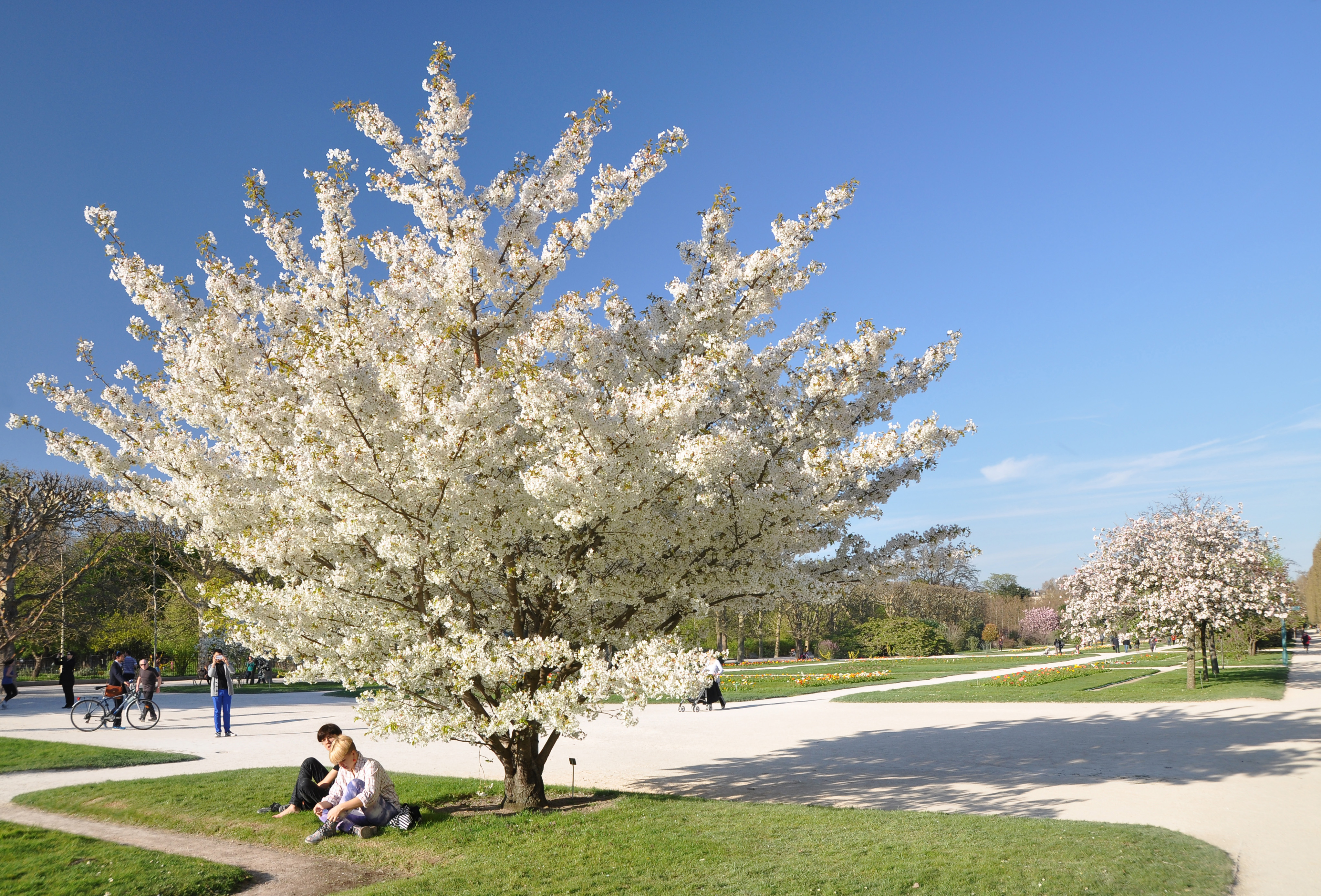
is a Ryukyuan ''gusuku'' located in Nakijin, Okinawa. It is currently in ruins. In the late 14th century, the island of Okinawa consisted of three principalities: Nanzan to the south, Chūzan in the central area, and Hokuzan in the north. Nakijin was the capital of Hokuzan. The fortress includes several sacred Utaki groves, reflecting the castle's role as a center of religious activity. It is today known for the Hikan cherries which bloom in northern Okinawa between mid-January and early February, providing the first cherry blossoms each year in Japan. In 2000, Nakijin Castle was designated as a World Heritage Site, as a part of the Gusuku Sites and Related Properties of the Kingdom of Ryukyu. History Though there had been Lords of Nakijin prior to the creation of the Hokuzan kingdom, and thus some form of chiefly residence can be presumed to have been on or near the site before, it is believed that the ''gusuku'' form of Nakijin castle only emerged at the founding of the kingd ... [...More Info...] [...Related Items...] OR: [Wikipedia] [Google] [Baidu] |
Nakijin, Okinawa
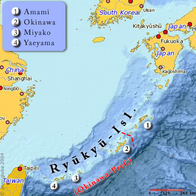
is a village located in Kunigami District, Okinawa Prefecture, Japan. , the village has an estimated population of 9,529 and a population density of 239.00 persons per km2. The total area is 39.87 km2. Geography Nakijin Village occupies the northern half of Motobu Peninsula on Okinawa Island. It includes the island of Kouri that was linked to the island of Yagaji (belonging to Nago City) by a bridge in 2005 (Kouri-Ōhashi Bridge). Yagaji was linked to Nakijin Village by the Urumi-Ōhashi Bridge in 2010. The village is crossed by the Ōi-gawa River that runs northward to the East China Sea. Administrative divisions The village includes nineteen wards. *Amesoko (天底) *Gogayama (呉我山) *Heshiki (平敷) *Imadomari (今泊), merger of Nakijin (今帰仁) and Oyadomari (親泊) *Jana (謝名) *Kamiunten (上運天) *Kaneshi (兼次) *Koechi (越地) *Kouri (古宇利) *Nakaoji (仲尾次) *Nakasone (仲宗根) *Sakiyama (崎山) *Serikyaku (勢理客) *Shoshi (諸 ... [...More Info...] [...Related Items...] OR: [Wikipedia] [Google] [Baidu] |
Ryukyuan Religion
Ryukyu may refer to: * Ryukyu Islands, a volcanic arc archipelago * Ryukyuan languages * Ryukyuan people * Kingdom of Ryukyu (1429–1879) * Ryukyu (My Hero Academia), Ryuko Tatsuma, a character in the animanga series ''My Hero Academia'' See also * Okinawa (other) * Okinawan (other) * Liuqiu (medieval), Liuqiu * Lewchewan (other) {{disambig Language and nationality disambiguation pages ... [...More Info...] [...Related Items...] OR: [Wikipedia] [Google] [Baidu] |
Former Castles In Japan
A former is an object, such as a template, gauge or cutting die, which is used to form something such as a boat's hull. Typically, a former gives shape to a structure that may have complex curvature. A former may become an integral part of the finished structure, as in an aircraft fuselage, or it may be removable, being used in the construction process and then discarded or re-used. Aircraft formers Formers are used in the construction of aircraft fuselage, of which a typical fuselage has a series from the nose cone to the empennage, typically perpendicular to the longitudinal axis of the aircraft. The primary purpose of formers is to establish the shape of the fuselage and reduce the column length of stringers to prevent instability. Formers are typically attached to longerons, which support the skin of the aircraft. The "former-and-longeron" technique (also called stations and stringers) was adopted from boat construction, and was typical of light aircraft built until t ... [...More Info...] [...Related Items...] OR: [Wikipedia] [Google] [Baidu] |
World Heritage Sites In Japan
The United Nations Educational, Scientific and Cultural Organization (UNESCO) World Heritage Sites are places of importance to cultural or natural heritage as described in the UNESCO World Heritage Convention, established in 1972. Cultural heritage consists of monuments (such as architectural works, monumental sculptures, or inscriptions), groups of buildings, and sites (including archaeological sites). Natural features (consisting of physical and biological formations), geological and physiographical formations (including habitats of threatened species of animals and plants), and natural sites that are important from the point of view of science, conservation, or natural beauty, are defined as natural heritage. Japan accepted the UNESCO World Heritage Convention on 30 June 1992. There are 26 sites listed in Japan, with a further four sites on the tentative list. Japan's first entries to the list took place in 1993, when four sites were inscribed. The most recent site, the Sa ... [...More Info...] [...Related Items...] OR: [Wikipedia] [Google] [Baidu] |
Sakura
The cherry blossom, or sakura, is the flower of trees in ''Prunus'' subgenus '' Cerasus''. ''Sakura'' usually refers to flowers of ornamental cherry trees, such as cultivars of ''Prunus serrulata'', not trees grown for their fruit (although these also have blossoms). Cherry blossoms have been described as having a vanilla-like smell, which is mainly attributed to coumarin. Wild species of cherry tree are widely distributed, mainly in the Northern Hemisphere. They are common in East Asia, especially in Japan, where they have been cultivated, producing many varieties. Most of the ornamental cherry trees planted in parks and other places for viewing are cultivars developed for ornamental purposes from various wild species. In order to create a cultivar suitable for viewing, a wild species with characteristics suitable for viewing is needed. ''Prunus speciosa'' (Oshima cherry), which is endemic to Japan, produces many large flowers, is fragrant, easily mutates into double fl ... [...More Info...] [...Related Items...] OR: [Wikipedia] [Google] [Baidu] |
Amami Islands
The The name ''Amami-guntō'' was standardized on February 15, 2010. Prior to that, another name, ''Amami shotō'' (奄美諸島), was also used. is a Japanese archipelago in the Satsunan Islands, which is part of the Ryukyu Islands, and is southwest of Kyushu. Administratively, the group belongs to Kagoshima Prefecture, Japan. The Geospatial Information Authority of Japan and the Japan Coast Guard agreed on February 15, 2010, to use the name of for the Amami Islands. Prior to that, was also used. The name of Amami is probably cognate with , the goddess of creation in the Ryukyuan religion#Ryukyuan creation myth, Ryukyuan creation myth. Geography The Amami Islands are limestone islands of coralline origin and have a total area of approximately , of which constitute the city (''-shi'') of Amami, and constitute the district (''-gun'') of Oshima. The highest elevation is ''Yuwandake'' with a height of on Amami Ōshima. The islands have a humid subtropical climate (Köppen clima ... [...More Info...] [...Related Items...] OR: [Wikipedia] [Google] [Baidu] |
Satsuma Domain
The , briefly known as the , was a Han system, domain (''han'') of the Tokugawa shogunate of Japan during the Edo period from 1600 to 1871. The Satsuma Domain was based at Kagoshima Castle in Satsuma Province, the core of the modern city of Kagoshima, located in the south of the island of Kyushu. The Satsuma Domain was ruled for its existence by the ''Tozama daimyō, Tozama'' ''daimyō'' of the Shimazu clan, who had ruled the Kagoshima area since the 1200s, and covered territory in the Provinces of Japan, provinces of Satsuma, Ōsumi Province, Ōsumi and Hyūga Province, Hyūga. The Satsuma Domain was assessed under the ''Kokudaka'' system and its value peaked at 770,000 ''koku'', the second-highest domain in Japan after the Kaga Domain.Conrad Totman, Totman, Conrad. (1993) ''Early Modern Japan'', p. 119 The Satsuma Domain was one of the most powerful and prominent of Japan's domains during the Edo period, conquering the Ryukyu Kingdom as a vassal state after the invasion of ... [...More Info...] [...Related Items...] OR: [Wikipedia] [Google] [Baidu] |
Shuri, Okinawa
is a district of the city of Naha, Okinawa, Japan. Formerly a separate city in and of itself, it was once the royal capital of the Ryūkyū Kingdom, hence the name. A number of famous historical sites are located in Shuri, including Shuri Castle, the Shureimon gate, Sunuhyan-utaki (a sacred space of the native Ryukyuan religion), and royal mausoleum Tamaudun, all of which are designated World Heritage Sites by UNESCO. Originally established as a castle town surrounding the royal palace, Shuri ceased to be the capital when the kingdom was abolished and incorporated into Japan as Okinawa prefecture. In 1896, Shuri was made a of the new prefectural capital, Naha, though it was made a separate city again in 1921. In 1954, it was merged again into Naha. History Medieval and early modern periods Shuri Castle was first built during the reign of Shunbajunki (r. 1237–1248), who ruled from nearby Urasoe Castle. Kerr, George H. (2000). '' Okinawa: the History of an Island People''. ... [...More Info...] [...Related Items...] OR: [Wikipedia] [Google] [Baidu] |
Unten Harbor
''Expedition ins O'' is a 2013 German hip-hop album by Käptn Peng & Die Tentakel von Delphi. It is the first album by the band, but Käptn Peng's second album, following his 2012 album '' Die Zähmung der Hydra''. It was published by the independent label Kreismusik. The album features lyrics focusing on themes such as the insignificance of humanity, mental health, and the origin of everything. The album received a generally positive reception, with reviewers complimenting the wordplay and themes. Background and production Käptn Peng, real name Robert Gwisdek, is also an actor. He had produced an album the prior year alongside his brother (Shaban), '' Die Zähmung der Hydra.'' Unlike their first album, ''Expedition ins O'' was created with Die Tentakel von Delphi, their live band with three others in addition to Gwisdek and his brother. They had played live together for some time before the creation of the album. This was in contrast to the previous album, which was mo ... [...More Info...] [...Related Items...] OR: [Wikipedia] [Google] [Baidu] |
East China Sea
The East China Sea is a marginal sea of the Western Pacific Ocean, located directly offshore from East China. China names the body of water along its eastern coast as "East Sea" (, ) due to direction, the name of "East China Sea" is otherwise designated as a formal name by International Hydrographic Organization (IHO) and used internationally. It covers an area of roughly . The sea's northern extension between Korean Peninsula and mainland China is the Yellow Sea, separated by an imaginary line between the southwestern tip of South Korea's Jeju Island and the eastern tip of Qidong, Jiangsu, Qidong at the Yangtze River estuary. The East China Sea is bounded in the east and southeast by the middle portion of the first island chain off the eastern Eurasian continental mainland, including the Japanese island of Kyushu and the Ryukyu Islands, and in the south by the island of Taiwan. It connects with the Sea of Japan in the northeast through the Korea Strait, the South China Sea i ... [...More Info...] [...Related Items...] OR: [Wikipedia] [Google] [Baidu] |
Motobu Peninsula
The is a peninsula in the Yanbaru region of Okinawa Island. It is surrounded by Nago Bay to the east, the Haneda Inland Sea to the north, and the East China Sea to the west.Okinawa Island Guide " Nago City / Motobu Town / Nakijin VillageOkinawa Island Guide » Nago City / Motobu Town / Nakijin Village accessdate: April 4, 2017Google MapsGoogle Maps accessdate: April 3, 2017 It is mostly mountainous, with a few Plain (geography), plains. The peninsula's northeasternmost point is Cape Bise.Figure 5 of 6terminal point accessdate: April 3, 2017 Its highest point is Mount Yae, whose summit is .Stripes OkinawaJapan's cherry blossom season starts here , Stripes Okinawa, accessdate: April 3, 2017 Due to a US military communications tower, the summit is off-limits.Map It! Okinawa: January 2017Map It! Okinawa: January 2017 accessdate: April 5, 2017Map It! Okinawa: Cherry Blossoms on Yaedake (Mt. Yae) accessdate: April 5, 2017 The peninsula was the center of power for the kingdom of Hokuz ... [...More Info...] [...Related Items...] OR: [Wikipedia] [Google] [Baidu] |


