|
Nab Tower
The Nab Tower is a tower originally planned for anti-submarine protection in the English Channel in World War I. It was sunk over the Nab rocks east of the Isle of Wight to replace a lightship after the war, and is a well-known landmark for sailors as it lies off Spithead and marks the deep-water eastern entry into the Solent. History During the First World War, the British Admiralty designed eight towers codenamed M-N that were to be built and positioned in the Straits of Dover to protect allied merchant shipping from German U-boats. Designed by civilian Guy Maunsell, the towers were to be linked together with steel nets and armed with two 4-inch guns with the idea of closing the English Channel to enemy ships. However, by the end of the war in 1918 only one such tower had been completed, at the then-cost of one million pounds, and was located at Shoreham Harbour, awaiting deployment. While another part-built tower would eventually be dismantled in 1924, there remained th ... [...More Info...] [...Related Items...] OR: [Wikipedia] [Google] [Baidu] |
Isle Of Wight
The Isle of Wight (Help:IPA/English, /waɪt/ Help:Pronunciation respelling key, ''WYTE'') is an island off the south coast of England which, together with its surrounding uninhabited islets and Skerry, skerries, is also a ceremonial county. The county is bordered by Hampshire across the Solent strait to the north, and is otherwise surrounded by the English Channel. Its largest settlement is Ryde, and the administrative centre is Newport, Isle of Wight, Newport. Wight has a land area of and had a population of 140,794 in 2022, making it the List of islands of England#Largest islands, largest and List of islands of England#Most populous islands, second-most populous English island. The island is largely rural, with the largest settlements primarily on the coast. These include Ryde in the north-east, Shanklin and Sandown in the south-east, and the large villages of Totland and Freshwater, Isle of Wight, Freshwater in the west. Newport is located inland at the point at which the ... [...More Info...] [...Related Items...] OR: [Wikipedia] [Google] [Baidu] |
Incandescent Light Bulb
An incandescent light bulb, also known as an incandescent lamp or incandescent light globe, is an electric light that produces illumination by Joule heating a #Filament, filament until it incandescence, glows. The filament is enclosed in a glass bulb that is either vacuum, evacuated or filled with inert gas to protect the filament from oxidation. Electric current is supplied to the filament by terminals or wires embedded in the glass. A bulb socket provides mechanical support and electrical connections. Incandescent bulbs are manufactured in a wide range of sizes, light output, and voltage ratings, from 1.5 volts to about 300 volts. They require no external Regulator (automatic control), regulating equipment, have low manufacturing costs, and work equally well on either alternating current or direct current. As a result, the incandescent bulb became widely used in household and commercial lighting, for portable lighting such as table lamps, car headlamps, and flashlights, an ... [...More Info...] [...Related Items...] OR: [Wikipedia] [Google] [Baidu] |
Acetylene Lamp
A carbide lamp or acetylene gas lamp is a simple lamp that produces and burns acetylene (C2H2), which is created by the reaction of calcium carbide (CaC2) with water (H2O). Acetylene gas lamps were used to illuminate buildings, as lighthouse beacons, and as headlights on motor-cars and bicycles. Portable acetylene gas lamps, worn on the hat or carried by hand, were widely used in mining in the early twentieth century. They are still employed by cavers, hunters, and cataphiles. History In 1892, Thomas Willson discovered an economically efficient process for creating calcium carbide in an electric arc furnace from a mixture of lime and coke. The arc furnace provides the high temperature required to drive the reaction. Manufacture of calcium carbide was an important part of the industrial revolution in chemistry, and was made possible in the United States as a result of massive amounts of inexpensive hydroelectric power produced at Niagara Falls before the turn of the twentie ... [...More Info...] [...Related Items...] OR: [Wikipedia] [Google] [Baidu] |
Helicopter Pad
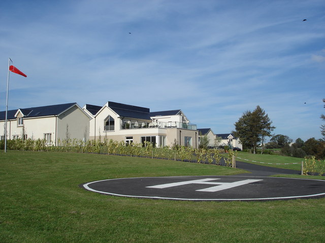
A helipad is the landing area of a heliport, in use by helicopters, powered lift, and VTOL, vertical lift aircraft to land on surface. While helicopters and powered lift aircraft are able to operate on a variety of relatively flat surfaces, a fabricated helipad provides a clearly marked hard surface away from obstacles where such aircraft can land safely. Larger helipads, intended for use by helicopters and other VTOL, vertical take-off and landing (VTOL) aircraft, may be called ''vertiports.'' An example is Vertiport Chicago, which opened in 2015. Usage Helipads may be located at a heliport or airport where fuel, air traffic control and service facilities for aircraft are available. Most helipads are located away from populated areas due to sounds, winds, space and cost constraints. Some skyscrapers have one on their roofs to accommodate air taxi services. Some basic helipads are built on top of highrise buildings for evacuation in case of a major fire outbreak. Major pol ... [...More Info...] [...Related Items...] OR: [Wikipedia] [Google] [Baidu] |
Bofors 40 Mm Automatic Gun L/60
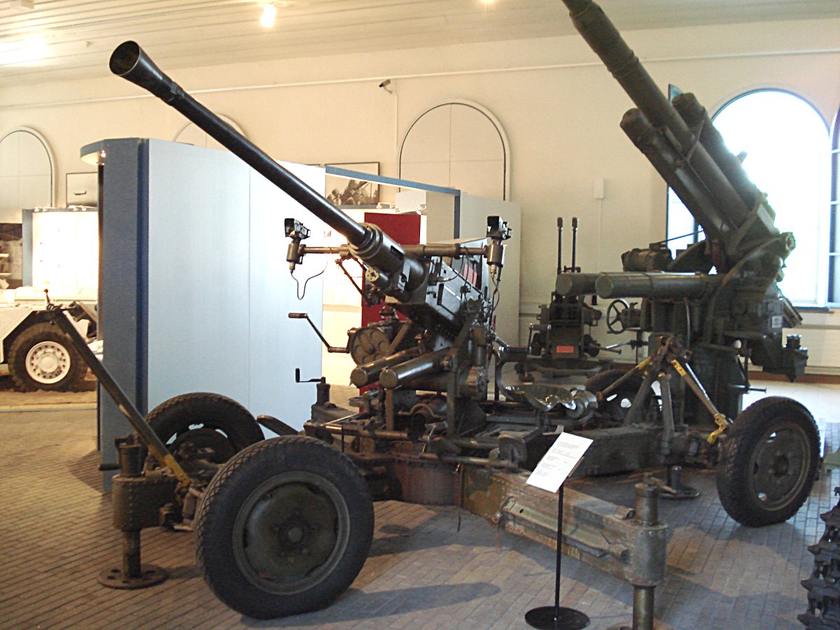
The Bofors 40 mm Automatic Gun L/60 (often referred to simply as the "Bofors 40 mm gun", the "Bofors gun" and the like, see #Name, name) is an Anti-aircraft warfare, anti-aircraft autocannon, designed in the 1930s by the Swedish arms manufacturer AB Bofors. The gun was designed as an intermediate anti-aircraft gun, filling the gap between fast firing close-range small calibre anti-aircraft guns and slower firing long-range high calibre anti-aircraft guns. For its time, the Bofors 40 mm L/60 was perfectly suited for this role and outperformed competing designs in the years leading up to World War II in both effectiveness and reliability. It entered the export market around 1932 and was in service with 18 countries by 1939. Throughout World War II it became one of the most popular and widespread medium-weight anti-aircraft guns. It was used by the majority of the western Allies of World War II, Allies and some Axis powers such as Nazi Germany and Hungary. In the po ... [...More Info...] [...Related Items...] OR: [Wikipedia] [Google] [Baidu] |
World War II
World War II or the Second World War (1 September 1939 – 2 September 1945) was a World war, global conflict between two coalitions: the Allies of World War II, Allies and the Axis powers. World War II by country, Nearly all of the world's countries participated, with many nations mobilising all resources in pursuit of total war. Tanks in World War II, Tanks and Air warfare of World War II, aircraft played major roles, enabling the strategic bombing of cities and delivery of the Atomic bombings of Hiroshima and Nagasaki, first and only nuclear weapons ever used in war. World War II is the List of wars by death toll, deadliest conflict in history, causing World War II casualties, the death of 70 to 85 million people, more than half of whom were civilians. Millions died in genocides, including the Holocaust, and by massacres, starvation, and disease. After the Allied victory, Allied-occupied Germany, Germany, Allied-occupied Austria, Austria, Occupation of Japan, Japan, a ... [...More Info...] [...Related Items...] OR: [Wikipedia] [Google] [Baidu] |
Signal Station
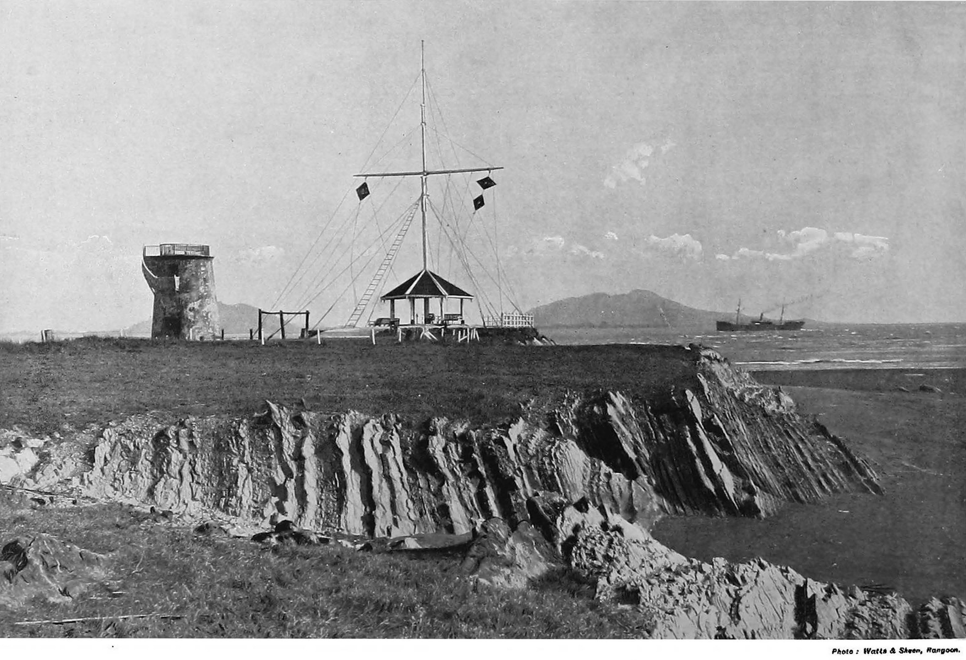
A signal station is a form of Navigational aid, Aids to Navigation that is defined by the International Hydrographic Organization, IHO simply as "A signal station is a place on shore from which signals are made to ships at sea". While this broad definition would include coast radio station, coastal radio stations and fog signal stations, the term is most often used for shore installation that use ''visual'' signals to communicate with ships at sea. History Signal stations were the only practical mean of communicating with passing ships until the development of radio, and played a critical role in both navigation safety and commercial operation of fleets. As they were normally located in high places with extensive fields of view, surviving signal stations are often in scenic locations, and have become local landmarks. Signal stations used a variety of means to communicate shore-to-ship: Semaphore line, Chappe Telegraph or other forms of pole-and-arm optical telegraph, flag semaph ... [...More Info...] [...Related Items...] OR: [Wikipedia] [Google] [Baidu] |
Fog Bell
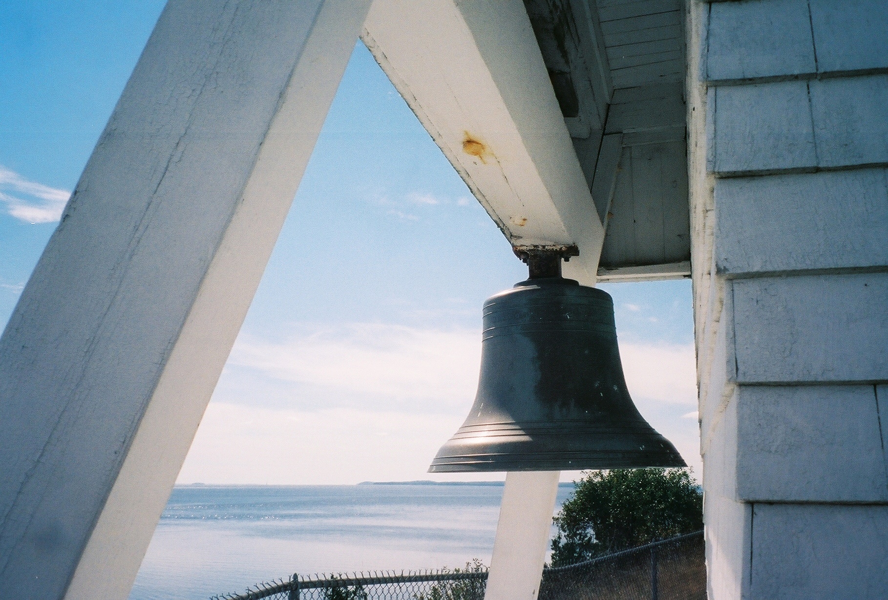
A fog bell is a navigation mark used as an audible aid to navigation in seafaring, especially in fog and poor visibility. Floating navigation signs with bells are called bell buoys. On ships, the ship's bell is used for sound signals. Due to more suitable sound generators, but also the development and spread of radar, satellite navigation and Electronic Chart Display and Information System, electronic charting systems, fog bells have lost their importance for maritime navigation. Maritime marks on land Starting in the 18th century, fog signals were given for seafaring in Europe, initially with cannons or guns. In 1766, the first bell for this purpose was installed in Nidingen on the Baltic Sea.Thomas Tag''Fog Bells''. United States Lighthouse Society website. Retrieved September 27, 2021. These were initially rung by hand, which was a chore during prolonged fog, others used mechanisms similar to clockwork that had to be wound periodically. Andrew Morse Jr. eventually developed a " ... [...More Info...] [...Related Items...] OR: [Wikipedia] [Google] [Baidu] |
Diaphone
The diaphone is a noisemaking device best known for its use as a foghorn: It can produce deep, powerful tones, able to carry a long distance. Although they have fallen out of favor, diaphones were also used at some fire stations and in other situations where a loud, audible signal was required. History The diaphone horn was based directly on the organ stop of the same name invented by Robert Hope-Jones, creator of the Wurlitzer organ. Hope-Jones' design was based on a piston that was closed only at its bottom end and had slots, perpendicular to its axis, cut through its sides; the slotted piston moved within a similarly slotted cylinder. Outside of the cylinder was a reservoir of high-pressure air. Initially, high-pressure air would be admitted behind the piston, pushing it forward. When the slots of the piston aligned with those of the cylinder, air passed into the piston, making a sound and pushing the piston back to its starting position, whence the cycle would repeat. A ... [...More Info...] [...Related Items...] OR: [Wikipedia] [Google] [Baidu] |
Radio Beacon
In navigation, a radio beacon or radiobeacon is a kind of beacon, a device that marks a fixed location and allows direction finding, direction-finding equipment to find relative Bearing (navigation), bearing. But instead of employing visible light, radio beacons transmit electromagnetic radiation in the radio wave electromagnetic spectrum, band. They are used for direction-finding systems on ships, aircraft and vehicles. Radio beacons transmitter, transmit a continuous or periodic radio signal with limited information (for example, its identification or location) on a specified radio frequency. Occasionally, the beacon's transmission includes other information, such as telemetry, telemetric or meteorological data. Radio beacons have many applications, including air and sea navigation, propagation research, robotic mapping, radio-frequency identification (RFID), near-field communication (NFC) and indoor navigation, as with real-time locating systems (RTLS) like Syledis or simulta ... [...More Info...] [...Related Items...] OR: [Wikipedia] [Google] [Baidu] |
Selsey Bill
Selsey Bill is a headland into the English Channel on the south coast of England in the county of West Sussex. The southernmost town in Sussex is Selsey which is at the end of the Manhood Peninsula and ''Selsey Bill'' is situated on the town's southern coastline. It is the easternmost point of Bracklesham Bay and the westernmost point of the Sussex Coast. Toponymy Although the place name ''Selsey'' has existed since Saxon times, and is derived from the Old English meaning ''Seal's Island'', there is no evidence to suggest that the place name ''Selsey Bill'' is particularly old. A 1698 survey of the area included in a report for the Royal Navy, by Dummer and Wiltshaw mentioned Selsey Island but not Selsey Bill. The place name does not appear to have been used before the early 18th century when it started appearing on maps; for example Philip Overton's 1740 map of Sussex and Richard Budgen's map of 1724. It is possible that the idea was taken from Portland Bill, another he ... [...More Info...] [...Related Items...] OR: [Wikipedia] [Google] [Baidu] |


