|
N4 Road (Senegal)
The N4 road is one of the 7 national roads in Senegal. It connects central-Senegal with Basse Casamance by a route which crosses The Gambia. The road runs in a southerly direction from Diourbel to Kaolack where it crosses the Saloum River before heading to Bounkiling in Casamance via The Gambia and swinging south-westward to follow the northern bank of the Casamance River to Bignona. Turning southwards the road crosses the Casamance River to end in Ziguinchor. The route is 337 km long including the 25 km transit route in The Gambia. The road traverses central Gambia as the Trans-Gambia Highway linking Farafenni in the north to Soma in the south, crossing the Gambia River on the Senegambia Bridge. It connects with the ... [...More Info...] [...Related Items...] OR: [Wikipedia] [Google] [Baidu] |
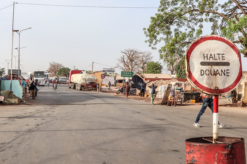
N4 - Border Senegal Gambia
N4, N-4, or N.4 may refer to: Computing * N4 (NHS), the successor to the N3 NHS computer network * NASCAR Racing 4, a NASCAR sim by Papyrus and Sierra * N4, a Markup Language * N4, TSMC's 4 nm semiconductor process node Energy * N4 (nuclear reactor), a French pressurized water reactor type Roads * N4 highway (Philippines) * N4 (Bangladesh) * N4 road (Belgium), a road connecting Brussels and Arlon * N4 road (France) * N4 road (Gabon) * N4 road (Ireland), a National Primary Route connecting Dublin, Mullingar, Longford, Carrick-on-Shannon, and Sligo * N4 road (Luxembourg) * N4 road (Senegal) * N4 road (South Africa), a road connecting the Botswana border, Pretoria, and the Mozambique border * N4 road (Spain), a National Primary Route connecting Madrid and Andalusia * N4 road (Switzerland) * Nebraska Highway 4, a state highway in the U.S. state of Nebraska Transport * Fairey N.4, a British reconnaissance flying boat of the 1920s * LNER Class N4, a British steam locomo ... [...More Info...] [...Related Items...] OR: [Wikipedia] [Google] [Baidu] |
Trans-Gambia Highway
The Trans-Gambia Highway is a major highway in The Gambia, running across the centre of the nation in a north–south direction. Within the Gambia, the highway consists of two main stretches, the North Bank Road and South Bank Road, each corresponding to the parts of the country on either side of the Gambia River. The two roads are connected via the Senegambia bridge between Farafenni and Soma, as well as bridges at Basse Santa Su and Fatoto, at the far eastern end of the country. Prior to the building of these bridge, the crossings were served by a ferry. Aside from a short four-lane section in Kombo, both the North Bank and South Bank roads are paved two lane highways. The road is also economically important for Senegal, in which it is designated as the N4 road. Geography The Gambia is an elongated state forming a country that is almost surrounded by Senegal (but not an enclave, as it also borders the Atlantic Ocean). The Gambia almost separates the Casamance region fr ... [...More Info...] [...Related Items...] OR: [Wikipedia] [Google] [Baidu] |
N2 Road (Senegal)
The N2 road is one of the national roads of Senegal. It connects the west and the east of the country in a large arc following the northern frontier from the outskirts of the capital Dakar via Thiès, Louga, Saint-Louis, Richard Toll, Thilogne, Ouro Sogui, Kidira and Nayé on the border with Mali Mali, officially the Republic of Mali, is a landlocked country in West Africa. It is the List of African countries by area, eighth-largest country in Africa, with an area of over . The country is bordered to the north by Algeria, to the east b .... See also * N1 road * N3 road * N4 road * N5 road * N6 road * N7 road * Transport in Senegal Roads in Senegal {{Africa-road-stub ... [...More Info...] [...Related Items...] OR: [Wikipedia] [Google] [Baidu] |
Banjul
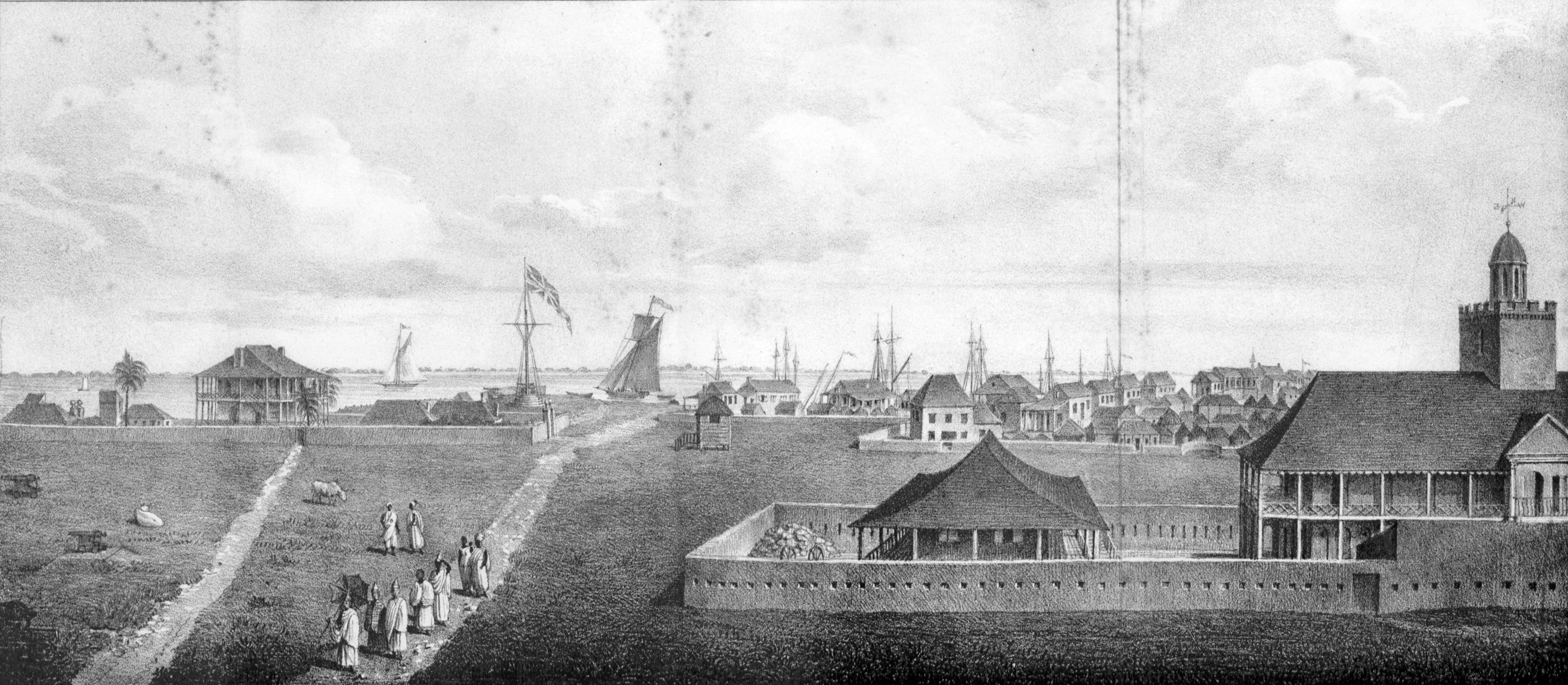
Banjul (, (US) and ), officially the City of Banjul, is the capital city of The Gambia. It is the centre of the eponymous administrative division which is home to an estimated 400,000 residents, making it The Gambia's largest and most densely populated metropolitan area. The city Banjul is located on St Mary's Island (Banjul Island), where the Gambia River enters the Atlantic Ocean. The population of the city proper is 31,301, with the Greater Banjul Area, which includes the City of Banjul and the Kanifing Municipal Council, at a population of 413,397 (2013 census). The island is connected to the mainland to the west and the rest of Greater Banjul Area via bridges. There are also ferries linking Banjul to the mainland at the other side of the river. From the 19th century until 24 April 1973, the city was known as Bathurst. Etymology There are several etymologies for 'Banjul.' One traditional history recounts that Bandjougou, son of Barafin, came to the island after fleeing t ... [...More Info...] [...Related Items...] OR: [Wikipedia] [Google] [Baidu] |
N5 Road (Senegal)
The N5 road is one of the 7 national roads of Senegal. It connects the centre of Senegal to Basse Casamance in the south by a route which traverses the Gambia at the mouth of the River Gambia. The road runs in a south-westerly direction from its junction with the N4 road at Kaolack via Sokone to the mouth of the River Gambia, where there is a ferry crossing to Banjul Banjul (, (US) and ), officially the City of Banjul, is the capital city of The Gambia. It is the centre of the eponymous administrative division which is home to an estimated 400,000 residents, making it The Gambia's largest and most densely .... From Banjul the road runs south-eastwards via Diouloulou to reconnect with the N4 at Bignona. See also * N1 road * N2 road * N3 road * N4 road * N6 road * N7 road * Transport in Senegal Roads in Senegal Transport in the Gambia {{Africa-road-stub ... [...More Info...] [...Related Items...] OR: [Wikipedia] [Google] [Baidu] |
N6 Road (Senegal)
The N6 road is one of the 7 national roads of Senegal. It connects Tambacounda in the centre of Senegal to Ziguinchor in Basse Casamance in the south by a route which avoids traversing the Gambia The Gambia, officially the Republic of The Gambia, is a country in West Africa. Geographically, The Gambia is the List of African countries by area, smallest country in continental Africa; it is surrounded by Senegal on all sides except for .... It is also known as the Route du Sud. The road runs in a southerly direction from Tambacounda before swinging westwards to follow the southern bank of the Casamance River via Vélingara and Kolda to Ziguichor, where it connects to the N4 road. See also * N1 road * N2 road * N3 road * N4 road * N5 road * N7 road * Transport in Senegal Roads in Senegal {{Africa-road-stub ... [...More Info...] [...Related Items...] OR: [Wikipedia] [Google] [Baidu] |
N1 Road (Senegal)
The N1 road is one of the national roads of Senegal. It connects the west and the east of the country by a direct route across the middle from the capital Dakar via Mbour, Fatick, Kaolack, Kaffrine, Koungheul, Tambacounda, Goudiry to Nayé and Kidira on the border with Mali Mali, officially the Republic of Mali, is a landlocked country in West Africa. It is the List of African countries by area, eighth-largest country in Africa, with an area of over . The country is bordered to the north by Algeria, to the east b .... It connects with the N4 at Kaolack and the N2 at Kidira. See also * N2 road * N3 road * N4 road * N5 road * N6 road * N7 road * Transport in Senegal * ' Roads in Senegal {{Africa-road-stub ... [...More Info...] [...Related Items...] OR: [Wikipedia] [Google] [Baidu] |
N3 Road (Senegal)
The N3 road is one of the Roads in Senegal, national roads of Senegal. It connects the west and the east of the country by a direct route across the middle from Thiès in the west via Bambey, Diourbel, Mbacké, Touba, Senegal, Touba, Dahra, Linguère and Ranérou to Ouro Sogui and Malem on the eastern border with Mauritania. The N3 connects with the N2 road (Senegal), N2 road at both ends (Thiès and Ouro Sogui). See also * N1 road (Senegal), N1 road * N2 road (Senegal), N2 road * N4 road (Senegal), N4 road * N5 road (Senegal), N5 road * N6 road (Senegal), N6 road * N7 road (Senegal), N7 road * Transport in Senegal Roads in Senegal {{Africa-road-stub ... [...More Info...] [...Related Items...] OR: [Wikipedia] [Google] [Baidu] |
Gambia River
The Gambia River (formerly known as the River Gambra, French language, French: ''Fleuve Gambie'', Portuguese language, Portuguese: ''Rio Gâmbia'') is a major river in West Africa, running from the Fouta Djallon plateau in north Guinea westward through Senegal and The Gambia to the Atlantic Ocean at the city of Banjul. It is navigability, navigable for about half that length. The river is strongly associated with The Gambia, the smallest country in mainland Africa, which occupies the downstream half of the river and its two banks. Geography The Gambia River runs a total length of . From the Fouta Djallon, it runs northwest into the Tambacounda Region of Senegal, where it flows through the Parc National du Niokolo Koba, then is joined by the Nieri Ko and and passing through the Barrakunda Falls before entering the Gambia at Koina. At this point, the river runs generally west, but in a meandering course with a number of Oxbow lake, oxbows, and about from its mouth it gradually ... [...More Info...] [...Related Items...] OR: [Wikipedia] [Google] [Baidu] |
Soma, Gambia
Soma is a town in The Gambia, lying south of the River Gambia. It is an important crossroads, where the main east–west road in the country crosses the Trans-Gambia Highway The Trans-Gambia Highway is a major highway in The Gambia, running across the centre of the nation in a north–south direction. Within the Gambia, the highway consists of two main stretches, the North Bank Road and South Bank Road, each corre ... and it also sits between Northern and Southern Senegal. A vibrant market town and an economic hub of the region, known for its assortments of cooked meat locally known as 'dibitair'. The town has a number of higher learning centers. The town has three Lower Basic Schools; Soma Proper, Soma New and Notre Dame Lower Basic School. Soma Senior Secondary School is located at Sare Mawdo neighborhood of the town and Tahir Senior Secondary School attract thousands of students to the town. Soma has seen a robust response from its citizens living abroad and locally by f ... [...More Info...] [...Related Items...] OR: [Wikipedia] [Google] [Baidu] |
Farafenni
Farafenni or Farafegni sometimes called Chakubanta or Faracity is a town in the Gambia, lying on the Trans-Gambia Highway in the North Bank Division, just south of the border with Senegal. It is an important market town. The population of Farafenni is around 25,000 and the main local language is Wolof, although Mandinka, Fula and other languages are also fairly common. Infrastructure and services Farafenni is the site of a recently built hospital and also contains a military base which was attacked in 1995 by six men later claiming to be Sanyang's collaborators. There is only one senior secondary school, called: Farafenni Senior Secondary School; two junior Secondary: Farafenni Junior Secondary School, and Anglican Junior Secondary School. Both located in the Outskirts of the town; and two primary Schools, namely: Farafenni Lower Basic School, and Mauritani Lower Basic School. Farafenni Upper Basic School is sponsored by John Cabot Academy in Bristol Bristol ( ... [...More Info...] [...Related Items...] OR: [Wikipedia] [Google] [Baidu] |


