|
Market–Frankford Line
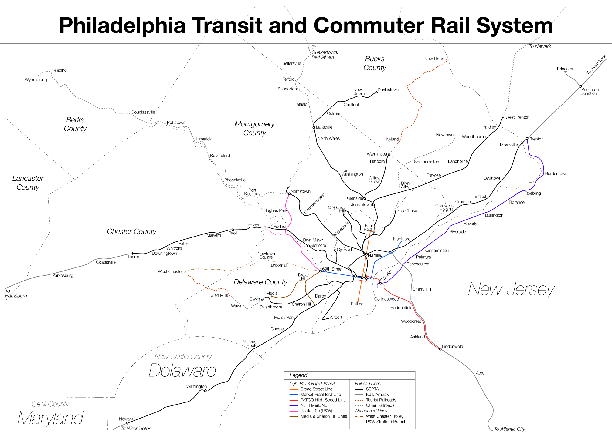
The Market–Frankford Line (MFL) (also called the Market–Frankford Subway–Elevated Line (MFSE), the Market–Frankford El (MFE), the El (), or the Blue Line) is one of three rapid transit lines in Philadelphia, Pennsylvania; it and the Broad Street Line are operated by SEPTA, and the PATCO Speedline is operated by PATCO. The Market–Frankford Line runs from the 69th Street Transportation Center in Upper Darby, just outside of West Philadelphia, through Center City Philadelphia to the Frankford Transportation Center in Near Northeast Philadelphia. With more than 170,000 boardings on an average weekday, it is the busiest route in the SEPTA system. The line has both elevated and underground portions along its full length. Route The Market–Frankford Line begins at 69th Street Transportation Center in Upper Darby. The MFL heads east at ground level and passes north of the borough of Millbourne. From there, it enters West Philadelphia and is elevated over Market Street until 46 ... [...More Info...] [...Related Items...] OR: [Wikipedia] [Google] [Baidu] |
63rd Street Station (Market–Frankford Line)
63rd Street station is an elevated rapid transit station in Philadelphia, Pennsylvania, served by SEPTA's Market–Frankford Line trains. Located at the intersection of 63rd and Market Streets in the Haddington neighborhood of West Philadelphia, it is the westernmost stop on the line within the Philadelphia city limits. The station is also served by SEPTA bus routes 21 and 31. The station is also the northern terminus of the Cobbs Creek Trail. History 63rd Street station is one of the original Market Street Elevated stations built by the Philadelphia Rapid Transit Company; the line opened for service on March 4, 1907 between and stations. The station was closed on June 13, 2008 for rehabilitation as part of a multi-phase reconstruction of the entire western Market Street Elevated. The renovated station included new elevators, escalators, lighting, and other infrastructure, as well as a new brick station house. The station reopened on May 4, 2009. The project resulted in ... [...More Info...] [...Related Items...] OR: [Wikipedia] [Google] [Baidu] |
Center City, Philadelphia
Center City includes the central business district and central neighborhoods of Philadelphia. It comprises the area that made up the City of Philadelphia prior to the Act of Consolidation, 1854, which extended the city borders to be coterminous with Philadelphia County. Greater Center City (defined from Girard Avenue to Tasker Street) has grown into the second-most densely populated downtown area in the United States, after Midtown Manhattan in New York City, with an estimated 202,100 residents in 2020 and a population density of 26,284 per square mile. Geography Boundaries Center City is bounded by South Street to the south, the Delaware River to the east, the Schuylkill River to the west, and Vine Street to the north. The district occupies the old boundaries of the City of Philadelphia before the city was made coterminous with Philadelphia County in 1854. The Center City District, which has special powers of taxation, has a complicated, irregularly shaped boundary that in ... [...More Info...] [...Related Items...] OR: [Wikipedia] [Google] [Baidu] |
Delaware River
The Delaware River is a major river in the Mid-Atlantic region of the United States. From the meeting of its branches in Hancock, New York, the river flows for along the borders of New York, Pennsylvania, New Jersey, and Delaware, before emptying into Delaware Bay. It is the longest free-flowing river in the Eastern United States. The river has been recognized by the National Wildlife Federation as one of the country's Great Waters. The river's watershed drains an area of and provides drinking water for 17 million people. The river has two branches that rise in the Catskill Mountains of New York: the West Branch at Mount Jefferson in Jefferson, Schoharie County, and the East Branch at Grand Gorge, Delaware County. The branches merge to form the main Delaware River at Hancock, New York. Flowing south, the river remains relatively undeveloped, with protected as the Upper, Middle, and Lower Delaware National Scenic Rivers. At Trenton, New Jersey, the Dela ... [...More Info...] [...Related Items...] OR: [Wikipedia] [Google] [Baidu] |
Schuylkill River
The Schuylkill River ( , ) is a river running northwest to southeast in eastern Pennsylvania. The river was improved by navigations into the Schuylkill Canal, and several of its tributaries drain major parts of Pennsylvania's Coal Region. It flows for U.S. Geological Survey. National Hydrography Dataset high-resolution flowline dataThe National Map , accessed April 1, 2011 from Pottsville to Philadelphia, where it joins the Delaware River as one of its largest tributaries. In 1682, William Penn chose the left bank of the confluence upon which he founded the planned city of Philadelphia on lands purchased from the native Delaware nation. It is a designated Pennsylvania Scenic River, and its whole length was once part of the Delaware people's southern territories. The river's watershed of about lies entirely within the state of Pennsylvania, the upper portions in the Ridge-and-valley Appalachian Mountains where the folding of the mountain ridges metamorphically modified bi ... [...More Info...] [...Related Items...] OR: [Wikipedia] [Google] [Baidu] |
Interstate 95 In Pennsylvania
Interstate 95 (I-95) is a major north-south Interstate highway that runs along the East Coast of the United States from Miami, Florida, north to Houlton, Maine. In the state of Pennsylvania, it runs from the Delaware state line near Marcus Hook in Delaware County northeast to the Delaware River–Turnpike Toll Bridge at the New Jersey state line near Bristol in Bucks County. From the Delaware state line to exit 40, the route is known by many as the Delaware Expressway but is officially named the Vietnam Veterans Memorial Highway. North of exit 40, I-95 follows the easternmost portion of the Pennsylvania Turnpike; this portion of road is not signed as part of the turnpike. I-95 parallels its namesake Delaware River for its entire route through the city of Philadelphia and its suburbs. It is a major route through the city and the metropolitan Delaware Valley, providing access to locally important landmarks such as Subaru Park, Philadelphia International Airport, the South Phi ... [...More Info...] [...Related Items...] OR: [Wikipedia] [Google] [Baidu] |
Philadelphia City Hall
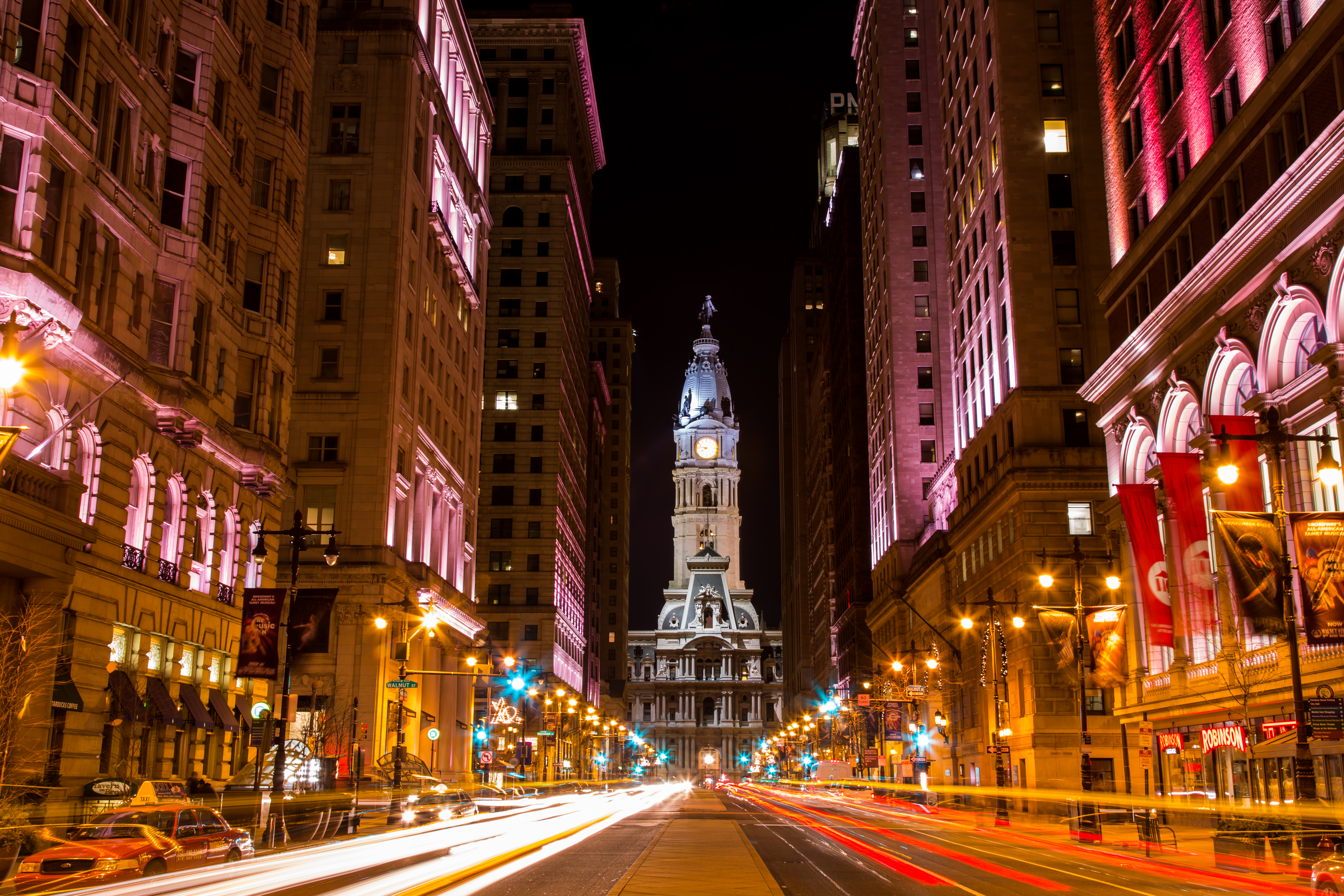
Philadelphia City Hall is the seat of the municipal government of the City of Philadelphia. Built in the ornate Second Empire style, City Hall houses the chambers of the Philadelphia City Council and the offices of the Mayor of Philadelphia. It is also a courthouse, serving as the seat of the First Judicial District of Pennsylvania, and houses the Civil Trial and Orphans' Court Divisions of the Court of Common Pleas of Philadelphia County. Built of brick, white marble, and limestone, Philadelphia City Hall is the world's largest free-standing masonry building and was the world's tallest habitable building upon its completion in 1894. In 1976, it was designated a National Historic Landmark, and in 2006, was also named a National Historic Civil Engineering Landmark by the American Society of Civil Engineers. History and description The building was designed by Scottish-born architect John McArthur Jr. and Thomas Ustick Walter [...More Info...] [...Related Items...] OR: [Wikipedia] [Google] [Baidu] |
Balloon Loop
A balloon loop, turning loop, or reversing loop ( North American Terminology) allows a rail vehicle or train to reverse direction without having to shunt or stop. Balloon loops can be useful for passenger trains and unit freight trains. Balloon loops are common on tram and streetcar systems. Many streetcar and tram systems use single-ended vehicles that have doors on only one side and controls at only one end. These systems may also haul trailers with no controls in the rear car, and, as such, must be turned at each end of the route. History Balloon loops were first introduced on tram and, later, metro lines. They did not commonly appear on freight railways until the 1960s, when the modernising British Rail system introduced ''merry-go-round'' (MGR) coal trains that operated from mines to power stations and back again without shunting. Tramways On the former Sydney tram system, loops were used from 1881 until the second-generation system's closure in 1961. Initially ... [...More Info...] [...Related Items...] OR: [Wikipedia] [Google] [Baidu] |
Tram
A tram (called a streetcar or trolley in North America) is a rail vehicle that travels on tramway tracks on public urban streets; some include segments on segregated right-of-way. The tramlines or networks operated as public transport are called tramways or simply trams/streetcars. Many recently built tramways use the contemporary term light rail. The vehicles are called streetcars or trolleys (not to be confused with trolleybus) in North America and trams or tramcars elsewhere. The first two terms are often used interchangeably in the United States, with ''trolley'' being the preferred term in the eastern US and ''streetcar'' in the western US. ''Streetcar'' or ''tramway'' are preferred in Canada. In parts of the United States, internally powered buses made to resemble a streetcar are often referred to as "trolleys". To avoid further confusion with trolley buses, the American Public Transportation Association (APTA) refers to them as " trolley-replica buses". In th ... [...More Info...] [...Related Items...] OR: [Wikipedia] [Google] [Baidu] |
30th Street Station (subway)
30th Street station is an underground SEPTA rapid transit and trolley station in Philadelphia. It is located on Market Street between 30th and 31st Streets in the University City neighborhood, adjacent to 30th Street Station and Drexel University. The station features four tracks – the inner pair serving the Market–Frankford Line and the outer pair for subway–surface trolleys. History 30th Street station opened on November 6, 1955 by the Philadelphia Transportation Company (PTC), built as a replacement for the elevated 32nd Street station that had opened in 1907 as part of the Philadelphia Rapid Transit Company's original Market Street subway–elevated line from to , which was elevated west of 23rd Street. The PRT announced a project to bury the elevated tracks between 23rd to 46th streets in the 1920s. The tunnel from 23rd to 32nd streets was completed by 1933, but construction on the remaining segment was put on hiatus due to the Great Depression and World War ... [...More Info...] [...Related Items...] OR: [Wikipedia] [Google] [Baidu] |
SEPTA Subway–surface Trolley Lines
The Southeastern Pennsylvania Transportation Authority (SEPTA) is a regional public transportation authority that operates transit bus, bus, rapid transit, commuter rail, light rail, and electric trolleybus services for nearly 4 million people in five counties in and around Philadelphia, Pennsylvania. It also manages projects that maintain, replace and expand its infrastructure, facilities and vehicles. SEPTA is the major transit provider for Philadelphia and the counties of Delaware County, Pennsylvania, Delaware, Montgomery County, Pennsylvania, Montgomery, Bucks County, Pennsylvania, Bucks, and Chester County, Pennsylvania, Chester. It is a state-created authority, with the majority of its board appointed by the five Pennsylvania counties it serves. While several SEPTA commuter rail lines terminate in the nearby states of Delaware and New Jersey, additional service to Philadelphia from those states is provided by other agencies: the PATCO Speedline from Camden County, New Jer ... [...More Info...] [...Related Items...] OR: [Wikipedia] [Google] [Baidu] |


_p11_STATUE_OF_WILLIAM_PENN.jpg)


