|
MAX Light Rail
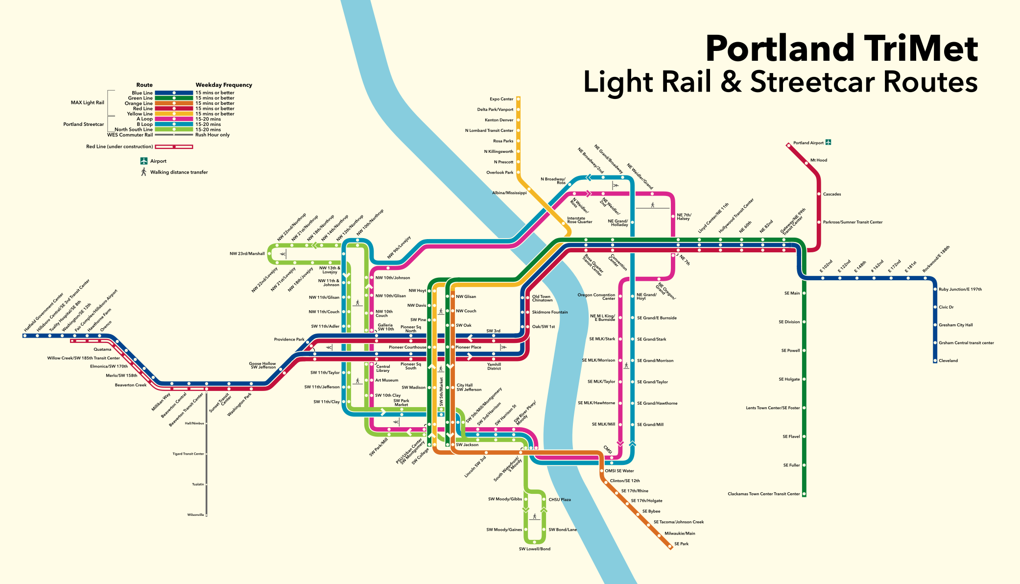
The Metropolitan Area Express (MAX) is a light rail system serving the Portland metropolitan area in the U.S. state of Oregon. Owned and operated by TriMet, it consists of five color-designated lines that altogether connect the six sections of Portland; the communities of Beaverton, Clackamas, Gresham, Hillsboro, Milwaukie, and Oak Grove; and Portland International Airport to Portland City Center. Service runs seven days a week with headways of between 30 minutes off-peak and three minutes during rush hours. In 2019, MAX had an average daily ridership of 120,900, or 38.8 million annually. Due to the COVID-19 pandemic, which impacted public transit use globally, annual ridership plummeted, with only 14.8 million riders recorded in 2021. MAX was among the first second-generation American light rail systems to be built, conceived from freeway revolts that took place in Portland in the early 1970s. Planning for the network's inaugural eastside segment, then ... [...More Info...] [...Related Items...] OR: [Wikipedia] [Google] [Baidu] |
Portland Streetcar
The Portland Streetcar is a streetcar system in Portland, Oregon, that opened in 2001 and serves areas surrounding downtown Portland. The NS Line runs from Northwest Portland to the South Waterfront via Downtown and the Pearl District. The Loop Service, which opened in September 2012 as the Central Loop (CL Line), runs from Downtown to the Oregon Museum of Science and Industry via the Pearl District, the Broadway Bridge across Willamette River, the Lloyd District, and the Central Eastside Industrial District and added of route. In September 2015 the line was renamed as the Loop Service, with the A Loop traveling clockwise, and the B Loop traveling counterclockwise. The two-route system serves some 20,000 daily riders. As with the heavier-duty MAX Light Rail network which serves the broader Portland metropolitan area, Portland Streetcars are operated and maintained by TriMet. But unlike MAX, the streetcar system is owned by the city of Portland and managed by Portland Street ... [...More Info...] [...Related Items...] OR: [Wikipedia] [Google] [Baidu] |
Clackamas, Oregon
Clackamas is an unincorporated community and former census-designated place (CDP) in Clackamas County, Oregon, United States, and is a suburb of Portland. The population was approximately 7,000 . Clackamas is home to Camp Withycombe, which is a military base, and to a branch of the Kaiser Permanente Hospital. Geography Clackamas is part of the Portland Metropolitan Area and lies approximately southeast of downtown Portland and to the east of Interstate 205 along Oregon Routes 212 and 224 and to the north of the Clackamas River. According to the United States Census Bureau, the CDP has a total area of , all of it land. Demographics As of the census of 2000, there were 5,177 people, 2,000 households, and 1,336 families residing in the CDP. The population density was 2,425.3 people per square mile (938.4/km2). There were 2,133 housing units at an average density of 999.3 per square mile (386.6/km2). The racial makeup of the CDP was 85.28% White, 1.08% African America ... [...More Info...] [...Related Items...] OR: [Wikipedia] [Google] [Baidu] |
Banfield Light Rail Project
The MAX Blue Line is a light rail service in Portland, Oregon, United States, operated by TriMet as part of the MAX Light Rail system. It travels east–west for approximately —the longest in the network—between Hillsboro, Beaverton, Portland, and Gresham and serves 48 stations from to . The line carried an average 55,370 riders each day on weekdays in September 2018, the busiest of the five MAX lines. It runs for 22 hours per day from Monday to Thursday, with headways of between 30 minutes off-peak and five minutes during rush hour. Service runs later in the evening on Fridays and Saturdays and ends earlier on Sundays. The success of local freeway revolts in Portland in the early 1970s led to the reallocation of federal assistance funds from the proposed Mount Hood Freeway and Interstate 505 (I-505) projects to mass transit. Amid various proposals, local governments approved the construction of a light rail line between Gresham and Portland in 1978. Referred to as t ... [...More Info...] [...Related Items...] OR: [Wikipedia] [Google] [Baidu] |
Highway Revolts In The United States
Highway revolts have occurred in cities and regions across the United States. In many cities, there remain unused highways, abruptly terminating freeway alignments, and short stretches of freeway in the middle of nowhere, all of which are evidence of larger projects which were never completed. In some instances, freeway revolts have led to the eventual removal or relocation of freeways that had been built. In the post-World War II economic expansion, there was a major drive to build a freeway network in the United States, including (but not limited to) the Interstate Highway System. Design and construction began in earnest in the 1950s, with many cities and rural areas participating. However, many of the proposed freeway routes were drawn up without considering local interests; in many cases, the construction of the freeway system was considered a regional (or national) issue that trumped local concerns. Starting in 1956, in San Francisco, when many neighborhood activists beca ... [...More Info...] [...Related Items...] OR: [Wikipedia] [Google] [Baidu] |
Light Rail In The United States
Light rail in the United States is a mode of rail-based transport, usually urban in nature. When compared to heavy rail systems like commuter rail or rapid transit (subway), light rail systems are typically designed to carry fewer passengers and are capable of operating in mixed traffic (street running) or on routes that are not entirely grade-separated. Systems typically take one of four forms: the "first-generation" legacy systems, the "second-generation" modern light rail systems, streetcars, and hybrid rail systems (light rail with some commuter rail features). All of the systems use similar technologies, and some systems blur the lines between the different forms. The United States, with its 27 systems (as counted by the Light Rail Transit Association), has a much larger number of "true" light rail systems (not including streetcar systems), by far, compared to any other country in the world (the next largest are Germany with 10 and Japan with 9). According to the American Pu ... [...More Info...] [...Related Items...] OR: [Wikipedia] [Google] [Baidu] |
Impact Of The COVID-19 Pandemic On Public Transport
The COVID-19 pandemic had a large impact on public transport. Many countries advised that public transport should only be used when essential; passenger numbers fell drastically, and services were reduced. Provision of a reasonable service for the much smaller number of fare-paying passengers incurred large financial losses. Protective measures such as obligatory mask-wearing and spacing of passengers where possible were introduced, and ventilation and sanitation (disinfection) were implemented. Protection required passengers and operators to make many changes to the way they operated and behaved. The risks It was suggested in March 2021 that the use of public transport had led to the spread of COVID-19. There has been little evidence that mass transit poses a risk of covid infection. According to ''Santé Publique France'' (Public Health France) in June 2020, none of 150 clusters of infection studied were due to public transport; it was suggested that this was helped by spacing ... [...More Info...] [...Related Items...] OR: [Wikipedia] [Google] [Baidu] |
COVID-19 Pandemic
The COVID-19 pandemic, also known as the coronavirus pandemic, is an ongoing global pandemic of coronavirus disease 2019 (COVID-19) caused by severe acute respiratory syndrome coronavirus 2 (SARS-CoV-2). The novel virus was first identified in an outbreak in the Chinese city of Wuhan in December 2019. Attempts to contain it there failed, allowing the virus to spread to other areas of Asia and later worldwide. The World Health Organization (WHO) declared the outbreak a public health emergency of international concern on 30 January 2020, and a pandemic on 11 March 2020. As of , the pandemic had caused more than cases and confirmed deaths, making it one of the deadliest in history. COVID-19 symptoms range from undetectable to deadly, but most commonly include fever, dry cough, and fatigue. Severe illness is more likely in elderly patients and those with certain underlying medical conditions. COVID-19 transmits when people breathe in air contaminated by droplets ... [...More Info...] [...Related Items...] OR: [Wikipedia] [Google] [Baidu] |
Rush Hour
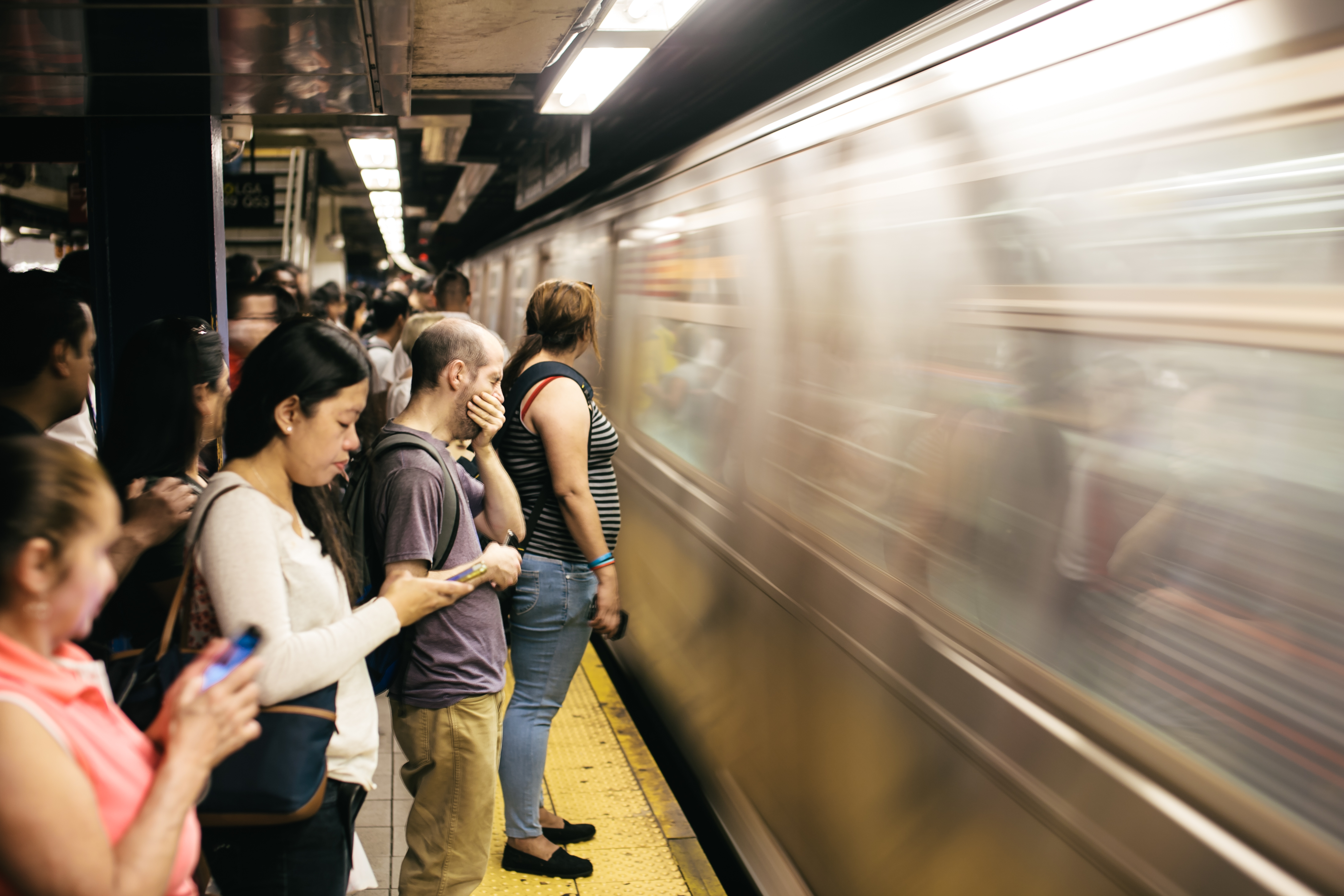
A rush hour (American English, British English) or peak hour (Australian English) is a part of the day during which traffic congestion on roads and crowding on public transport is at its highest. Normally, this happens twice every weekday: once in the morning and once in the afternoon or evening, the times during which the most people commute. The term is often used for a period of peak congestion that may last for more than one hour. The term is very broad, but often refers specifically to private automobile transportation traffic, even when there is a large volume of cars on a road but not many people, or if the volume is normal but there is some disruption of speed. By analogy to vehicular traffic, the term Internet rush hour has been used to describe periods of peak data network usage, resulting in delays and slower delivery of data packets. Definition The name is sometimes a misnomer, as the peak period often lasts more than one hour and the "rush" refers to the volume ... [...More Info...] [...Related Items...] OR: [Wikipedia] [Google] [Baidu] |
Headway
Headway is the distance or duration between vehicles in a transit system measured in space or time. The ''minimum headway'' is the shortest such distance or time achievable by a system without a reduction in the speed of vehicles. The precise definition varies depending on the application, but it is most commonly measured as the distance from the tip (front end) of one vehicle to the tip of the next one behind it. It can be expressed as the distance between vehicles, or as time it will take for the trailing vehicle to cover that distance. A "shorter" headway signifies closer spacing between the vehicles. Airplanes operate with headways measured in hours or days, freight trains and commuter rail systems might have headways measured in parts of an hour, metro and light rail systems operate with headways on the order of 90 seconds to 20 minutes, and vehicles on a freeway can have as little as 2 seconds headway between them. Headway is a key input in calculating the overall route c ... [...More Info...] [...Related Items...] OR: [Wikipedia] [Google] [Baidu] |
Downtown Portland, Oregon
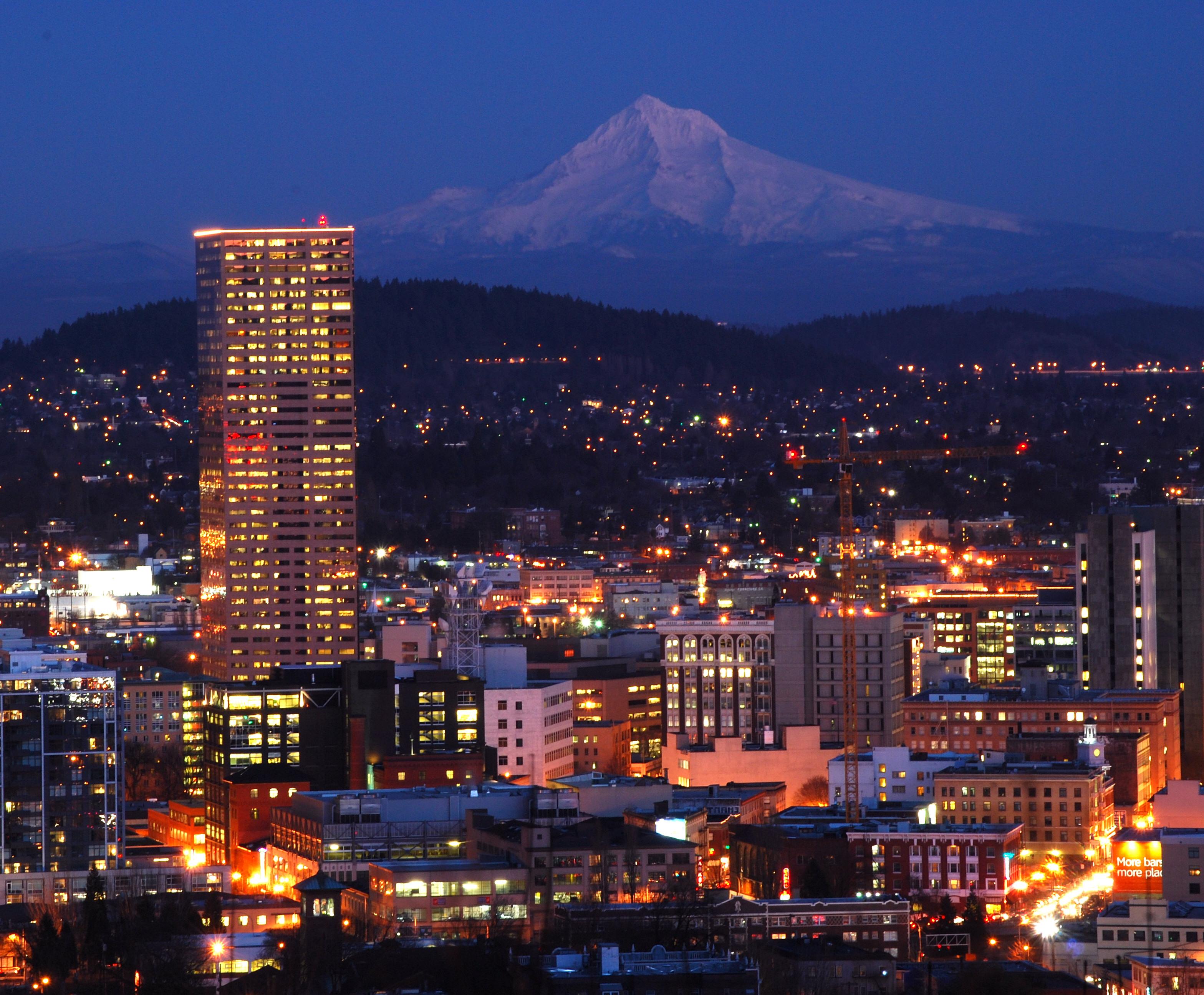
Downtown Portland is the city center of Portland, Oregon, United States. It is on the west bank of the Willamette River in the northeastern corner of the southwest section of the city and where most of the city's high-rise buildings are found. The downtown neighborhood extends west from the Willamette to Interstate 405 and south from Burnside Street to just south of the Portland State University campus (also bounded by I-405), except for a part of northeastern portion north of SW Harvey Milk Street and east of SW 3rd Ave that belongs to the Old Town Chinatown neighborhood. High-density business and residential districts near downtown include the Lloyd District, across the river from the northern part of downtown, and the South Waterfront area, just south of downtown in the South Portland neighborhood. Portland's downtown features narrow streets— wide—and square, compact blocks on a side, to create more corner lots that were expected to be more valuable. The ... [...More Info...] [...Related Items...] OR: [Wikipedia] [Google] [Baidu] |
Portland International Airport
Portland International Airport is a joint civil–military airport and the largest airport in the U.S. state of Oregon, accounting for 90% of the state's passenger air travel and more than 95% of its air cargo. It is within Portland's city limits just south of the Columbia River in Multnomah County, by air and by highway northeast of downtown Portland. Portland International Airport is often referred to by its IATA airport code, PDX. The airport covers 3,000 acres (1,214 ha) of land. Portland International Airport has direct flights and connections to most major airports throughout the United States, and non-stop international flights to Canada, Germany, Japan, Mexico, the Netherlands, South Korea, Iceland and the United Kingdom. The airport is a hub for Alaska Airlines. It also has a maintenance facility for Alaska Air subsidiary Horizon Air. General aviation services are provided at PDX by Atlantic Aviation. The Oregon Air National Guard has a base on the southwest por ... [...More Info...] [...Related Items...] OR: [Wikipedia] [Google] [Baidu] |
Oak Grove, Oregon
Oak Grove is an Unincorporated area, unincorporated community in Clackamas County, Oregon, Clackamas County, Oregon, United States, in the Portland metropolitan area. For statistical purposes, the United States Census Bureau has defined Oak Grove as a census-designated place (CDP). The census definition of the area may not precisely correspond to local understanding of the area with the same name. The population was 16,629 at the 2010 United States Census, 2010 census. History Oak Grove was named at the suggestion of Edward W. Cornell, a member of the surveying party that platted the townsite in the 1890s. The company that was developing the property had not been able to come up with a good name for the place, and Cornell suggested "Oak Grove" after a crew ate lunch in a stand of Quercus garryana, oak trees in the northwestern part of the tract. The area was served first from the Milwaukie, Oregon, Milwaukie post office. In 1904, Creighton post office was established, named fo ... [...More Info...] [...Related Items...] OR: [Wikipedia] [Google] [Baidu] |


