|
Mönchgut
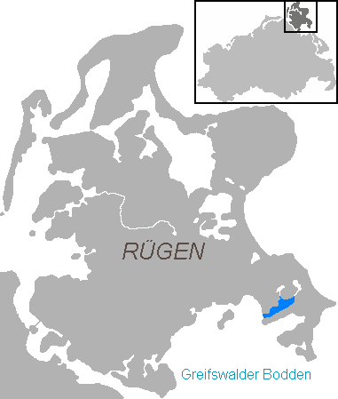
Mönchgut (''Monk's Estates'' in German) is a peninsula of 20.66 square kilometers with 1,374 inhabitants in the southeast of Rügen island in Mecklenburg-Western Pomerania, Germany. It lies just between the Greifswalder Bodden and the rest of the Baltic Sea. Mönchgut contains the districts of Göhren, Rügen, Göhren and Thiessow; the peninsula is part of the Mönchgut-Granitz administration area. It is also a part of the Biosphere Reserve of Südost-Rügen. The name translates as ''the monks' estates''. In 1252, Jaromar II, Prince of Rügen sold the area to the Cistercian monks of Eldena Abbey, which was founded by one of his predecessors, Jaromar I, Prince of Rügen in 1199 and by that time also belonged to the Denmark, Danish Principality of Rügen. To separate the monks' possessions from the rest of the island, a ditch was dug between Baabe and Sellin, known as ''Mönchsgraben'' ("monks' ditch"). Today, a large wooden gate built upon the bridge over the ''Mönchsgraben'' mark ... [...More Info...] [...Related Items...] OR: [Wikipedia] [Google] [Baidu] |
Rügen
Rügen (; Rani: ''Rȯjana'', ''Rāna''; , ) is Germany's largest island. It is located off the Pomeranian coast in the Baltic Sea and belongs to the state of Mecklenburg-Western Pomerania. The "gateway" to Rügen island is the Hanseatic city of Stralsund, where it is linked to the mainland by road and railway via the Rügen Bridge and Causeway, two routes crossing the two-kilometre-wide Strelasund, a sound of the Baltic Sea. Rügen has a maximum length of (from north to south), a maximum width of in the south and an area of . The coast is characterised by numerous sandy beaches, lagoons () and open bays (), as well as peninsulas and headlands. In June 2011, UNESCO awarded the status of a World Heritage Site to the Jasmund National Park, characterised by vast stands of beeches and chalk cliffs like King's Chair, the main landmark of Rügen island. The island of Rügen is part of the district of Vorpommern-Rügen, with its county seat in Stralsund. The towns on Rüg ... [...More Info...] [...Related Items...] OR: [Wikipedia] [Google] [Baidu] |
Thiessow
Thiessow is a village and a former municipality in the Vorpommern-Rügen district, in Mecklenburg-Vorpommern, Germany Germany, officially the Federal Republic of Germany, is a country in Central Europe. It lies between the Baltic Sea and the North Sea to the north and the Alps to the south. Its sixteen States of Germany, constituent states have a total popu .... Since January 2018, it is part of the new municipality Mönchgut. Besides Thiessow, the municipality included the village Klein Zicker. Thiessow is believed to have therapeutic waters for its thermal sources. References External links Official website of Thiessow (German) Towns and villages on Rügen Mönchgut [...More Info...] [...Related Items...] OR: [Wikipedia] [Google] [Baidu] |
Mönchgut-Granitz
Mönchgut-Granitz is an '' Amt'' in the district of Vorpommern-Rügen, in Mecklenburg-Vorpommern, Germany. The seat of the ''Amt'' is in Baabe. The ''Amt'' Mönchgut-Granitz consists of the following municipalities: #Baabe # Göhren # Lancken-Granitz #Mönchgut Mönchgut (''Monk's Estates'' in German) is a peninsula of 20.66 square kilometers with 1,374 inhabitants in the southeast of Rügen island in Mecklenburg-Western Pomerania, Germany. It lies just between the Greifswalder Bodden and the rest of the ... # Sellin # Zirkow References Ämter in Mecklenburg-Western Pomerania Rügen {{VorpommernRügen-geo-stub ... [...More Info...] [...Related Items...] OR: [Wikipedia] [Google] [Baidu] |
Baabe
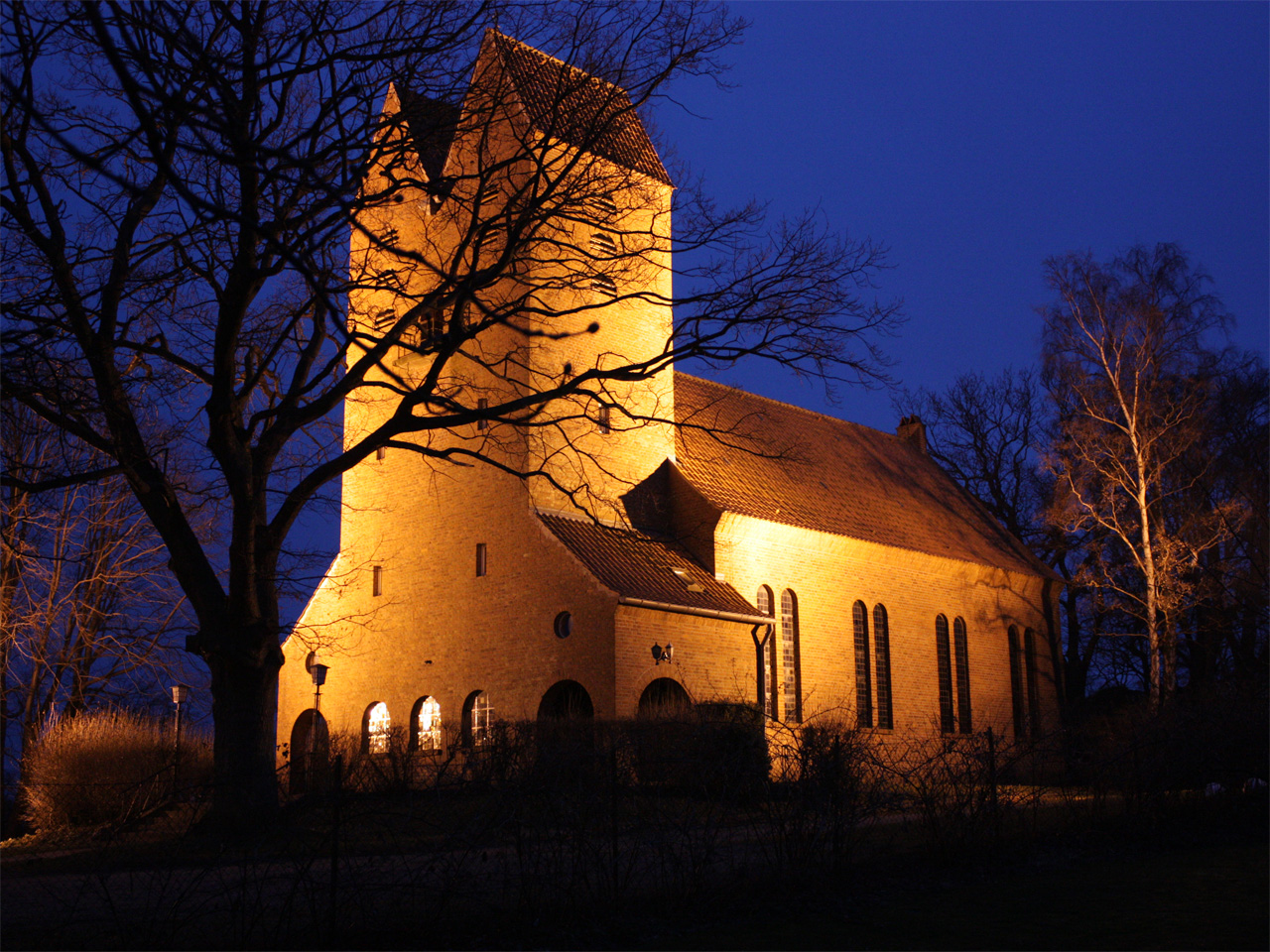
Baabe () is a municipality in the Vorpommern-Rügen district in Mecklenburg-Vorpommern, Germany. Sights * ''Baaber Bollwerk'' viewing point * Thatched Thatching is the craft of building a roof with dry vegetation such as straw, water reed, sedge ('' Cladium mariscus''), rushes, heather, or palm branches, layering the vegetation so as to shed water away from the inner roof. Since the bulk of ... houses * Mönchgut Coastal Fishing Museum * Baabe Village Church At the northern exit from the village runs the Mönchgraben, the remnants of a medieval boundary ditch. Weather In Baabe, the average temperature varies greatly. Considering humidity, the temperatures feel cool for half the year with some rain or snow. The warmest months to visit are June, July, and August with highs of 74.5°F (23.6°C) and lows of 58.5°F (14.7°C) at night. The months with the lowest chance of significant rain or snow in Baabe are February, March, and April, with the best being March. It i ... [...More Info...] [...Related Items...] OR: [Wikipedia] [Google] [Baidu] |
Göhren, Rügen
Göhren is a Municipalities of Germany, municipality in the Vorpommern-Rügen district, in Mecklenburg-Vorpommern, Germany. Geography The municipality of Göhren adjoins the easternmost point of the island of Rugen: Cape Nordperd. It separates the North Beach (''Nordstrand'') from the South Beach (''Südstrand''). The North Beach is the actual bathing beach with a seaside promenade. Between Göhren Pier and the Nordperd lies the Buskam, the largest glacial erratic boulder in North Germany, which rises one metre about the sea. Sights * Göhren Pier was rebuilt in the 1990s. It is 270 metres long. * Speckbusch Barrow (''Hügelgrab Speckbusch'') is next to Göhren church and dates to the Bronze Age. * The ''Mönchguter Museums'' are four museums that are protected and, together, form an open-air museum. There is a local history museum, the motor yacht ''Luise'', the museum farm (since 1973), and a thatched fisherman's house, the ''Rookhuus''. * The ''Drachenhaus'' was the las ... [...More Info...] [...Related Items...] OR: [Wikipedia] [Google] [Baidu] |
Gustavia, Rügen
Gustavia was a 19th-century unfinished Swedish town on the island of Rügen, the construction of which began and had to be aborted during the Napoleonic Wars. Background The Swedish Empire was involved in several wars, with Swedish Pomerania frequently turning into a battlefield. Not having a port on the isle of Rügen proved disadvantageous in situations when access to nearby Stralsund was blocked by enemy forces on the mainland.Krüger, pp.2,3 In situations like that, Swedish landing forces often suffered casualties when they were deployed at Rügen's unsecured beaches.Krüger, p.3 Thus, in 1806 plans for a port city on Rügen's southeastern shore were drafted.Krüger, p.2 Furthermore, Sweden hoped to be able to easily block any naval access to Stralsund, Greifswald and Wolgast with a fortified port city on the Mönchgut peninsula. This port was to be named after the contemporary Swedish monarch, Gustav IV Adolf, who planned Gustavia not only as a naval base, but also as a tr ... [...More Info...] [...Related Items...] OR: [Wikipedia] [Google] [Baidu] |
Vorpommern-Rügen
Vorpommern-Rügen is a Districts of Germany, district in the north of Mecklenburg-Vorpommern, Germany. It is bounded by (from the west and clockwise) the Baltic Sea and the districts Vorpommern-Greifswald, Mecklenburgische Seenplatte (district), Mecklenburgische Seenplatte and Rostock (district), Rostock. The district seat is the Hanseatic city of Stralsund. Vorpommern-Rügen is characterized by diverse shore line landscapes with many lagoons, beaches and cliff lines, part of them protected in the Western Pomerania Lagoon Area National Park and in the Jasmund National Park. The area is also a very popular destination for national and international tourism, including Rügen, the biggest island of Germany, the island of Hiddensee, the Fischland-Darss-Zingst peninsula and its adjacent town of Barth, Germany, Barth with the Stralsund Barth Airport, the port of Sassnitz and the UNESCO World Heritage city of Stralsund. The Vorpommern-Rügen district is one of the most popular places fo ... [...More Info...] [...Related Items...] OR: [Wikipedia] [Google] [Baidu] |
Having (bay)
The Having is an inlet in the northeast of the Rügischer Bodden, the northern half of the Bay of Greifswald, which cuts deeply into the peninsula of Mönchgut, the southeastern tip of the German island of Rügen. The inlet is about 5.7 kilometres long, 1.1 kilometres wide and has an area of 7.5 km². It opens towards the southwest onto the Rügische Bodden. The Having is up to eight metres deep. In the south the Having is bounded by the narrow, elongated peninsula of Reddevitzer Höft, in the north by the Granitz. In the north there are two narrow waterways to the lakes of Selliner See and Neuensiener See. The heights around the bay climb to over 30 metres. There are no settlements on the shores of the Having itself. The inlet is part of the Mönchgut Nature Reserve in the Southeast Rügen Biosphere Reserve The Southeast Rügen Biosphere Reserve () is a biosphere reserve in the German state of Mecklenburg-Vorpommern, which covers the southeastern part ... [...More Info...] [...Related Items...] OR: [Wikipedia] [Google] [Baidu] |
Principality Of Rügen
The Principality of Rügen was a Medieval Denmark, Danish principality, formerly a duchy, consisting of the island of Rügen and the adjacent mainland from 1168 until 1325. It was governed by a local dynasty of princes of the ''Wizlawiden'' (''House of Wizlaw'') dynasty. For at least part of this period, Rügen was subject to the Holy Roman Empire. Danish conquest and conversion The Danes (Germanic tribe), Danes conquered the Rani (Slavic tribe), Rani stronghold of Cape Arkona, Arkona in 1168. The rulers of the Rani became vassals of the Danish king, and the Slavic population was gradually Christianized. In the 12th century, the Duchy of Rügen not only functioned as a bridgehead for Danish expansions into Wends, ''Vendland'', but also Rani forces successfully participated in Danish raids into Circipania and areas conquered by Pomerania's Wartislaw I in the 1120s. After Pomerania became part of the Holy Roman Empire in 1181, it sent out a navy in 1184 to subdue Rügen for the ... [...More Info...] [...Related Items...] OR: [Wikipedia] [Google] [Baidu] |
Sellin
Sellin is a municipality on the Island of Rügen, in Mecklenburg-Vorpommern, Germany. History First mentions of Sellin date to 1295. From 1880 on, the town gained importance as a Baltic Sea spa town. After the '' Wende'' in 1989, the building stock in the village was extensively renovated. In 1992, Sellin Pier was rebuilt and was officially opened on 2 April 1998. Culture and sights ''Wilhelmstraße'', with its houses from the resort architecture period (turn of the 19th and 20th century), runs up to the steep coast, up to 30 metres high - where there is a steep flight of steps or a lift to Sellin Pier or the promenade on the South Beach (''Südstrand''). Sellin has the longest pier on Rügen: 394 metres. Since 1991 the historic centre has been thoroughly renovated as part of a programme of urban development. Other sights are the ''Galerie Hartwich'' in the old fire station (''Feuerwehrhaus''), the Amber Museum with its associated workshop and the ''Gnadenkirche''. The ... [...More Info...] [...Related Items...] OR: [Wikipedia] [Google] [Baidu] |
Jaromar II, Prince Of Rügen
Jaromar II, Prince of Rügen ( – 20 August 1260) was a Slavic nobleman. He was the ruling Prince of Rügen from 1249 until his death. Life He was first mentioned on 8 November 1231. From 28 September 1246, he was co-ruler with his father, Prince Vitslav I. During the early years of his reign, he tried to maintain peaceful relations with his neighbours, the Dukes of Pomerania, especially with the princes of Gützkow, who were vassals of Barnim I. He promoted trade by outlawing wrecking and providing safe passage for merchant ships from Lübeck. In 1249, troops from Lübeck destroyed the city of Stralsund; this resulted in a war which lasted four years, during which Stralsund's privateers were allowed to capture ships from Lübeck. All privileges granted to Lübeck were suspended until they paid compensation for the damage done to Stralsund. Jaromar II donated land to the three Cistercian monasteries in his territory, in Bergen auf Rügen, Neuenkamp, and Hilda. In ... [...More Info...] [...Related Items...] OR: [Wikipedia] [Google] [Baidu] |


