|
Mystic River Reservation
Mystic River State Reservation is a publicly owned nature preserve with recreational features located along the Mystic River in the towns of Winchester, Arlington, Medford, Somerville, Everett, and Chelsea in eastern Massachusetts Massachusetts ( ; ), officially the Commonwealth of Massachusetts, is a U.S. state, state in the New England region of the Northeastern United States. It borders the Atlantic Ocean and the Gulf of Maine to its east, Connecticut and Rhode .... The reserve is part of the nearly Mystic River watershed. It is managed by the Massachusetts Department of Conservation and Recreation. History The reservation was established in 1893 by the newly formed Metropolitan Parks Commission (later renamed the Metropolitan District Commission), making it one of the first official nature preserves in Massachusetts, and one of five designed by the commission in that year. Of these five, three were planned as woodland river reservations: the Mystic Rive ... [...More Info...] [...Related Items...] OR: [Wikipedia] [Google] [Baidu] |
Mystic Valley Parkway
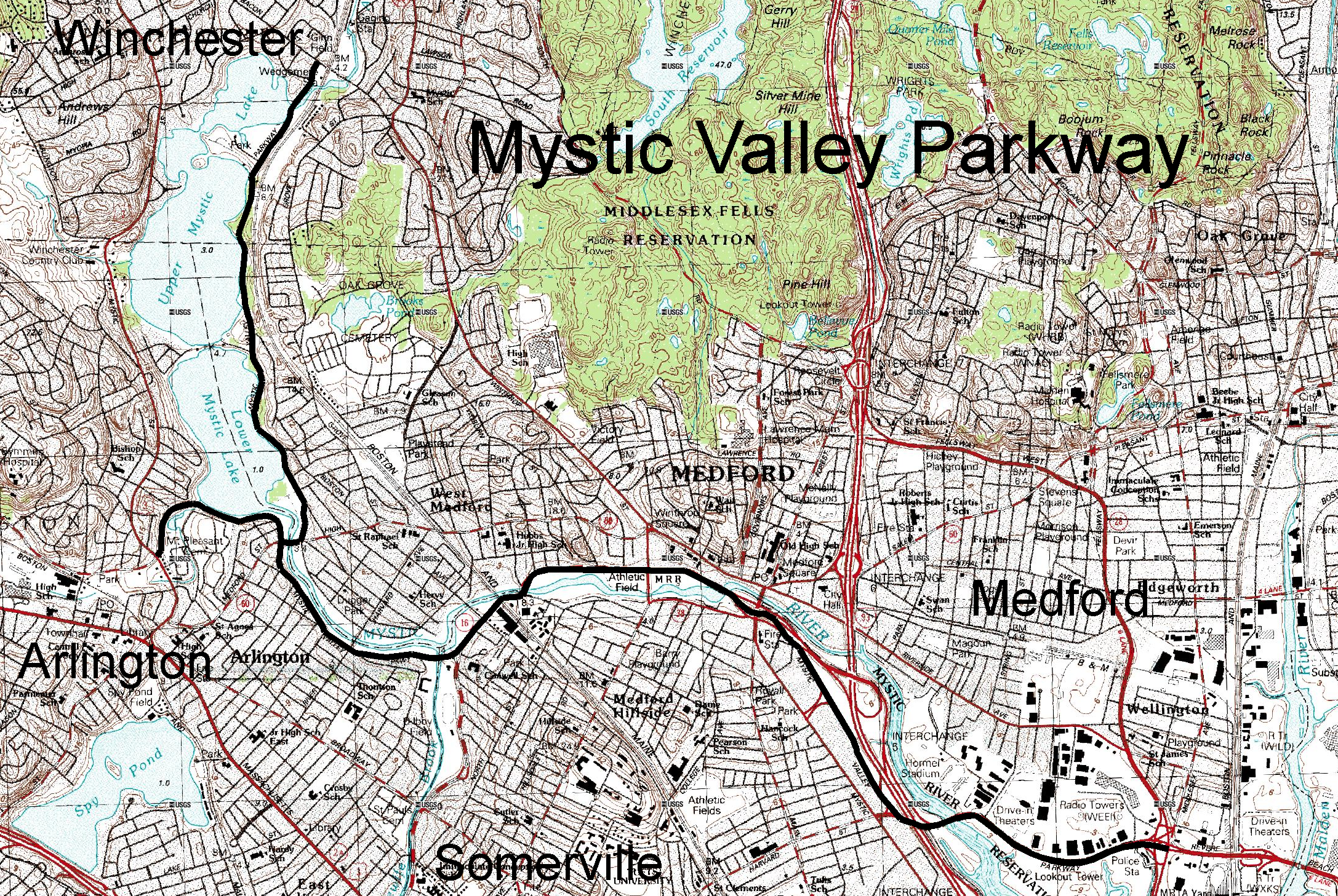
Mystic Valley Parkway is a parkway in Arlington, Massachusetts, Arlington, Medford, Massachusetts, Medford, Somerville, Massachusetts, Somerville, and Winchester, Massachusetts, Winchester, Massachusetts, United States. It is listed on the National Register of Historic Places, and forms part of Route 16 (Massachusetts), Route 16. Route description The parkway runs roughly north–south from the Middlesex Fells Reservation, Middlesex Fells in Winchester, down the Aberjona River valley, and along the east side of the Mystic Lakes into Medford. This section follows the path of the old Middlesex Canal. It then crosses the Mystic River into Arlington (sharing a bridge with Massachusetts Route 60), and curves to follow the river as it runs east–west through Arlington. A short branch also runs along the southern shore of the Lower Mystic Lake from Route 60 where it ends at a junction with U.S. Route 3 and Massachusetts Route 2A. It meets Alewife Brook Parkway (and joins with Massach ... [...More Info...] [...Related Items...] OR: [Wikipedia] [Google] [Baidu] |
Neponset River Reservation
Neponset River Reservation is a Massachusetts state reservation along the Neponset River in the towns of Milton and Dorchester, near where the river flows through an estuary into the Boston Harbor. It is adjacent to the Dorchester-Milton Lower Mills Industrial District along the River. This was some of the last land retained by Cutshamekin (Massachusett) before he deeded much of the land comprising Dorchester and Milton to English colonists in the 17th century. In February 2022, Massachusetts Governor Charlie Baker announced an $8.2 million project to construct a 0.7-mile shared-use path from Tenean Beach on the reservation to Morrissey Boulevard. It will connect the Boston Harborwalk with Neponset via Morrissey (including a 670-foot boardwalk in the salt marshes near the National Grid gas tank). The project will be one funded under the $9.5 billion in federal funds the state government received under the Infrastructure Investment and Jobs Act. In March 2022, the United St ... [...More Info...] [...Related Items...] OR: [Wikipedia] [Google] [Baidu] |
Environment Of Massachusetts
Massachusetts is the seventh-smallest state in the United States with an area of . It is bordered to the north by New Hampshire and Vermont, to the west by New York, to the south by Connecticut and Rhode Island, and to the east by the Atlantic Ocean and Gulf of Maine. Massachusetts is the most populous New England state. Massachusetts is nicknamed "The Bay State" because of several large bays, which distinctly shape its coast: Massachusetts Bay and Cape Cod Bay, to the east; Buzzards Bay, to the south; and several cities and towns on the Massachusetts–Rhode Island border sit adjacent to Mount Hope Bay. At the southeastern corner of the state is a large, sandy, arm-shaped peninsula, Cape Cod, which forms the southern boundary of the Gulf of Maine to the north. The islands Martha's Vineyard and Nantucket lie south of Cape Cod, across Nantucket Sound. Central Massachusetts features rolling, rocky hills, while Western Massachusetts encompasses a fertile valley and mountains surr ... [...More Info...] [...Related Items...] OR: [Wikipedia] [Google] [Baidu] |
Protected Areas Of Middlesex County, Massachusetts
Protection is any measure taken to guard something against damage caused by outside forces. Protection can be provided to physical objects, including organisms, to systems, and to intangible things like civil and political rights. Although the mechanisms for providing protection vary widely, the basic meaning of the term remains the same. This is illustrated by an explanation found in a manual on electrical wiring: Some kind of protection is a characteristic of all life, as living things have evolved at least some protective mechanisms to counter damaging environmental phenomena, such as ultraviolet light. Biological membranes such as bark on trees and skin on animals offer protection from various threats, with skin playing a key role in protecting organisms against pathogens and excessive water loss. Additional structures like scales and hair offer further protection from the elements and from predators, with some animals having features such as spines or camouflage servi ... [...More Info...] [...Related Items...] OR: [Wikipedia] [Google] [Baidu] |
Massachusetts Natural Resources
Massachusetts ( ; ), officially the Commonwealth of Massachusetts, is a U.S. state, state in the New England region of the Northeastern United States. It borders the Atlantic Ocean and the Gulf of Maine to its east, Connecticut and Rhode Island to its south, New Hampshire and Vermont to its north, and New York (state), New York to its west. Massachusetts is the List of U.S. states and territories by area, sixth-smallest state by land area. With a 2024 U.S. Census Bureau-estimated population of 7,136,171, its highest estimated count ever, Massachusetts is the most populous state in New England, the List of U.S. states and territories by population, 16th-most-populous in the United States, and the List of states and territories of the United States by population density, third-most densely populated U.S. state, after New Jersey and Rhode Island. Massachusetts was a site of early British colonization of the Americas, English colonization. The Plymouth Colony was founded in 16 ... [...More Info...] [...Related Items...] OR: [Wikipedia] [Google] [Baidu] |
Nature Reserves In Massachusetts
Nature is an inherent character or constitution, particularly of the ecosphere or the universe as a whole. In this general sense nature refers to the laws, elements and phenomena of the physical world, including life. Although humans are part of nature, human activity or humans as a whole are often described as at times at odds, or outright separate and even superior to nature. During the advent of modern scientific method in the last several centuries, nature became the passive reality, organized and moved by divine laws. With the Industrial Revolution, nature increasingly became seen as the part of reality deprived from intentional intervention: it was hence considered as sacred by some traditions (Rousseau, American transcendentalism) or a mere decorum for divine providence or human history (Hegel, Marx). However, a vitalist vision of nature, closer to the pre-Socratic one, got reborn at the same time, especially after Charles Darwin. Within the various uses of the word t ... [...More Info...] [...Related Items...] OR: [Wikipedia] [Google] [Baidu] |
View Of Mystic River From Mystic River Reservation, Massachusetts
Acornsoft was the software arm of Acorn Computers, and a major publisher of software for the BBC Micro and Acorn Electron. As well as games, it also produced a large number of educational titles, extra computer languages and business and utility packages – these included word processor ''VIEW'' and the spreadsheet ''ViewSheet'' supplied on ROM and cartridge for the BBC Micro/Acorn Electron and included as standard in the BBC Master and Acorn Business Computer. History Acornsoft was formed in late 1980 by Acorn Computers directors Hermann Hauser and Chris Curry, and David Johnson-Davies, author of the first game for a UK personal computer and of the official Acorn Atom manual "Atomic Theory and Practice". David Johnson-Davies was managing director and in early 1981 was joined by Tim Dobson, Programmer and Chris Jordan, Publications Editor. While some of their games were clones or remakes of popular arcade games (e.g. ''Hopper'' is a clone of Sega's ''Frogger'', '' Snapper' ... [...More Info...] [...Related Items...] OR: [Wikipedia] [Google] [Baidu] |
Mystic Lakes
The Mystic Lakes, consisting of Upper Mystic Lake and Lower Mystic Lake, are closely linked bodies of water in the northwestern suburbs of Boston, Massachusetts. The lakes lie at an elevation of 1 meter above sea level, within the towns of Winchester, Arlington, and Medford, Massachusetts. Upper Mystic Lake is fed by the Aberjona River, and drains south, over the Mystic Dam, into Lower Mystic Lake, which in turn empties into the Mystic River and then Boston Harbor. Description Lower Mystic Lake is a meromictic lake, which means that the lake has a deep layer of water that rarely, if ever, mixes with its top waters. As a consequence, the sediments at the bottom of Lower Mystic Lake accumulate in annual layers (or varves) that have been nearly undisturbed for a thousand years. Such varves in meromictic lakes preserve a historical record somewhat like tree rings do. In the case of Lower Mystic Lake, the varves have been used by Mark Besonen and his collaborators to study the his ... [...More Info...] [...Related Items...] OR: [Wikipedia] [Google] [Baidu] |
Charles River Bicycle Path
The Charles River Bike Path is a mixed-use path in the Boston, Massachusetts area. A portion of the trail is named after the cardiologist Paul Dudley White, a prominent advocate of preventive medicine. His research led him to proclaim frequently "''I'd like to put everybody on bicycles.''" In 1955 White served as president Eisenhower's cardiologist and prescribed his famous patient bicycle therapy after his 1955 heart attack. The path follows both shores of the Charles River from Boston, Massachusetts to Norumbega Park in Newton, passing through Watertown and Waltham. The path consists of several segments in the Charles River Reservation separated by road and bridge crossings and forms part of the planned East Coast Greenway, the 3,000-mile trail system connecting cities from Maine to Florida. Charles River Reservation The Paul Dudley White Bicycle Path runs on both sides of the river within the Charles River Reservation. From the Museum of Science on the Charles River Dam ... [...More Info...] [...Related Items...] OR: [Wikipedia] [Google] [Baidu] |
Somerville Community Path
The Somerville Community Path is a paved rail trail in Somerville, Massachusetts, running from the Alewife Linear Park at the Cambridge/Somerville border to East Cambridge via Davis Square. The first portion opened in 1985 along part of the former Fitchburg Cutoff rail line. Extensions opened in 1994 and 2015. A further extension to East Cambridge opened in June 2023 as part of the Green Line Extension project. It is a section of the partially completed Mass Central Rail Trail. History The east part of the Fitchburg Cutoff opened in 1870, connecting the Lexington and Arlington Railroad (Lexington Branch) to the Boston and Lowell Railroad. Only used for Boston and Maine Railroad freight trains after 1926, the line was abandoned as far east as Cedar Street in 1979 to allow construction of the Red Line Northwest Extension. The Alewife Linear Park opened from to in 1985. The Somerville Community Path opened from Davis Square to Cedar Street in 1994, with the Cambridge/Somervill ... [...More Info...] [...Related Items...] OR: [Wikipedia] [Google] [Baidu] |
Sullivan Square
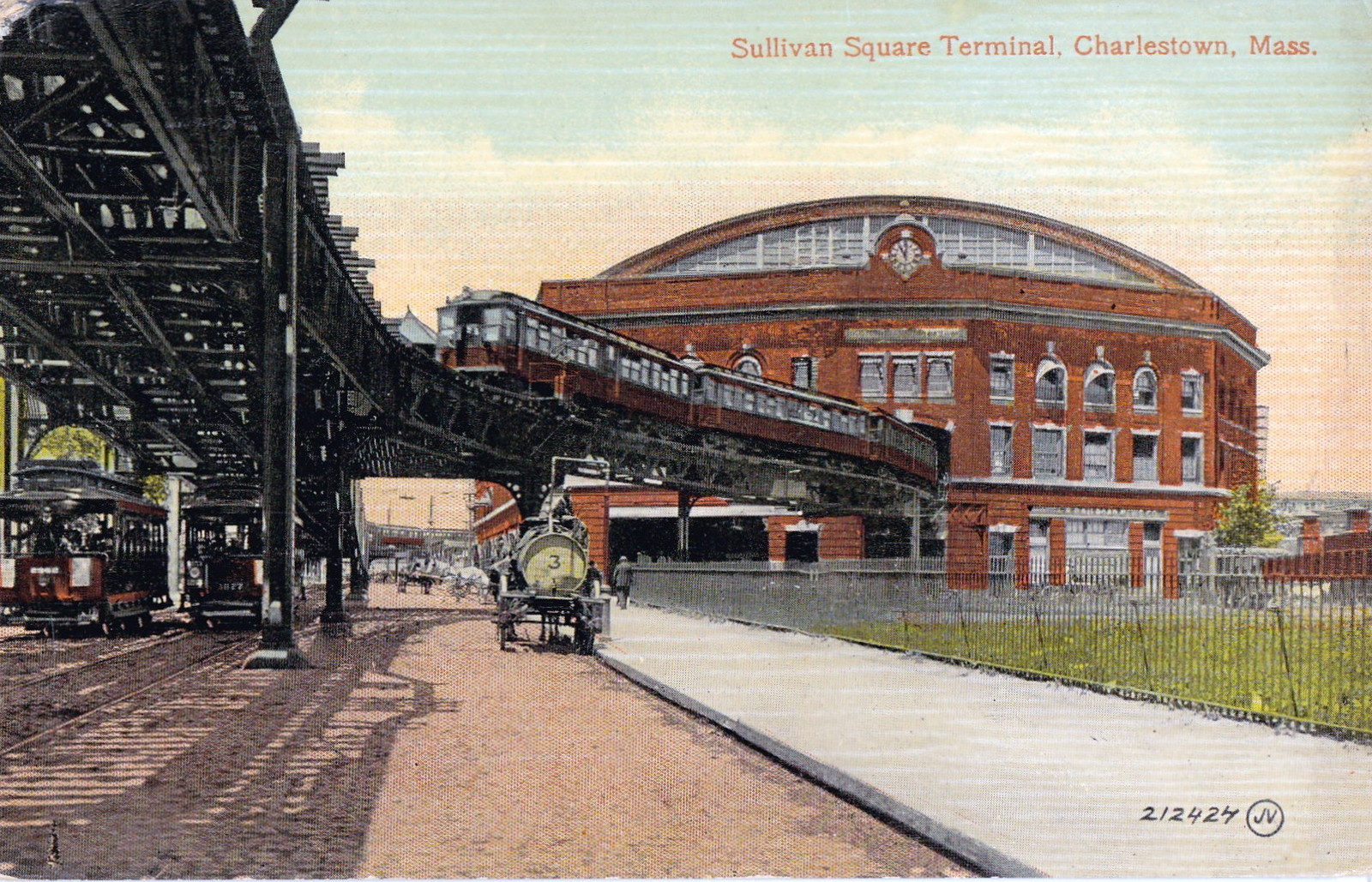
Sullivan Square is a traffic circle located at the north end of the Charlestown neighborhood of Boston, Massachusetts. It is named after James Sullivan, an early 19th-century Governor of Massachusetts. The MBTA Orange Line station of the same name is located just west of the square. History Prior to the 19th century, Mishawum (later Charlestown) was only connected to the mainland (now Somerville) by an isthmus called "the neck". Roads to Everett (previously a ferry), Medford, and Cambridge and Somerville fanned out from the Charlestown Neck. An extension of the Middlesex Canal from Medford to a millpond at the neck was authorized in 1795 and completed in 1803, with the canal running through where the traffic circle now stands. The junction was eventually named Sullivan Square after James Sullivan, an early 19th-century Governor of Massachusetts who was among the organizers of the canal. The Boston and Lowell Railroad opened in 1835, followed by the Boston and Maine Railro ... [...More Info...] [...Related Items...] OR: [Wikipedia] [Google] [Baidu] |
Assembly Square
Assembly Square is a neighborhood in Somerville, Massachusetts, United States. It is located along the west bank of the Mystic River, bordered by Ten Hills and Massachusetts Route 28 to the north and the Charlestown neighborhood of Boston to the south. The district's western border runs along Interstate 93. Located from downtown Boston, the parcel is named for a former Ford Motor Company plant that closed in 1958. The area is home to Assembly Row, a mixed-use, smart growth development that broke ground in April 2012 and opened in 2014. It includes retail outlets, restaurants, residential space, office and research and development space, a 12-screen cinema and a 200-room hotel. Other amenities include a marina, a revitalized waterfront park, bike paths and other green space. The area is served by the MBTA Orange Line at Assembly station. History Early use In the 17th century, the southern bank of the Mystic River, a low-lying tidal marsh and wetlands area bordered by upla ... [...More Info...] [...Related Items...] OR: [Wikipedia] [Google] [Baidu] |


