|
Muzahmiyya
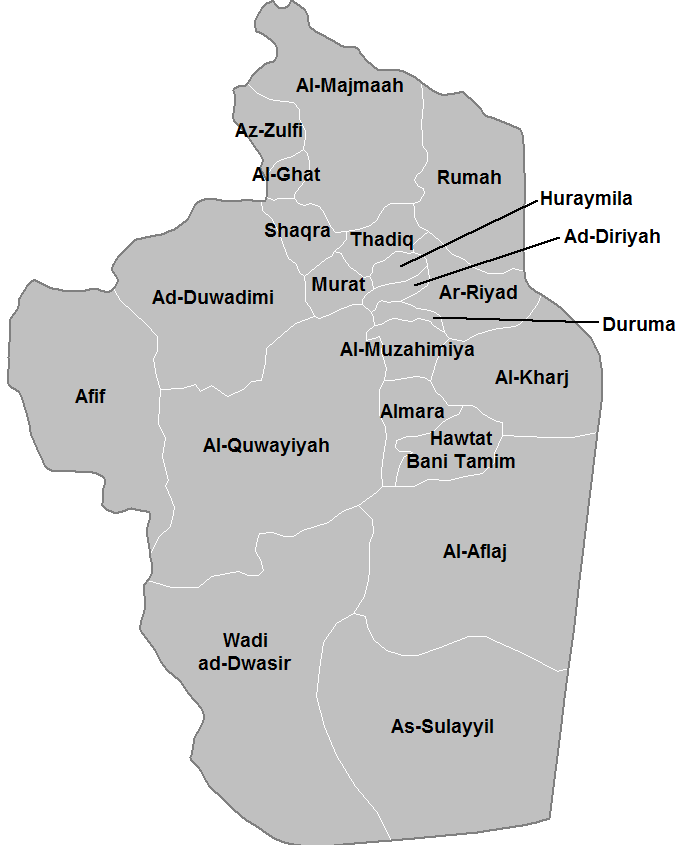
Al-Muzahmiyya ar, المزاحمية) is one of the fastest-growing towns in Riyadh Province, Saudi Arabia. It is located by road southwest of Riyadh, on the important Riyadh-Mecca Highway. As of the 2004 census it had a population of 24,224 people. It lies in a wide valley known as Wadi Al-Batin, and was founded in the 16th century as a colony of small independent farms and estates that later joined together to form one village. It is currently part of Al-Muzahmiyya Governorate. It's considered the west gate of the capital city of Saudi Arabia Riyadh Al-Muzahmiyya has become number 1 destination for Riyadh residents due to its convenient location and its great attractions specially during winter season. The city is famous with its nature which combines golden sand dunes which are some of the world's great natural wonders in one side and the other side of the city is surrounded by mountains. See also * List of cities and towns in Saudi Arabia * Regions of Saudi Arabia ... [...More Info...] [...Related Items...] OR: [Wikipedia] [Google] [Baidu] |
Riyadh Province
The Riyadh Province ( ar, منطقة الرياض '), also known as the Riyadh Region, is a region of Saudi Arabia, located in the geographic center of the country. It has an area of and with a 2017 population of 8,216,284, it is the second-largest region by both area and population, behind the Eastern Province and Mecca Region respectively. The capital governorate of the province is the Riyadh Governorate and it is named after the capital of the kingdom, Riyadh, which is the most populous city in the region and the kingdom, with a little less than two-thirds of the population of the region residing within the city. The province was governed for nearly five decades by Prince Salman bin Abdulaziz from 1963 to 2011. Other populous cities in the region include Al Ghat, Zulfi and Majma'ah. Approximately half of the region's area is desert, and it only borders other regions of the kingdom; it has no international borders. The region borders, clockwise from the north, the East ... [...More Info...] [...Related Items...] OR: [Wikipedia] [Google] [Baidu] |
List Of Cities And Towns In Saudi Arabia ...
The following is a list of cities and towns in Saudi Arabia. Alphabetical list of cities and towns References Central Department of Statistics and Information {{Portal, Saudi Arabia Lists of cities by country, Saudi Arabia, List of cities and towns in * Cities A city is a human settlement of notable size.Goodall, B. (1987) ''The Penguin Dictionary of Human Geography''. London: Penguin.Kuper, A. and Kuper, J., eds (1996) ''The Social Science Encyclopedia''. 2nd edition. London: Routledge. It can be def ... [...More Info...] [...Related Items...] OR: [Wikipedia] [Google] [Baidu] |
Provinces Of Saudi Arabia
The Provinces of Saudi Arabia, also known as Regions, and officially the Emirates of the Provinces of the Kingdom of Saudi Arabia (), are the 13 first-level administrative divisions of the Kingdom of Saudi Arabia. History After the unification of Saudi Arabia, the kingdom was divided into seven administrative-territorial entities: the ' Asir Province, Al Hasa' Province, the Hejaz Province, the Najd Province, the Rub' al-Khali Province and the Shammar Province. King Fahd bin Abdulaziz Al Saud issued Royal Order A/92 on March 2, 1992, known as the Regions' System, which provided for the division of the kingdom into 13 emirates. Subsequently, the five previous provinces were divided into thirteen geographic regions, called provinces (''manātiq'') and administrative regions, called the emirates of the provinces (''imārāt al-manātiq''). The emirates form the first-level administrative division of the Organization of the Kingdom of Saudi Arabia and are further divided into ... [...More Info...] [...Related Items...] OR: [Wikipedia] [Google] [Baidu] |
East Africa Time
East Africa Time, or EAT, is a time zone used in eastern Africa. The time zone is three hours ahead of UTC ( UTC+03:00), which is the same as Moscow Time, Arabia Standard Time, Further-eastern European Time and Eastern European Summer Time. As this time zone is predominantly in the equatorial region, there is no significant change in day length throughout the year and so daylight saving time is not observed. East Africa Time is observed by the following countries: * * * * * * * * * See also * Moscow Time, an equivalent time zone covering Belarus, Turkey and most of European Russia, also at UTC+03:00 * Arabia Standard Time, an equivalent time zone covering Bahrain, Iraq, Kuwait, Qatar, Saudi Arabia and Yemen, also at UTC+03:00 * Eastern European Summer Time, an equivalent time zone covering European and Middle Eastern countries during daylight saving, also at UTC+03:00 * Israel Summer Time, an equivalent time zone covering the State of Israel Israel ( ... [...More Info...] [...Related Items...] OR: [Wikipedia] [Google] [Baidu] |
Saudi Arabia
Saudi Arabia, officially the Kingdom of Saudi Arabia (KSA), is a country in Western Asia. It covers the bulk of the Arabian Peninsula, and has a land area of about , making it the List of Asian countries by area, fifth-largest country in Asia, the second-largest in the Arab world, and the largest in Western Asia and the Middle East. It is bordered by the Red Sea to the west; Jordan, Iraq, and Kuwait to the north; the Persian Gulf, Qatar and the United Arab Emirates to the east; Oman to the southeast; and Yemen to the south. Bahrain is an island country off the east coast. The Gulf of Aqaba in the northwest separates Saudi Arabia from Egypt. Saudi Arabia is the only country with a coastline along both the Red Sea and the Persian Gulf, and most of its terrain consists of arid desert, lowland, steppe, and mountains. Its capital and List of cities and towns in Saudi Arabia, largest city is Riyadh. The country is home to Mecca and Medina, the two Holiest sites in Islam, holiest citi ... [...More Info...] [...Related Items...] OR: [Wikipedia] [Google] [Baidu] |
Riyadh
Riyadh (, ar, الرياض, 'ar-Riyāḍ, Literal translation, lit.: 'The Gardens' Najdi Arabic, Najdi pronunciation: ), formerly known as Hajr al-Yamamah, is the capital and largest city of Saudi Arabia. It is also the capital of the Riyadh Province and the centre of the Riyadh Governorate. It is the List of Arabian cities by population, largest city on the Arabian Peninsula, and is situated in the center of the An Nafud, an-Nafud desert, on the eastern part of the Najd plateau. The city sits at an average of above sea level, and receives around 5 million Tourism in Saudi Arabia, tourists each year, making it the List of cities by international visitors, forty-ninth most visited city in the world and the 6th in the Middle East. Riyadh had a population of 7.6 million people in 2019, making it the List of cities in Saudi Arabia, most-populous city in Saudi Arabia, List of largest cities, 3rd most populous in the Middle East, and List of metropolitan areas in Asia, 38th most ... [...More Info...] [...Related Items...] OR: [Wikipedia] [Google] [Baidu] |
Riyadh-Mecca Highway
Highway 40 () is a major east–west six-lane controlled-access highway in Saudi Arabia, spanning 1,395 km (867 mi). The highway connects Jeddah, the second-largest city in the kingdom, on the western coast of Saudi Arabia to Dammam, the sixth-largest city on the eastern coast and the largest in the Eastern Province. Apart from Jeddah and Dammam, Highway 40 also runs near or through Mecca, Ta'if, Riyadh, Abqaiq and Khobar along its length, and provides access to the Mahazat as-Sayd and Saja and Umm Al Ramth wildlife sanctuaries. The highway consists of three traffic lanes and an emergency lane on each side (a total of six traffic lanes and eight total lanes) separated by a median strip. All intersections of the highway are grade separated. The route traverses the mostly flat Najd plateau, and thus requires no bridges or tunnels for most of its length. Near the western part, the highway twists and turns around the Hejaz mountains, before reaching the western coastal plain. ... [...More Info...] [...Related Items...] OR: [Wikipedia] [Google] [Baidu] |
Google Maps
Google Maps is a web mapping platform and consumer application offered by Google. It offers satellite imagery, aerial photography, street maps, 360° interactive panorama, interactive panoramic views of streets (Google Street View, Street View), real-time traffic conditions, and route planner, route planning for traveling by foot, car, bike, air (in Software release life cycle#Beta, beta) and public transportation. , Google Maps was being used by over 1 billion people every month around the world. Google Maps began as a C++ desktop program developed by brothers Lars Rasmussen (software developer), Lars and Jens Eilstrup Rasmussen, Jens Rasmussen at Where 2 Technologies. In October 2004, the company was acquired by Google, which converted it into a web application. After additional acquisitions of a geospatial data visualization company and a real-time traffic analyzer, Google Maps was launched in February 2005. The service's Front and back ends, front end utilizes JavaScript, X ... [...More Info...] [...Related Items...] OR: [Wikipedia] [Google] [Baidu] |
Census
A census is the procedure of systematically acquiring, recording and calculating information about the members of a given population. This term is used mostly in connection with national population and housing censuses; other common censuses include censuses of agriculture, traditional culture, business, supplies, and traffic censuses. The United Nations (UN) defines the essential features of population and housing censuses as "individual enumeration, universality within a defined territory, simultaneity and defined periodicity", and recommends that population censuses be taken at least every ten years. UN recommendations also cover census topics to be collected, official definitions, classifications and other useful information to co-ordinate international practices. The UN's Food and Agriculture Organization (FAO), in turn, defines the census of agriculture as "a statistical operation for collecting, processing and disseminating data on the structure of agriculture, coverin ... [...More Info...] [...Related Items...] OR: [Wikipedia] [Google] [Baidu] |
Colony
In modern parlance, a colony is a territory subject to a form of foreign rule. Though dominated by the foreign colonizers, colonies remain separate from the administration of the original country of the colonizers, the ''metropole, metropolitan state'' (or "mother country"). This administrative colonial separation makes colonies neither incorporated territories nor client states. Some colonies have been organized either as dependent territory, dependent territories that are Chapter XI of the United Nations Charter, not sufficiently self-governed, or as self-governing colony, self-governed colonies controlled by settler colonialism, colonial settlers. The term colony originates from the ancient rome, ancient Roman ''colonia (Roman), colonia'', a type of Roman settlement. Derived from ''colon-us'' (farmer, cultivator, planter, or settler), it carries with it the sense of 'farm' and 'landed estate'. Furthermore the term was used to refer to the older Greek ''apoikia'' (), which w ... [...More Info...] [...Related Items...] OR: [Wikipedia] [Google] [Baidu] |


