|
Muyembe–Nakapiripirit Road
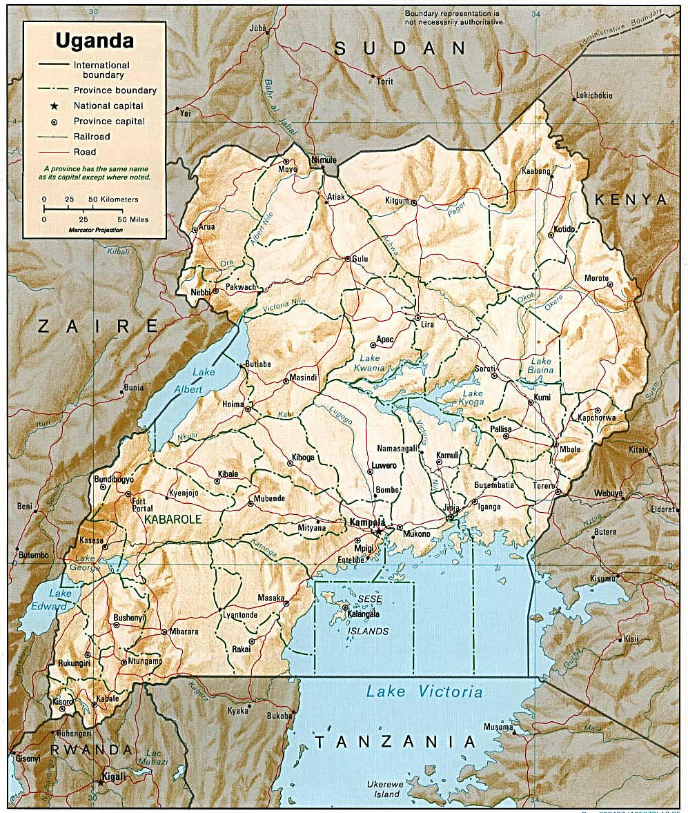
Muyembe–Nakapiripirit Road is a road in the Eastern and Northern regions of Uganda. The road connects the towns of Muyembe in Bulambuli District, to the town of Nakapiripirit in Nakapiripirit District. Location The road starts at Muyembe, approximately northeast of Mbale, the largest city in Eastern Uganda. The road continues north to end at Nakapiripirit, a total distance of approximately . The coordinates of the road near Tabagonyi are 1°28'45.0"N, 34°24'56.0"E (Latitude:1.479179; Longitude:34.415548). Upgrade to bitumen Plans are underway to upgrade this gravel road to class II bitumen surface with road width of , shoulders of , with drainage channels and culverts. In December 2014, this road was listed as "At project preparation". In March 2015, the Ugandan Parliament, authorized the borrowing of US$110 million, representing 86 percent of the cost, from the Islamic Development Bank (IDB). The government of Uganda will fund the remaining 14 percent, amounting to ab ... [...More Info...] [...Related Items...] OR: [Wikipedia] [Google] [Baidu] |
Muyembe
Muyembe is a town in the Eastern Region of Uganda. Location Muyembe is in Bulambuli District, approximately , by road, south of Bulambuli, where the district headquarters are located. Muyembe is approximately , by road, northeast of Mbale, the nearest large city and the largest urban area in eastern Uganda. This location is approximately , northeast of Kampala, Uganda's capital and largest city. The coordinates of Muyembe are 1°18'21.0"N, 34°17'210"E (Latitude:1.305833; Longitude:34.289172). The average elevation of Muyembe is about above sea level. Overview Muyembe lies on the main road between Mbale, (2014 pop. 96,189), the largest town in Eastern Uganda and Moroto, (2014 pop. 14,818), the largest town in Karamoja sub-region. At Muyembe, the tarmacked Mbale–Muyembe Road, meets the gravel-surfaced Muyembe–Nakapiripirit Road. Arrangements are underway to improve the un-tarmacked road to class II bitumen surface with drainage channels and culverts. See also *Gisu people * ... [...More Info...] [...Related Items...] OR: [Wikipedia] [Google] [Baidu] |
Uganda National Roads Authority
The Uganda National Roads Authority (UNRA) was a government agency mandated to develop and maintain the national roads network, advise the government on general roads policy, contribute to the addressing of national transport concerns, and perform certain other functions. UNRA is charged with, among other things, the selection of contractors, the supervision of construction, the scheduling of maintenance, and the prioritization of national road works. Headquarters The headquarters of UNRA were located in the UAP Nakawa Business Park, at 3-5 New Port Bell Road, in the Nakawa Division of Kampala, Uganda's capital and largest city. The geographical coordinates of UNRA's headquarters are:0°19'40.0"N, 32°36'46.0"E (Longitude:0.327778; Latitude:32.612778). Overview UNRA was established in 2006 by parliamentary enactment of the Uganda National Roads Authority Act. UNRA became fully operational on 1 July 2008. UNRA closed on 23 December 2024 after president museveni signed the Repeal ... [...More Info...] [...Related Items...] OR: [Wikipedia] [Google] [Baidu] |
Bugisu Sub-region
Bugisu sub-region is a region in Eastern Uganda that consists of the following districts: * Bududa District * Bulambuli District * Manafwa District * Mbale District * Namisindwa District * Sironko District The sub-region is home mainly to the Gisu people, also called Bagisu, (singular is ''Mugisu''). The Bagisu speak Lugisu, a dialect of Lumasaba, a Bantu language. Lugisu is very similar to the Bukusu language spoken of the Bukusu people of Kenya. According to the 2002 national census, the Bugisu sub-region was home to an estimated 1 million people at that time. Estimated Population of Bugisu Sub-region In 2002 See also * Regions of Uganda * Districts of Uganda As of 1 July 2020, Uganda is divided into 135 districts plus the capital city of Kampala, which are grouped into four Regions of Uganda, geographic regions. Since 2005, the Ugandan government has been in the process of dividing districts into sm ... References Sub-regions of Uganda Eastern Region, Uga ... [...More Info...] [...Related Items...] OR: [Wikipedia] [Google] [Baidu] |
Sironko District
Sironko District is a district in the Eastern Region of Uganda. The district was created in 2000 and had previously been part of Mbale District. Sironko is the main commercial town in the district. Location Sironko District is bordered by Bulambuli District to the north, Kapchorwa and Kween Districts to the north-east, Kenya to the east, Bududa District to the south-east, Mbale District to south-west, and Bukedea District to the west. Sironko lies north-east of Mbale, the largest city in the Bugisu sub-region. Population In 1991, the national population census estimated the district population at 147,700. The 2002 census estimated the population at 185,800, with an annual growth rate of 2.6 percent. The population was estimated to be 239,600 in 2012. Geography The district has a total area of . Major towns Sironko is the largest town and the administrative headquarters of the district. Mafuni, Nakaloke, Mutufu, and Budadiri are the main trading centers within the district. ... [...More Info...] [...Related Items...] OR: [Wikipedia] [Google] [Baidu] |
Roads In Uganda
Transport in Uganda refers to the transportation structure in Uganda. The country has an extensive network of paved and unpaved roads. Roadways As of 2017, according to the Ministry of Works and Transport (Uganda), Uganda Ministry of Works and Transport, Uganda had about of roads, with approximately (4 percent) paved. Most paved roads radiate from Kampala, the country's capital and largest city. International highways The Lagos-Mombasa Highway, part of the Trans-African Highway network, Trans-Africa Highway and aiming to link East Africa and West Africa, passes through Uganda. This is complete only eastwards from the Uganda–DR Congo border to Mombasa, linking the African Great Lakes region to the sea. In East Africa, this roadway is part of the Northern Corridor. It cannot be used to reach West Africa because the route westwards across DR Congo to Bangui in the Central African Republic (CAR) is impassable after the Second Congo War and requires reconstruction. An altern ... [...More Info...] [...Related Items...] OR: [Wikipedia] [Google] [Baidu] |
List Of Roads In Uganda
The following is a list of the national roads in Uganda, which are under the jurisdiction of the Uganda National Roads Authority. The list is not exhaustive. National roads See also * Economy of Uganda * Transport in Uganda * Kinshasa Highway References {{reflist, 2 External linksUNRA, World Bank in talks to resume road funding * Roads
[...More Info...] [...Related Items...] OR: [Wikipedia] [Google] [Baidu] |
Economy Of Uganda
The Economy of Uganda has great potential and appears poised for rapid growth and development. Uganda is endowed with significant natural resources, including ample fertile land, regular rainfall, and mineral deposits. Chronic political instability and erratic economic management since the implementation of self-rule has produced a record of persistent economic decline that has left Uganda among of the world's poorest and least-developed countries. The informal economy, which is predominantly female, is broadly defined as a group of vulnerable individuals without protections in regards to their work. Women face a plethora of barriers specific to gender when attempting to access the formal economy of Uganda, and research revealed prejudice against lending to women in the informal sector. The national energy needs have historically exceeded the domestic energy generation, though large petroleum reserves have been found in the country's west. After the turmoil of the Amin peri ... [...More Info...] [...Related Items...] OR: [Wikipedia] [Google] [Baidu] |
New Vision
The ''New Vision'' is a Ugandan English-language daily newspaper. It was established in its current form in 1986 by the Government of Uganda. It is the flagship newspaper of the state-owned Vision Group, a multimedia conglomerate. Along with its privately-owned competitor, the ''Daily Monitor'', the ''New Vision'' is one of the two largest national newspapers in Uganda. History The ''New Vision'' traces its origins to the colonial era. Its institutional predecessor, the ''Uganda Argus'', was founded in 1955 as a British colonial government publication. Following Uganda's independence in 1962, the government of President Milton Obote retained the ''Uganda Argus'' as its official paper. After the 1971 coup, the government of Idi Amin renamed the paper the ''Voice of Uganda''. When Amin was overthrown in 1979, the succeeding government named it the ''Uganda Times''. When the National Resistance Movement (NRM) came to power in 1986, the publication was rebranded as the ''New ... [...More Info...] [...Related Items...] OR: [Wikipedia] [Google] [Baidu] |
Allen Kagina
Allen Catherine Kagina is a Ugandan administrator and corporate executive. She was the executive director of the Uganda National Roads Authority (UNRA). She was appointed to that position on 27 April 2015 and was made redundant on 23rd December 2024. Before that, from 2004 until 2014, she served as the Commissioner General of the Uganda Revenue Authority (URA). Background and education Kagina was born in Rukungiri District, Western Region of Uganda, in 1961 to Hezron and Catherine Kakuyo. She studied at Gayaza High School, a prestigious, private, boarding, all-girl middle and high school. She holds a Bachelor of Science degree in psychology obtained from Makerere University, Uganda's oldest and largest public university. She also holds a Master of Public Administration obtained from the University of Liverpool in the United Kingdom. She received a Master of Arts in Organisational Leadership and Management on 30 October 2015 from Uganda Christian University, in Mukono, Uganda. ... [...More Info...] [...Related Items...] OR: [Wikipedia] [Google] [Baidu] |
Turkey
Turkey, officially the Republic of Türkiye, is a country mainly located in Anatolia in West Asia, with a relatively small part called East Thrace in Southeast Europe. It borders the Black Sea to the north; Georgia (country), Georgia, Armenia, Azerbaijan, and Iran to the east; Iraq, Syria, and the Mediterranean Sea to the south; and the Aegean Sea, Greece, and Bulgaria to the west. Turkey is home to over 85 million people; most are ethnic Turkish people, Turks, while ethnic Kurds in Turkey, Kurds are the Minorities in Turkey, largest ethnic minority. Officially Secularism in Turkey, a secular state, Turkey has Islam in Turkey, a Muslim-majority population. Ankara is Turkey's capital and second-largest city. Istanbul is its largest city and economic center. Other major cities include İzmir, Bursa, and Antalya. First inhabited by modern humans during the Late Paleolithic, present-day Turkey was home to List of ancient peoples of Anatolia, various ancient peoples. The Hattians ... [...More Info...] [...Related Items...] OR: [Wikipedia] [Google] [Baidu] |
Government Of Uganda
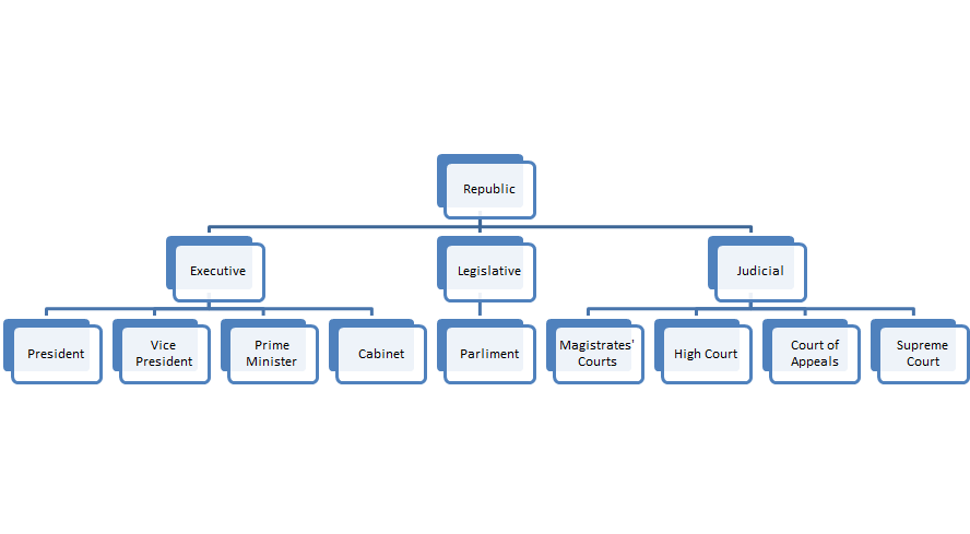
The politics of Uganda occurs in an Authoritarianism, authoritarian context. Since assuming office in 1986 at the end of the Ugandan Bush War, Ugandan civil war, Yoweri Museveni has ruled Uganda as an Autocracy, autocrat. Political party, Political parties were banned from 1986 to 2006 in the wake of the 2005 Ugandan multi-party referendum which was won by pro-democracy forces. Since 2006, Museveni has used legal means, patronage, and violence to maintain power. Under the Constitution of Uganda, Ugandan constitution, Uganda is a Presidential system, presidential republic in which the President of Uganda, President is the head of state and the prime minister is the head of government business. There is a multi-party system. Executive power is exercised by the government. Legislative power is given to both the government and the National Assembly. The system is based on a democratic parliamentary system with equal rights for all citizens over 18 years of age. Political culture ... [...More Info...] [...Related Items...] OR: [Wikipedia] [Google] [Baidu] |


