|
Muya River
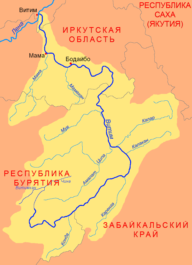
The Muya (russian: Муя) is a left tributary of the Vitim in Buryatia, Russia. It is long, and has a drainage basin of . The area through which the river flows is sparsely populated, the only settlement on the river being Taksimo, with the small village of Ust-Muya located where the river flows into the Vitim. The Muya is navigable for small craft from the Vitim around to Taksimo. The Muya has lent its name to a number of other geographic features, including the Northern Muya Range, the Southern Muya Range, as well as the local Muya District. See also *List of rivers of Russia Russia can be divided into a European Russia, European and an North Asia, Asian part. The dividing line is generally considered to be the Ural Mountains. The European part is drained into the Arctic Ocean, Baltic Sea, Black Sea, and Caspian Sea. Th ... References Rivers of Buryatia Stanovoy Highlands {{Russia-river-stub ... [...More Info...] [...Related Items...] OR: [Wikipedia] [Google] [Baidu] |
Northern Muya Range
The Northern Muya Range (russian: Се́веро-Му́йский хребе́т, translit=Severo-Muyskiy khrebet) is a mountain range in Buryatia, Russia, part of the Stanovoy Highlands. Google Earth The Baikal Amur Mainline (BAM) railway traverses the southern end of the mountain range via the Severomuysky Tunnel. Geography The Northern Muya Range stretches from the valley of the Svetlaya river, a left tributary of the Upper Angara, in the southwest, to the valley of the Vitim in the northeast. The Upper Angara Depression lies to the northwest and the Muya-Kuanda Depression to the southeast. To the north it runs parallel with the Delyun-Uran Range just south of it, and to the south with the Muyakan Range. The highest summit of the range is a high mountain located in its extreme southwestern part. Peaks and ridges have sharp glacial shapes in the central sector of the range, while flat summits predominate on the periphery. In its southwestern part the Northern Muya Range is ... [...More Info...] [...Related Items...] OR: [Wikipedia] [Google] [Baidu] |
Vitim (river)
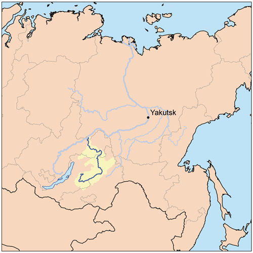
The Vitim (russian: Витим; evn, Витым, ; sah, Виитим, ; Buryat and mn, Витим, ''Vitim'') is a major tributary of the Lena. Its source is east of Lake Baikal, at the confluence of rivers Vitimkan from the west and China from the east. The Vitim flows first south, bends eastwards and then northward in the Vitim Plateau. Then it flows north through the Stanovoy Highlands and the town of Bodaybo. Including river Vitimkan, its western source, it is long, and has a drainage basin of .Витим (река в Бурят. АССР) It is navigable from the Lena to Bodaybo. Upst ... [...More Info...] [...Related Items...] OR: [Wikipedia] [Google] [Baidu] |
Russia
Russia (, , ), or the Russian Federation, is a transcontinental country spanning Eastern Europe and Northern Asia. It is the largest country in the world, with its internationally recognised territory covering , and encompassing one-eighth of Earth's inhabitable landmass. Russia extends across eleven time zones and shares land boundaries with fourteen countries, more than any other country but China. It is the world's ninth-most populous country and Europe's most populous country, with a population of 146 million people. The country's capital and largest city is Moscow, the largest city entirely within Europe. Saint Petersburg is Russia's cultural centre and second-largest city. Other major urban areas include Novosibirsk, Yekaterinburg, Nizhny Novgorod, and Kazan. The East Slavs emerged as a recognisable group in Europe between the 3rd and 8th centuries CE. Kievan Rus' arose as a state in the 9th century, and in 988, it adopted Orthodox Christianity from the ... [...More Info...] [...Related Items...] OR: [Wikipedia] [Google] [Baidu] |
Buryatia
Buryatia, officially the Republic of Buryatia (russian: Республика Бурятия, r=Respublika Buryatiya, p=rʲɪsˈpublʲɪkə bʊˈrʲætʲɪjə; bua, Буряад Улас, Buryaad Ulas, , mn, Буриад Улс, Buriad Uls), is a republic of Russia located in Siberia. It is the historical native land of indigenous Buryats. Formerly part of the Siberian Federal District, it has been a part of the Russian Far East since 2018. Its capital is the city of Ulan-Ude, which means Red Gateway in Buryat Mongolian. Its area is with a population of 978,588 ( 2021 Census). Geography The republic is located in the south-central region of Siberia along the eastern shore of Lake Baikal. *Area: *Borders: **Internal: Irkutsk Oblast (W/NW/N), Zabaykalsky Krai (NE/E/SE/S), Tuva (W) **International: Mongolia ( Bulgan Province, Khövsgöl Province and Selenge Province) (S/SE) **Water: Lake Baikal (N) *Highest point: Mount Munku-Sardyk () Rivers Major rivers include ... [...More Info...] [...Related Items...] OR: [Wikipedia] [Google] [Baidu] |
Taksimo
Taksimo (russian: Таксимо́; Buryat and mn, Таксимо, ''Taksimo'') is an urban locality (an urban-type settlement) and the administrative center of Muysky District of the Republic of Buryatia, Russia, located on the Muya River on the Muysk Plateau in the far northeast of the republic. As of the 2010 Census, its population was 9,438. Etymology Taksimo's name comes from the Evenki language and means ''cup'' or ''bowl'', possibly because of its location in a valley in Muysky Mountains. History Buryats, who had emigrated from the Chara River area, began settling the region in the 1860s, although a number of Evenks already lived there. Modern Taksimo began as the settlement of exile Ivan Barancheyev, who escaped from the settlement of Kirensk in the Lena mining area during rioting in 1905. He gradually wandered along the Vitim River and eventually settled in the area of present-day Taksimo in 1910. Barancheyev's outpost became a trading point for stagecoaches, ... [...More Info...] [...Related Items...] OR: [Wikipedia] [Google] [Baidu] |
Southern Muya Range
The Southern Muya Range (russian: Южно-Муйский хребе́т, translit=Yuzhno-Muyskiy khrebet) is a mountain range in Buryatia and Zabaykalsky Krai, Russia, part of the Stanovoy Highlands. The highest point of the range is 3,067 m high Muisky Gigant; another important peak is 2363 m high Mount Shaman. Google Earth Geography This mountain range is located in the Baikal Rift Zone, in the southwestern part of the Baikal-Stanovoy Region. It stretches from west to east for almost 400 km from the Barguzin river basin to the upper course of the Chara River. In its eastern part it reaches a maximum width of 80 km. The Ikat Range connects with it from the southwest. The Southern Muya Range is limited by the Muya-Kuanda Depression in the north, by the Baunt Depression in the south and in the east by the Bambuyka and Vitim rivers. Hydrography Rivers Pravaya Shurinda and Dyaltukta, right tributaries of the Muya originate from the northwestern slopes of the axial or main Souther ... [...More Info...] [...Related Items...] OR: [Wikipedia] [Google] [Baidu] |
Muya District
Muysky District (russian: Му́йский райо́н; bua, Муяын аймаг, ''Muyayn aimag'') is an administrativeResolution #431 and municipalLaw #985-III district (raion), one of the twenty-one in the Republic of Buryatia, Russia. It is located in the northeast of the republic. The area of the district is .Official website of the Buryat RepublicInformation about Muysky District Its administrative center is the urban locality (an urban-type settlement) of Taksimo. As of the 2010 Census, the total population of the district was 13,142, with the population of Taksimo accounting for 71.8% of that number. History The district was established on October 23, 1989 from parts of the territories of Bauntovsky and Severo-Baykalsky Districts. Administrative and municipal status Within the framework of administrative divisions, Muysky District is one of the twenty-one in the Republic of Buryatia. It is divided into two urban-type settlements (administrative division ... [...More Info...] [...Related Items...] OR: [Wikipedia] [Google] [Baidu] |
Vitim ;
{{Set index article, populated places in Russia ...
Vitim (russian: Витим) is the name of several inhabited localities in Russia. Modern localities *Vitim, Sakha Republic, an urban locality (an urban-type settlement) in Lensky District of the Sakha Republic * Vitim, Republic of Buryatia, a rural locality (a settlement) in Muysky Selsoviet of Muysky District in the Republic of Buryatia; Alternative names *Vitim, alternative name of Romanovka, a '' selo'' in Vitimsky Selsoviet of Bauntovsky District in the Republic of Buryatia Buryatia, officially the Republic of Buryatia (russian: Республика Бурятия, r=Respublika Buryatiya, p=rʲɪsˈpublʲɪkə bʊˈrʲætʲɪjə; bua, Буряад Улас, Buryaad Ulas, , mn, Буриад Улс, Buriad Uls), is ... [...More Info...] [...Related Items...] OR: [Wikipedia] [Google] [Baidu] |
List Of Rivers Of Russia
Russia can be divided into a European Russia, European and an North Asia, Asian part. The dividing line is generally considered to be the Ural Mountains. The European part is drained into the Arctic Ocean, Baltic Sea, Black Sea, and Caspian Sea. The Asian part is drained into the Arctic Ocean and the Pacific Ocean. Notable rivers of Russia in Europe are Volga (which is the longest river in Europe), Pechora (river), Pechora, Don River, Russia, Don, Kama River, Kama, Oka River, Oka and the Northern Dvina, while several other rivers originate in Russia but flow into other countries, such as the Dnieper and the Western Dvina. In Asia, important rivers are the Ob River, Ob, the Irtysh River, Irtysh, the Yenisei River, Yenisei, the Angara River, Angara, the Lena River, Lena, the Amur River, Amur, the Yana River, Yana, the Indigirka River, Indigirka, and the Kolyma River, Kolyma. In the list below, the rivers are grouped by the seas or oceans into which they flow. Rivers that flow into o ... [...More Info...] [...Related Items...] OR: [Wikipedia] [Google] [Baidu] |
Rivers Of Buryatia
A river is a natural flowing watercourse, usually freshwater, flowing towards an ocean, sea, lake or another river. In some cases, a river flows into the ground and becomes dry at the end of its course without reaching another body of water. Small rivers can be referred to using names such as creek, brook, rivulet, and rill. There are no official definitions for the generic term river as applied to geographic features, although in some countries or communities a stream is defined by its size. Many names for small rivers are specific to geographic location; examples are "run" in some parts of the United States, "burn" in Scotland and northeast England, and "beck" in northern England. Sometimes a river is defined as being larger than a creek, but not always: the language is vague. Rivers are part of the water cycle. Water generally collects in a river from precipitation through a drainage basin from surface runoff and other sources such as groundwater recharge, springs, a ... [...More Info...] [...Related Items...] OR: [Wikipedia] [Google] [Baidu] |


