|
Mutoko District
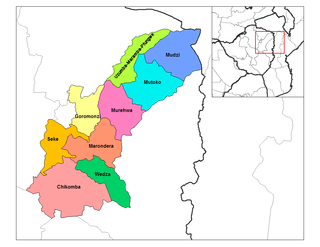
Mutoko District is a district of Mashonaland East Province, Zimbabwe, in southern Africa. It is located in the eastern part of Zimbabwe, and covers . In 2022, the district had a population of 161,091. At that time, nearly 50% of the population was under 19 years of age. Infrastructure The settlement at Mutoko was designated as a "growth point" in the initial planning of the new Zimbabwe government in the early 1980s. It has electricity, a hospital, a post office, and banking facilities. In addition there is grain storage run by the Grain Marketing Board, and storage for cotton run by the Cotton Company of Zimbabwe. There is a main road that runs northeast-southwest from Murehwa District with connections to Harare through the district to Mudzi District and thereafter to Mozambique Mozambique, officially the Republic of Mozambique, is a country located in Southeast Africa bordered by the Indian Ocean to the east, Tanzania to the north, Malawi and Zambia to the northwest ... [...More Info...] [...Related Items...] OR: [Wikipedia] [Google] [Baidu] |
Districts Of Zimbabwe
The Republic of Zimbabwe is broken down into 10 administrative provinces of Zimbabwe, provinces, which are divided into 64 districts and 1,970 Wards of Zimbabwe, wards. Bulawayo Province * Bulawayo Harare Province * Harare * Chitungwiza * Epworth, Zimbabwe, Epworth Manicaland Province * Buhera District, Buhera * Chimanimani District, Chimanimani * Chipinge District, Chipinge * Makoni District, Makoni * Mutare District, Mutare * Mutasa District, Mutasa * Nyanga District, Nyanga Mashonaland Central Province * Bindura District, Bindura * Guruve District, Guruve * Mazowe District, Mazowe * Mbire District, Mbire * Mount Darwin District, Mount Darwin * Muzarabani District, Muzarabani * Rushinga District, Rushinga * Shamva District, Shamva Mashonaland East Province * Chikomba District, Chikomba * Goromonzi District, Goromonzi * Marondera District, Marondera * Mudzi District, Mudzi * Murehwa District, Murehwa * Mutoko District, Mutoko * Seke District, Se ... [...More Info...] [...Related Items...] OR: [Wikipedia] [Google] [Baidu] |
Mashonaland East Province
Mashonaland East, informally Mash East, is a province of Zimbabwe. It has an area of 32,230 km2 and a population of approximately 1.73 million (2022). Marondera is the capital of the province. Demographics The province has a history of African migrants from neigboouring countries such as Mozambique and Malawi. Notable ethnic groups in the province are the Shonas, Ndebele, Nyanja, Tumbuka and other groups. Several languages are spoken in different districts such as Shona, Nyanja, Ndebele, Chitumbuka, and Chibarwe, among others. Geography Districts The Mashonaland East is divided into nine districts: * Chikomba * Goromonzi * Marondera * Mudzi * Murehwa (Mrehwa) * Mutoko * Seke * Uzumba-Maramba-Pfungwe (UMP) * Wedza (Hwedza) Education See also * Provinces of Zimbabwe * Districts of Zimbabwe The Republic of Zimbabwe is broken down into 10 administrative provinces of Zimbabwe, provinces, which are divided into 64 districts and 1,970 ... [...More Info...] [...Related Items...] OR: [Wikipedia] [Google] [Baidu] |
Zimbabwe
file:Zimbabwe, relief map.jpg, upright=1.22, Zimbabwe, relief map Zimbabwe, officially the Republic of Zimbabwe, is a landlocked country in Southeast Africa, between the Zambezi and Limpopo Rivers, bordered by South Africa to the south, Botswana to the southwest, Zambia to the north, and Mozambique to the east. The capital and largest city is Harare, and the second largest is Bulawayo. A country of roughly 16.6 million people as per 2024 census, Zimbabwe's largest ethnic group are the Shona people, Shona, who make up 80% of the population, followed by the Northern Ndebele people, Northern Ndebele and other #Demographics, smaller minorities. Zimbabwe has 16 official languages, with English, Shona language, Shona, and Northern Ndebele language, Ndebele the most common. Zimbabwe is a member of the United Nations, the Southern African Development Community, the African Union, and the Common Market for Eastern and Southern Africa. The region was long inhabited by the San people, ... [...More Info...] [...Related Items...] OR: [Wikipedia] [Google] [Baidu] |
Harare
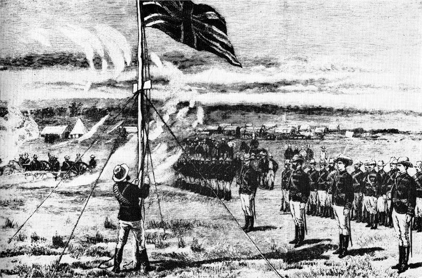
Harare ( ), formerly Salisbury, is the Capital city, capital and largest city of Zimbabwe. The city proper has an area of , a population of 1,849,600 as of the 2022 Zimbabwe census, 2022 census and an estimated 2,487,209 people in its metropolitan province. The city is situated in north-eastern Zimbabwe in the country's Mashonaland region. Harare Metropolitan Province incorporates the city and the municipalities of Chitungwiza, Epworth, Zimbabwe, Epworth and Ruwa. The city sits on a plateau at an elevation of above sea level, and its climate falls into the subtropical highland category. The city was founded in 1890 by the Pioneer Column, a small military force of the British South Africa Company, and was named Southern Rhodesia, Fort Salisbury after the British Prime Minister Robert Gascoyne-Cecil, 3rd Marquess of Salisbury, Lord Salisbury. Company Company rule in Rhodesia, administrators Demarcation line, demarcated the city and ran it until Southern Rhodesia achieved respo ... [...More Info...] [...Related Items...] OR: [Wikipedia] [Google] [Baidu] |
Mozambique
Mozambique, officially the Republic of Mozambique, is a country located in Southeast Africa bordered by the Indian Ocean to the east, Tanzania to the north, Malawi and Zambia to the northwest, Zimbabwe to the west, and Eswatini and South Africa to the south and southwest. The sovereign state is separated from the Comoros, Mayotte, and Madagascar by the Mozambique Channel to the east. The capital and largest city is Maputo. Between the 7th and 11th centuries, a series of Swahili port towns developed on that area, which contributed to the development of a distinct Swahili culture and dialect. In the late medieval period, these towns were frequented by traders from Somalia, Ethiopia, Egypt, Arabia, Persia, and India. The voyage of Vasco da Gama in 1498 marked the arrival of the Portuguese Empire, Portuguese, who began a gradual process of colonisation and settlement in 1505. After over four centuries of Portuguese Mozambique, Portuguese rule, Mozambique Mozambican War of Indepen ... [...More Info...] [...Related Items...] OR: [Wikipedia] [Google] [Baidu] |
United Nations Office For The Coordination Of Humanitarian Affairs
The United Nations Office for the Coordination of Humanitarian Affairs (OCHA) is a United Nations (UN) body established in December 1991 by the General Assembly to strengthen the international response to complex emergencies and natural disasters. It is the successor to the Office of the United Nations Disaster Relief Coordinator (UNDRO). The Department of Humanitarian Affairs (DHA) was established shortly thereafter by the Secretary-General, but in 1998, was merged into OCHA, which became the UN's main focal point on major disasters. OCHA's mandate was subsequently broadened to include coordinating humanitarian response, policy development and humanitarian advocacy. Its activities include organizing and monitoring humanitarian funding, advocacy, policymaking, and information exchange to facilitate rapid-response teams for emergency relief. OCHA is led by the Under-Secretary-General for Humanitarian Affairs and Emergency Relief Coordinator (USG/ERC), appointed for a five-yea ... [...More Info...] [...Related Items...] OR: [Wikipedia] [Google] [Baidu] |
Mutoko District
Mutoko District is a district of Mashonaland East Province, Zimbabwe, in southern Africa. It is located in the eastern part of Zimbabwe, and covers . In 2022, the district had a population of 161,091. At that time, nearly 50% of the population was under 19 years of age. Infrastructure The settlement at Mutoko was designated as a "growth point" in the initial planning of the new Zimbabwe government in the early 1980s. It has electricity, a hospital, a post office, and banking facilities. In addition there is grain storage run by the Grain Marketing Board, and storage for cotton run by the Cotton Company of Zimbabwe. There is a main road that runs northeast-southwest from Murehwa District with connections to Harare through the district to Mudzi District and thereafter to Mozambique Mozambique, officially the Republic of Mozambique, is a country located in Southeast Africa bordered by the Indian Ocean to the east, Tanzania to the north, Malawi and Zambia to the northwest ... [...More Info...] [...Related Items...] OR: [Wikipedia] [Google] [Baidu] |

