|
Musala
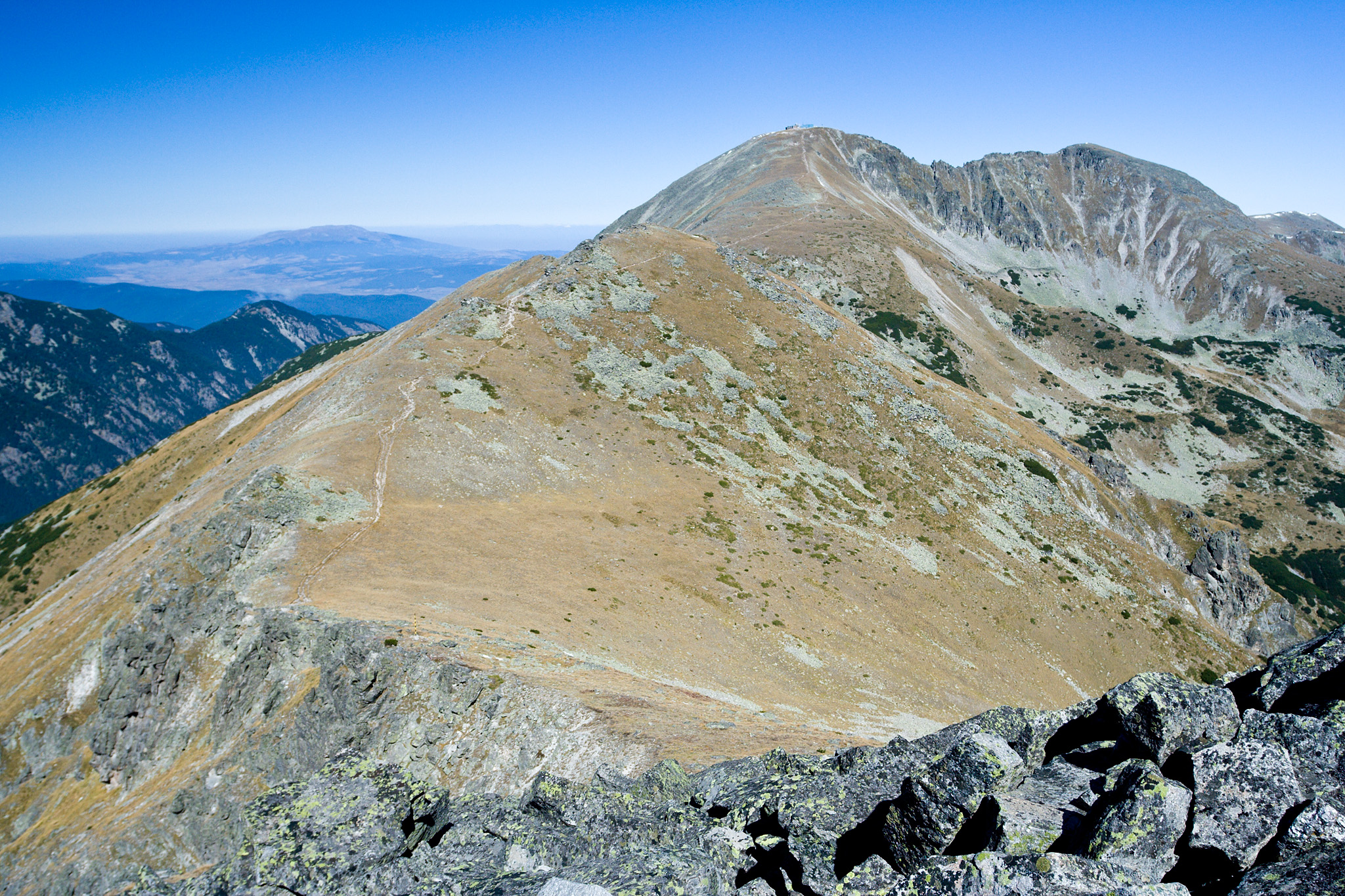
Musala ( ); from Arabic through Ottoman Turkish: from '' Musalla'', "near God" or "place for prayer" is the highest peak in the Rila Mountains, as well as in Bulgaria and the entire Balkan Peninsula, standing at . With a topographic prominence of , Musala is also the 6th highest peak by topographic prominence in mainland Europe. It is also the 3rd most topographically isolated major peak in Continental Europe. Musala is situated within the Rila National Park, which is noted for its rich flora, including species such as Macedonian Pine and Bulgarian Fir in the forests on its middle slopes, and fauna; it is one of the easiest places in Europe to see the wallcreeper. All major mountain ranges of Bulgaria can be seen from the top; these include Vitosha to the northwest, Sredna Gora towards the northeast, the Balkan Mountains along most of the northern horizon behind Vitosha and Sredna Gora, the Rhodope Mountains to the southeast, Pirin to the south, Osogovo and Ruy Mountai ... [...More Info...] [...Related Items...] OR: [Wikipedia] [Google] [Baidu] |
Rila
Rila (, ) is the highest mountain range of Bulgaria, the Balkans, Balkan Peninsula, and Southeast Europe. It is situated in southwestern Bulgaria and forms part of the Rila–Rhodope Mountains, Rhodope Massif. The highest summit is Musala at an elevation of 2,925 m which makes Rila the sixth highest mountain range in Europe after the Caucasus, the Alps, Sierra Nevada (Spain), Sierra Nevada, the Pyrenees and Mount Etna, and the highest one between the Alps and the Caucasus. It spans a territory of 2,629 km2 with an average elevation of 1487 m. The mountain is believed to have been named after the Rilska River, river of the same name, which comes from the Old Bulgarian language, Old Bulgarian verb "рыти" meaning "to grub". Rila has abundant water resources. Some of the Balkans' longest and deepest rivers originate from Rila, including the Maritsa, Iskar (river), Iskar and Nestos (river), Mesta rivers. Bulgaria's main water divide separating the Black Sea and the A ... [...More Info...] [...Related Items...] OR: [Wikipedia] [Google] [Baidu] |
Malka Musala
Malka Musala (, meaning ''Lesser Musala'') is a summit in the eastern part of the Rila Mountain in southwestern Bulgaria. With an altitude of 2,902 m, it is the second highest peak in Rila after Musala (2,925 m), fourth in Bulgaria behind Vihren (2,914 m) and Kutelo (2,908 m) in the Pirin Mountain, and seventh in the Balkan Peninsula. The summit is situated to the north-east of Musala, separated by a rocky ridge. The ridge extends in a north-eastern direction to the summits of Irechek (2,852 m) and Deno (2,790 m). To the north-west is located the Musala Cirque and the highest of the seven Musala Lakes. To the south and the east the slopes of Malka Musala descend to the deep valley of the Maritsa Maritsa or Maritza ( ), also known as Evros ( ) and Meriç ( ), is a river that runs through the Balkans in Southeast Europe. With a length of , [...More Info...] [...Related Items...] OR: [Wikipedia] [Google] [Baidu] |
Most Isolated Major Summits Of Europe
The most isolated major summits of Europe by topographic isolation are located in the Europe, European continent and its Eurasian Plate, tectonic and Geography of Europe, geographic boundaries. This includes major mountain peaks of fold mountain, fold and fault-block mountains, and also volcanoes, located not only in the Continental Europe, European Mainland, but also those located on lands and islands on the Boundaries between the continents of Earth, limits of Europe, like the North Atlantic Ocean islands of the Azores and Iceland, the Arctic Ocean islands of Jan Mayen, Svalbard archipelago and Novaya Zemlya archipelago, the Mediterranean Sea, Mediterranean island of Sicily, the Ural Mountains, and Mount Elbrus. The last mentioned is HP of the transboundary Caucasus Mountains and Greater Caucasus region, but as a geologically separate stratovolcano, it is entirely laying in Europe (and Russia), north of the main ridge of the Greater Caucasus, considered as the one that is forming t ... [...More Info...] [...Related Items...] OR: [Wikipedia] [Google] [Baidu] |
List Of European Ultra-prominent Peaks
This is a list of all the mountains in Europe with ultra-prominent peaks with topographic prominence greater than . European peaks by prominence The column "Col" in the chart below denotes the highest elevation to which one must descend from a peak in order to reach peaks with higher elevations; note that the elevation of any peak is the sum of its prominence and col. The above European Top 10 list excludes peaks on lands and islands that are part of European countries but are outside or on the limits of the European continent and its tectonic and geographic boundaries, like Teide (with prominence of ), Tenerife Island, Spain; Belukha peak of the Altai Mountains in Russia (with prominence of ); and Piton des Neiges (with prominence of ), Réunion, France. For ease of reference, the complete list below is divided into sections. Islands in the Atlantic, like Azores and Iceland, the Arctic archipelagos of Jan Mayen, Svalbard, and Novaya Zemlya, Mediterranean Sicily and the oth ... [...More Info...] [...Related Items...] OR: [Wikipedia] [Google] [Baidu] |
Sofia Province
Sofia Province () is a province (''oblast'') of Bulgaria. The province does not include Sofia in its territories, but Sofia remains the seat of its administration. The province borders on the provinces of Pernik, Kyustendil, Blagoevgrad, Pazardzhik, Plovdiv, Lovech, Vratsa, Montana, and "Sofia City Province" (which is in a separate ''oblast'', see Sofia Administration), and borders with Serbia to the northwest. History Prehistory and antiquity Archaeological excavations near Chavdar suggest that the region has been settled by humans as early as 7,000 years ago. The earliest evidence of a mass settlement dates back to Thracian times, including ''tumuli'' (burial mounds) which remain poorly studied. According to Thucydides, the areas north of Vitosha were inhabited by the Tilataei and the Treri. The Triballi were also known to have inhabited the region around Serdica. The Serdi, a Celtic tribe that appeared in place of the vanished Treri and Tilataei, were first mentio ... [...More Info...] [...Related Items...] OR: [Wikipedia] [Google] [Baidu] |
Balkan Peninsula
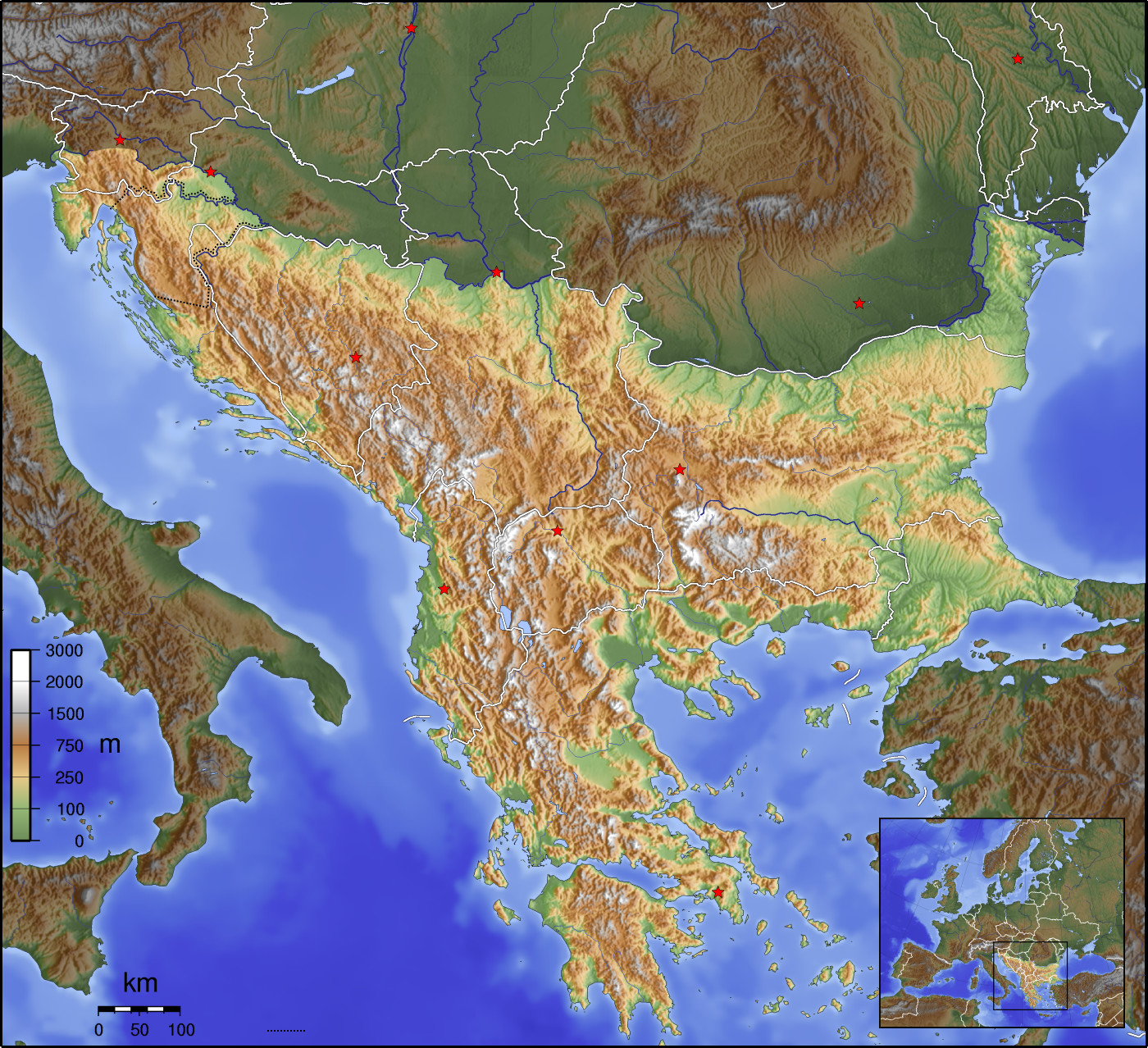
The Balkans ( , ), corresponding partially with the Balkan Peninsula, is a geographical area in southeastern Europe with various geographical and historical definitions. The region takes its name from the Balkan Mountains that stretch throughout the whole of Bulgaria. The Balkan Peninsula is bordered by the Adriatic Sea in the northwest, the Ionian Sea in the southwest, the Aegean Sea in the south, the Turkish straits in the east, and the Black Sea in the northeast. The northern border of the peninsula is variously defined. The highest point of the Balkans is Musala, , in the Rila mountain range, Bulgaria. The concept of the Balkan Peninsula was created by the German geographer August Zeune in 1808, who mistakenly considered the Balkan Mountains the dominant mountain system of southeastern Europe spanning from the Adriatic Sea to the Black Sea. In the 19th century the term ''Balkan Peninsula'' was a synonym for Rumelia, the parts of Europe that were provinces of the Ottoman E ... [...More Info...] [...Related Items...] OR: [Wikipedia] [Google] [Baidu] |
Iskar (river)
The Iskar (, ; ) is a right tributary of the Danube. With a length of 368 km, it is the longest river that runs entirely within Bulgaria.Statistical Yearbook 2017 National Statistical Institute (Bulgaria), p. 17 Originating as three forks in Balkan's highest mountain range Rila, the Iskar flows in a northern direction until its confluence with the Danube. As it flows northwards it fuels the largest artificial lake in the country, the Iskar Reservoir, forms the divide between the Vitosha and Plana Mountains in the west and the Sredna Gora mountain range in the east before entering the Sofia Valley, which contains the nation's capital Sofia. From there the Iskar runs through the Balkan Mountains, forming the spectacular 84 km long Iskar Gorge. As it crosses the mountains, its water course turns ... [...More Info...] [...Related Items...] OR: [Wikipedia] [Google] [Baidu] |
Musalla
A musalla () is a space apart from a mosque, mainly used for prayer in Islam. The word is derived from the verb (''ṣallā''), meaning "to pray". It is traditionally used for twice-yearly Eid prayers (''Eid al-Fitr, ʿĪd al-Fiṭr'' and ''Eid al-Adha, ʿĪd al-Aḍḥā)'' and for Salat al-Janazah, funeral prayers as per the Sunnah. “Musalla” may also refer to a room, structure, or place for performing ''salah'' (canonical prayers), and this is also translated as a “prayer hall” when smaller than a mosque. It is often used for conducting the five mandatory daily Salah, prayers, or other prayers in (or without) a small Salah al jama'ah, congregation, but not for large congregational worship such as the Friday prayers, Friday Prayers or the Eid Prayers (the latter is done in Jama Masjid, congregational mosques if there is no available musalla, in the original sense of an open space). Such musallas are usually present in airports, malls, universities, and other public ... [...More Info...] [...Related Items...] OR: [Wikipedia] [Google] [Baidu] |
Rila National Park
Rila National Park () is the largest national park in Bulgaria spanning an area of in the Rila mountain range in the south-west of the country. History It was established on 24 February 1992 to protect several ecosystems of national importance. Its altitude varies from near Blagoevgrad to at Musala Peak, the highest summit in the Balkan Peninsula. The park has 120 glacial lakes, including the prominent Seven Rila Lakes. Many rivers have their source in the national park, including the river that carries the most water entirely within the Balkans (the Maritsa river) and the longest river entirely within Bulgaria (the Iskar river). The national park occupies territory of 4 of the 28 provinces of the country: Sofia, Kyustendil, Blagoevgrad and Pazardzhik. It includes four nature reserves: Parangalitsa, Central Rila Reserve, Ibar and Skakavitsa. Rila National Park is among the largest and most valuable protected areas in Europe. The International Union for Conservation ... [...More Info...] [...Related Items...] OR: [Wikipedia] [Google] [Baidu] |
List Of Countries By Highest Point
The following sortable table lists land surface elevation extremes by country or dependent territory. Elevation, Topographic elevation is the vertical distance above the reference geoid, a mathematical model of the Earth's sea level as an equipotential Gravity, gravitational surface. Table National elevation ranges Of all countries, Lesotho has the world's highest low point at . Other countries with high low points include Rwanda and Andorra . Countries with very low high points include Maldives , Tuvalu, and the Marshall Islands . These island countries also have the smallest range between their lowest (sea level) and highest points, and are very sensitive to changes in sea level. The highest and lowest points in China constitute the greatest elevation range within any single country at . The elevation ranges are also great in Nepal , Pakistan , and India . Monaco's elevation range is among the greatest relative to surface area. Within its 2.02 km2 territory, there ... [...More Info...] [...Related Items...] OR: [Wikipedia] [Google] [Baidu] |
Bulgaria
Bulgaria, officially the Republic of Bulgaria, is a country in Southeast Europe. It is situated on the eastern portion of the Balkans directly south of the Danube river and west of the Black Sea. Bulgaria is bordered by Greece and Turkey to the south, Serbia and North Macedonia to the west, and Romania to the north. It covers a territory of and is the tenth largest within the European Union and the List of European countries by area, sixteenth-largest country in Europe by area. Sofia is the nation's capital and List of cities and towns in Bulgaria, largest city; other major cities include Burgas, Plovdiv, and Varna, Bulgaria, Varna. One of the earliest societies in the lands of modern-day Bulgaria was the Karanovo culture (6,500 BC). In the 6th to 3rd century BC, the region was a battleground for ancient Thracians, Persians, Celts and Ancient Macedonians, Macedonians; stability came when the Roman Empire conquered the region in AD 45. After the Roman state splintered, trib ... [...More Info...] [...Related Items...] OR: [Wikipedia] [Google] [Baidu] |
Borovets
Borovets ( , known as Chamkoria ( ) until the middle of the 20th century) is a mountain resort in Samokov Municipality in Sofia Province in Bulgaria. Geography Borovets is situated on the northern slopes of Rila mountain, at an elevation of . It is located approximately 10 km from Samokov and 70 km from Sofia. Climate Borovets has a humid continental climate ( Dfb) with long, cold, and snowy winters and short, warm, and rainy summers with cool nights. History Borovets is the oldest Bulgarian winter resort with its history dating back to 1896. Borovets was originally established at the end of the nineteenth century as a hunting place for the Bulgarian rulers when General Tantilov, then a lieutenant colonel, built the first vacation villa, and subsequently Ferdinand I of Bulgaria built the Tsarska Bistritsa palace. In the 20th century, Borovets gradually developed into a modern ski resort with hotels, restaurants, bars and a network of ski runs and lifts along t ... [...More Info...] [...Related Items...] OR: [Wikipedia] [Google] [Baidu] |


