|
Munak Canal
The Munak Canal is a 102 kilometer long aqueduct that is part of Western Yamuna Canal in Haryana and Delhi states in India. The canal conveys water from the Yamuna River at Munak regulator in Karnal district of Haryana and travels in a southerly direction via Khubru barrage and Mandora barrage, terminating at Haidarpur in Delhi. It is one of the primary sources of drinking water for Delhi. A memorandum of understanding was signed between the Haryana and Delhi governments in 1996 and the Canal was constructed by Haryana between 2003 and 2012 on payment by Delhi. Originally a porous trench, the canal was eventually cemented due to excess seepage, saving 80 million gallons of water per day.Army guarding ... [...More Info...] [...Related Items...] OR: [Wikipedia] [Google] [Baidu] |
Munak, Karnal
Munak and adjacent Kheri Munak is a village and development block in Assandh sub-district of Karnal district, Haryana, India.census 2011 of Munak , 2011. Munak canal, which diverts Western Yamuna Canal's water to New Delhi, originates here at Munak regulator. History Munak Canal was constructed in British Raj, Canal Rest h ...[...More Info...] [...Related Items...] OR: [Wikipedia] [Google] [Baidu] |
Indian Rivers Inter-link
The Indian Rivers Inter-link is a proposed large-scale civil engineering project that aims to effectively manage water resources in India by linking Indian rivers by a network of reservoirs and canals to enhance irrigation and groundwater recharge, reduce persistent floods in some parts and water shortages in other parts of India.Jayanta Bandyopadhyay and Shama Perveen (2003)The Interlinking of Indian Rivers: Some Questions on the Scientific, Economic and Environmental Dimensions of the Proposal IIM Calcutta, IISWBM, Kolkata India accounts for 18% of the world population and about 4% of the world’s water resources. One of the solutions to solve the country’s water woes is to link rivers and lakes. The Inter-link project has been split into three parts: a northern Himalayan rivers inter-link component, a southern Peninsular component and starting 2005, an intrastate rivers linking component. The project is being managed by India's National Water Development Agency Ministr ... [...More Info...] [...Related Items...] OR: [Wikipedia] [Google] [Baidu] |
Neher Water System
Neher water system provided clean water for the people of Aurangabad and its suburbs. It was created by Malik Ambar who founded the town under the name Khadki and was later expanded by Aurangzeb to facilitate the military activity that became prevalent under Mughal rule during the 17th century. History The first aqueduct in Aurangabad was designed in 1612 by Malik Ambar to address the shortage of water caused by the lack of reservoirs and natural water reserves in the area. Despite the surrounding landscape, which made it difficult to construct the aqueducts' supporting pillars, the construction went ahead. The reason for the construction of the aqueduct was the discovery of a subterranean water supply in the mountainous valleys north of Aurangabad. The consequent construction of the waterway provided a stable water supply for a population of around seven lakhs (around seven hundred thousand people), with the city of Aurangabad receiving enough fresh water to prevent the short ... [...More Info...] [...Related Items...] OR: [Wikipedia] [Google] [Baidu] |
Surajkund
Surajkund is an ancient reservoir of the 10th century located on Southern Delhi Ridge of Aravalli range in Faridabad city of Haryana state about 8 km (5mi) from South Delhi. Surajkund (literally 'Lake of the Sun') is an artificial Kund ('Kund' means "lake" or reservoir) built in the backdrop of the Aravalli hills with an amphitheatre shaped embankment constructed in semicircular form. It is said to have been built by the king Surajpal of the Tomara dynasty in the 10th century. Tomar, a younger son of Anangpal Tomar – the ruler of Delhi, was a sun worshipper and he had therefore built a Sun temple on its western bank. Surajkund is known for its annual fair "Surajkund International Craft Mela", 2015 edition of this fair was visited by 1.2 million visitors including 160,000 foreigners with more than 20 countries participating in it. There are several dozen 43 paleolithic sites (100,000 BC), with rock art and microlithic stone tools, scattered surround the Surajkund fr ... [...More Info...] [...Related Items...] OR: [Wikipedia] [Google] [Baidu] |
Okhla Sanctuary
Okhla Bird Sanctuary is a bird sanctuary at the Okhla barrage over Yamuna River. It is situated in Noida, Gautam Buddh Nagar district, on Delhi-Uttar Pradesh state border and known as a haven for over 300 bird species, especially waterbirds. In 1990, an area of on the river Yamuna was designated a bird sanctuary by the Government of Uttar Pradesh under the Wildlife Protection Act, 1972. The site is located at the point where the river enters Uttar Pradesh. The most prominent feature of the sanctuary is the large lake created by damming the river, which lies between Okhla village to the west and Gautam Budh Nagar to the east. The Okhla Bird Sanctuary (OBS) is roughly 4 square kilometres in size and is situated at the entrance of NOIDA in Gautam Budh Nagar district of Uttar Pradesh. It is situated at a point where river Yamuna enters in the state of Uttar Pradesh leaving the territory of Delhi. It is one among fifteen bird sanctuaries in the state. The bird species of thorny s ... [...More Info...] [...Related Items...] OR: [Wikipedia] [Google] [Baidu] |
Hathni Kund Barrage
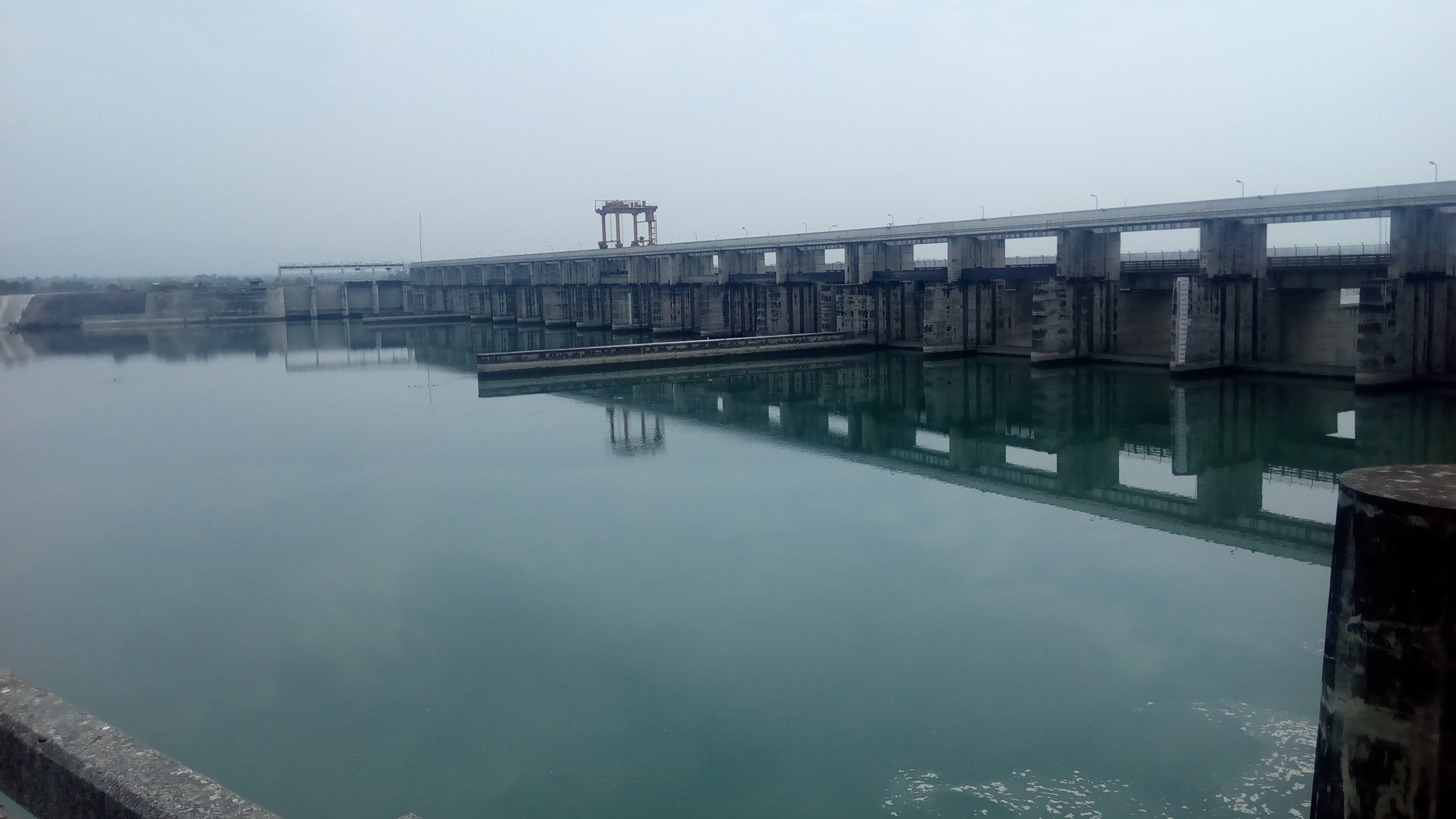
The Hathni Kund is a concrete barrage located on the Yamuna River in Yamuna Nagar district of Haryana state, India. It was constructed between October 1996 and June 1999 for the purpose of irrigation. It replaced the Tajewala Barrage downstream which was constructed in 1873 and is now out of service. The barrage diverts water into the Western and Eastern Yamuna Canals. The small reservoir created by the barrage also serves as a wetland for 31 species of waterbird. Plans to replace the Tajewala Barrage had been in the works since the early 1970s but an agreement between the governments of Haryana and Himachal Pradesh (which share the water it diverts) was not made until July 1994. Although the barrage was completed in late 1999, it was not operational until March 2002 because of work delays. The barrage is long and its spillway is composed of ten main floodgates along with five undersluices on its right side and three on its left. The maximum discharge of the barrage is (1 in ... [...More Info...] [...Related Items...] OR: [Wikipedia] [Google] [Baidu] |
Bhakra Dam
Bhakra Dam is a concrete gravity dam on the Sutlej River in Bhakra Village near Bilaspur in Bilaspur district, Himachal Pradesh in northern India. The dam forms the Gobind Sagar reservoir. The dam, located at a gorge near the (now submerged) upstream Bhakra village in Bilaspur district of Himachal Pradesh of height 226 m. The length of the dam (measured from the road above it) is 518.25 m and the width is 9.1 m. Its reservoir known as "Gobind Sagar" stores up to 9.34 billion cubic metres of water. The 90 km long reservoir created by the Bhakra Dam is spread over an area of 168.35 km2. In terms of quantity of water, it is the third largest reservoir in India, the first being Indira Sagar dam in Madhya Pradesh with capacity of 12.22 billion cu m and second Nagarjunasagar Dam. Described as "New Temple of Resurgent India" by Jawaharlal Nehru, the first prime minister of India, the dam attracts tourists from all over India. Bhakra dam is 15 ... [...More Info...] [...Related Items...] OR: [Wikipedia] [Google] [Baidu] |
Pinjore
Pinjore is a town in Panchkula district in the Indian state of Haryana. This residential 'township', located close to Panchkula, Chandigarh, is set over 1,800 feet above the sea level in a valley, overlooking the Sivalik Hills. Pinjore is known for Pinjore Gardens, Asia's best 17th Century Mughal garden, and the Hindustan Machine Tools (HMT) factory. History Etymology The town is named after the five Pandava brothers from Mahabharta, who during the time of their exile had stayed here for some time, hence the name Panchpura which later got corrupted to its current form, Pinjore.Haryana Samvad , Oct 2018, p38-40. Panchpura baoli Panchpura baoli, a step well has an inscription. |
Kaushalya Dam
The Kaushalya Dam (Hindi: कौशल्या बांध) is an earth-fill embankment dam on the Kaushalya river, which is a tributary of Ghaggar-Hakra River ( modern remnant of ancient Sarasvati river), in Pinjore of Haryana state, India. It was constructed between 2008 and 2012 with the primary purpose of water supply. Location Kaushalya barrage and resulting upstream dam on Kaushalya river are located 21 km from Chandigarh, 12 km from Panchkula city and Khol Hi-Raitan Wildlife Sanctuary near Panchkula, 5 km from Pinjore city,Directions from Kaushalya dam to Pinjore/ref> and 13 km from Bir Shikargah Wildlife Sanctuary near Pinjore. History The first plan, which never materialised, for a dam on Ghaggar river was first proposed by the British raj in the mid 19th century to provide drinking water to Ambala Cantonment. The proposal was revisited only in the 1960s to construct a dam on Ghaggar river at Gumthala near Chandimandir to provide water to Chandig ... [...More Info...] [...Related Items...] OR: [Wikipedia] [Google] [Baidu] |
Hisar (city)
Hisar is a city, municipal corporation and administrative headquarters of Hisar district of Hisar division in the state of Haryana in northwestern India. It is located 161.2 km (100.16 mi) to the west of New Delhi, India's capital, and has been identified as a counter-magnet city for the National Capital Region to develop as an alternative centre of growth to Delhi. The city was founded in 1354 AD, as ''Hisar-e-Firoza'' by Firoz Shah Tughlaq, the Sultan of Delhi from 1351 to 1388. The word Hisar means fort or castle in Persian. The city was ruled by several major powers, including the Tughlaqs in the 14th century, the Mughals in the 16th century, and the British in the 19th century. After India achieved independence, it was unified History Early history Archeological excavations at nearby locations of Rakhigarhi (7000 BCE), Siswal (4000 BCE), and Lohari Ragho suggest the presence of human habitation from pre-Harappan period. Later, Aryan people settled a ... [...More Info...] [...Related Items...] OR: [Wikipedia] [Google] [Baidu] |
Blue Bird Lake
Blue Bird Lake, Hisar is a resident and endangered migratory bird wetland habitat, lake and recreation area in the town of Hisar, in the Hisar district of Haryana State, India.Blue Bird lake Location Blue Bird Lake is close to on NH-9 in Hisar, |
Upper Ganges Canal Expressway
Upper Ganges Canal Expressway, also known as Hindon Expressway, is a planned eight-lane expressway. It is planned to stretch from Bulandshahr, Uttar Pradesh to Haridwar, Uttarakhand through Muzaffarnagar and Roorkee Roorkee (Rūṛkī) is a city and a municipal corporation in the Haridwar district of the state of Uttarakhand, India. It is from Haridwar city, the district headquarter. It is spread over a flat terrain under Sivalik Hills of Himalayas. The ..., in India. References {{reflist Transport in Haridwar Transport in Ghaziabad, Uttar Pradesh ... [...More Info...] [...Related Items...] OR: [Wikipedia] [Google] [Baidu] |


.jpg)


