|
Mummy Mountain (Nevada)
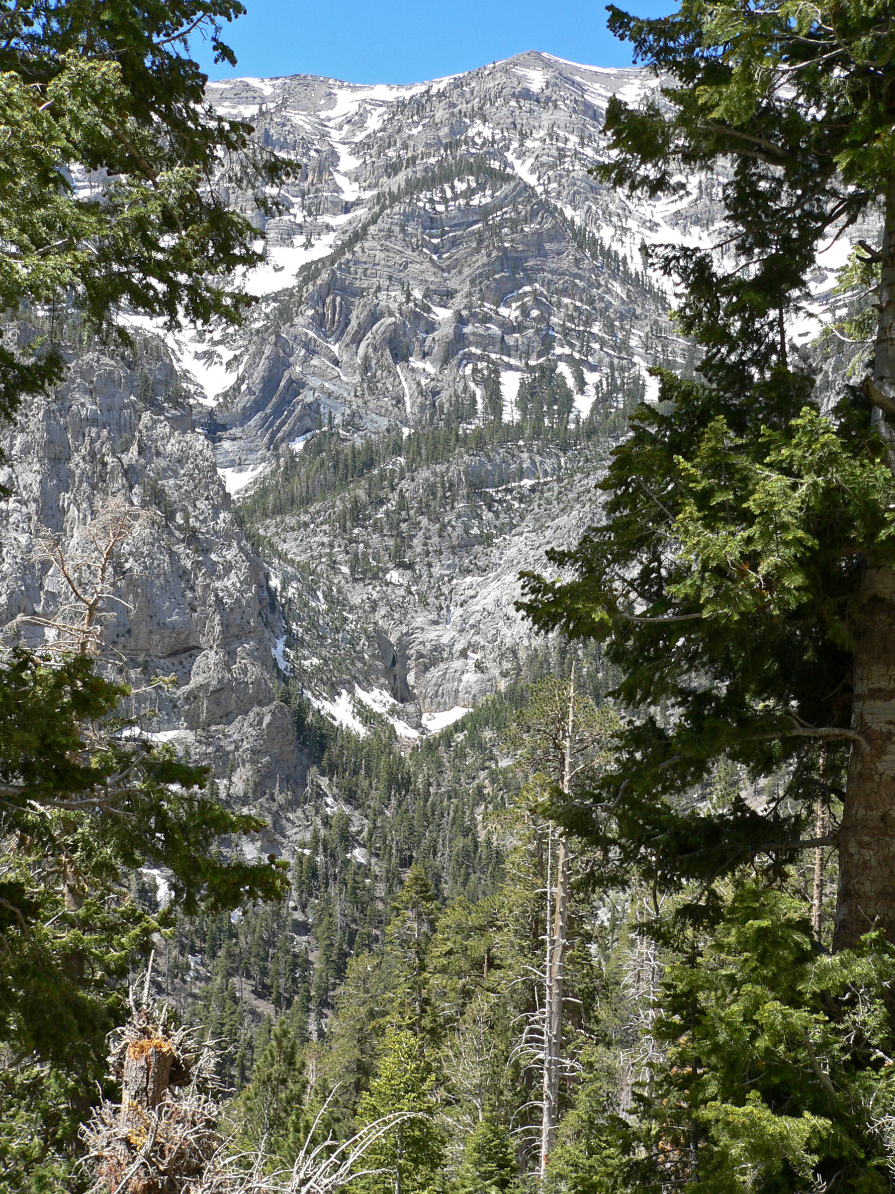
Mummy Mountain is the second highest peak of the Spring Mountains in Clark County, Nevada, United States. It is the twentieth highest mountain in the state. The mountain is located within the Mount Charleston Wilderness and the Humboldt-Toiyabe National Forest. It takes its name from its vague resemblance to a mummy, or perhaps more accurately an Egyptian sarcophagus seen in profile, with the "head" to the north formed by outcropping above Lee Canyon, the gently rounded main summit forming the "body", and a southern rise and cliffs forming the "feet", called "Mummy's Toe". This appearance is especially prominent from U.S. Route 95, which passes by the mountain to the east. The most common route to the summit is from the North Loop Trail or Trail Canyon to Mount Charleston, starting from where it reaches close to the top of the ridge between Mummy Mountain and Mount Charleston. After the first two switchbacks, a steep scramble up a scree Scree is a collection of broken rock f ... [...More Info...] [...Related Items...] OR: [Wikipedia] [Google] [Baidu] |
Griffith Peak
Griffith Peak is located in the Spring Mountains in Clark County of southern Nevada. It is approximately northwest of the Las Vegas Strip and southeast of Mount Charleston. Griffith Peak is Nevada's 43rd highest peak, and the third highest peak in southern Nevada. It is within Humboldt-Toiyabe National Forest, Mount Charleston Wilderness and Spring Mountains National Recreation Area The Spring Mountains National Recreation Area (SMNRA) is a U.S. national recreation area, administered by the U.S. Forest Service, west of Las Vegas, Nevada. It covers over . The area runs from low meadows (around above sea level), to the M .... Griffith Peak is accessible by two primary trails: the South Loop Trail and the Harris Springs Trail. The South Loop Trail leads directly to the Griffith Saddle from which both Griffith Peak and Mount Charleston are accessible. References Spring Mountains Mountains of Nevada Mountains of Clark County, Nevada {{ClarkCountyNV-geo ... [...More Info...] [...Related Items...] OR: [Wikipedia] [Google] [Baidu] |
Scree
Scree is a collection of broken rock fragments at the base of a cliff or other steep rocky mass that has accumulated through periodic rockfall. Landforms associated with these materials are often called talus deposits. The term ''scree'' is applied both to an unstable steep mountain slope composed of rock fragments and other debris, and to the mixture of rock fragments and debris itself. It is loosely synonymous with talus, material that accumulates at the base of a projecting mass of rock, or talus slope, a landform composed of talus. The term ''scree'' is sometimes used more broadly for any sheet of loose rock fragments mantling a slope, while ''talus'' is used more narrowly for material that accumulates at the base of a cliff or other rocky slope from which it has obviously eroded. Scree is formed by rockfall, which distinguishes it from colluvium. Colluvium is rock fragments or soil deposited by rainwash, sheetwash, or slow downhill creep, usually at the base of gentle ... [...More Info...] [...Related Items...] OR: [Wikipedia] [Google] [Baidu] |
Mount Charleston
Mount Charleston, including Charleston Peak (Nuvagantu, literally "where snow sits", in Southern Paiute or Nüpakatütün in Shoshoni) at , is the highest mountain in both the Spring Mountains and Clark County, in Nevada, United States. It is the eighth-highest mountain in the state. Well separated from higher peaks by large, low basins, Charleston Peak is the most topographically prominent peak in Nevada, and the eighth-most-prominent peak in the contiguous United States. It is one of eight ultra-prominent peaks in Nevada. It is located about northwest of Las Vegas within the Mount Charleston Wilderness, which is within the Spring Mountains National Recreation Area of the Humboldt–Toiyabe National Forest. Overview Mount Charleston is a year-round getaway for Las Vegas's residents and visitors, with a number of hiking trails, a modest ski area, a hotel and a small restaurant. The mountain, which is snow-capped more than half the year, can be seen from parts of the La ... [...More Info...] [...Related Items...] OR: [Wikipedia] [Google] [Baidu] |
Lee Canyon
Lee Canyon is a canyon containing a small community and recreational area in the Spring Mountains located in Clark County, Nevada, United States. Primary access is via Lee Canyon Road. Access to the adjacent Kyle Canyon The Spring Mountains are a mountain range of Southern Nevada in the United States, running generally northwest–southeast along the west side of Las Vegas and south to the border with California. Most land in the mountains is owned by the Uni ... and Mount Charleston, Nevada is via SR 158. It is 17 acres and is located at latitude: 36-18'31"N Longitude: 115-40'37"W. It is 8,510 ft above sea level. Services *The Las Vegas Ski and Snowboard Resort is located at the top of Lee Canyon. *Camp Lee Canyon *Lee Canyon Fire Station staffed by the Nevada Division of Forestry with a single Type 3 Brush Engine. *Bristlecone Trail Loop *McWilliams Campground *Dolomite Campground *Old Mill Campground Notes Spring Mountains Canyons and gorges of Nevada ... [...More Info...] [...Related Items...] OR: [Wikipedia] [Google] [Baidu] |
Sarcophagus
A sarcophagus (: sarcophagi or sarcophaguses) is a coffin, most commonly carved in stone, and usually displayed above ground, though it may also be buried. The word ''sarcophagus'' comes from the Greek language, Greek wikt:σάρξ, σάρξ ' meaning "flesh", and wikt:φαγεῖν, φαγεῖν ' meaning "to eat"; hence ''sarcophagus'' means "flesh-eating", from the phrase ''lithos sarkophagos'' (wikt:λίθος, λίθος wikt:σαρκοφάγος, σαρκοφάγος), "flesh-eating stone". The word also came to refer to a particular kind of limestone that was thought to rapidly facilitate the corpse decomposition, decomposition of the flesh of corpses contained within it due to the chemical properties of the limestone itself. History of the sarcophagus Sarcophagi were most often designed to remain above ground. The earliest stone sarcophagi were used by Pharaoh, Egyptian pharaohs of the 3rd dynasty, which reigned from about 2686 to 2613 BC. The Hagia Triada sarcoph ... [...More Info...] [...Related Items...] OR: [Wikipedia] [Google] [Baidu] |
Mummy
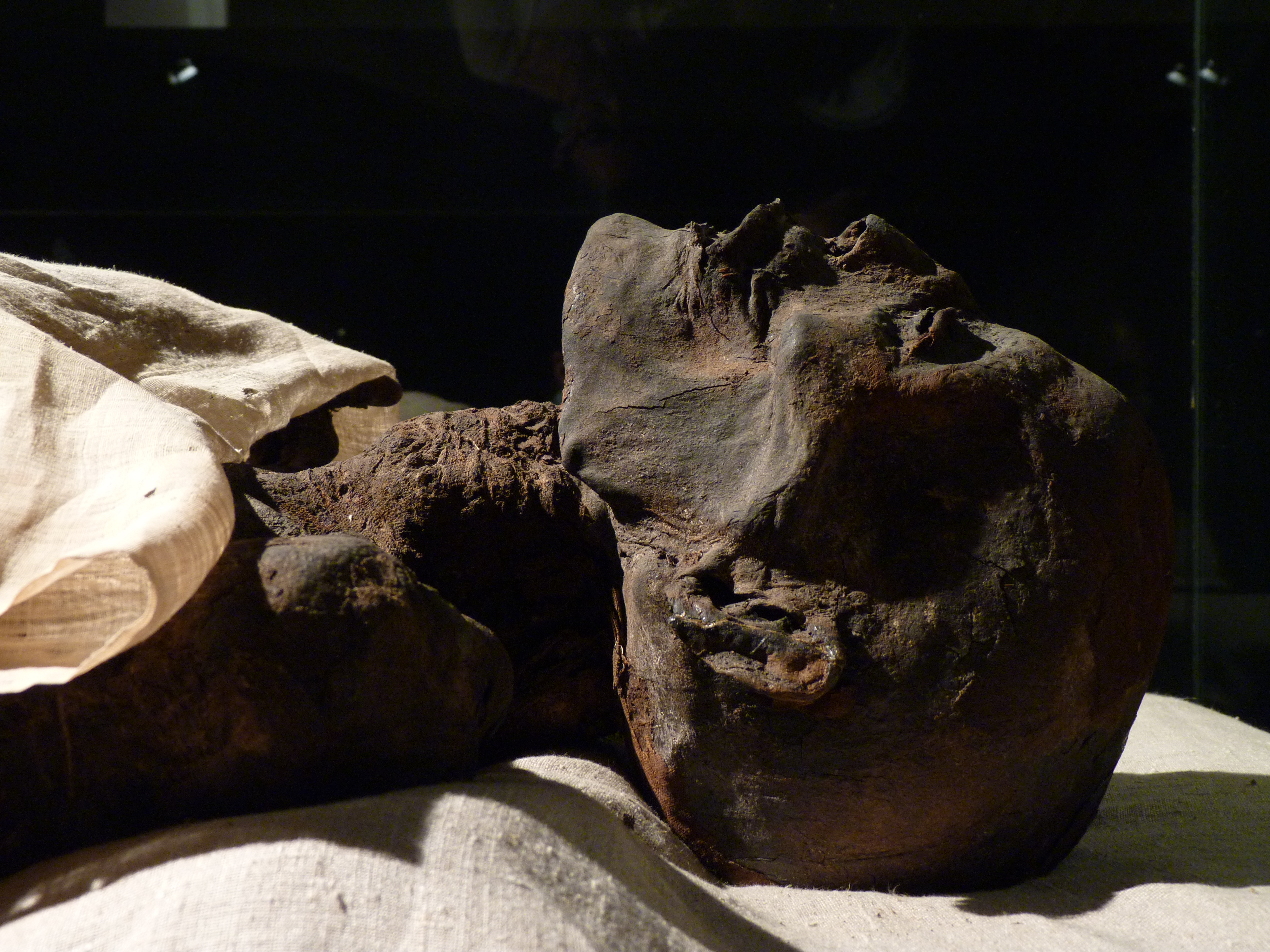
A mummy is a dead human or an animal whose soft tissues and Organ (biology), organs have been preserved by either intentional or accidental exposure to Chemical substance, chemicals, extreme cold, very low humidity, or lack of air, so that the recovered body does not Corpse decomposition, decay further if kept in cool and dry conditions. Some authorities restrict the use of the term to bodies deliberately embalming, embalmed with chemicals, but the use of the word to cover accidentally desiccation, desiccated bodies goes back to at least the early 17th century. Mummies of humans and animals have been found on every continent, both as a result of natural preservation through unusual conditions, and as cultural artifacts. Over one million Animal mummy, animal mummies have been found in Egypt, many of which are cats. Many of the Egyptian animal mummies are African sacred ibis, sacred ibis, and radiocarbon dating suggests the Egyptian ibis mummies that have been analyzed were from ... [...More Info...] [...Related Items...] OR: [Wikipedia] [Google] [Baidu] |
Mount Charleston Wilderness
The Mount Charleston Wilderness Area is located west of Las Vegas, Nevada, Las Vegas in the southern part of the state of Nevada in the western United States. It was created by the Congress of the United States, U.S. Congress in 1989 under the provisions allowed by the Wilderness Act of 1964, and is managed by both the Bureau of Land Management and the United States Forest Service, U.S. Forest Service. Geography The Mount Charleston Wilderness Area consists of a total of of protected wilderness, with the BLM managing and the rest by the U.S. Forest Service. The Wilderness Area extends across the entire Spring Mountains Range, including the highest point of Mount Charleston (Charleston Peak), at an elevation of . Habitat * The Mount Charleston Wilderness Area is also home to around of Bristlecone pine and is the largest collection of these trees in the Intermountain Region of the United States. * The area also provides the only habitat for the only herd of Elk, Rocky Mountai ... [...More Info...] [...Related Items...] OR: [Wikipedia] [Google] [Baidu] |
Clark County, Nevada
Clark County is the most populous County (United States), county in the U.S. state of Nevada with 2,265,461 residents as of the 2020 United States census, 2020 census. The county is the location of the state's three largest cities, Las Vegas (the county seat), Henderson, Nevada, Henderson, and North Las Vegas, Nevada, North Las Vegas, as well as the Las Vegas Strip, Nellis Air Force Base, and Hoover Dam. Clark County has of land area, roughly the size of New Jersey. Although the county has 70% of Nevada's population making it the List of the most populous counties in the United States, 11th-most populous county in the United States, Clark County covers only 7% of Nevada's land mass. Despite having the name ''Las Vegas'' as part of their address, over 1 million residents live in Unincorporated towns in Nevada, unincorporated Clark County, with municipal services provided by the county. The county plays a role much larger than is typical in the US as it has direct jurisdiction ov ... [...More Info...] [...Related Items...] OR: [Wikipedia] [Google] [Baidu] |
Mountain
A mountain is an elevated portion of the Earth's crust, generally with steep sides that show significant exposed bedrock. Although definitions vary, a mountain may differ from a plateau in having a limited summit area, and is usually higher than a hill, typically rising at least above the surrounding land. A few mountains are inselberg, isolated summits, but most occur in mountain ranges. mountain formation, Mountains are formed through tectonic plate, tectonic forces, erosion, or volcanism, which act on time scales of up to tens of millions of years. Once mountain building ceases, mountains are slowly leveled through the action of weathering, through Slump (geology), slumping and other forms of mass wasting, as well as through erosion by rivers and glaciers. High elevations on mountains produce Alpine climate, colder climates than at sea level at similar latitude. These colder climates strongly affect the Montane ecosystems, ecosystems of mountains: different elevations hav ... [...More Info...] [...Related Items...] OR: [Wikipedia] [Google] [Baidu] |
Scrambling
Scrambling is a mountaineering term for ascending steep terrain using one's hands to assist in holds and balance.''New Oxford American Dictionary''. It can be described as being between hiking and climbing, rock climbing. "A scramble" is a related term, denoting terrain that could be ascended in this way. Sure-footedness and a head for heights are essential. Canyoning and stream climbing both involve scrambling. Overview Scrambling is ascending or traversing a grade without technical apparatus. Unroped ascent in exposure (heights), exposed situations is potentially one of the most dangerous of mountaineering activities. As soon as an ascent involves a rope, going up or down, it is no longer a scramble. Alpine scrambling Alpine scrambling is scrambling in high mountains and may not follow a defined or waymarked path. The Seattle Mountaineers climbing organization defines alpine scrambling as follows: Alpine Scrambles are off-trail trips, often on snow or rock, with a 'non-t ... [...More Info...] [...Related Items...] OR: [Wikipedia] [Google] [Baidu] |


