|
Multi-cellular Thunderstorm
A multicellular thunderstorm cluster is a thunderstorm that is composed of multiple convective cells, each being at a different stage in the life cycle of a thunderstorm. It appears as several anvils clustered together. A cell is an updraft/downdraft couplet. These different cells will dissipate as new cells form and continue the life of the multicellular thunderstorm cluster with each cell taking a turn as the dominant cell in the group. Description The formation of multicellular thunderstorms imply that the updraft in the mother thunderstorm is offset from its downdraft. New cells usually form in the upwind (usually western or southwestern) part of the storm where the downdrafts of the mature cells meet the environmental wind, lifting air parcels and triggering new convection. The mature cells are thus usually in the center of the storm, and dissipating cells are usually in the downwind (usually eastern or northeastern) part of the storm. Characteristics The multicellular c ... [...More Info...] [...Related Items...] OR: [Wikipedia] [Google] [Baidu] |
Cumulonimbus
Cumulonimbus () is a dense, towering, vertical cloud, typically forming from water vapor condensing in the lower troposphere that builds upward carried by powerful buoyant air currents. Above the lower portions of the cumulonimbus the water vapor becomes ice crystals, such as snow and graupel, the interaction of which can lead to hail and to lightning formation, respectively. When causing thunderstorms, these clouds may be called thunderheads. Cumulonimbus can form alone, in clusters, or along squall lines. These clouds are capable of producing lightning and other dangerous severe weather, such as tornadoes, hazardous winds, and large hailstones. Cumulonimbus progress from overdeveloped cumulus congestus clouds and may further develop as part of a supercell. Cumulonimbus is abbreviated as Cb. Description Towering cumulonimbus clouds are typically accompanied by smaller cumulus clouds. The cumulonimbus base may extend several kilometres (miles) across, or be as small as ... [...More Info...] [...Related Items...] OR: [Wikipedia] [Google] [Baidu] |
Outflow Boundary
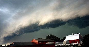
An outflow boundary, also known as a gust front, is a storm-scale or mesoscale meteorology, mesoscale boundary separating thunderstorm-cooled air (Outflow (meteorology), outflow) from the surrounding air; similar in effect to a cold front, with passage marked by a wind shift and usually a drop in temperature and a related pressure jump. Outflow boundaries can persist for 24 hours or more after the thunderstorms that generated them dissipate, and can travel hundreds of kilometers from their area of origin. New thunderstorms often develop along outflow boundaries, especially near the point of intersection with another boundary (cold front, dry line, another outflow boundary, etc.). Outflow boundaries can be seen either as fine lines on weather radar imagery or else as arcs of low clouds on weather satellite imagery. From the ground, outflow boundaries can be co-located with the appearance of roll clouds and shelf clouds. Outflow boundaries create low-level wind shear which can be ... [...More Info...] [...Related Items...] OR: [Wikipedia] [Google] [Baidu] |
Skywarn
Skywarn (sometimes stylized as SKYWARN) is a program of the National Weather Service (NWS). Its mission is to collect reports of localized severe weather in the United States. These reports are used to aid forecasters in issuing and verifying severe weather watches and warnings and to improve the forecasting and warning processes and the tools used to collect meteorological data. Reports are also used by local emergency managers and public safety organizations. Skywarn consists of a network of severe storm spotters who observe weather conditions and make reports of severe weather to their local NWS offices. These spotters are regularly trained by personnel from the local NWS offices. In many areas, classes are conducted each spring in advance of the coming severe weather season. Many Skywarn spotters use methods to communicate with one another during severe storm events. A notable example of this is through the use of amateur radio nets, which is still an important method sinc ... [...More Info...] [...Related Items...] OR: [Wikipedia] [Google] [Baidu] |
Supercell
A supercell is a thunderstorm characterized by the presence of a mesocyclone, a deep, persistently rotating updraft. Due to this, these storms are sometimes referred to as rotating thunderstorms. Of the four classifications of thunderstorms (supercell, squall line, multi-cell, and single-cell), supercells are the overall least common and have the potential to be the most severe. Supercells are often isolated from other thunderstorms, and can dominate the local weather up to away. They tend to last 2–4 hours. Supercells are often put into three classification types: classic (normal precipitation level), low-precipitation (LP), and high-precipitation (HP). LP supercells are usually found in climates that are more arid, such as the high plains of the United States, and HP supercells are most often found in moist climates. Supercells can occur anywhere in the world under the right pre-existing weather conditions, but they are most common in the Great Plains of the United State ... [...More Info...] [...Related Items...] OR: [Wikipedia] [Google] [Baidu] |
Pulse Storm
A pulse storm is a single cell thunderstorm of substantial intensity which only produces severe weather for short periods of time. Such a storm weakens and then generates another short burst – hence "pulse". The term was coined by researchers at the National Severe Storms Laboratory in 1979 to describe a single storm cell briefly becoming severe within a cluster of multi-cellular thunderstorms, but has since been used to describe a variety of isolated and brief thunderstorms with both severe and non-severe characteristics. __TOC__ Description Single cell thunderstorms ordinarily form in environments with low wind shear and moderate instability, with the low wind shear contributing to a short average lifespan of less than an hour. When the instability, calculated by convective available potential energy (CAPE), is strong, the updraft will bring a larger amount of humid air very high above ground and generate a cumulonimbus cloud with high water and ice content. When the rain con ... [...More Info...] [...Related Items...] OR: [Wikipedia] [Google] [Baidu] |
Derecho
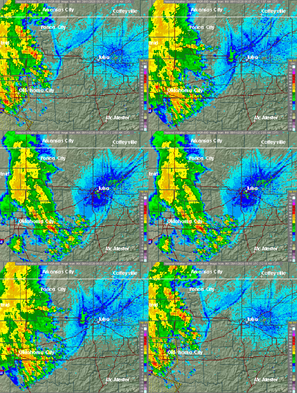
A ''derecho'' (, from , 'straight') is a widespread, long-lived, straight-line wind storm that is associated with a fast-moving group of Severe weather#Categories, severe thunderstorms known as a mesoscale convective system. Derechos cause Beaufort scale, hurricane-force winds, heavy rains, and flash floods. In many cases, convection-induced winds take on a bow echo (backward "C") form of squall line, often forming beneath an area of diverging upper troposphere, tropospheric winds, and in a region of both rich low-level moisture and Thermal wind#Advection turning, warm-air advection. Derechos move rapidly in the direction of movement of their associated storms, similar to an outflow boundary (gust front), except that the wind remains maximum sustained wind, sustained for a greater period of time (often increasing in strength after onset), and may reach tornado- and hurricane-force winds. A derecho-producing convective system may remain active for many hours and, occasionally, ov ... [...More Info...] [...Related Items...] OR: [Wikipedia] [Google] [Baidu] |
Outflow (meteorology)
Outflow, in meteorology, is air that flows outwards from a storm system. It is associated with ridging, or anticyclone, anticyclonic flow. In the low levels of the troposphere, outflow radiates from thunderstorms in the form of a wedge of rain-cooled air, which is visible as a thin rope-like cloud on weather satellite imagery or a fine line on weather radar imagery. For observers on the ground, a thunderstorm outflow boundary often approaches in otherwise clear skies as a low, thick cloud that brings with it a gust front. Low-level outflow boundaries can disrupt the center of small tropical cyclones. However, outflow aloft is essential for the strengthening of a tropical cyclone. If this outflow is restricted or undercut, the tropical cyclone weakens. If two tropical cyclones are close, the upper-level outflow from the upwind system can limit the development of the other system. Thunderstorms For thunderstorms, outflow tends to indicate the development of a system. Large quan ... [...More Info...] [...Related Items...] OR: [Wikipedia] [Google] [Baidu] |
Squall Line
A squall line, or quasi-linear convective system (QLCS), is a line of thunderstorms, often forming along or ahead of a cold front. In the early 20th century, the term was used as a synonym for cold front (which often are accompanied by abrupt and gusty wind shifts). Linear thunderstorm structures often contain heavy precipitation, hail, frequent lightning, strong straight-line winds, and occasionally tornadoes or waterspouts. Particularly strong straight-line winds can occur where the linear structure forms into the shape of a bow echo. Tornadoes can occur along waves within a line echo wave pattern (LEWP), where mesoscale low-pressure areas are present. Some bow echoes can grow to become derechos as they move swiftly across a large area. On the back edge of the rainband associated with mature squall lines, a wake low can be present, on very rare occasions associated with a heat burst. Theory Polar front theory was developed by Jacob Bjerknes, derived from a dense netwo ... [...More Info...] [...Related Items...] OR: [Wikipedia] [Google] [Baidu] |
Mesoscale Convective System
A mesoscale convective system (MCS) is a complex of thunderstorms that becomes organized on a scale larger than the individual thunderstorms but smaller than extratropical cyclones, and normally persists for several hours or more. A mesoscale convective system's overall cloud and precipitation pattern may be round or linear in shape, and include weather systems such as tropical cyclones, squall lines, lake-effect snow events, polar lows, and mesoscale convective complexes (MCCs), and generally forms near weather fronts. The type that forms during the warm season over land has been noted across North and South America, Europe, and Asia, with a maximum in activity noted during the late afternoon and evening hours. Forms of MCS that develop within the tropics use either the Intertropical Convergence Zone (ITCZ) or monsoon troughs as a focus for their development, generally within the warm season between spring and fall. One exception is that of lake-effect snow bands, which form due ... [...More Info...] [...Related Items...] OR: [Wikipedia] [Google] [Baidu] |
Wind Shear
Wind shear (; also written windshear), sometimes referred to as wind gradient, is a difference in wind speed and/or direction over a relatively short distance in the atmosphere. Atmospheric wind shear is normally described as either vertical or horizontal wind shear. Vertical wind shear is a change in wind speed or direction with a change in altitude. Horizontal wind shear is a change in wind speed with a change in lateral position for a given altitude. Wind shear is a microscale meteorological phenomenon occurring over a very small distance, but it can be associated with mesoscale or synoptic scale weather features such as squall lines and cold fronts. It is commonly observed near microbursts and downbursts caused by thunderstorms, fronts, areas of locally higher low-level winds referred to as low-level jets, near mountains, radiation inversions that occur due to clear skies and calm winds, buildings, wind turbines, and sailboats. Wind shear has significant effects on ... [...More Info...] [...Related Items...] OR: [Wikipedia] [Google] [Baidu] |
Rain
Rain is a form of precipitation where water drop (liquid), droplets that have condensation, condensed from Water vapor#In Earth's atmosphere, atmospheric water vapor fall under gravity. Rain is a major component of the water cycle and is responsible for depositing most of the fresh water on the Earth. It provides water for hydroelectricity, hydroelectric power plants, crop irrigation, and suitable conditions for many types of ecosystems. The major cause of rain production is moisture moving along three-dimensional zones of temperature and moisture contrasts known as weather fronts. If enough moisture and upward motion is present, precipitation falls from convection, convective clouds (those with strong upward vertical motion) such as cumulonimbus (thunder clouds) which can organize into narrow rainbands. In mountainous areas, heavy precipitation is possible where upslope flow is maximized within windward sides of the terrain at elevation which forces moist air to condense and ... [...More Info...] [...Related Items...] OR: [Wikipedia] [Google] [Baidu] |


