|
Mughal Maidan
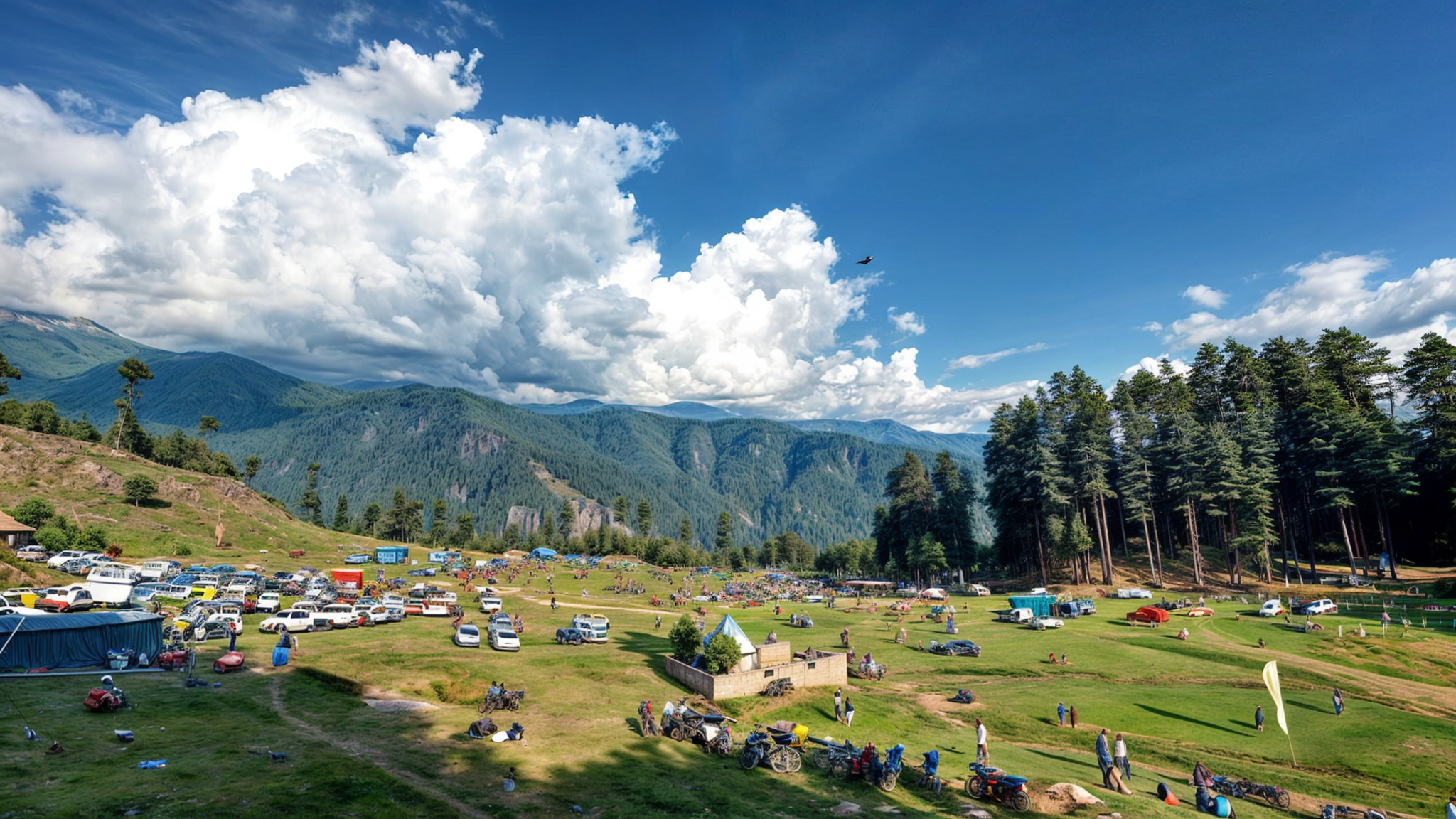
Mughal Maidan is a tehsil in the Kishtwar district of the Jammu and Kashmir union territory, India. It is situated about 22 kilometers from the town of Kishtwar and lies on the banks of the Chatroo river. History Mughal Maidan is historically notable as a site where the Mughals reportedly fought a battle against Kishtwar's rulers while advancing via Sinthan and Singhpora passes. The area has a legacy associated with the Mughal period, lending it historical and cultural importance. Geography Mughal Maidan is located at an elevation of approximately 1,500 meters (4,921 feet). The village serves as the starting point for a scenic trek to the Kashmir Valley via the Singhpora pass, which culminates at Vailo near Kokarnag. The trek passes through mountainous terrain, reaching a height of 11,570 feet (3,527 meters). Demographics As per the 2011 Census of India, Mughal Maidan has a population of 25,827 residing in 5,773 households. It is part of a block that includes 15 panchayats ... [...More Info...] [...Related Items...] OR: [Wikipedia] [Google] [Baidu] |
Chenab Valley
The Chenab River is a major river in India and Pakistan, and is one of the 5 major rivers of the Punjab region. It is formed by the union of two headwaters, the Chandra and Bhaga, which rise in the upper Himalayas in the Lahaul region of Himachal Pradesh, India. The Chenab flows then through the Jammu region of Jammu and Kashmir, India into the plains of Punjab, Pakistan, where it joins the Sutlej River to form the Panjnad, which ultimately flows into the Indus River at Mithankot. The waters of the Chenab were allocated to Pakistan under the terms of the Indus Waters Treaty. India is allowed non-consumptive uses such as power generation. The Chenab River is extensively used in Pakistan for irrigation. Its waters are also transferred to the channel of the Ravi River via numerous link canals. Name The Chenab river was called ' () in the Rigveda (VIII.20.25, X.75.5). The name meant that it was seen to have dark-coloured waters. The term Krishana is also found in the Atharv ... [...More Info...] [...Related Items...] OR: [Wikipedia] [Google] [Baidu] |
Kishtwar District
Kishtwar district is an administrative district of the Jammu division of Indian-administered Jammu and Kashmir of the disputed Kashmir region.The application of the term "administered" to the various regions of Kashmir and a mention of the Kashmir dispute is supported by the tertiary sources (a) through (d), reflecting due weight in the coverage. Although "controlled" and "held" are also applied neutrally to the names of the disputants or to the regions administered by them, as evidenced in sources (f) through (h) below, "held" is also considered politicized usage, as is the term "occupied," (see (i) below). (a) (subscription required) Quote: "Kashmir, region of the northwestern Indian subcontinent ... has been the subject of dispute between India and Pakistan since the partition of the Indian subcontinent in 1947. The northern and western portions are administered by Pakistan and comprise three areas: Azad Kashmir, Gilgit, and Baltistan, the last two being part of a terr ... [...More Info...] [...Related Items...] OR: [Wikipedia] [Google] [Baidu] |
Jammu And Kashmir (union Territory)
Jammu and Kashmir ( J&K) is a region administered by India as a union territory and consists of the southern portion of the larger Kashmir region, which has been the subject of a Kashmir#Kashmir dispute, dispute between India and Pakistan since 1947 and between India and China since 1959.The application of the term "administered" to the various regions of Kashmir and a mention of the Kashmir dispute is supported by the WP:TERTIARY, tertiary sources (a) through (e), reflecting WP:DUE, due weight in the coverage. Although "controlled" and "held" are also applied neutrally to the names of the disputants or to the regions administered by them, as evidenced in sources (h) through (i) below, "held" is also considered politicised usage, as is the term "occupied", (see (j) below). (a) (subscription required) Quote: "Kashmir, region of the northwestern Indian subcontinent ... has been the subject of dispute between India and Pakistan since the partition of the Indian subcontinent in 1 ... [...More Info...] [...Related Items...] OR: [Wikipedia] [Google] [Baidu] |
India
India, officially the Republic of India, is a country in South Asia. It is the List of countries and dependencies by area, seventh-largest country by area; the List of countries by population (United Nations), most populous country since 2023; and, since its independence in 1947, the world's most populous democracy. Bounded by the Indian Ocean on the south, the Arabian Sea on the southwest, and the Bay of Bengal on the southeast, it shares land borders with Pakistan to the west; China, Nepal, and Bhutan to the north; and Bangladesh and Myanmar to the east. In the Indian Ocean, India is near Sri Lanka and the Maldives; its Andaman and Nicobar Islands share a maritime border with Thailand, Myanmar, and Indonesia. Modern humans arrived on the Indian subcontinent from Africa no later than 55,000 years ago., "Y-Chromosome and Mt-DNA data support the colonization of South Asia by modern humans originating in Africa. ... Coalescence dates for most non-European populations averag ... [...More Info...] [...Related Items...] OR: [Wikipedia] [Google] [Baidu] |
Kishtwar
Kishtwar is a town, municipality and administrative headquarter of the Kishtwar district in the Indian-administered Jammu and Kashmir. The district was carved out of the Doda district in 2007. and is located in the Jammu division. The town of Kishtwar is situated at a distance of from the summer capital of Srinagar, and from the winter capital of Jammu. A large ground locally called as Chowgan ground is located in the heart of the town. The old name of Kishtwar was "Kashtvatha" as mentioned in Rajtarangni of Kalhana Pandita written in 1148 CE. In 2013, the municipality was the location of the Kishtwar Riots, which claimed three lives and injured 80 more, and was a conflict between Muslim and Hindu communities that occurred in the aftermath of the Eid festival on 9 August 2013 at Kishtwar, Jammu and Kashmir. Demographics As of the 2011 Indian census, Kishtwar had a population of 14,865. Males constitute 63% of the population and females 37%. Kishtwar has an average ... [...More Info...] [...Related Items...] OR: [Wikipedia] [Google] [Baidu] |
Sinthan Top
Sinthan Top is a mountain pass, a popular tourist destination located in Kishtwar district and borders with South Kashmir's Breng Valley (Sub-District Kokernag) of Anantnag district in the Indian union territory of Jammu and Kashmir. Majority of the area lies on the Kishtwar side. The top acts as a sort of base camp to several alpine lakes in the region. Location The Sinthan pass connects Anantnag with Kishtwar and is the only road that connects the people of Warwan and Marwah (Marye) of Kishtwar district with district headquarters in Kishtwar town. It is above sea level and is snow-capped for most of the year. It is located on the Anantnag–Kokernag–Kishtwar section of NH 244, and is 80 km from Kishtwar town, 130 km south of Srinagar and 73 km from Anantnag and 48 km from Kokernag. Sinthan Top has no local population. Shepherds from adjoining places like Kokernag, Daksum, and tourists and those working in the tourism industry may stay overnight in ... [...More Info...] [...Related Items...] OR: [Wikipedia] [Google] [Baidu] |
Kokarnag
Kokernag ( ; ) is a sub-district, town and a Nagar Panchayat (Notified Area Council), notified area committee in the Breng Valley (also known as the Golden Crown of Kashmir) of Anantnag district in the Indian union territory of Jammu and Kashmir (union territory), Jammu and Kashmir. The place is known for its botanical gardens, pristine freshwater springs, and rainbow trout farm. It is 25.3 km from Anantnag District via NH244. It is one of the most popular weekend getaways from the state capital of Srinagar. Etymology The etymology of the word 'Kokernag' () is controversial and there are various theories, none of which has any conclusive historical proof. One theory is that the name derives from the two words ''koker'' and ''nag''. ''Koker'' has been taken from a Kashmiri language, Kashmiri word for chicken, while ''nag'' has been taken from a Sanskrit language, Sanskrit word for springs. The springs gush out of the base of a thickly wooded hill from where it divides into channe ... [...More Info...] [...Related Items...] OR: [Wikipedia] [Google] [Baidu] |


