|
Muckish Mountain
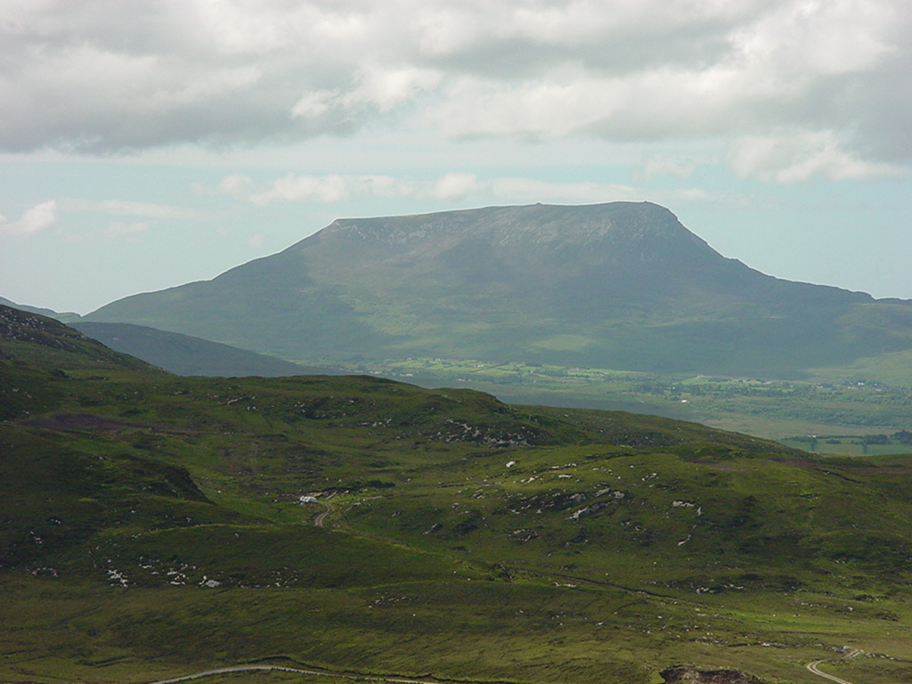
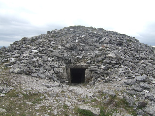
Muckish () is a distinctive flat-topped mountain in the Derryveagh Mountains of County Donegal, Ireland. At , it is the third-highest peak in the Derryveagh Mountains and the 163rd highest in Ireland. Muckish is also the most northern and second highest of the mountain chain called the " Seven Sisters" by locals. The Seven Sisters are Muckish, Crocknalaragagh, Aghla Beg, Ardloughnabrackbaddy, Aghla More, Mackoght, and Errigal. Overview High-grade quartz sand was mined on the flanks of the mountain; the remains of the quarry workings can be seen on its northern side. The "Miner's Path" is a route to the summit up the northern side of the mountain. Part of this route follows the path used by the workers to reach the quarry. The sand was exported and was mainly used in the manufacture of optical glass. A less difficult route to the summit begins from the Muckish Gap on the southern side of the mountain. A large cairn (man-made mound of stones), visible from sea level, can be ... [...More Info...] [...Related Items...] OR: [Wikipedia] [Google] [Baidu] |
Marilyn (hill)
This is a list of Marilyn hills and mountains in the United Kingdom, Republic of Ireland, Ireland and surrounding islands and Stack (geology), sea stacks. Lists of mountains and hills in the British Isles#Marilyns, Marilyns are defined as peaks with a topographic prominence, prominence of or more, regardless of height or any other merit (e.g. topographic isolation, as used in Lists of mountains and hills in the British Isles#Munros, Munros). Thus, Marilyns can be mountains, with a height above , or relatively small hills. there were 2,010 recorded Marilyns. Definition The Marilyn classification was created by Alan Dawson in his 1992 book ''The Relative Hills of Britain''. The name Marilyn was coined by Dawson as a punning contrast to the ''Munro'' classification of Scottish mountains above , but which has no explicit prominence threshold, being homophone, homophonous with (Marilyn) ''Marilyn Monroe, Monroe''. The list of Marilyns was extended to Ireland by Clem Clements. Ma ... [...More Info...] [...Related Items...] OR: [Wikipedia] [Google] [Baidu] |
Errigal
Errigal () is a mountain near Gweedore in County Donegal, Ireland. It is the tallest peak of the Derryveagh Mountains and the tallest peak in County Donegal. Errigal is also the most southern and the highest of the mountain chain called the " Seven Sisters" by locals. The other peaks of the Seven Sisters are Muckish, Crocknalaragagh, Aghla Beg, Ardloughnabrackbaddy, Aghla More, and Mackoght. Geography Errigal is the most southern, steepest and highest of the mountain chain, called the " Seven Sisters". The Seven Sisters includes Muckish, Crocknalaragagh, Aghla Beg, Ardloughnabrackbaddy, Aghla More, Mackoght and Errigal. The nearest peak is Mackoght (from Irish: Mac Uchta, meaning "son of the mountain-breast") which is also known as Little Errigal or Wee Errigal (). Errigal is known for the pinkish glow of its quartzite in the setting sun. Another noted quality is the ever-changing shape of the mountain depending on what direction you view it from. Errigal was ... [...More Info...] [...Related Items...] OR: [Wikipedia] [Google] [Baidu] |
Mountains And Hills Of County Donegal
A mountain is an elevated portion of the Earth's crust, generally with steep sides that show significant exposed bedrock. Although definitions vary, a mountain may differ from a plateau in having a limited summit area, and is usually higher than a hill, typically rising at least above the surrounding land. A few mountains are isolated summits, but most occur in mountain ranges. Mountains are formed through tectonic forces, erosion, or volcanism, which act on time scales of up to tens of millions of years. Once mountain building ceases, mountains are slowly leveled through the action of weathering, through slumping and other forms of mass wasting, as well as through erosion by rivers and glaciers. High elevations on mountains produce colder climates than at sea level at similar latitude. These colder climates strongly affect the ecosystems of mountains: different elevations have different plants and animals. Because of the less hospitable terrain and climate, mountains te ... [...More Info...] [...Related Items...] OR: [Wikipedia] [Google] [Baidu] |
Marilyns Of Ireland
This is a list of Marilyn hills and mountains in the United Kingdom, Ireland and surrounding islands and sea stacks. Marilyns are defined as peaks with a prominence of or more, regardless of height or any other merit (e.g. topographic isolation, as used in Munros). Thus, Marilyns can be mountains, with a height above , or relatively small hills. there were 2,010 recorded Marilyns. Definition The Marilyn classification was created by Alan Dawson in his 1992 book ''The Relative Hills of Britain''. The name Marilyn was coined by Dawson as a punning contrast to the ''Munro'' classification of Scottish mountains above , but which has no explicit prominence threshold, being homophonous with (Marilyn) '' Monroe''. The list of Marilyns was extended to Ireland by Clem Clements. Marilyn was the first of several subsequent British Isles classifications that rely solely on prominence, including the P600s, the HuMPs, and the TuMPs. Topographic prominence is more difficult to est ... [...More Info...] [...Related Items...] OR: [Wikipedia] [Google] [Baidu] |
Horn Head
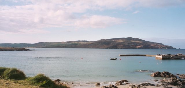
Horn Head () is a peninsula in northwest County Donegal, Ireland, close to Dunfanaghy. It forms part of Sheephaven Bay. Archeological significance Horn Head has many remains of Neolithic stone circles, court tombs, passage tombs and prehistoric field boundaries. Natural Heritage Area Horn Head cliffs rise straight out of the water to a height of about on the ocean side of the peninsula. They are an internationally important colony for breeding seabirds. Species include the European shag and the razorbill. It is designated as an Irish Natural Heritage Area and as a refuge for fauna specifically seabirds. Horn Head cliffs are also designated a Special Protection Area and a Special Area of Conservation by the Irish government. McSwyne's Gun McSwyne's Gun is a blow hole on the west side of the peninsula. Previously, during storms, water could be forced through it to a height of with a noise that could be heard away. Although still functional, it is not as spectacular an ... [...More Info...] [...Related Items...] OR: [Wikipedia] [Google] [Baidu] |
Percy French
William Percy French (1 May 1854 – 24 January 1920) was an Irish songwriter, author, poet, entertainer and painter. Life French was born at Clooneyquinn House, near Tulsk, County Roscommon, the son of an Anglo-Irish landlord, Christopher French, and Susan Emma French (née Percy). He was the third of nine children. His younger sister, Emily later Emily de Burgh Daly was also a writer. He was educated in England at Kirk Langley and Windermere College before going to Foyle College in Derry and wrote his first successful song while studying at Trinity College Dublin (TCD) in 1877 for a smoking concert. The song, " Abdul Abulbul Amir", was published in 200 copies for £5 and French sold each copy for 2s6d, making a small fortune. However, he fatally omitted to register the copyright on the song and lost all the subsequent income from the royalties as it was re-published without his name. The royalties were restored to his widow and daughters after his death. The song later b ... [...More Info...] [...Related Items...] OR: [Wikipedia] [Google] [Baidu] |
Creeslough
Creeslough ( , locally ; ) is a village in County Donegal, Ireland, south of Dunfanaghy on the N56 road (Ireland), N56 road. It overlooks an arm of Sheephaven Bay, with the population of the surrounding area engaged mainly in agriculture, mostly livestock rearing. Name The English name 'Creeslough' (occasionally 'Cresslough') is an anglicisation, anglicised respelling of an Irish name, the modern official spelling of which is (including the definite article ). According to the Placenames Database of Ireland, this means "the gorge". Under the Official Languages Act 2003, only the Irish name of Creeslough Electoral division (Ireland), electoral division has official status, because part of it is in the Gaeltacht, whereas Creeslough village is outside the Gaeltacht and its English name has equal status. is usually interpreted as +; where means "lake", while literally means "gullet, throat" and metaphorically can mean either a gap or gluttony. In the 1830s, John O'Donovan (sc ... [...More Info...] [...Related Items...] OR: [Wikipedia] [Google] [Baidu] |
Dunfanaghy
Dunfanaghy () is a small town, former fishing port, and commercial centre on the north coast of County Donegal, Ireland. It lies on Donegal's North West coast, specifically the west side of Sheephaven Bay, on the N56 road (the West Donegal Coastal Route), 30 km north-west of Letterkenny. Description The centre of Dunfanaghy is a small square with a market house built in 1847 and a quay built in 1831 and formerly used to export corn. There are four churches: the early 17th-century Clondehorky Old Church (now ruined), constructed during the Plantation of Ulster; Dunfanaghy Presbyterian Church; Holy Cross Church (Catholic and known locally as 'the Chapel'); and Holy Trinity Church of Ireland Church. The village is also home to a golf club, several art galleries and craft shops, and a museum, situated in part of a former workhouse, which describes the effects of the Great Famine on Dunfanaghy. Dunfanaghy is also home to St Michael's GAA, a Gaelic football club. Local are ... [...More Info...] [...Related Items...] OR: [Wikipedia] [Google] [Baidu] |
Falcarragh
''An Fál Carrach'' (anglicised as Falcarragh), sometimes called ('the Crossroads'), is a small ''Gaeltacht'' town and townland in the north-west of County Donegal, Ireland. The settlement is in the district and old parish of Cloughaneely. Irish language According to the 2016 census, of the 1,329 people over the age of 3 living in electoral division, 70% of the population are able to speak Irish while 34% claim to speak the language on a daily basis outside the education system. Etymology The name Falcarragh (lit. An (the) Fál (Wall) Carrach (Stone), ''Stone Wall / Boundary'') has been used since 1850, ascribed so by O'Donovan as he believed , meaning 'the Crossroads', was too common in Ireland to allow distinction. is still used by local native Irish speakers when referring to the town. On some maps it shows up as 'Crossroads', deriving from its Irish language name , but older maps refer to it as Robinson's Town; however, it is now officially listed as . Falcarragh, the ... [...More Info...] [...Related Items...] OR: [Wikipedia] [Google] [Baidu] |
Cairn
A cairn is a human-made pile (or stack) of stones raised for a purpose, usually as a marker or as a burial mound. The word ''cairn'' comes from the (plural ). Cairns have been and are used for a broad variety of purposes. In prehistory, they were raised as markers, as memorials and as burial monuments (some of which Chambered cairn, contained chambers). In the modern era, cairns are often raised as landmarks, especially to mark the summits of mountains, and as Trail blazing, trail markers. They vary in size from small piles of stones to entire artificial hills, and in complexity from loose conical rock piles to elaborate megalithic structures. Cairns may be painted or otherwise decorated, whether for increased visibility or for religious reasons. History Europe The building of cairns for various purposes goes back into prehistory in Eurasia, ranging in size from small rock sculptures to substantial human-made hills of stone (some built on top of larger, natural hills). ... [...More Info...] [...Related Items...] OR: [Wikipedia] [Google] [Baidu] |
Quartz
Quartz is a hard, crystalline mineral composed of silica (silicon dioxide). The Atom, atoms are linked in a continuous framework of SiO4 silicon–oxygen Tetrahedral molecular geometry, tetrahedra, with each oxygen being shared between two tetrahedra, giving an overall chemical formula of Silicon dioxide, SiO2. Quartz is, therefore, classified structurally as a Silicate mineral#Tectosilicates, framework silicate mineral and compositionally as an oxide mineral. Quartz is the second most abundant mineral in Earth's continental crust, behind feldspar. Quartz exists in two forms, the normal α-quartz and the high-temperature β-quartz, both of which are chiral. The transformation from α-quartz to β-quartz takes place abruptly at . Since the transformation is accompanied by a significant change in volume, it can easily induce microfracturing of ceramics or rocks passing through this temperature threshold. There are many different varieties of quartz, several of which are classifi ... [...More Info...] [...Related Items...] OR: [Wikipedia] [Google] [Baidu] |
Mackoght
Mackoght or Macoght (), also called Little Errigal or Wee Errigal (), is a high mountain in County Donegal, Ireland. Geography The mountain is the second most southern and second lowest of the mountain chain called the '' Seven Sisters'' by locals. The Seven Sisters are Muckish, Crocknalaragagh, Aghla Beg, Ardloughnabrackbaddy, Aghla More, Mackoght and Errigal. The Seven Sisters are part of the Derryveagh Mountains. Mackoght is also the 351st tallest peak in Ireland Ireland (, ; ; Ulster Scots dialect, Ulster-Scots: ) is an island in the North Atlantic Ocean, in Northwestern Europe. Geopolitically, the island is divided between the Republic of Ireland (officially Names of the Irish state, named Irelan .... References {{Mountains and hills of Ulster Marilyns of Ireland Mountains and hills of County Donegal ... [...More Info...] [...Related Items...] OR: [Wikipedia] [Google] [Baidu] |


