|
Moz Town
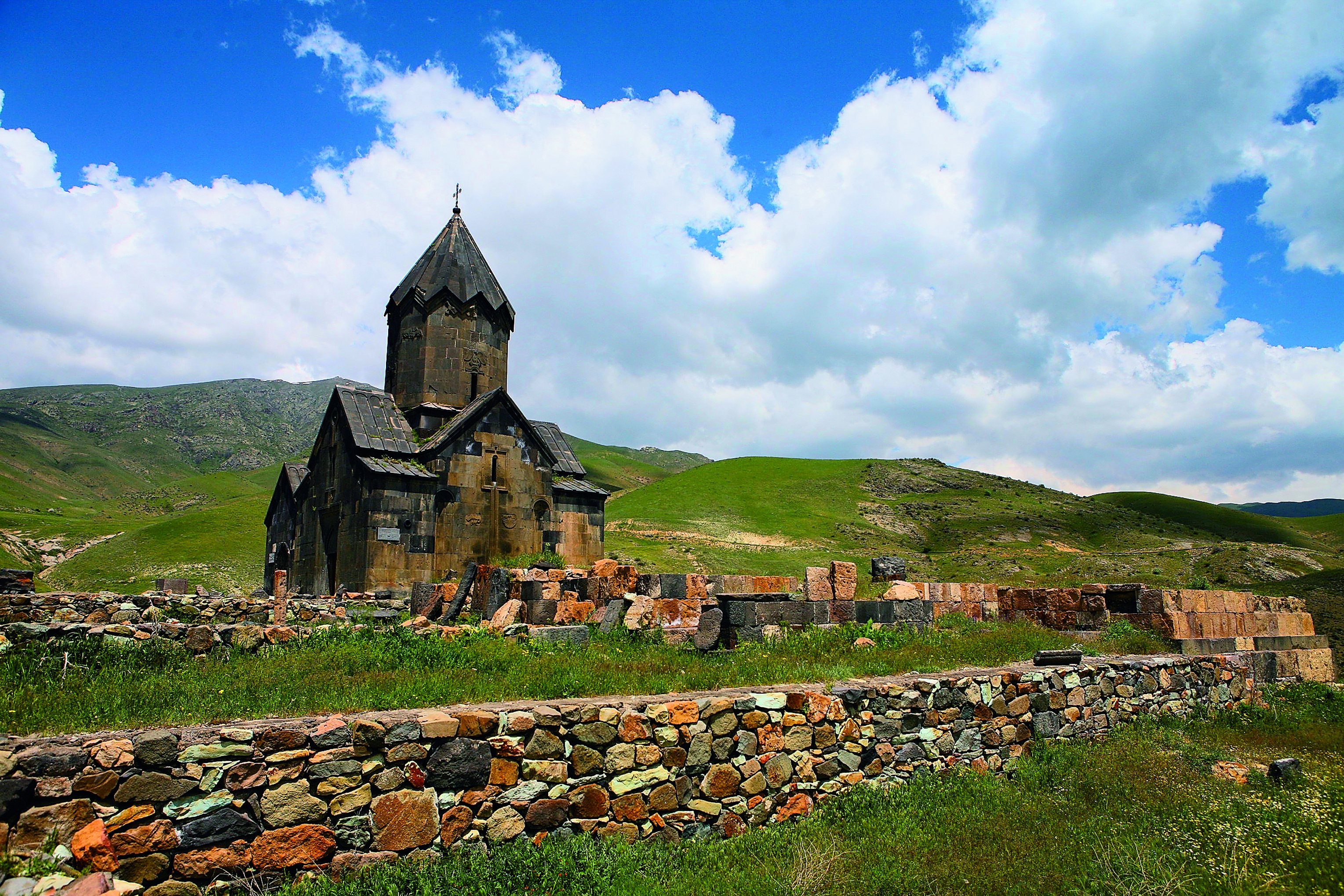
Moz in the province of Vayots Dzor was an ancient town in southern Armenia that was destroyed by an earthquake and volcanic eruption in the year of 735. It is the oldest historically documented settlement in Vayots Dzor. In the 7th to 8th centuries, the town was a significant trading and craft center on the Silk Road, with several thousand inhabitants. Moz was the main seat of the Armenian princes of Syunik from the House of Orbelian, who relocated it to Yeghegis after the destruction of the town. Moz is located on a 1,200 meter high hill above the right bank of the Arpa River, three to four kilometers southeast of the village of Malishka. In its heyday, the town was surrounded by fertile lands and dense forests. After the forests disappeared, the area began to be devastated. The place itself has disappeared. However, the ruins, that occupy an area of about 8 hectares, still lie on an important transport route, the M2 highway, the only transit route for cargo from Iran to Yerevan ... [...More Info...] [...Related Items...] OR: [Wikipedia] [Google] [Baidu] |
Vayots Dzor Province
Vayots Dzor (, ) is a province (''marz'') of Armenia. It lies at the southeastern end of the country, bordering the Nakhchivan exclave of Azerbaijan to the west and the Kalbajar District of Azerbaijan to the east. It covers an area of . With a population of only 52,324 (2011 census), it is the most sparsely populated province in the country. The capital and largest city of the province is the town of Yeghegnadzor. A major wine-producing region in Armenia, Vayots Dzor is home to many ancient landmarks and historical attractions. Among them are the Areni-1 cave complex and Areni-1 winery of the Chalcolithic period, the 8th-century Tanahat Monastery, the 10th-century fortress of Smbataberd, and the 13th-century monastery of Noravank. The province is also home to the spa-town of Jermuk and the village of Gladzor, known for the 13th and 14th-century University of Gladzor. Etymology The province is named after the Vayots Dzor canton of historic Syunik, the ninth province of ... [...More Info...] [...Related Items...] OR: [Wikipedia] [Google] [Baidu] |
Hellenistic Period
In classical antiquity, the Hellenistic period covers the time in Greek history after Classical Greece, between the death of Alexander the Great in 323 BC and the death of Cleopatra VII in 30 BC, which was followed by the ascendancy of the Roman Empire, as signified by the Battle of Actium in 31 BC and the Roman conquest of Ptolemaic Egypt the following year, which eliminated the last major Hellenistic kingdom. Its name stems from the Ancient Greek word ''Hellas'' (, ''Hellás''), which was gradually recognized as the name for Greece, from which the modern historiographical term ''Hellenistic'' was derived. The term "Hellenistic" is to be distinguished from "Hellenic" in that the latter refers to Greece itself, while the former encompasses all the ancient territories of the period that had come under significant Greek influence, particularly the Hellenized Middle East, after the conquests of Alexander the Great. After the Macedonian conquest of the Achaemenid Empire in ... [...More Info...] [...Related Items...] OR: [Wikipedia] [Google] [Baidu] |
Cartography
Cartography (; from , 'papyrus, sheet of paper, map'; and , 'write') is the study and practice of making and using maps. Combining science, aesthetics and technique, cartography builds on the premise that reality (or an imagined reality) can be modeled in ways that communicate spatial information effectively. The fundamental objectives of traditional cartography are to: * Set the map's agenda and select traits of the object to be mapped. This is the concern of map editing. Traits may be physical, such as roads or land masses, or may be abstract, such as toponyms or political boundaries. * Represent the terrain of the mapped object on flat media. This is the concern of map projections. * Eliminate the mapped object's characteristics that are irrelevant to the map's purpose. This is the concern of Cartographic generalization, generalization. * Reduce the complexity of the characteristics that will be mapped. This is also the concern of generalization. * Orchestrate the elements ... [...More Info...] [...Related Items...] OR: [Wikipedia] [Google] [Baidu] |
Cuneiform
Cuneiform is a Logogram, logo-Syllabary, syllabic writing system that was used to write several languages of the Ancient Near East. The script was in active use from the early Bronze Age until the beginning of the Common Era. Cuneiform scripts are marked by and named for the characteristic wedge-shaped impressions (Latin: ) which form their Grapheme, signs. Cuneiform is the History of writing#Inventions of writing, earliest known writing system and was originally developed to write the Sumerian language of southern Mesopotamia (modern Iraq). Over the course of its history, cuneiform was adapted to write a number of languages in addition to Sumerian. Akkadian language, Akkadian texts are attested from the 24th century BC onward and make up the bulk of the cuneiform record. Akkadian cuneiform was itself adapted to write the Hittite language in the early second millennium BC. The other languages with significant cuneiform Text corpus, corpora are Eblaite language, Eblaite, Elamit ... [...More Info...] [...Related Items...] OR: [Wikipedia] [Google] [Baidu] |
Herher
Herher () is a village in the Vayk Municipality of the Vayots Dzor Province of Armenia. History Herher was once a fief of the Orbelian vassals, the Shahurnetsi family in the 13th century. Within the village is a 19th-century church of Saint Gevorg, and south is a shrine of Grigor Lusavorich from 1296 with Saint Gevorg or Chiki Vank of 1297. Southeast one km on a hill is the small Kapuyt Berd ("Blue Fortress"). Upon a hilltop one km northeast is Saint Sion Monastery, first mentioned in the 8th century. At the complex are the churches of Saint Sion and Saint Astvatsatsin. Other sites of historical significance are in close proximity to Herher, such as village ruins with khachkars of the 14th century. Rare endemic fruit Herher boasts a critically endangered species of wild pear found nowhere else in the world: ''Pyrus gergerana'' (common name: Gergeranian pear), named for the village. There are estimated to be a mere 50 trees left in the wild, yet, as of 2014, there have been ... [...More Info...] [...Related Items...] OR: [Wikipedia] [Google] [Baidu] |
Palace
A palace is a large residence, often serving as a royal residence or the home for a head of state or another high-ranking dignitary, such as a bishop or archbishop. The word is derived from the Latin name palātium, for Palatine Hill in Rome which housed the Roman Empire, Imperial residences. Most European languages have a version of the term (''palats'', ''palais'', ''palazzo'', ''palacio'', etc.) and many use it to describe a broader range of buildings than English. In many parts of Europe, the equivalent term is also applied to large private houses in cities, especially of the aristocracy. It is also used for some large official buildings that have never had a residential function; for example in French-speaking countries ''Palais de Justice'' is the usual name of important courthouses. Many historic palaces such as parliaments, museums, hotels, or office buildings are now put to other uses. The word is also sometimes used to describe an elaborate building used for public ent ... [...More Info...] [...Related Items...] OR: [Wikipedia] [Google] [Baidu] |
Earthquake
An earthquakealso called a quake, tremor, or tembloris the shaking of the Earth's surface resulting from a sudden release of energy in the lithosphere that creates seismic waves. Earthquakes can range in intensity, from those so weak they cannot be felt, to those violent enough to propel objects and people into the air, damage critical infrastructure, and wreak destruction across entire cities. The seismic activity of an area is the frequency, type, and size of earthquakes experienced over a particular time. The seismicity at a particular location in the Earth is the average rate of seismic energy release per unit volume. In its most general sense, the word ''earthquake'' is used to describe any seismic event that generates seismic waves. Earthquakes can occur naturally or be induced by human activities, such as mining, fracking, and nuclear weapons testing. The initial point of rupture is called the hypocenter or focus, while the ground level directly above it is the ... [...More Info...] [...Related Items...] OR: [Wikipedia] [Google] [Baidu] |
Kirakos Gandzaketsi
Kirakos Gandzaketsi (; c. 1200/1202–1271) was an Armenian historian of the 13th century S. Peter Cowe. Kirakos Ganjakec'i or Arewelc'i // Christian-Muslim Relations. A Bibliographical History / Edited by David Thomas & Alex Mallet. — BRILL, 2012. —vol. IV. — p. 438: "''Kirakos is one of the most important Armenian historians of the 13th century. He was born in the region of Ganja and received his early formation at the monastic school of Nor Getik under the eminent savant Vanakan Vardapet.''" and author of the ''History of Armenia'', a summary of events from the 4th to the 12th century and a detailed description of the events of his own days.Khanlaryan, L. «Կիրակոս Գանձակեցի»'. Soviet Armenian Encyclopedia. vol. v. Yerevan, Armenian SSR: Armenian Academy of Sciences, 1979, p. 450. The work concentrates primarily on the history of Medieval Armenia and events occurring in the Caucasus and Near East. The work serves as a primary source for the study of the ... [...More Info...] [...Related Items...] OR: [Wikipedia] [Google] [Baidu] |
Movses Kaghankatvatsi
Movses Kaghankatvatsi ( 'Moses of Kaghankatuk'), or Movses Daskhurantsi ( 'Moses of Daskhuran'), is the reputed author (or the alias of several authors) of a tenth-century Classical Armenian historical work on Caucasian Albania and the eastern provinces of Armenia, known as '' The History of the Country of Albania'' (, ). Authorship In the works of earlier Armenian authors no name is attached to '' The History'' and early in the 13th century, however, Mkhitar Gosh names a Movses Dasxurants'i as the author. It is to be noted that the earliest extant manuscript of '' The History'', also of the 13th century (1289), bears no author's name; nor do other manuscripts. The earliest manuscript to bear the name of Movses Kalankatuaci is that copied by the scribe Lunkianos in 1761. The date of the compilation known as '' The History'' is based on the fact that the last person to have a hand in '' The History'' wrote at the earliest at the end of the 11th or the beginning of the 12th cen ... [...More Info...] [...Related Items...] OR: [Wikipedia] [Google] [Baidu] |
Yeghegnadzor Regional Museum
The Yeghegnadzor Regional Museum, , is a museum in Yeghegnadzor, in the Provinces of Armenia, province (''Marz (territorial entity), marz'') of Vayots Dzor Province, Vayots Dzor in southern Armenia.. It was established in 1968, and holds approximately 9000 archaeological and ethnological artefacts dating from pre-historic times to the twentieth century. Collection The museum contains approximately 9000 objects, ranging in date from pre-historic times to the twentieth century. They include jewellery, tools, utensils, carpets and coins. The most significant is an intricate fourteenth-century ''khachkar'' carved by Momik, originally in the monastery of Noravank; it is two parts, which were found in different places. The Bronze Age and Middle Ages, Medieval artifacts found during the archiological excavations of ancient Moz town of 1930, 1978, 1979 also are on display at the Yeghegnadzor Regional Museum. References Museums in Armenia Museums established in 1968 196 ... [...More Info...] [...Related Items...] OR: [Wikipedia] [Google] [Baidu] |


