|
Mount Selwyn (Canada)
:''There is also a mountain near Williston Lake in British Columbia name"Mount Selwyn."' __NOTOC__ Mount Selwyn, is a mountain summit located in Glacier National Park of British Columbia, Canada. It is part of the Selkirk Mountains range. The mountain is situated east-northeast of Revelstoke, and southwest of Golden. Its nearest higher peak is Mount Dawson, to the west. Originally named ''Deville'' in 1888 by mountaineer Rev. William S. Green, Mount Selwyn was renamed to honor Alfred Richard Cecil Selwyn (1824-1902), director of the Geological Survey of Canada, and President of the Royal Society of Canada. The mountain's name was officially adopted September 8, 1932, by the Geographical Names Board of Canada. The first ascent of the mountain was made in 1890 by Harold E. Forster, Harold Ward Topham, Harry Sinclair, and Samuel Yves. Climate Based on the Köppen climate classification, Mount Selwyn is located in a subarctic climate zone with cold, snowy winters, and mild sum ... [...More Info...] [...Related Items...] OR: [Wikipedia] [Google] [Baidu] |
Williston Lake
Williston Lake is a reservoir created by the W. A. C. Bennett Dam and is located in the Northern Interior of British Columbia, Canada. Geography The lake fills the basin of the upper Peace River, backing into the Rocky Mountain Trench which is where the Parsnip and Finlay met at Finlay Forks to form the Peace. The lake includes three reaches, the Peace Reach (formerly the Peace Canyon), and the Parsnip and Finlay Reaches, which are the lowermost basins of those rivers, and covers a total area of , being the largest lake in British Columbia and the seventh largest reservoir (by volume) in the world. The reservoir is fed by the Finlay, Omineca, Ingenika, Ospika, Parsnip, Manson, Nation and Nabesche Rivers and by Clearwater Creek, Carbon Creek, and other smaller creeks. Several provincial parks are maintained on the shore of the lake, including Muscovite Lakes Provincial Park, Butler Ridge Provincial Park, Heather-Dina Lakes Provincial Park and Ed Bird-Estella Provinc ... [...More Info...] [...Related Items...] OR: [Wikipedia] [Google] [Baidu] |
Geological Survey Of Canada
The Geological Survey of Canada (GSC; french: Commission géologique du Canada (CGC)) is a Canadian federal government agency responsible for performing geological surveys of the country, developing Canada's natural resources and protecting the environment. A branch of the Earth Sciences Sector of Natural Resources Canada, the GSC is the country's oldest scientific agency and was one of its first government organizations. History In September 1841, the Province of Canada legislature passed a resolution that authorized the sum of £1,500 sterling be granted to the government for the estimated expense of performing a geological survey of the province. In 1842, the Geological Survey of Canada was formed to fulfill this request.Christy Vodden (1992)No Stone Unturned: The First 150 years of the Geological Survey of Canada Geological Survey of Canada Web site William Edmond Logan was in Montreal at the time and made it known that he was interested in participating in this survey. ... [...More Info...] [...Related Items...] OR: [Wikipedia] [Google] [Baidu] |
Mount Fox (Selkirk Mountains)
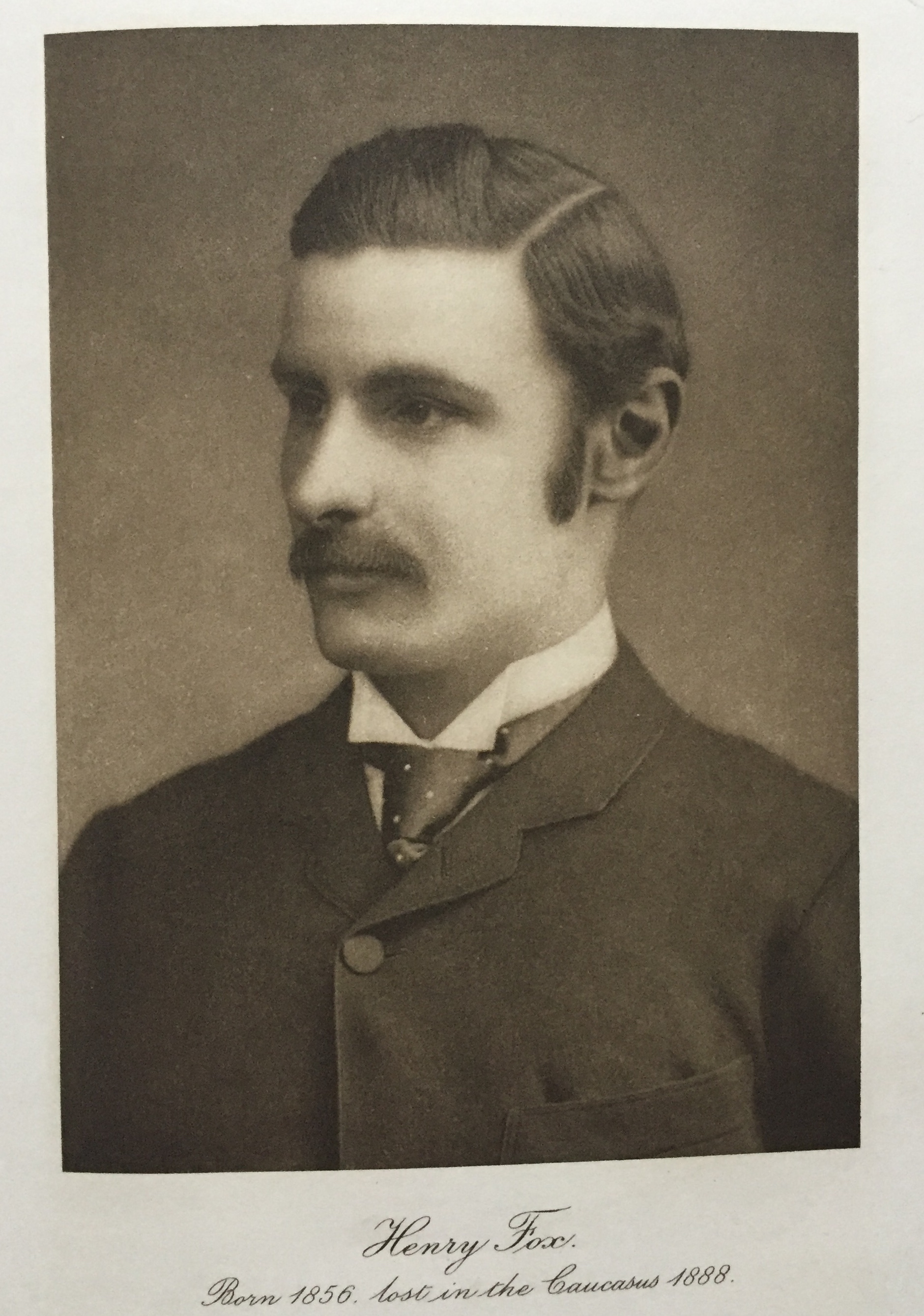
Mount Fox in the Selkirk Mountains of Canada was named, by William Green, in honour of Harry Fox who perished with William Donkin and two Swiss guides, in the Caucasus Mountains. Mount Donkin is nearby. Harry Fox (30 September 1856 – on or after 30 August 1888) was an English gentleman (also lived at Tone Dale House, Wellington, Somerset, England) who was a sportsman and adventurer. He played cricket and rugby for his country, and began climbing mountains in the mid-1880s. In 1884 he started mountaineering, and within two years he was well known in the mountain climbing community, and a well-regarded alpine explorer. In 1888, he travelled with William Frederick Donkin to the Caucasus Mountains in the Russian Empire in a bid to be the first people to climb Koshtan-Tau, but the pair, along with their Swiss guides, died in an accident. For the purposes of his will, Fox's death was recorded as being "on or since the 30th August, 1888, at some place unknown." __NOTOC__ Clim ... [...More Info...] [...Related Items...] OR: [Wikipedia] [Google] [Baidu] |
Mount Wheeler (British Columbia)
Mount Wheeler, is a mountain summit located in Glacier National Park of British Columbia, Canada. It is the third-highest peak in the park, and sixth-highest in the Selkirk Mountains range. The mountain is a remote east of Revelstoke, and southwest of Golden. Its nearest higher peak is Mount Selwyn, to the north-northwest. Mount Wheeler is surrounded by ice, including the Deville Glacier, Deville Névé, Black Glacier, and Thor Glacier. Precipitation runoff from the mountain and meltwater from its glaciers drains into tributaries of the Incomappleux and Beaver Rivers. History The first ascent of the mountain was made in 1902 by Arthur Oliver Wheeler and Fredrich Michel. Mount Wheeler was named in 1904 for Arthur Oliver Wheeler (1860-1945), a Dominion Land Surveyor who made the first ascent of the peak, and co-founder and first president of the Alpine Club of Canada. The mountain's name was officially adopted September 8, 1932, by the Geographical Names Board of Canada. ... [...More Info...] [...Related Items...] OR: [Wikipedia] [Google] [Baidu] |
Mount Topham
Mount Topham, is a mountain summit located in Glacier National Park of British Columbia, Canada. It is part of the Selkirk Mountains range. The mountain is a remote east of Revelstoke, and southwest of Golden. Its nearest higher peak is Mount Selwyn, to the west. Mount Topham is situated along the western edge of the Deville Glacier. Precipitation runoff from the mountain drains into the Beaver River. Mount Topham was named in 1902 by Arthur Oliver Wheeler to honor Harold Ward Topham (1857–1915), an English mountaineer who explored and mapped the Selkirks.Canadian Mountain Place Names, Glen W. Boles, Rocky Mountain Books, 2006, pg 252 The mountain's name was officially adopted September 8, 1932, by the Geographical Names Board of Canada. Based on the Köppen climate classification, Mount Topham is located in a subarctic climate zone with cold, snowy winters, and mild summers. Winter temperatures can drop below −20 °C with wind chill factors below −30 °C. ... [...More Info...] [...Related Items...] OR: [Wikipedia] [Google] [Baidu] |
Mount Macoun
Mount Macoun is a mountain summit located in Glacier National Park of British Columbia, Canada. It is part of the Selkirk Mountains range. The mountain is a remote east of Revelstoke, and southwest of Golden. Its nearest higher peak is Mount Fox, to the southwest, and Mount Topham rises to the south. The expansive Illecillewaet Névé lies to the northwest, and two small unnamed glaciers lie at the bottom of the steep east face. Precipitation runoff from the mountain drains into the Beaver River. Climate Based on the Köppen climate classification, Mount Macoun is located in a subarctic climate zone with cold, snowy winters, and mild summers. Winter temperatures can drop below −20 °C with wind chill factors below −30 °C. The months July through September offer the most favorable weather for viewing and climbing Mount Macoun. History Mount Macoun was named in 1888 by mountaineers Reverend William S. Green and Rev. Henry Swanzy to honor John Macoun (1 ... [...More Info...] [...Related Items...] OR: [Wikipedia] [Google] [Baidu] |
Geography Of British Columbia
British Columbia is the westernmost province of Canada, bordered by the Pacific Ocean. With an area of it is Canada's third-largest province. The province is almost four times the size of the United Kingdom and larger than every United States state except Alaska. It is bounded on the northwest by the U.S. state of Alaska, directly north by Yukon and the Northwest Territories, on the east by Alberta, and on the south by the U.S. states of Washington, Idaho, and Montana. Formerly part of the British Empire, the southern border of British Columbia was established by the 1846 Oregon Treaty. The province is dominated by mountain ranges, among them the Canadian Rockies but dominantly the Coast Mountains, Cassiar Mountains, and the Columbia Mountains. Most of the population is concentrated on the Pacific coast, notably in the area of Vancouver, located on the southwestern tip of the mainland, which is known as the Lower Mainland. It is the most mountainous province of Canada. Statis ... [...More Info...] [...Related Items...] OR: [Wikipedia] [Google] [Baidu] |
Beaver River (Columbia River Tributary)
The Beaver River, also known as the Beavermouth Creek or Beaver Creek, is a tributary of the Columbia River in British Columbia, Canada, joining that river in the Rocky Mountain Trench northwest of the town of Golden. It enters the Columbia via Kinbasket Lake. The Beaver River is the eastern egress from the Rogers Pass and its valley is the route of the Trans-Canada Highway and Canadian Pacific Railway on that side of the pass, and it is located in Glacier National Park. Its lower reaches are officially named Beaver Canyon. The pass between the Beaver River and the Duncan River forms the dividing line between the Selkirks and the Purcell Mountains. A semi-decommissioned hiking trail follows the Beaver from the Trans-Canada highway for much of its length, including now-abandoned spurs to Copperstain Pass and Glacier Circle. The trail no longer receives maintenance from Parks Canada, which closed remaining stream crossings in 2009. See also * List of tributaries of the Columb ... [...More Info...] [...Related Items...] OR: [Wikipedia] [Google] [Baidu] |
Surface Runoff
Surface runoff (also known as overland flow) is the flow of water occurring on the ground surface when excess rainwater, stormwater, meltwater, or other sources, can no longer sufficiently rapidly infiltrate in the soil. This can occur when the soil is saturated by water to its full capacity, and the rain arrives more quickly than the soil can absorb it. Surface runoff often occurs because impervious areas (such as roofs and pavement) do not allow water to soak into the ground. Furthermore, runoff can occur either through natural or man-made processes. Surface runoff is a major component of the water cycle. It is the primary agent of soil erosion by water. The land area producing runoff that drains to a common point is called a drainage basin. Runoff that occurs on the ground surface before reaching a channel can be a nonpoint source of pollution, as it can carry man-made contaminants or natural forms of pollution (such as rotting leaves). Man-made contaminants in runoff i ... [...More Info...] [...Related Items...] OR: [Wikipedia] [Google] [Baidu] |
Subarctic Climate
The subarctic climate (also called subpolar climate, or boreal climate) is a climate with long, cold (often very cold) winters, and short, warm to cool summers. It is found on large landmasses, often away from the moderating effects of an ocean, generally at latitudes from 50° to 70°N, poleward of the humid continental climates. Subarctic or boreal climates are the source regions for the cold air that affects temperate latitudes to the south in winter. These climates represent Köppen climate classification ''Dfc'', ''Dwc'', ''Dsc'', ''Dfd'', ''Dwd'' and ''Dsd''. Description This type of climate offers some of the most extreme seasonal temperature variations found on the planet: in winter, temperatures can drop to below and in summer, the temperature may exceed . However, the summers are short; no more than three months of the year (but at least one month) must have a 24-hour average temperature of at least to fall into this category of climate, and the coldest month should a ... [...More Info...] [...Related Items...] OR: [Wikipedia] [Google] [Baidu] |
Köppen Climate Classification
The Köppen climate classification is one of the most widely used climate classification systems. It was first published by German-Russian climatologist Wladimir Köppen (1846–1940) in 1884, with several later modifications by Köppen, notably in 1918 and 1936. Later, the climatologist Rudolf Geiger (1894–1981) introduced some changes to the classification system, which is thus sometimes called the Köppen–Geiger climate classification system. The Köppen climate classification divides climates into five main climate groups, with each group being divided based on seasonal precipitation and temperature patterns. The five main groups are ''A'' (tropical), ''B'' (arid), ''C'' (temperate), ''D'' (continental), and ''E'' (polar). Each group and subgroup is represented by a letter. All climates are assigned a main group (the first letter). All climates except for those in the ''E'' group are assigned a seasonal precipitation subgroup (the second letter). For example, ''Af'' i ... [...More Info...] [...Related Items...] OR: [Wikipedia] [Google] [Baidu] |
Geographical Names Board Of Canada
The Geographical Names Board of Canada (GNBC) is a national committee with a secretariat in Natural Resources Canada, part of the Government of Canada, which authorizes the names used and name changes on official federal government maps of Canada created since 1897. The board consists of 27 members, one from each of the provinces and territories, and others from departments of the Government of Canada. The board also is involved with names of areas in the Antarctic through the Antarctic Treaty. Structure The secretariat is provided by Natural Resources Canada. In addition to the provincial and territorial members are members from the following federal government departments: Aboriginal Affairs and Northern Development Canada, Canada Post Corporation, Fisheries and Oceans Canada, Elections Canada, Library and Archives Canada, Department of National Defence, Natural Resources Canada (including Geological Survey of Canada and Canada Centre for Mapping and Earth Observatio ... [...More Info...] [...Related Items...] OR: [Wikipedia] [Google] [Baidu] |


