|
Mount Kalatungan
Mount Kalatungan, also known as Keretungan by the indigenous Manobo people, is a volcano located in the Provinces of the Philippines, province of Bukidnon in the southern Philippines. It is a stratovolcano with no known historical eruptions and classified by the Philippine Institute of Volcanology and Seismology (PHIVOLCS) as a Philippine Institute of Volcanology and Seismology#Potentially active, potentially active volcano. It is the fifth highest mountain in the Philippines and is an indigenous and community conserved area (ICCA). Description Mount Kalatungan is the fifth highest mountain in the country with an elevation of above mean sea level, asl. It is one of the several high elevation peaks in the Kalatungan Mountain Range in Bukidnon on the island of Mindanao, the second largest island in the Philippines. Ancestral domain The mountain is part of the ancestral domain of the indigenous Manobo people, Manobo and Talaandig people. It is inhabited by around 531 households ... [...More Info...] [...Related Items...] OR: [Wikipedia] [Google] [Baidu] |
Kalatungan Mountain Range
The Kalatungan Mountain Range in the central portion of the province of Bukidnon, Philippines, is one of the few areas in the province covered with old growth or mossy forests. It covers an area of approximately 213.0134 km2 (82.24493 mi2), with about 113.7175 km2 (43.90657 mi2) identified as part of the critical watershed area declared under Presidential Decree 127, issued on June 29, 1987 (Muleta-Manupali Watershed). The water from two rivers, the Muleta and Manupali Rivers, flood the multimillion dam project of the Philippine National Irrigation Administration (NIA). The rivers drain into the Pulangi River, the site of a National Power Corporation hydroelectric dam. Geography The mountain range is in the central section of the province of Bukidnon A neighbor of Kitanglad Mountain Range . It lies between the coordinates 8°00’ and 8°60’ latitude and between 124°35’ and 124°60’ longitude. It is bounded on the north by the municipality of Talakag, ... [...More Info...] [...Related Items...] OR: [Wikipedia] [Google] [Baidu] |
Volcano
A volcano is commonly defined as a vent or fissure in the crust of a planetary-mass object, such as Earth, that allows hot lava, volcanic ash, and gases to escape from a magma chamber below the surface. On Earth, volcanoes are most often found where tectonic plates are diverging or converging, and because most of Earth's plate boundaries are underwater, most volcanoes are found underwater. For example, a mid-ocean ridge, such as the Mid-Atlantic Ridge, has volcanoes caused by divergent tectonic plates whereas the Pacific Ring of Fire has volcanoes caused by convergent tectonic plates. Volcanoes resulting from divergent tectonic activity are usually non-explosive whereas those resulting from convergent tectonic activity cause violent eruptions."Mid-ocean ridge tectonics, volcanism and geomorphology." Geology 26, no. 455 (2001): 458. https://macdonald.faculty.geol.ucsb.edu/papers/Macdonald%20Mid-Ocean%20Ridge%20Tectonics.pdf Volcanoes can also form where there is str ... [...More Info...] [...Related Items...] OR: [Wikipedia] [Google] [Baidu] |
Philippine Shamans
Filipino shamans, commonly known as (also ''balian'' or , among many other names), were shamans of the various ethnic groups of the pre-colonial Philippine islands. These shamans specialized in communicating, appeasing, or harnessing the spirits of the dead and the spirits of nature. They were almost always women or feminized men ( or ). They were believed to have spirit guides, by which they could contact and interact with the spirits and deities (''anito'' or ''diwata'') and the spirit world. Their primary role were as mediums during ''pag-anito'' séance rituals. There were also various subtypes of specializing in the arts of healing and herbalism, divination, and sorcery. Terminology The most common native terms for shamans among Austronesian groups in Island Southeast Asia are ''balian'', ''baylan'', or cognates and spelling variants thereof. They are all derived from Proto-Western-Malayo-Polynesian ''*balian'', meaning "shaman" (probably originally female, tr ... [...More Info...] [...Related Items...] OR: [Wikipedia] [Google] [Baidu] |
Datu
''Datu'' is a title which denotes the rulers (variously described in historical accounts as chiefs, sovereign princes, and monarchs) of numerous Indigenous peoples throughout the Philippine archipelago. The title is still used today, though not as much as early Philippine history. It is a cognate of ''datuk'', ''dato'', and ''ratu'' in several other Austronesian languages. Overview In early Philippine history, ''datus'' and a small group of their Cognatic kinship, close relatives formed the "apex stratum" of the traditional three-tier social hierarchy of lowland Philippine societies. Only a member of this birthright aristocracy (called ''maginoo'', ''nobleza'', ''maharlika'', or ''timagua'' by various early chroniclers) could become a ''datu''; members of this elite could hope to become a ''datu'' by demonstrating prowess in war or exceptional leadership. In large coastal polities such as those in Maynila (historical polity), Maynila, Tondo (historical polity), Tondo, Pangasi ... [...More Info...] [...Related Items...] OR: [Wikipedia] [Google] [Baidu] |
Talakag
Talakag, officially the Municipality of Talakag ( Bukid and Higaonon: ''Banuwa ta Talakag''; ; ), is a municipality in the province of Bukidnon, Philippines. According to the 2020 census, it has a population of 77,027 people. It is located on the border to major cities of Cagayan de Oro and Iligan, and between Marawi and Malaybalay, the provincial capital. Etymology Once in the not so distant past, a nomadic tribe wandered down south. Finally, they settled upon a place attuned to their needs and liking. The place, was traversed by a zigzagging creek swollen with clear sparkling water where on its banks grew in abundance wild Malayan trees called “Balangas” (now popularly known as Rambutan – Nephelium lappaceum of the Family: Sapindaceae). The trees were full of attractive bloody red but juicy and delicious fruits, clustered in their very green foliages. Because of fanatical attachment of this tribe to these balangas trees, they decided to name their settlement “Kabala ... [...More Info...] [...Related Items...] OR: [Wikipedia] [Google] [Baidu] |
Pangantucan
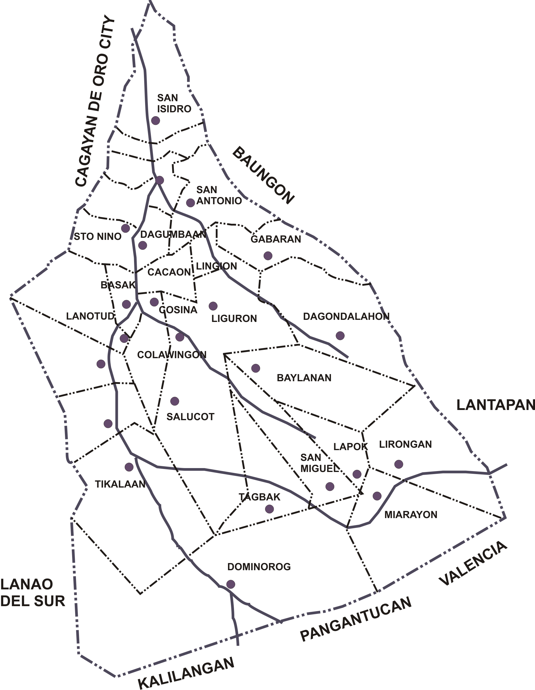
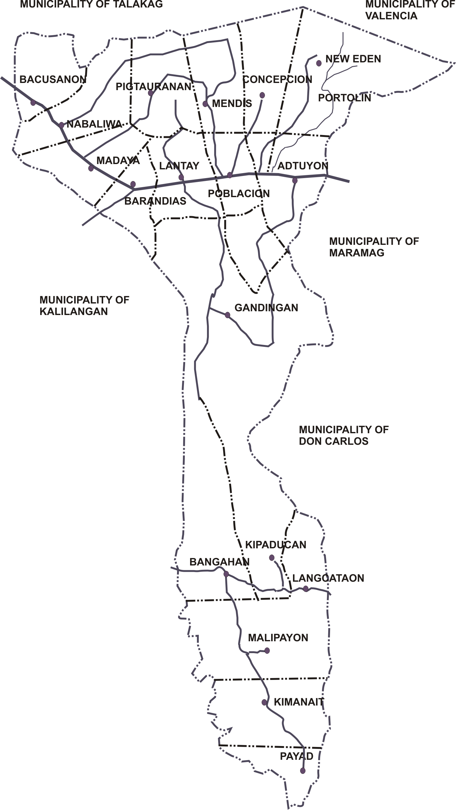
Pangantucan, officially the Municipality of Pangantucan (; ), is a municipality in the province of Bukidnon, Philippines. According to the 2020 census, it has a population of 56,580 people. History The indigenous groups of Pangantucan are various Talaandig and Manobo tribes. It has also been settled by Dumagat (Visayans) in recent times. The name “Pangantucan” means wisdom and strength in the Manobo languages and is said to refer to a white stallion that uprooted a bamboo stalk to warn his master, a tribal ''datu'', of approaching raiders from other tribes. Pangantucan was previously a ''barrio'' of Maramag. It was merged in 1931 with Adtuyon, Dominorog, Panalagsagan, Kalilangan and Barandias to form a separate municipal district. It was granted Municipal status in 1961. Geography Pangantucan is situated in south–western Bukidnon and located approximately south of the provincial capital Malaybalay. Pangantucan shares borders to its south-west and south with the p ... [...More Info...] [...Related Items...] OR: [Wikipedia] [Google] [Baidu] |
Barangay
The barangay (; abbreviated as Brgy. or Bgy.), historically referred to as ''barrio'', is the smallest Administrative divisions of the Philippines, administrative division in the Philippines. Named after the Precolonial barangay, precolonial polities of the same name, modern barangays are political subdivisions of cities and municipalities which are analogous to Village#Philippines, villages, districts, neighborhoods, suburbs, or boroughs. The word ''barangay'' originated from ''balangay'', a type of boat used by a group of Austronesian peoples when they migrated to the Philippines. All Municipalities of the Philippines, municipalities and Cities of the Philippines, cities in the Philippines are politically subdivided into barangays, with the exception of the municipalities of Adams, Ilocos Norte, Adams in Ilocos Norte and Kalayaan, Palawan, Kalayaan in Palawan, each containing a single barangay. Barangays are sometimes informally subdivided into smaller areas called ''purok'' ( ... [...More Info...] [...Related Items...] OR: [Wikipedia] [Google] [Baidu] |
Visayans
Visayans ( Cebuano: ''mga Bisayà'' ) are a Philippine ethnolinguistic family group or metaethnicity native to the Visayas, to the southernmost islands south of Luzon, and to a significant portion of Mindanao. They are composed of numerous distinct ethnic groups. When taken as a single group, they number around 33.5 million. The Visayans, like the Luzon Lowlanders (Tagalogs, Bicolanos, Ilocanos, etc.) were originally predominantly animist-polytheists and broadly share a maritime culture until the 16th century when the Spanish Empire enforced Catholicism as the state religion. In more inland or otherwise secluded areas, ancient animistic-polytheistic beliefs and traditions either were reinterpreted within a Roman Catholic framework or syncretized with the new religion. Visayans are generally speakers of one or more of the distinct Bisayan languages, the most widely spoken being Cebuano, followed by Hiligaynon (Ilonggo) and Waray-Waray. Terminology "Visayan" is the a ... [...More Info...] [...Related Items...] OR: [Wikipedia] [Google] [Baidu] |
Talaandig People
The Lumad are a group of Austronesian indigenous peoples in the southern Philippines. It is a Cebuano term meaning "native" or "indigenous". The term is short for Katawhang Lumad (Literally: "indigenous people"), the autonym officially adopted by the delegates of the Lumad Mindanao Peoples Federation (LMPF) founding assembly on 26 June 1986 at the Guadalupe Formation Center, Balindog, Kidapawan, Cotabato. Usage of the term was accepted in Philippine jurisprudence when President Corazon Aquino signed into law Republic Act 6734, where the word was used in Art. XIII sec. 8(2) to distinguish Lumad ethnic communities from the islands of Mindanao. Mindanao is home to a substantial part of the country's indigenous population, comprising around 15% of the Philippine population.National Statistics Office. "Statistics on Filipino Children." Journal of Philippine Statistics, vol. 59, no. 4, 2008, p. 119. History The name ''Lumad'' grew out of the political awakening among tribes duri ... [...More Info...] [...Related Items...] OR: [Wikipedia] [Google] [Baidu] |
Ancestral Domain
Ancestral domain or ancestral lands are the lands, territories and resources of indigenous peoples, particularly in the Asia-Pacific region. The term differs from indigenous land rights, Aboriginal title or Native Title by directly indicating relationship to land based on ancestry, while domain indicates relationships beyond material lands and territories, including spiritual and cultural aspects that may not be acknowledged in land titles and legal doctrine about trading ownership. Concept Indigenous peoples may prefer to be described as custodians or guardians of their ancestral domain or lands rather than as title owners or land owners. The concept of individual property ownership and land tenure that can be traded was often introduced as part of colonialism. While the Western model of land ownership gives an individual the property right to control land as a commodity, indigenous conceptions have a cultural and spiritual character. They invoke a mutual responsibilit ... [...More Info...] [...Related Items...] OR: [Wikipedia] [Google] [Baidu] |
Above Mean Sea Level
Height above mean sea level is a measure of a location's vertical distance (height, elevation or altitude) in reference to a vertical datum based on a historic mean sea level. In geodesy, it is formalized as orthometric height. The zero level varies in different countries due to different reference points and historic measurement periods. Climate change and other forces can cause sea levels and elevations to vary over time. Uses Elevation or altitude above sea level is a standard measurement for: * Geographic locations such as towns, mountains and other landmarks. * The top of buildings and other structures. * Mining infrastructure, particularly underground. * Flying objects such as airplanes or helicopters below a Transition Altitude defined by local regulations. Units and abbreviations Elevation or altitude is generally expressed as "metres above mean sea level" in the metric system, or " feet above mean sea level" in United States customary and imperial units. Com ... [...More Info...] [...Related Items...] OR: [Wikipedia] [Google] [Baidu] |


