|
Mount Kakepuku
Kakepuku (Te Kakepuku ō Kahu) is a volcanic cone that rises from the plain between the Waipā and Puniu rivers, about NW of Te Kawa and SW of Te Awamutu in the Waikato region of New Zealand's North Island. History Kakepuku was named Te Kakepuku ō Kahu ('the hill over which Kahu climbed') by Kahupeka, the bereaved widow of Uenga (descendant of Hoturoa, ariki of the Tainui waka). Following Uenga's death, Kahupeka left Kāwhia and set forth with her son Rākamaomao, naming many peaks across the Waikato region. Kakepuku translates as ''to climb the swollen belly''. In Māori pūrākau (legend), Kakepuku travelled north in search of his father, until he reached the Waipa plain and fell in love with Te Kawa, daughter of Pirongia and Taupiri Mountains. However, he had a rival in Karewa, who also stood nearby. The mountains fought, Karewa lost and, pursued by Kakepuku's rocks, fled into the Tasman Sea, now also known as Kārewa / Gannet Island. So Kakepuku remains guarding Te Kaw ... [...More Info...] [...Related Items...] OR: [Wikipedia] [Google] [Baidu] |
North Island Main Trunk
The North Island Main Trunk (NIMT) is the main railway line in the North Island of New Zealand, connecting the capital city Wellington with the country's largest city, Auckland. The line is long, built to the New Zealand rail gauge of and serves the large cities of Palmerston North and Hamilton, New Zealand, Hamilton. Most of the NIMT is Single track (rail), single track with frequent passing loops, but sections at each end that also handle suburban commuter traffic are double tracked: * The section known as the North-South Junction between Wellington railway station, Wellington and Waikanae railway station, Waikanae, except for of single-track through tunnels between North Junction ( from Wellington) and South Junction, ( from Wellington), on the Pukerua Bay railway station, Pukerua Bay to Paekakariki railway station, Paekākāriki section, * between Hamilton and Te Kauwhata railway station, Te Kauwhata (except for the single-track Waikato River Bridge at Ngāruawāhia rai ... [...More Info...] [...Related Items...] OR: [Wikipedia] [Google] [Baidu] |
Waipa District
Waipa may refer to: New Zealand * Waipa (New Zealand electorate), a former electorate * Waipa District, a territorial local authority * Waipā River The Waipā River is in the Waikato region of the North Island of New Zealand. The headwaters are in the Rangitoto Range east of Te Kūiti. It flows north for , passing through Ōtorohanga and Pirongia, before flowing into the Waikato Ri ..., a waterway Elsewhere * World Association of Investment Promotion Agencies, using the acronym WAIPA * Waipa Foundation, non-profit organisation in Hawaii {{disambiguation ... [...More Info...] [...Related Items...] OR: [Wikipedia] [Google] [Baidu] |
Feral Goat
The feral goat is the domestic goat (''Capra hircus'') when it has become established in the wild. Feral goats occur in many parts of the world. Species Feral goats consist of many breeds of domestic goats, all of which stem from the wild goat (''C. aegagrus''). Although breeds can look different, they all share similar characteristics. Physically, both domestic and feral goats can be identified by their prominent straight horns (more prominent on male goats), rectangular pupils, and coarse hair. In addition, most domestic goats/feral goats weigh around , with heavier goats tending to be wild goats. Behavior The feral goat is seen in Australia, New Zealand, Great Britain, Ireland, Hawaii, Brazil, Honduras, Lebanon, Panama, Madagascar, the Comoros, Mauritius, Réunion, New Guinea, the Galápagos Islands, Cuba, and in many other parts of the world. When feral goats reach large populations in habitats which are not adapted to them, they may become an invasive species with seri ... [...More Info...] [...Related Items...] OR: [Wikipedia] [Google] [Baidu] |
Common Brushtail Possum
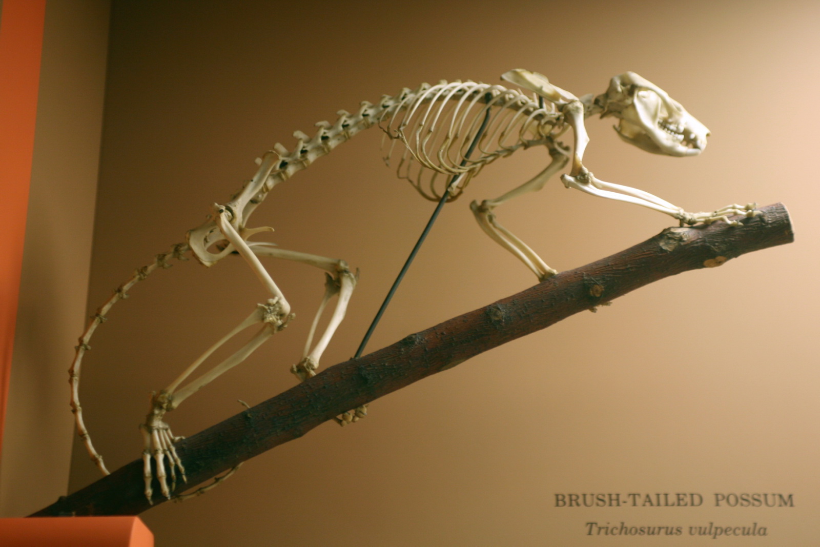
The common brushtail possum (''Trichosurus vulpecula'', from the Ancient Greek, Greek for "furry tailed" and the Latin for "little fox", previously in the genus ''Phalangista'') is a nocturnal, semiarboreal marsupial of the family Phalangeridae, native to Australia and Invasive species, invasive in New Zealand, and the second-largest of the Phalangeriformes, possums. Like most possums, the common brushtail possum is nocturnal. It is mainly a folivore, but has been known to eat small mammals such as rats. In most Australian habitats, eucalyptus leaves are a significant part of the diet, but rarely the sole item eaten. Its tail is Prehensile tail, prehensile and naked on its lower underside. The four colour variations are silver-grey, brown, black, and gold. It is the Australian marsupial most often seen by city dwellers, as it is one of few that thrive in cities and a wide range of natural and human-modified environments. Around human habitations, common brushtails are inventive ... [...More Info...] [...Related Items...] OR: [Wikipedia] [Google] [Baidu] |
Aeromagnetic Survey
An aeromagnetic survey is a common type of geophysical survey carried out using a magnetometer aboard or towed behind an aircraft. The principle is similar to a magnetic survey carried out with a hand-held magnetometer, but allows much larger areas of the Earth's surface to be covered quickly for regional reconnaissance. The aircraft typically flies in a grid-like pattern with height and line spacing determining the resolution of the data (and cost of the survey per unit area). Method As the aircraft flies, the magnetometer measures and records the total intensity of the magnetic field at the sensor, which is a combination of the desired magnetic field generated in the Earth as well as tiny variations due to the temporal effects of the constantly varying solar wind and the magnetic field of the survey aircraft. By subtracting the solar, regional, and aircraft effects, the resulting aeromagnetic map shows the spatial distribution and relative abundance of magnetic minerals (most ... [...More Info...] [...Related Items...] OR: [Wikipedia] [Google] [Baidu] |
Mount Pirongia
Mount Pirongia is an extinct stratovolcano located in the Waikato region of New Zealand's North Island. It rises to and is the highest peak around the Waikato plains. Pirongia's many peaks are basaltic cones created by successive volcanic eruptions between the late Pliocene and early Pleistocene, about 2.5 million years ago. In the adjacent picture, the characteristic profile of the mountain can be seen, along with a prominent accessory cone to the right (on the northern flank). History The Māori people of the Tainui waka (Ngāti Maniapoto, Waikato Tainui, Ngāti Hikairo) have strong whakapapa-based links to Mount Pirongia. The mountain was first encountered after landfall of the Tainui waka around 800 years ago. Early names bestowed on the mountain included Paewhenua (the land barrier, given by Rakātaura) and Pukehoua (now given to a flank cone on the eastern side of the mountain). The present name is:, which translates to 'the putrid stench of Kahu', or more gently, th ... [...More Info...] [...Related Items...] OR: [Wikipedia] [Google] [Baidu] |
Clinopyroxene
The pyroxenes (commonly abbreviated Px) are a group of important rock-forming inosilicate minerals found in many igneous and metamorphic rocks. Pyroxenes have the general formula , where X represents ions of calcium (Ca), sodium (Na), iron (Fe(II)) or magnesium (Mg) and more rarely zinc, manganese or lithium, and Y represents ions of smaller size, such as chromium (Cr), aluminium (Al), magnesium (Mg), cobalt (Co), manganese (Mn), scandium (Sc), titanium (Ti), vanadium (V) or even iron (Fe(II) or Fe(III)). Although aluminium substitutes extensively for silicon in silicates such as feldspars and amphiboles, the substitution occurs only to a limited extent in most pyroxenes. They share a common structure consisting of single chains of silica tetrahedra. Pyroxenes that crystallize in the monoclinic system are known as clinopyroxenes and those that crystallize in the orthorhombic system are known as orthopyroxenes. The name ''pyroxene'' is derived from the Ancient Greek words for ' ... [...More Info...] [...Related Items...] OR: [Wikipedia] [Google] [Baidu] |
Megacryst
In geology, a megacryst is a crystal or grain that is considerably larger than the encircling Matrix (geology), matrix. They are found in igneous rock, igneous and metamorphic rocks. Megacrysts can be further classified based on the nature of their origin, either as:Chapman, Carleton A. (2014). Phenocryst. In AccessScience. McGraw-Hill Education. https://doi.org/10.1036/1097-8542.506500 *Phenocrysts, which crystallize in molten rock material (lava or magma) and are hence an earlier crystallization than the matrix in which they are embedded *Porphyroblasts, which develop in solid rock as the result of metamorphism or metasomatism See also *Xenolith, an inclusion of one rock type in another References Notes Significance of k-feldspar megacryst size and distribution in the tuolumne intrusive suite, California Petrology {{Petrology-stub ... [...More Info...] [...Related Items...] OR: [Wikipedia] [Google] [Baidu] |
Ankaramite
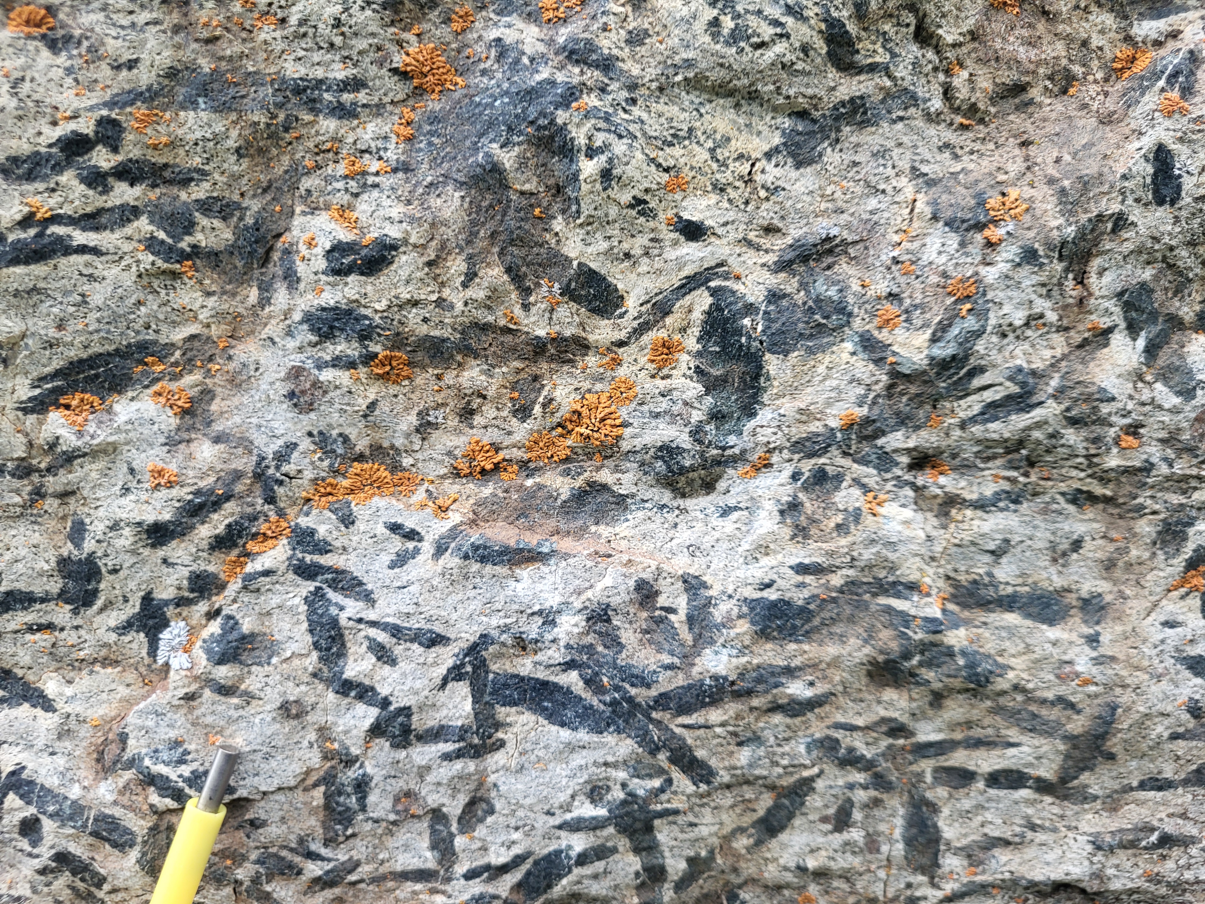
Ankaramite is volcanic rock type of mafic composition. It is a dark porphyritic variety of basanite containing abundant pyroxene and olivine phenocrysts.https://dialnet.unirioja.es/descarga/articulo/281059.pdf Luis Enrique Ortiz Hernández, ''An Arc Ankaramite Occurrence in Central Mexico,'' Revista Mexicana de Ciencias Geológicas, volumen 17, número 1 2000, p. 34-44 It contains minor amounts of plagioclase and accessory biotite, apatite, and iron oxides. Its type locality is Ankaramy in Madagascar. It was first described in 1916. It is also found in the Sierra de Guanajuato of Central Mexico, the South Pacific on islands such as Tahiti, Rarotonga, Samoa and in the Zealandia Zealandia (pronounced ), also known as (Māori language, Māori) or Tasmantis (from Tasman Sea), is an almost entirely submerged continent, submerged mass of continental crust in Oceania that subsided after breaking away from Gondwana 83� ..., Alexandra Volcanic Group. References Porphyrit ... [...More Info...] [...Related Items...] OR: [Wikipedia] [Google] [Baidu] |
Karioi
Karioi or Mount Karioi is a 2.4 million year old extinct stratovolcano SW of Raglan in the Waikato region of New Zealand's North Island. It was the earliest of the line of 6 calcalkalic volcanoes, the largest of which is Mount Pirongia (the others are at Kakepuku, Te Kawa, Tokanui, Waikeria and probably Puketotara). Karioi forms a background to many parts of Raglan. Karioi was also a Highway Board area around the maunga from 1870 to 1889, when it was absorbed (with Whaingaroa Board area and formed into Karioi Riding) into Raglan County Council. In 1876, it had a population of 112 in 27 houses and in 1889 119 ratepayers, 80 of them absentees. 19th century maps, documents and reports sometimes used the spelling Karehoe. Karioi is also a location on the Central Plateau (see article on Karioi railway station). History and culture Pre-European history Many iwi whakapapa back to Karioi, which features in several Māori legends. One says that, a long time ago, Karewa ... [...More Info...] [...Related Items...] OR: [Wikipedia] [Google] [Baidu] |
Whāingaroa Harbour
Raglan ( or ) is a small beachside town located west of Hamilton, New Zealand on State Highway 23. It is known for its surfing, and volcanic black sand beaches. History The Ngāti Māhanga iwi occupied the area around Raglan in the late 18th century. There are at least 81 archaeological sites in the area, mainly near the coast. Limited radiocarbon dating puts the earliest sites at about 1400AD. The Māori people named the site ("the long pursuit"). One tradition says that Tainui priest, Rakataura, crossed Whāingaroa on his way to Kāwhia. Another says it was among the places the early Te Arawa explorer, Kahumatamomoe, with his nephew Īhenga, visited on their expedition from Maketū. The first Europeans to settle in the area, the Rev James and Mary Wallis, Wesleyan missionaries, were embraced and welcomed by local Māori in 1835. European settlement, including large scale conversion of land to pasture, began in the mid-1850s after a large sale of land by Chief Wiremu Ne ... [...More Info...] [...Related Items...] OR: [Wikipedia] [Google] [Baidu] |


