|
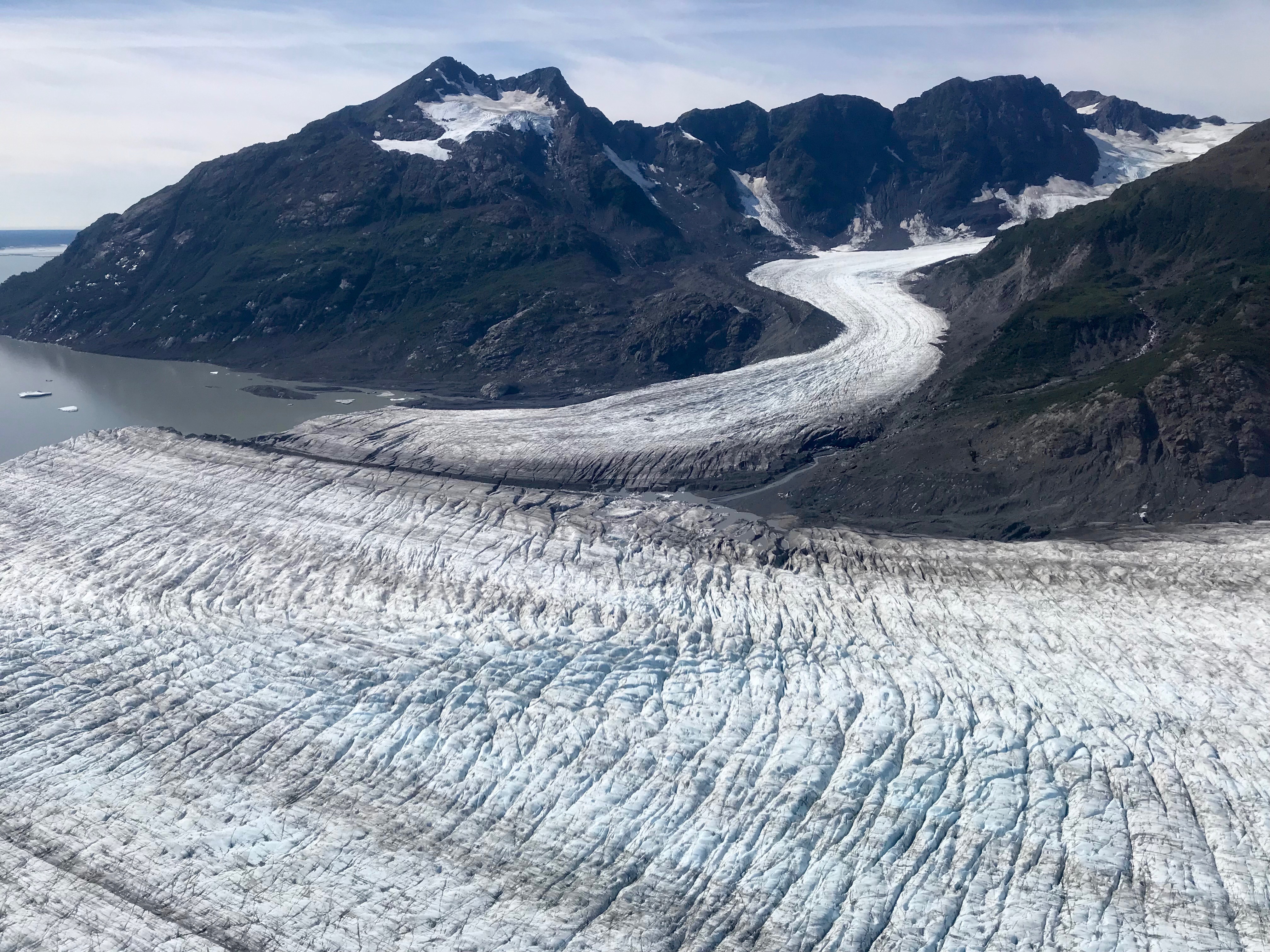
Mount Craig (Yukon)
Mount Craig () is in Kluane National Park and Reserve in Yukon Territory, Canada Canada is a country in North America. Its Provinces and territories of Canada, ten provinces and three territories extend from the Atlantic Ocean to the Pacific Ocean and northward into the Arctic Ocean, making it the world's List of coun .... References Craiga Craig {{Yukon-geo-stub ... [...More Info...] [...Related Items...] OR: [Wikipedia] [Google] [Baidu] |
Yukon Territory
Yukon () is a territory of Canada, bordering British Columbia to the south, the Northwest Territories to the east, the Beaufort Sea to the north, and the U.S. state of Alaska to the west. It is Canada’s westernmost territory and the smallest territory by land area. As of the 2021 census, Yukon is the middle territory in terms of population, but the most densely populated. Yukon has an estimated population of 47,126 as of 2025. Whitehorse, the territorial capital, is the largest settlement. Yukon was split from the Northwest Territories by a federal statute in 1898 as the Yukon Territory. The current governing legislation is a new statute passed by the federal Parliament in 2002, the ''Yukon Act''. That act established Yukon as the territory's official name, although Yukon Territory remains in popular usage. Canada Post uses the territory's internationally approved postal abbreviation of YT. In 2021, territorial government policy was changed so that The Yukon would be rec ... [...More Info...] [...Related Items...] OR: [Wikipedia] [Google] [Baidu] |
Saint Elias Mountains
The Saint Elias Mountains () are a subgroup of the Pacific Coast Ranges, located in southeastern Alaska in the United States, Southwestern Yukon and the very far northwestern part of British Columbia in Canada. The range spans Wrangell-St. Elias National Park and Preserve in the United States and Kluane National Park and Reserve in Canada and includes all of Glacier Bay National Park in Alaska. In Alaska, the range includes parts of the city/borough of Yakutat and the Hoonah-Angoon and Valdez-Cordova census areas. This mountain range is named after Mount Saint Elias, which in turn was named in 1741 by the Danish-born Russian explorer Vitus Bering. Geology The Saint Elias Mountains form the highest coastal mountain range on Earth. It formed due to the subduction of the Yakutat microplate underneath the North American Plate. The Yakutat microplate is a wedge shaped oceanic plateau with a thickness of . Similar to the adjacent Pacific Plate, which has a crustal thickness of ... [...More Info...] [...Related Items...] OR: [Wikipedia] [Google] [Baidu] |
National Topographic System
The National Topographic System or NTS is the system used by Natural Resources Canada for providing general purpose topographic maps of the country. NTS maps are available in a variety of scales, the standard being 1:50,000 and 1:250,000 scales. The maps provide details on landforms and terrain, lakes and rivers, forested areas, administrative zones, populated areas, roads and railways, as well as other human-made features. These maps are currently used by all levels of government and industry for forest fire and flood control (as well as other environmental issues), depiction of crop areas, right-of-way, real estate planning, development of natural resources and highway planning. To add context, land area outside Canada is depicted on the 1:250,000 maps, but not on the 1:50,000 maps. History Topographic mapping in Canada was originally undertaken by many different agencies, with the Canadian Army’s Intelligence Branch forming a survey division to create a more standardized ... [...More Info...] [...Related Items...] OR: [Wikipedia] [Google] [Baidu] |
Kluane National Park And Reserve
Kluane National Park and Reserve (; ) are two protected areas in the southwest corner of the Provinces and territories of Canada, territory of Yukon. The National Park Reserve was set aside in 1972 to become a national park, pending settlement of First Nations in Canada, First Nations land claims. It covered an area of . When agreement was reached with the Champagne and Aishihik First Nations over an eastern portion of the Reserve, that part—about —became a national park in 1993, and is a unit of the national park system administered co-operatively with Parks Canada. The larger western section remains a Reserve, awaiting a final land claim settlement with the Kluane First Nation. The park borders British Columbia to the south, while the Reserve borders both British Columbia to the south, and the United States (Alaska) to the south and west. The Reserve includes the highest mountain in Canada, Mount Logan () of the Saint Elias Mountains. Mountains and glaciers, including Donj ... [...More Info...] [...Related Items...] OR: [Wikipedia] [Google] [Baidu] |
Canada
Canada is a country in North America. Its Provinces and territories of Canada, ten provinces and three territories extend from the Atlantic Ocean to the Pacific Ocean and northward into the Arctic Ocean, making it the world's List of countries and dependencies by area, second-largest country by total area, with the List of countries by length of coastline, world's longest coastline. Its Canada–United States border, border with the United States is the world's longest international land border. The country is characterized by a wide range of both Temperature in Canada, meteorologic and Geography of Canada, geological regions. With Population of Canada, a population of over 41million people, it has widely varying population densities, with the majority residing in List of the largest population centres in Canada, urban areas and large areas of the country being sparsely populated. Canada's capital is Ottawa and List of census metropolitan areas and agglomerations in Canada, ... [...More Info...] [...Related Items...] OR: [Wikipedia] [Google] [Baidu] |

