|
Mount Cotton Road
Mount Cotton Road, or Mt Cotton Rd, is a major split road in the Brisbane area of South East Queensland, Australia. It runs in both an east-west direction between Burbank, Queensland, Burbank (City of Brisbane, Brisbane) and Sheldon, Queensland, Sheldon (Redland City, Redlands), and a north-south direction between Capalaba, Queensland, Capalaba (Redland City, Redlands) and Carbrook, Queensland, Carbrook (City of Logan, Logan). In total, the road is approximately long, and is split at a three-way roundabout. The road is notable for connecting three adjacent local government areas of Queensland: the City of Brisbane, Redland City, and the City of Logan. As there are no List of highways in Queensland, highways in this region east of the Gateway Motorway, Gateway and Pacific Motorway (Brisbane–Brunswick Heads), Pacific Motorways, Mount Cotton Road often provides the fastest link between the three cities (more so regarding the south-east of Brisbane and north-east of Logan). Hist ... [...More Info...] [...Related Items...] OR: [Wikipedia] [Google] [Baidu] |
Tingalpa Creek
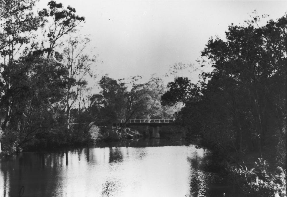
Tingalpa Creek is a creek in South East Queensland. It flows along Brisbane's south east boundary with Redland City Council. On early maps the creek was called both Tunim Creek and Tangulba Creek. The waterway serves as important wildlife corridor on the city's fringe. The creek also provides limited kayaking and fishing opportunities. The creek's water catchment area covers 150 km². Tingalpa Creek has its headwaters in Venman Bushland National Park at Mount Cotton and the Brisbane Koala Park in Burbank. It then flows a short distance through Sheldon to the waters of the Leslie Harrison Dam. The creek below the dam, now tidal, continues along its winding course through Capalaba West, Birkdale and Ransome. In this area the creek which is popular with recreational anglers, is bordered by the Capalaba Regional Park, John Fredericks Park, Sciacca Sportsfield to the east and Tingalpa Creek Reserve on its western side. The Cleveland railway line crosses the creek before ... [...More Info...] [...Related Items...] OR: [Wikipedia] [Google] [Baidu] |
List Of Highways In Queensland
Queensland, being the second largest (by area) state in Australia, is also the most decentralised. Hence the highways and roads cover most parts of the state unlike the sparsely populated Western Australia. Even Queensland's outback is well served as it is relatively populated. Road quality varies from 8-laned Pacific Motorway linking Brisbane– Gold Coast to earth-packed outback tracks, reflecting the great diversity of its terrain and climatic conditions. The route markings are also unique in the sense that Queensland uses all available schemes, from old-style National Route scheme and the blue-shielded State Route scheme to the latest alphanumeric numbering scheme and the Metroads metropolitan route numbering scheme. National Land Transport Network * **Bruce Highway ** Gateway Motorway ** Pacific Motorway * Bruce Highway * ** Gateway Motorway **Ipswich Motorway **Logan Motorway **Warrego Highway * ** Barkly Highway ** Landsborough Highway ** Warrego Highway * Flinde ... [...More Info...] [...Related Items...] OR: [Wikipedia] [Google] [Baidu] |
List Of Hindu Temples In Australia
Apart from India, where the vast majority (1.12 billion) of the world's 1.3 billion Hindu population lives, Hindu Temples are found across the world, on every continent. In the Indian Subcontinent, thousands of modern and historic temples are spread across Nepal, Sri Lanka, Bangladesh and Pakistan. Outside the region, the oldest temples can be found in Cambodia, Thailand, Myanmar, Malaysia and Indonesia where ancient seafaring empires like the Chola Empire and Vijayanagara Empire spread their dominions. In the early modern period, Fiji, Guyana, Kenya, Malaysia, Mauritius, Réunion, Myanmar, Seychelles, Singapore, South Africa, Suriname, Tanzania, Trinidad and Tobago and Uganda, have seen many temples being built, as the Indian Diaspora settled across these areas over the past 250–300 years. Over the past 70 years, immigration to western nations have led to the construction of temples for the Hindu communities in these countries. Afghanistan Australia Bangladesh Botsw ... [...More Info...] [...Related Items...] OR: [Wikipedia] [Google] [Baidu] |
Carbrook Lutheran Cemetery - Low Wide View, 2005 , a village in Norfolk, England
{{geodis ...
Carbrook may refer to: * Carbrook, Queensland, a suburb of Logan City, Australia * Carbrook, Sheffield, a district of Sheffield, South Yorkshire, England * Carbrook Ravine, a nature reserve in Sheffield, South Yorkshire, England See also * Carbrooke Carbrooke is a village and civil parish in the Breckland district of Norfolk, England. It is from the centre of Watton and from Thetford. In the 2011 Census, Carbrooke had a population of 2,073 people in 835 households. History Carbrooke's n ... [...More Info...] [...Related Items...] OR: [Wikipedia] [Google] [Baidu] |
Wallaby
A wallaby () is a small or middle-sized macropod native to Australia and New Guinea, with introduced populations in New Zealand, Hawaii, the United Kingdom and other countries. They belong to the same taxonomic family as kangaroos and sometimes the same genus, but kangaroos are specifically categorised into the four largest species of the family. The term "wallaby" is an informal designation generally used for any macropod that is smaller than a kangaroo or a wallaroo that has not been designated otherwise. There are nine species (eight extant and one extinct) of the brush wallaby (genus ''Notamacropus''). Their head and body length is and the tail is long. The 19 known species of rock-wallabies (genus ''Petrogale'') live among rocks, usually near water; two species in this genus are endangered. The two living species of hare-wallabies (genus ''Lagorchestes''; two other species in this genus are extinct) are small animals that have the movements and some of the habits ... [...More Info...] [...Related Items...] OR: [Wikipedia] [Google] [Baidu] |
Leslie Harrison Dam
The Leslie Harrison Dam is an earth-fill embankment dam across the Tingalpa Creek that is located in the South East region of Queensland, Australia. The main purpose of the dam is for potable water supply of the Redland City in Brisbane. The impounded reservoir is called Tingalpa Reservoir. The dam was named after Robert Leslie Harrison, a Queensland parliamentarian who died in April 1966. Location and features The dam is located between the suburbs of Capalaba, Chandler and Burbank, approximately southeast of Brisbane. The primary inflow of the reservoir is the Tingalpa Creek, not far above its mouth at Waterloo Bay. The dam is one of a number of dams connected to the South East Queensland Water Grid, and the dam provides approximately 20% of the water supply for Redland City. Completed in 1968, the earthfill dam structure is high and long. The dam wall holds back the reservoir when at full capacity. From a catchment area of that includes much of the northern ... [...More Info...] [...Related Items...] OR: [Wikipedia] [Google] [Baidu] |
Capalaba Park Shopping Centre
Capalaba is an urban locality in the City of Redland, Queensland, Australia. In the , Capalaba had a population of 17,333 people. Geography The suburb has large shopping and commercial centres with two malls and a major bus station, as well as light industrial zones surrounded by bushland and residential streets, making it the second most populous suburb in the Redlands. Surrounding suburbs include Alexandra Hills, Birkdale, and Sheldon, also in Redland City, along with Burbank and Chandler (and formerly Capalaba West), which lie within Brisbane. Tingalpa Creek marks the border between the present-day suburb Capalaba in Redland City (to the eas)t and the City of Brisbane (to the west), making the suburb a gateway to the coastal Redlands region for urban Brisbanites. Leslie Harrison Dam is on Tingalpa Creek. History The name of Capalaba is believed to be derived from the Indigenous Yugarabul word for the ringtail possum, a marsupial native to the area. Europea ... [...More Info...] [...Related Items...] OR: [Wikipedia] [Google] [Baidu] |
The Salvation Army
The Salvation Army (TSA) is a Protestant church and an international charitable organisation headquartered in London, England. The organisation reports a worldwide membership of over 1.7million, comprising soldiers, officers and adherents collectively known as Salvationists. Its founders sought to bring salvation to the poor, destitute, and hungry by meeting both their "physical and spiritual needs". It is present in 133 countries, running charity shops, operating shelters for the homeless and disaster relief, and humanitarian aid to developing countries. The theology of the Salvation Army is derived from Methodism, although it is distinctive in institution and practice. A distinctive characteristic of the Salvation Army is its use of titles derived from military ranks, such as "lieutenant" or "major". It does not celebrate the rites of Baptism and Holy Communion. However, the Army's doctrine is otherwise typical of holiness churches in the Wesleyan–Arminian tradition. ... [...More Info...] [...Related Items...] OR: [Wikipedia] [Google] [Baidu] |
Post Office
A post office is a public facility and a retailer that provides mail services, such as accepting letters and parcels, providing post office boxes, and selling postage stamps, packaging, and stationery. Post offices may offer additional services, which vary by country. These include providing and accepting government forms (such as passport applications), and processing government services and fees (such as road tax, postal savings, or bank fees). The chief administrator of a post office is called a postmaster. Before the advent of postal codes and the post office, postal systems would route items to a specific post office for receipt or delivery. During the 19th century in the United States, this often led to smaller communities being renamed after their post offices, particularly after the Post Office Department began to require that post office names not be duplicated within a state. Name The term "post-office" has been in use since the 1650s, shortly after the leg ... [...More Info...] [...Related Items...] OR: [Wikipedia] [Google] [Baidu] |
Aviculture
Aviculture is the practice of keeping and breeding birds, especially of wild birds in captivity. Types There are various reasons that people get involved in aviculture. Some people breed birds to preserve a species. Some people breed parrots as companion birds, and some people breed birds to make a profit. Aviculture Aviculture is the practice of keeping birds ( class ''Aves'') in captivity using controlled conditions, normally within the confines of an aviary, for hobby, business, research and conservation purposes. Some reasons for aviculture are: breeding birds to preserve the species because many avian species are at risk due to habitat destruction and natural disaster. Aviculture encourages conservation, provides education about avian species, provides companion birds for the public, and includes research on avian behaviour. Publications and avicultural societies Publications on aviculture include books on species which include pets, books on breeding and introductor ... [...More Info...] [...Related Items...] OR: [Wikipedia] [Google] [Baidu] |
Telephone Line
A telephone line or telephone circuit (or just line or circuit industrywide) is a single-user circuit on a telephone communication system. It is designed to reproduce speech of a quality that is understandable. It is the physical wire or other signaling medium connecting the user's telephone apparatus to the telecommunications network, and usually also implies a single telephone number for billing purposes reserved for that user. Telephone lines are used to deliver landline telephone service and Digital subscriber line (DSL) phone cable service to the premises. Telephone overhead lines are connected to the public switched telephone network. The voltage at a subscriber's network interface is typically 48 V between the ring and tip wires, with tip near ground and ring at -48 V. In the United States In 1878, the Bell Telephone Company began to use two-wire circuits, called the local loop, from each user's telephone to end offices which performed any necessary electrical swit ... [...More Info...] [...Related Items...] OR: [Wikipedia] [Google] [Baidu] |
Capalaba State College
Capalaba State College is a P–12 state school. The College consists of both Junior (Prep to Year 6) and Senior (Year 7 to Year 12) campuses. It is situated in the Redlands. Originally made up of separate Primary and Secondary Schools, they both amalgamated in 2005, and formed Capalaba State College. History Capalaba State School opened on Mt Cotton Road on 5 July 1880 with 22 pupils and one teacher. The school grew rapidly, and in 1884 there was an average attendance of 43. During this time, Capalaba supported a flourishing timber industry which later declined resulting in families leaving the district and the school was closed in 1922. Local support forced the reopening of the school in 1923. Tom McGrath was appointed Headmaster in 1925 remaining at the school for 27 years. In 1959, the school moved to its present site and continued to grow reaching 338 students in 1970. Capalaba State High School, situated on 13.6 hectares of land in School Road, opened its doors to 189 ... [...More Info...] [...Related Items...] OR: [Wikipedia] [Google] [Baidu] |


