|
Mount Butin
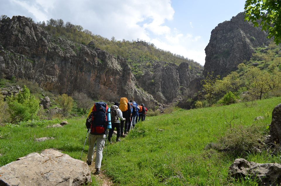
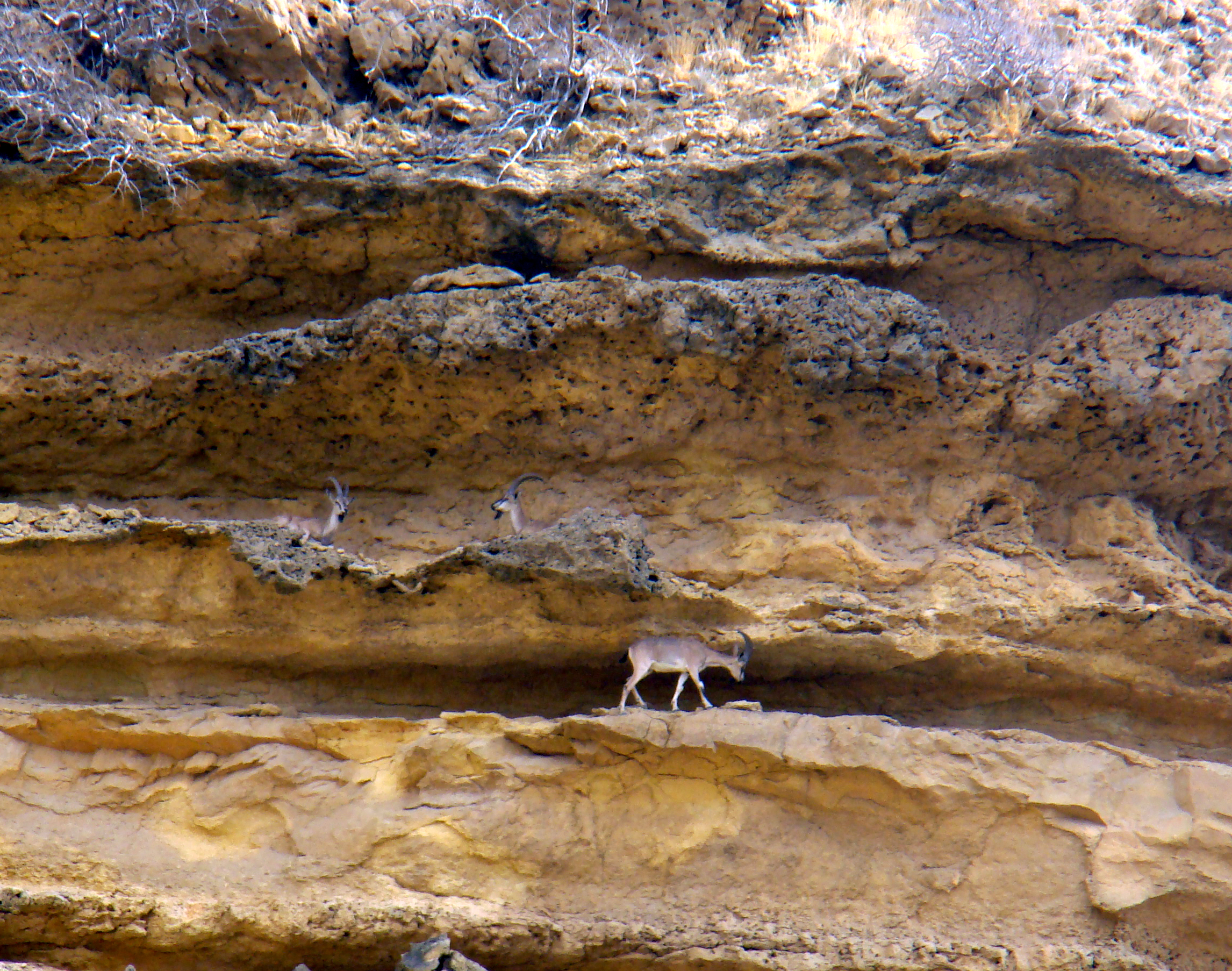
Butin or Botin ( ku, بۆتین ,Botîn) located on the Pendro terrain in Kurdistan Region. The mountain lies to the northeast of Pendro and some from Erbil. Hunting in Butin is prohibited and it is home to a large population of Wild Goat and other wildlife. Butin has a lot of valuable trees and mountain herbs, the most extensive growths on the Butin slopes. Photo gallery File:Butinpendro.jpg, Butin on May 9, 2010 File:Chema&butinpendro.jpg, Butin on April 8, 2016 File:Wildgoat.jpg, Wild goat in Buntin File:Butin winter.jpg, Butin in winter File:Pendroo-jalalmajid1968.jpg, Pendro village and Mount Butin File:Chema winter.jpg, Butin in winter Winter is the coldest season of the year in Polar regions of Earth, polar and temperate climates. It occurs after autumn and before spring (season), spring. The tilt of Axial tilt#Earth, Earth's axis causes seasons; winter occurs when a Hemi ... as viewed from Chemma File:KurdistanMountainClimbing1.jpg, Kurdistan Mountain Climbing Fed ... [...More Info...] [...Related Items...] OR: [Wikipedia] [Google] [Baidu] |
Pendro
Pendro or Pendru ( ku, پێندرۆ ,Pêndro, ar, بيندرو) is a village in Kurdistan Region of Iraq. In the Erbil Governorate, close to the border with Turkey, it is approximately 15–18 km to the north of Barzan. It has a population of over 2540 people and is in the territory of the Muzuri Kurds, one of the seven tribes of Barzani Kurds. It lies in a valley surrounded by low peaks. Mount Butin is about 4 km northeast of Pendro and the Sardav Canyon is north of the village. The villages of Banan and Shive are to the north, Hakkâri Province is to the northeast, Edlbey and Zet are to the east, Selke, Stope and Guiza Walati to the south, Binavye and Navkorka to the west, Dezo and Spindare to the northwest. The area of Pendro covers over . The terrain is highly mountainous, lying within the Zagros; less than 10% of the Pendro is below , and its highest point is . History Pendro's history stretches back to at least the era of Badinan Emirate rule in Amadiya, which e ... [...More Info...] [...Related Items...] OR: [Wikipedia] [Google] [Baidu] |
Kurdistan Region
Kurdistan Region ( ku, هەرێمی کوردستان, translit=Herêmî Kurdistan; ar, إقليم كردستان), abbr. KRI, is an autonomous region in Iraq comprising the four Kurdish-majority governorates of Erbil, Sulaymaniyah, Duhok, and Halabja, and bordering Iran, Syria, and Turkey. The Kurdistan Region encompasses most of Iraqi Kurdistan but excludes the disputed territories of Northern Iraq, contested between the Kurdistan Regional Government and the central Iraqi government in Baghdad since 1992 when autonomy was realized. The Kurdistan Region Parliament is situated in Erbil, but the constitution of the Kurdistan Region declares the disputed city of Kirkuk to be the capital of the Kurdistan Region. When the Iraqi Army withdrew from most of the disputed areas in mid-2014 following the Islamic State’s invasion of Iraq, Kurdish Forces entered the areas and held control there until Iraq retook the areas in October 2017. Throughout the 20th century, Kurds ... [...More Info...] [...Related Items...] OR: [Wikipedia] [Google] [Baidu] |
Iraqi Kurdistan
Iraqi Kurdistan or Southern Kurdistan ( ku, باشووری کوردستان, Başûrê Kurdistanê) refers to the Kurdish-populated part of northern Iraq. It is considered one of the four parts of "Kurdistan" in Western Asia, which also includes parts of southeastern Turkey (Northern Kurdistan), northern Syria (Western Kurdistan), and northwestern Iran (Eastern Kurdistan). Much of the geographical and cultural region of Iraqi Kurdistan is part of the Kurdistan Region (KRI), an autonomous region recognized by the Constitution of Iraq. As with the rest of Kurdistan, and unlike most of the rest of Iraq, the region is inland and mountainous. Etymology The exact origins of the name ''Kurd'' are unclear. The suffix ''-stan'' is an Iranian term for region. The literal translation for Kurdistan is "Region of Kurds". The name was also formerly spelled ''Curdistan''. One of the ancient names of Kurdistan is ''Corduene''.A.D. Lee, ''The Role of Hostages in Roman Diplomacy with Sas ... [...More Info...] [...Related Items...] OR: [Wikipedia] [Google] [Baidu] |
Erbil
Erbil, also called Hawler (, ar, أربيل, Arbīl; syr, ܐܲܪܒܹܝܠ, Arbel), is the capital and most populated city in the Kurdistan Region of Iraq. It lies in the Erbil Governorate. It has an estimated population of around 1,600,000. Human settlement at Erbil may be dated back to the fifth millennium BC. At the heart of the city is the ancient Citadel of Erbil and Mudhafaria Minaret. The earliest historical reference to the region dates to the Third Dynasty of Ur of Sumer, when King Shulgi mentioned the city of Urbilum. The city was later conquered by the Assyrians. In the 3rd millennium BC Erbil was an independent power in its area. It was conqureed for a time by the Gutians. Beginning in the late 2nd millennium BC it came under Assyrian control. Subsequent to this, it was part of the geopolitical province of Assyria under several empires in turn, including the Median Empire, the Achaemenid Empire ( Achaemenid Assyria), Macedonian Empire, Seleucid Empire, Arme ... [...More Info...] [...Related Items...] OR: [Wikipedia] [Google] [Baidu] |
Wild Goat
The wild goat (''Capra aegagrus'') is a wild goat species, inhabiting forests, shrublands and rocky areas ranging from Turkey and the Caucasus in the west to Turkmenistan, Afghanistan and Pakistan in the east. It has been listed as near threatened on the IUCN Red List and is threatened by destruction and degradation of habitat. It is one of the ancestors of the domestic goat (''C. hircus''). Taxonomy ''Capra aegagrus'' was the scientific name proposed by Johann Christian Polycarp Erxleben in 1777 for the wild goat populations of the Caucasus and Taurus Mountains. ''Capra blythi'' proposed by Allan Octavian Hume in 1874 were wild goat horns from Sindh. The following wild goat subspecies are considered valid taxa: *Bezoar ibex ''C. a. aegagrus'' * Sindh ibex ''C. a. blythi'' * Chiltan ibex ''C. a. chialtanensis'' * Turkmen wild goat ''C. a. turcmenica'' *''Capra aegagrus pictus'' The kri-kri was once thought to be a subspecies of the wild goat, but is now considered to be a ... [...More Info...] [...Related Items...] OR: [Wikipedia] [Google] [Baidu] |
Winter
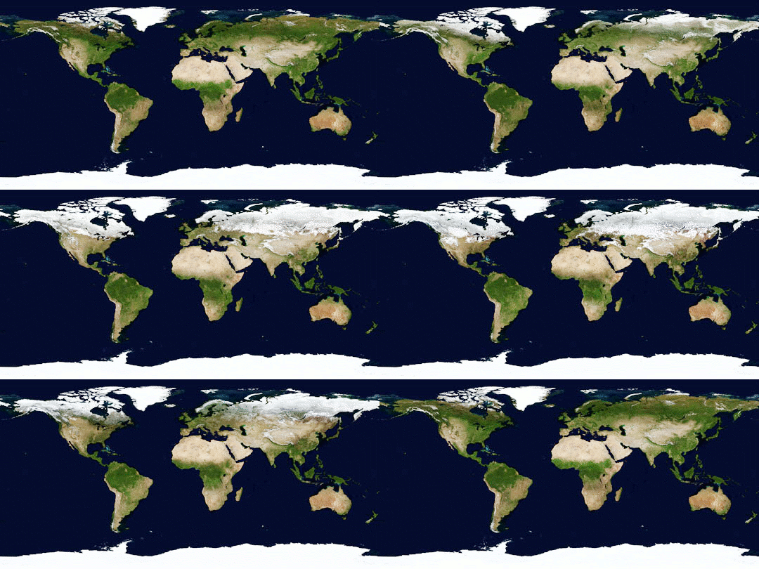
Winter is the coldest season of the year in Polar regions of Earth, polar and temperate climates. It occurs after autumn and before spring (season), spring. The tilt of Axial tilt#Earth, Earth's axis causes seasons; winter occurs when a Hemispheres of Earth, hemisphere is oriented away from the Sun. Different cultures define different dates as the start of winter, and some use a definition based on weather. When it is winter in the Northern Hemisphere, it is summer in the Southern Hemisphere, and vice versa. In many regions, winter brings snow and freezing temperatures. The moment of winter solstice is when the Sun's elevation with respect to the North or South Pole is at its most negative value; that is, the Sun is at its farthest below the horizon as measured from the pole. The day on which this occurs has the shortest day and the longest night, with daytime, day length increasing and nighttime, night length decreasing as the season progresses after the solstice. The earl ... [...More Info...] [...Related Items...] OR: [Wikipedia] [Google] [Baidu] |
Zagros Mountains
The Zagros Mountains ( ar, جبال زاغروس, translit=Jibal Zaghrus; fa, کوههای زاگرس, Kuh hā-ye Zāgros; ku, چیاکانی زاگرۆس, translit=Çiyakani Zagros; Turkish: ''Zagros Dağları''; Luri: ''Kuh hā-ye Zāgros'' ''کویا زاگرس'') are a long mountain range in Iran, northern Iraq, and southeastern Turkey. This mountain range has a total length of . The Zagros mountain range begins in northwestern Iran and roughly follows Iran's western border while covering much of southeastern Turkey and northeastern Iraq. From this border region, the range continues to the southeast under also the waters of the Persian Gulf. It spans the southern parts of the Armenian highland, the whole length of the western and southwestern Iranian plateau, ending at the Strait of Hormuz. The highest point is Mount Dena, at . Geology The Zagros fold and thrust belt was mainly formed by the collision of two tectonic plates, the Eurasian Plate and the Arabia ... [...More Info...] [...Related Items...] OR: [Wikipedia] [Google] [Baidu] |
Mountains Of Kurdistan
A mountain is an elevated portion of the Earth's crust, generally with steep sides that show significant exposed bedrock. Although definitions vary, a mountain may differ from a plateau in having a limited summit area, and is usually higher than a hill, typically rising at least 300 metres (1,000 feet) above the surrounding land. A few mountains are isolated summits, but most occur in mountain ranges. Mountains are formed through tectonic forces, erosion, or volcanism, which act on time scales of up to tens of millions of years. Once mountain building ceases, mountains are slowly leveled through the action of weathering, through slumping and other forms of mass wasting, as well as through erosion by rivers and glaciers. High elevations on mountains produce colder climates than at sea level at similar latitude. These colder climates strongly affect the ecosystems of mountains: different elevations have different plants and animals. Because of the less hospitable terrain and ... [...More Info...] [...Related Items...] OR: [Wikipedia] [Google] [Baidu] |


