|
Montes Spitzbergen
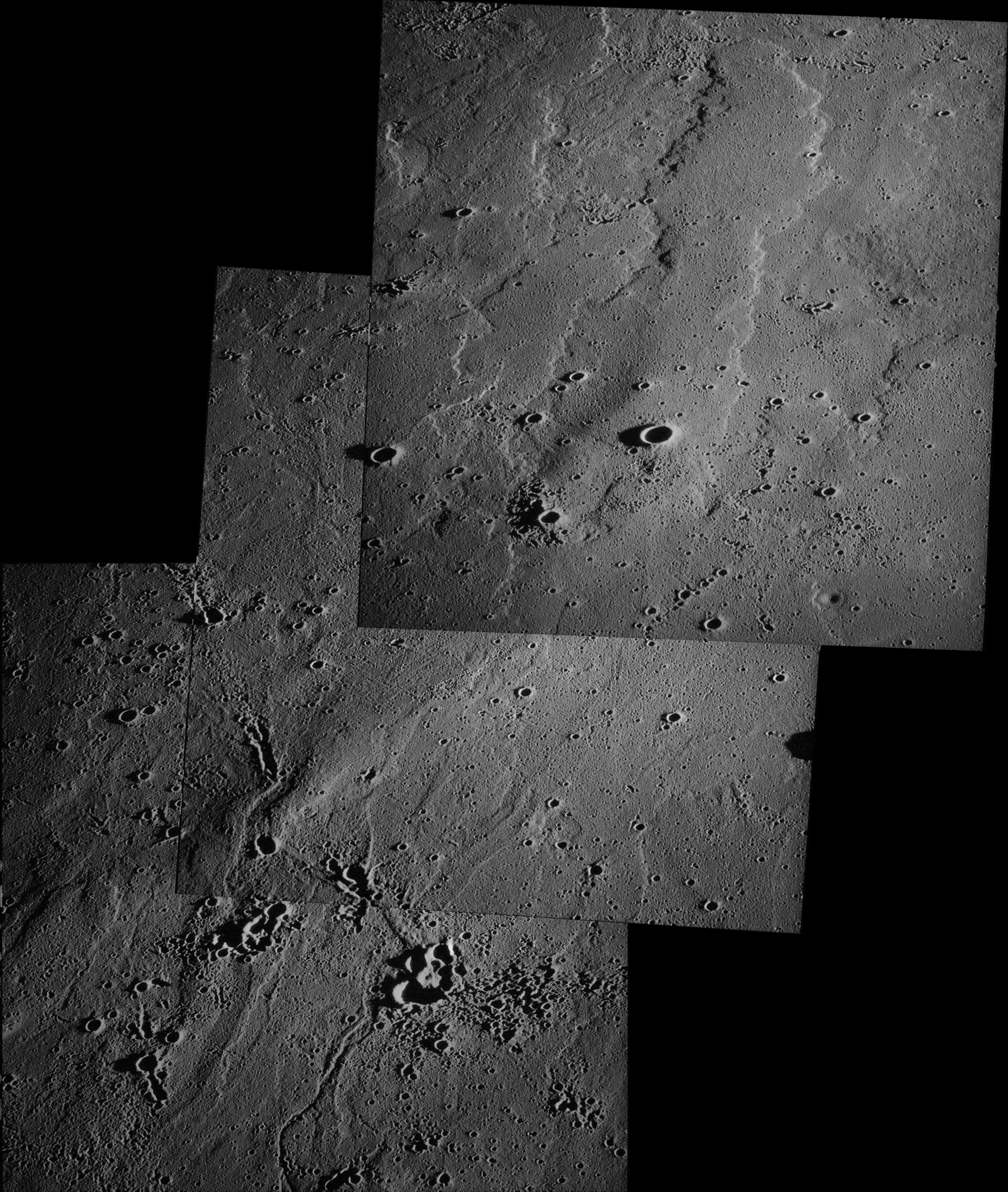
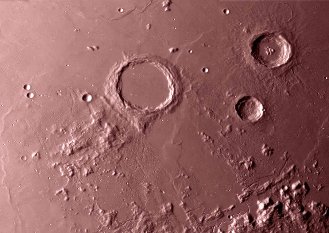
The Montes Spitzbergen (Spitzbergen Mountains) is a solitary mountain chain in the eastern Mare Imbrium of the Moon. It is located about 80 km to the north of the flooded crater Archimedes (crater), Archimedes. The range trends from south to north, consisting of a number of peaks separated by lava-flooded valleys, and has a maximum width of about 25 km. It is thought to be the surviving rim or inner ring of an impact crater that has been buried under magma flows. The range was named by Mary Adela Blagg, Mary Blagg for its resemblance to the jagged terrestrial mountains of the Spitzbergen island group. The name was approved by the International Astronomical Union in 1961. Gazetteer of Planetary Nomenclature International Astronomical Union (IAU) Working Group for Planetary System Nomenclature (WGPSN) ...
|
Lunar Reconnaissance Orbiter
The Lunar Reconnaissance Orbiter (LRO) is a NASA robotic spacecraft currently orbiting the Moon in an eccentric Polar orbit, polar mapping orbit. Data collected by LRO have been described as essential for planning NASA's future human and robotic missions to the Moon. Its detailed mapping program is identifying safe landing sites, locating potential resources on the Moon, characterizing the radiation environment, and demonstrating new technologies. Launched on June 18, 2009, in conjunction with the LCROSS, Lunar Crater Observation and Sensing Satellite (LCROSS), as the vanguard of NASA's Lunar Precursor Robotic Program, LRO was the first United States mission to the Moon in over ten years. LRO and LCROSS were launched as part of the United States's Vision for Space Exploration program. The probe has made a 3-D map of the Moon's surface at 100-meter resolution and 98.2% coverage (excluding polar areas in deep shadow), including 0.5-meter resolution images of Apollo landing sites. ... [...More Info...] [...Related Items...] OR: [Wikipedia] [Google] [Baidu] |
List Of Mountains On The Moon
This is a list of mountains on the Moon (with a scope including all named ''mons'' and ''montes'', planetary science jargon terms roughly equivalent to 'isolated mountain'/'massif' and 'mountain range'). Caveats * This list is not comprehensive, as surveying of the Moon is a work in progress. * Heights are in meters; most peaks have not been surveyed with the precision of a single meter. * Mountains on the Moon have heights and elevations/altitudes defined relative to various vertical datums (referring to the lunoid), each in turn defined relative to the center of mass (CoM) of the Moon. *: — the U.S. Army Mapping Service datum was established 1,737,988 meters from the CoM. *: — the U.S. Defense Mapping Agency used 1,730,000 meters. *: — The '' Clementine'' topographic data use 1,737,400 meters as the baseline, and show a range of about 18,100 meters from lowest to highest point on the Moon. * This is not a list of the highest places on the Moon, meaning those farthe ... [...More Info...] [...Related Items...] OR: [Wikipedia] [Google] [Baidu] |
Moon
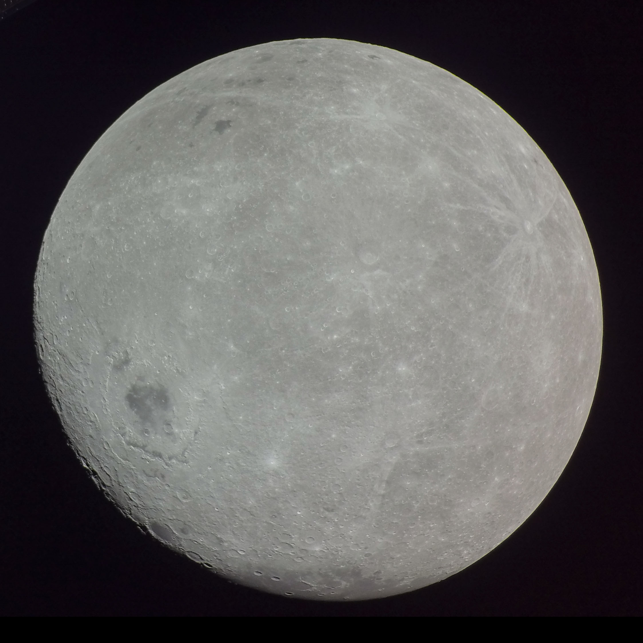
The Moon is Earth's only natural satellite. It Orbit of the Moon, orbits around Earth at Lunar distance, an average distance of (; about 30 times Earth diameter, Earth's diameter). The Moon rotation, rotates, with a rotation period (lunar day) that is synchronized to its orbital period (Lunar month#Synodic month, lunar month) of 29.5 Earth days. This is the product of Earth's gravitation having tidal forces, tidally pulled on the Moon until one part of it stopped rotating away from the near side of the Moon, near side, making always the same lunar surface face Earth. Conversley, the gravitational pull of the Moon, on Earth, is the main driver of Earth's tides. In geophysical definition of planet, geophysical terms, the Moon is a planetary-mass object or satellite planet. Its mass is 1.2% that of the Earth, and its diameter is , roughly one-quarter of Earth's (about as wide as the contiguous United States). Within the Solar System, it is the List of Solar System objects by ... [...More Info...] [...Related Items...] OR: [Wikipedia] [Google] [Baidu] |
Mare Imbrium Si Map
A mare is an adult female horse or other equine. In most cases, a mare is a female horse over the age of three, and a filly is a female horse three and younger. In Thoroughbred horse racing, a mare is defined as a female horse more than four years old. The word can also be used for other female equine animals, particularly mules and zebras, but a female donkey is usually called a "jenny". A ''broodmare'' is a mare used for breeding. Reproductive cycle Mares carry their young (called foals) for approximately 11 months from conception to birth, the average range being 320–370 days.Ensminger, M. E. ''Horses and Horsemanship: Animal Agriculture Series.'' Sixth Edition. Interstate Publishers, 1990. p. 156 Usually just one young is born; twins are rare. When a domesticated mare foals, she nurses the foal for at least four to six months before it is weaned, though mares in the wild may allow a foal to nurse for up to a year. The estrous cycle, also known as "season" or ... [...More Info...] [...Related Items...] OR: [Wikipedia] [Google] [Baidu] |
Montes Spitzbergen AS15-M-1543
Montes may refer to: * Montes (surname), includes a list of people with the name * Montes, an early name of Mons, Belgium Mons (; German and , ; Walloon language, Walloon and ) is a City status in Belgium, city and Municipalities of Belgium, municipality of Wallonia, and the capital of the Hainaut Province, province of Hainaut, Belgium. Mons was made into a fortifi ... * Montes (planetary nomenclature), mountains on celestial bodies * Montes, West Virginia, United States, an unincorporated community * Montes, Uruguay, a village * Montes, one of the Comarcas of Ciudad Real in Spain * ''Montes'' (journal), a Spanish scientific forestry journal See also * * Monte (other) * Montes-Bradley {{DEFAULTSORT:Montes (Disambiguation) ... [...More Info...] [...Related Items...] OR: [Wikipedia] [Google] [Baidu] |
Mare Imbrium
Mare Imbrium (Latin ''imbrium'', the "Sea of Showers" or "Sea of Rains") is a vast lunar mare, lava plain within the Imbrium Basin on the Moon and is one of the larger craters in the Solar System. The Imbrium Basin formed from the collision of a Protoplanet, proto-planet during the Late Heavy Bombardment. Basaltic lava later flooded the giant Impact crater, crater to form the flat volcanic plain seen today. The basin's age has been estimated using Uranium–lead dating, uranium–lead dating methods to approximately 3.9 billion years ago, and the diameter of the impactor has been estimated to be 250 ± 25 km. The Moon's maria (plural of Lunar mare, mare) have fewer features than other areas of the Moon because molten lava pooled in the craters and formed a relatively smooth surface. Mare Imbrium is not as flat as it would have originally been when it first formed as a result of later events that have altered its surface. Origin Mare Imbrium formed when a proto-planet ... [...More Info...] [...Related Items...] OR: [Wikipedia] [Google] [Baidu] |
Archimedes (crater)
Archimedes is a large lunar impact crater on the eastern edges of the Mare Imbrium. It was named by the IAU in 1935. Description The diameter of Archimedes is the largest of any crater on the Mare Imbrium. The rim has a significant outer rampart brightened with ejecta and the upper portion of a terraced inner wall, but lacks the ray system associated with younger craters. A triangular promontory extends 30 kilometers from the southeast of the rim. The interior of the crater lacks a central peak, and is flooded with lava. It is devoid of significant raised features, although there are a few tiny meteor craters near the rim. Scattered wisps of bright ray material lie across the floor, most likely deposited by the impact that created Autolycus. Archimedes is a crater of Upper (Late) Imbrian age. Surroundings To the south of Archimedes extends the Montes Archimedes, a mountainous region. On the southeastern rim is the Palus Putredinis, a lava-flooded plain containing a sys ... [...More Info...] [...Related Items...] OR: [Wikipedia] [Google] [Baidu] |
Lava
Lava is molten or partially molten rock (magma) that has been expelled from the interior of a terrestrial planet (such as Earth) or a Natural satellite, moon onto its surface. Lava may be erupted at a volcano or through a Fissure vent, fracture in the Crust (geology), crust, on land or underwater, usually at temperatures from . The volcanic rock resulting from subsequent cooling is often also called ''lava''. A lava flow is an outpouring of lava during an effusive eruption. (An explosive eruption, by contrast, produces a mixture of volcanic ash and other fragments called tephra, not lava flows.) The viscosity of most lava is about that of ketchup, roughly 10,000 to 100,000 times that of water. Even so, lava can flow great distances before cooling causes it to solidify, because lava exposed to air quickly develops a solid crust that insulates the remaining liquid lava, helping to keep it hot and inviscid enough to continue flowing. Etymology The word ''lava'' comes from Ital ... [...More Info...] [...Related Items...] OR: [Wikipedia] [Google] [Baidu] |
Valley
A valley is an elongated low area often running between hills or mountains and typically containing a river or stream running from one end to the other. Most valleys are formed by erosion of the land surface by rivers or streams over a very long period. Some valleys are formed through erosion by glacial ice. These glaciers may remain present in valleys in high mountains or polar areas. At lower latitudes and altitudes, these glacially formed valleys may have been created or enlarged during ice ages but now are ice-free and occupied by streams or rivers. In desert areas, valleys may be entirely dry or carry a watercourse only rarely. In areas of limestone bedrock, dry valleys may also result from drainage now taking place underground rather than at the surface. Rift valleys arise principally from earth movements, rather than erosion. Many different types of valleys are described by geographers, using terms that may be global in use or else applied only locally ... [...More Info...] [...Related Items...] OR: [Wikipedia] [Google] [Baidu] |
Mary Adela Blagg
Mary Adela Blagg (17 May 1858 – 14 April 1944) was an English astronomer and was elected a fellow of the Royal Astronomical Society in 1916. She is noted for her work on selenography and variable stars. Early life and education Blagg was born in Cheadle, Staffordshire, and lived her entire life there. She was the daughter of a solicitor, John Charles Blagg, and Frances Caroline Foottit. She trained herself in mathematics by reading her brother's textbooks. In 1875, she was sent to a finishing school in Kensington, where she studied algebra and German. She later worked as a Sunday school teacher and was the branch secretary of the Girls' Friendly Society. Scientific career By middle age, she became interested in astronomy after attending a university extension course taught by Joseph Hardcastle, John Herschel's grandson. Her tutor suggested working in the area of selenography, particularly on the problem of developing a uniform system of lunar nomenclature. (Sev ... [...More Info...] [...Related Items...] OR: [Wikipedia] [Google] [Baidu] |
Spitzbergen
Svalbard ( , ), previously known as Spitsbergen or Spitzbergen, is a Norwegian archipelago that lies at the convergence of the Arctic Ocean with the Atlantic Ocean. North of mainland Europe, it lies about midway between the northern coast of Norway and the North Pole. The islands of the group range from 74° to 81° north latitude, and from 10° to 35° east longitude. The largest island is Spitsbergen (37,673 km2), followed in size by Nordaustlandet (14,443 km2), (5,073 km2), and Barentsøya (1,288 km2). Bjørnøya or Bear Island (178 km2) is the most southerly island in the territory, situated some 147 km south of Spitsbergen. Other small islands in the group include Hopen to the southeast of Edgeøya, Kongsøya and Svenskøya in the east, and Kvitøya to the northeast. The largest settlement is Longyearbyen, situated in Isfjorden on the west coast of Spitsbergen. Whalers who sailed far north in the 17th and 18th centuries used the islands as a base; subsequ ... [...More Info...] [...Related Items...] OR: [Wikipedia] [Google] [Baidu] |


