|
Mont Tizard
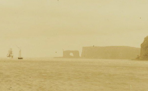
Mont Tizard is a mountain in the French Southern and Antarctic Lands. Located at the southern edge of the Joan of Arc Peninsula, Kerguelen, it rises to a height of above sea level.Google Earth Mont Tizard is the highest point of the Joan of Arc Peninsula. It rises only to the north of the seashore. A small mountain lake lies close to the eastern slope. This mountain was named in 1874 during the Challenger expedition after Thomas Henry Tizard, second-in-command of the HMS Challenger.Gracie Delépine, Toponymie des Terres Australes', éditions La Documentation française, Paris, 1973 See also * Toponymy of the Kerguelen Islands The Kerguelen Islands, an archipelago in the southern Indian Ocean, were discovered uninhabited on February 12, 1772 by Bretons, Breton navigator Yves-Joseph de Kerguelen-Trémarec, Yves Joseph de Kerguelen de Trémarec, and have remained without ... References External linksIPF - Logistics and implementation of science Landforms of the Kerguelen ... [...More Info...] [...Related Items...] OR: [Wikipedia] [Google] [Baidu] |
Sentinel-2
Sentinel-2 is an Earth observation mission from the Copernicus Programme that acquires optical imagery at high spatial resolution (10 m to 60 m) over land and coastal waters. The mission's Sentinel-2A and Sentinel-2B satellites were joined in orbit in 2024 by a third, Sentinel-2C, and in the future by Sentinel-2D, eventually replacing the A and B satellites, respectively. The mission supports services and applications such as agricultural monitoring, emergencies management, land cover classification, and water quality. Sentinel-2 has been developed and is being operated by the European Space Agency. The satellites were manufactured by a consortium led by Airbus Defence and Space in Friedrichshafen, Germany. Overview The Sentinel-2 mission includes: * Multispectral image, Multi-spectral data with 13 bands in the Visible spectrum, visible, Infrared#Regions within the infrared, near infrared, and Infrared#Regions within the infrared, short wave infrared part of the Electromagnetic ... [...More Info...] [...Related Items...] OR: [Wikipedia] [Google] [Baidu] |
Grande-Terre (Kerguelen)
The Kerguelen Islands ( or ; in French commonly ' but officially ', ), also known as the Desolation Islands (' in French), are a group of islands in the subantarctic, sub-Antarctic region. They are among the Extremes on Earth#Remoteness, most isolated places on Earth, with the closest territory being the Heard Island and McDonald Islands territory of Australia located at roughly , and the nearest inhabited territory being Madagascar at more than in distance. The islands, along with Adélie Land, the Crozet Islands, Île Amsterdam, Amsterdam and Île Saint-Paul, Saint Paul islands, and France's Scattered Islands in the Indian Ocean, are part of the French Southern and Antarctic Lands and are administered as a separate district. The islands constitute one of the two exposed parts of the Kerguelen Plateau (the other being Heard Island and the McDonald islands), a large igneous province mostly submerged in the southern Indian Ocean. The main island, Grande Terre, is in area, about ... [...More Info...] [...Related Items...] OR: [Wikipedia] [Google] [Baidu] |
French Southern And Antarctic Lands
The French Southern and Antarctic Lands (, TAAF) is an overseas territory ( or ) of France. It consists of: * Adélie Land (), the French claim on the continent of Antarctica. * Crozet Islands (), a group in the southern Indian Ocean, south of Madagascar. * Kerguelen Islands (), a group of volcanic islands in the southern Indian Ocean, southeast of Africa and southwest of Australia. * Saint Paul and Amsterdam Islands (), a group to the north of the Kerguelen Islands. * Scattered Islands (), a dispersed group of islands around the coast of Madagascar. The territory is sometimes referred to as the French Southern Lands () or the French Southern Territories, usually to emphasize non-recognition of French sovereignty over Adélie Land as part of the Antarctic Treaty System. The entire territory has no known permanently settled inhabitants. Approximately 150 (in the winter) to 310 (in the summer) people are usually present in the French Southern and Antarctic Lands at any time, ... [...More Info...] [...Related Items...] OR: [Wikipedia] [Google] [Baidu] |
Joan Of Arc Peninsula
Joan may refer to: People and fictional characters *Joan (given name), including a list of women, men and fictional characters ** Joan of Arc (c. 1412–1431), patron saint of France *Joan (surname) Art and media * ''Joan'' (Alexander McQueen collection), a fashion collection by Alexander McQueen * ''Joan'' (play), a 2015 one-woman play * ''Joan'' (rock opera), a 1975 rock opera * ''Joan'' (TV series), a 2024 British crime drama Music * ''Joan'' (album), a 1967 album by Joan Baez *Joan (band), an American duo formed in 2017 *"Joan", a song by The Art Bears from their 1978 album ''Hopes and Fears'' *"Joan", a song by Lene Lovich from her 1980 album '' Flex'' *"Joan", a song by Erasure from their 1991 album ''Chorus'' *"Joan", a song by The Innocence Mission from their 1991 album ''Umbrella'' *"Joan", a song by God Is My Co-Pilot from their 1992 album ''I Am Not This Body'' Other uses *Jōan (era), a Japanese era name *Joan Township, Ontario, Canada *List of storms named Joan, ... [...More Info...] [...Related Items...] OR: [Wikipedia] [Google] [Baidu] |
Google Earth
Google Earth is a web mapping, web and computer program created by Google that renders a 3D computer graphics, 3D representation of Earth based primarily on satellite imagery. The program maps the Earth by superimposition, superimposing satellite images, aerial photography, and geographic information system, GIS data onto a 3D globe, allowing users to see cities and landscapes from various angles. Users can explore the globe by entering addresses and coordinates, or by using a Computer keyboard, keyboard or computer mouse, mouse. The program can also be downloaded on a smartphone or Tablet computer, tablet, using a touch screen or stylus to navigate. Users may use the program to add their own data using Keyhole Markup Language and upload them through various sources, such as forums or blogs. Google Earth is able to show various kinds of images overlaid on the surface of the Earth and is also a Web Map Service client. In 2019, Google revealed that Google Earth covers more than 97 ... [...More Info...] [...Related Items...] OR: [Wikipedia] [Google] [Baidu] |
Challenger Expedition
The ''Challenger'' expedition of 1872–1876 was a scientific programme that made many discoveries to lay the foundation of oceanography. The expedition was named after the naval vessel that undertook the trip, . The expedition, initiated by William Benjamin Carpenter, was placed under the scientific supervision of Sir Charles Wyville Thomson—of the University of Edinburgh and Merchiston Castle School—assisted by five other scientists, including Sir John Murray (oceanographer), John Murray, a secretary-artist and a photographer. The Royal Society of London obtained the use of ''Challenger'' from the Royal Navy and in 1872 modified the ship for scientific tasks at Sheerness, equipping it with separate laboratories for natural history and chemistry. The expedition, led by Captain George Nares, sailed from Portsmouth, England, on 21 December 1872. Other naval officers included Commander John Maclear. – pages 19 and 20 list the civilian staff and naval officers and crew, along ... [...More Info...] [...Related Items...] OR: [Wikipedia] [Google] [Baidu] |
Thomas Henry Tizard
Thomas Henry Tizard (1839 – 17 February 1924) was an English oceanographer, hydrographic surveyor, and navigator. He was born in Weymouth, Dorset and educated at the Royal Hospital School, Greenwich, at that time noted for its advanced mathematical training. He entered the Royal Navy by competitive examination as master's assistant in 1854 and served in the Baltic during the Crimean War. In 1860 he was promoted second master and commenced surveying in the Rifleman ''Reed'', during which time he commanded the tender ''Saracen'' for three years. Tizard was largely responsible for an important series of observations on the surface and under-currents in the Straits of Gibraltar, which set at rest the vexed question of the movements of these waters. An atoll in the South China Sea that Tizard surveyed in the 1860s from aboard HMS ''Rifleman'' was later named Tizard Bank after him. Towards the end of 1872 Tizard transferred to . The appointment opened to him the greatest opport ... [...More Info...] [...Related Items...] OR: [Wikipedia] [Google] [Baidu] |
HMS Challenger (1858)
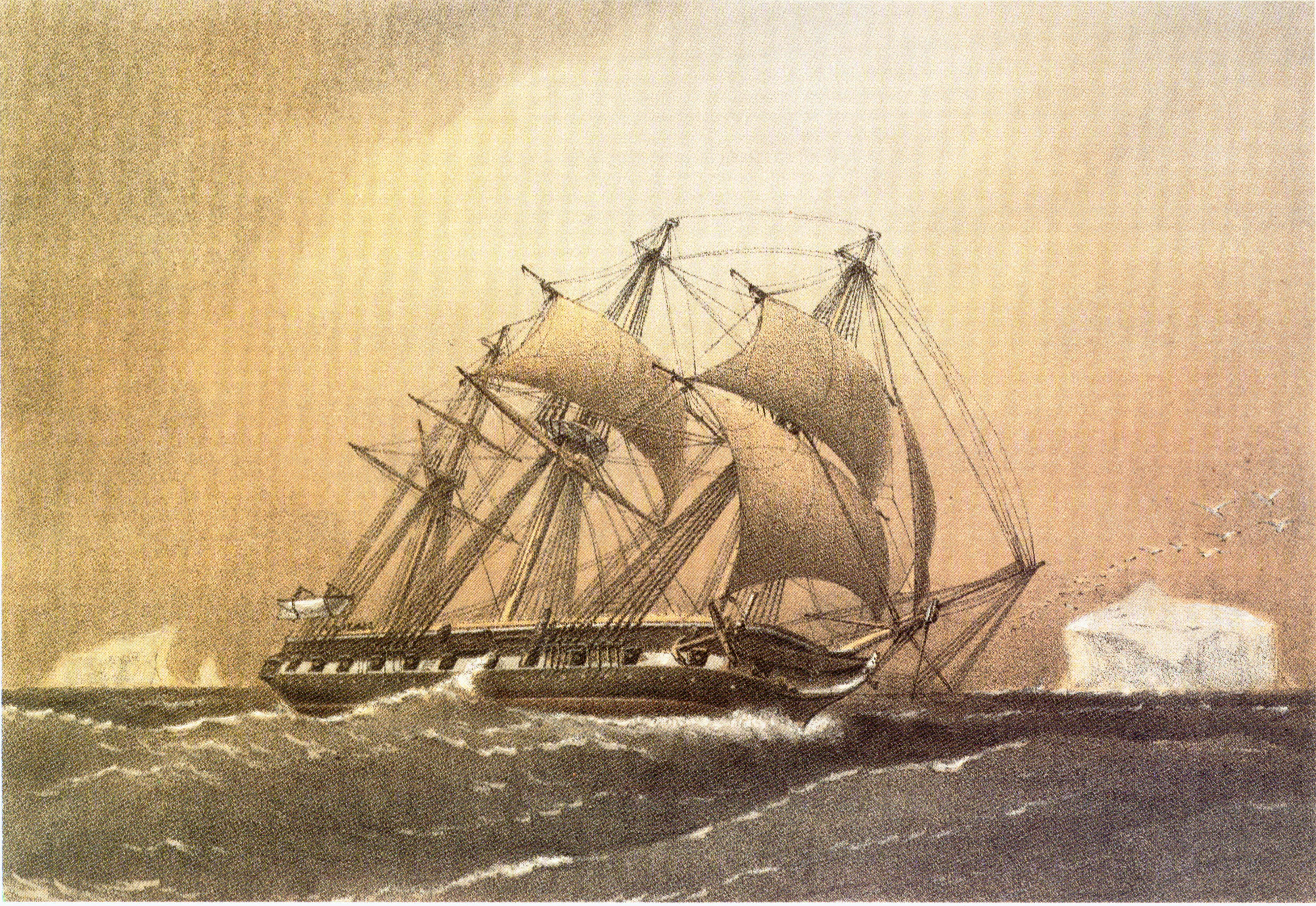
HMS ''Challenger'' was a ''Pearl''-class corvette of the Royal Navy launched on 13 February 1858 at the Woolwich Dockyard. As part of the North America and West Indies Station, she took part in naval operations during the Second French intervention in Mexico, including the occupation of Veracruz, in 1862. She was assigned as the flagship of Australia Station in 1866, undertaking a punitive expedition in Fiji before leaving the station four years later. The Royal Society of London obtained the use of ''Challenger'' from the Royal Navy in 1872 and modified the ship to undertake the first global marine research expedition: the ''Challenger'' expedition (1872–1876). She carried a complement of 243 officers (including commander George Nares), scientists (with Charles Wyville Thomson the chief scientific supervisor) and sailors when she embarked on her journey. The United States Space Shuttle ''Challenger'' was named after the ship. Her figurehead is on display in the foye ... [...More Info...] [...Related Items...] OR: [Wikipedia] [Google] [Baidu] |
Toponymy Of The Kerguelen Islands
The Kerguelen Islands, an archipelago in the southern Indian Ocean, were discovered uninhabited on February 12, 1772 by Bretons, Breton navigator Yves-Joseph de Kerguelen-Trémarec, Yves Joseph de Kerguelen de Trémarec, and have remained without a permanent population ever since. The only residents were during an attempt to set up a farm, a few occasional occupations for whaling activities, and since the 1950s, a French scientific presence. Its toponymy was thus given, starting from a blank page, by the various explorers, whalers and sealers who frequented its waters and anchorages, and then in the 20th century, once French possession of the archipelago had been reaffirmed, by a few French institutions. According to historian Gracie Delépine, the place names of the Kerguelen Islands are "witnesses both to the gradual discovery made by Europeans, and to the intellectual civilization of those same Europeans. Over a thousand toponyms have been left on the archipelago by explorers, h ... [...More Info...] [...Related Items...] OR: [Wikipedia] [Google] [Baidu] |
Landforms Of The Kerguelen Islands
A landform is a land feature on the solid surface of the Earth or other planetary body. They may be natural or may be anthropogenic (caused or influenced by human activity). Landforms together make up a given terrain, and their arrangement in the landscape is known as topography. Landforms include hills, mountains, canyons, and valleys, as well as shoreline features such as bays, peninsulas, and seas, including submerged features such as mid-ocean ridges, volcanoes, and the great oceanic basins. Physical characteristics Landforms are categorized by characteristic physical attributes such as elevation, slope, orientation, structure stratification, rock exposure, and soil type. Gross physical features or landforms include intuitive elements such as berms, cliffs, hills, mounds, peninsulas, ridges, rivers, valleys, volcanoes, and numerous other structural and size-scaled (e.g. ponds vs. lakes, hills vs. mountains) elements including various kinds of inland and oceanic waterbod ... [...More Info...] [...Related Items...] OR: [Wikipedia] [Google] [Baidu] |


