|
Mont Mégantic
Mont Mégantic (; Abenaki: Namesokanjik) is a monadnock located in Québec, Canada, about north of the border between Québec and the U.S. states of Maine and New Hampshire. Mégantic is on the border of the regional county municipalities of Le Granit and Le Haut-Saint-François. Its summit is the highest point of the latter. Many geologists believe that Mont Mégantic is a member of the Monteregian Hills formed by the New England hotspot, as it has the same mechanism and depth of intrusion. Mont Mégantic stands within the watershed of the Saint Lawrence River, which drains into the Gulf of Saint Lawrence. The east side of Mégantic drains into Rivière Victoria, thence into Lac Mégantic, the Chaudière River, and the St. Lawrence. The rest of Mégantic drains into Rivière Au Saumon (Salmon River), thence into the Saint-François River, and the St. Lawrence. An observatory Observatoire du Mont Mégantic (OMM) is located on the mountain's summit, whi ... [...More Info...] [...Related Items...] OR: [Wikipedia] [Google] [Baidu] |
Stoke Mountains
Mont Chapman (elevation ) is the highest peak in the Stoke Mountains of the southern Notre Dame mountain range located in Stoke, Quebec, Canada. It is accessible from trails maintained by Les Sentiers de l'Estrie. From the summit, one is able to see Mont Ham, Mont Ste-Cécile, and Mont Mégantic Mont Mégantic (; Abenaki: Namesokanjik) is a monadnock located in Québec, Canada, about north of the border between Québec and the U.S. states of Maine and New Hampshire. Mégantic is on the border of the regional county municipalities of .... Neighboring Bald Peak (elevation approx. , ) is accessible by these same trails. References External links Les Sentiers de l'Estrie inc.Peakbagger.com page Landforms of Estrie Chapman Tourist attractions in Estrie {{Estrie-geo-stub ... [...More Info...] [...Related Items...] OR: [Wikipedia] [Google] [Baidu] |
New England Hotspot
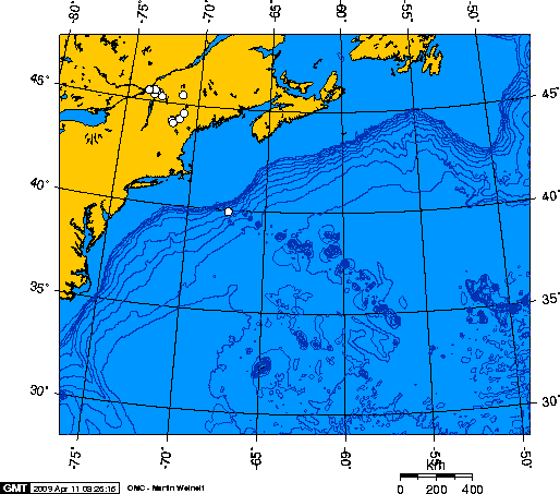
The New England hotspot, also referred to as the Great Meteor hotspot and sometimes the Monteregian hotspot, is a volcanic hotspot in the North Atlantic Ocean. It created the Monteregian Hills intrusions in Montreal and Montérégie, the White Mountains intrusions in New Hampshire, the New England and Corner Rise seamounts off the coast of North America, and the Seewarte Seamounts east of the Mid-Atlantic Ridge on the African Plate, the latter of which include its most recent eruptive center, the Great Meteor Seamount. The New England, Great Meteor, or Monteregian hotspot track has been used to estimate the movement of the North American Plate away from the African Plate from the early Cretaceous period to the present using the fixed hotspot reference frame. Geologic history The geologic history of the New England hotspot is the subject of much debate among geoscientists. The conventional opinion is that volcanic activity associated with the hotspot results from movement ... [...More Info...] [...Related Items...] OR: [Wikipedia] [Google] [Baidu] |
Mont-Mégantic National Park
Mont-Mégantic National Park ''(Parc national du Mont-Mégantic)'' is a provincial park in Quebec, Canada. It is located near the municipality of Notre-Dame-des-Bois in the Estrie region. The park was created in 1994 and is adjacent to the Samuel-Brisson Ecological Reserve which is located northeast of it. Mont Mégantic is the approximate geographic centre of the park. Located at its peak is the Mont Mégantic Observatory, which is the most important astronomical observatory in eastern Canada. Part of the park is also recognized as important area for bird conservation. The park is managed by the Quebec government through the Société des établissements de plein air du Québec (SÉPAQ). Special features of the park The park terrain is characteristic of the frontier mountains in the Appalachia region, although the bulk of it is in fact the most easterly of the Montérégie. Four peaks are accessible by hiking trails including the Pic de l'Aurore ( ), Mont Victoria ... [...More Info...] [...Related Items...] OR: [Wikipedia] [Google] [Baidu] |
Mont Mégantic Observatory
The Mont Mégantic Observatory (, ; OMM) is an astronomical observatory owned and operated jointly by the Université de Montréal (UdeM) and the Université Laval (ULaval). Founded in 1978, the observatory houses the second largest telescope in Eastern Canada after David Dunlap Observatory near Toronto. It is situated at the summit of Mont Mégantic, the highest point of Eastern Canada accessible by car. OMM is about east of Sherbrooke and east of Montreal. The asteroid 4843 Mégantic is named for the observatory. Telescope The Ritchey-Chrétien telescope is equipped with a complement of modern instruments. Imaging, spectroscopy, and polarimetry are routinely conducted at both visible and infrared wavelengths. Light pollution Efforts to control local light pollution, about one-quarter of which is due to the nearby city of Sherbrooke, have led to the establishment of the world's first International Dark-Sky Association (IDA) Dark Sky preserve around the observatory ... [...More Info...] [...Related Items...] OR: [Wikipedia] [Google] [Baidu] |
Observatory
An observatory is a location used for observing terrestrial, marine, or celestial events. Astronomy, climatology/meteorology, geophysics, oceanography and volcanology are examples of disciplines for which observatories have been constructed. The term ''observatoire'' has been used in French since at least 1976 to denote any institution that compiles and presents data on a particular subject (such as public health observatory) or for a particular geographic area (European Audiovisual Observatory). Astronomical observatories Astronomical observatories are mainly divided into four categories: space observatory, space-based, airborne observatory, airborne, ground-based, and underground-based. Historically, ground-based observatories were as simple as containing a mural instrument (for measuring the angle between stars) or Stonehenge (which has some alignments on astronomical phenomena). Ground-based observatories Ground-based observatories, located on the surface of Earth, are u ... [...More Info...] [...Related Items...] OR: [Wikipedia] [Google] [Baidu] |
20040720 OMM
4 (four) is a number, numeral and digit. It is the natural number following 3 and preceding 5. It is a square number, the smallest semiprime and composite number, and is considered unlucky in many East Asian cultures. Evolution of the Hindu-Arabic digit Brahmic numerals represented 1, 2, and 3 with as many lines. 4 was simplified by joining its four lines into a cross that looks like the modern plus sign. The Shunga would add a horizontal line on top of the digit, and the Kshatrapa and Pallava evolved the digit to a point where the speed of writing was a secondary concern. The Arabs' 4 still had the early concept of the cross, but for the sake of efficiency, was made in one stroke by connecting the "western" end to the "northern" end; the "eastern" end was finished off with a curve. The Europeans dropped the finishing curve and gradually made the digit less cursive, ending up with a digit very close to the original Brahmin cross. While the shape of the character for ... [...More Info...] [...Related Items...] OR: [Wikipedia] [Google] [Baidu] |
Saint-François River
The Saint-François River (, ) is a right tributary of the St. Lawrence River in Quebec, Canada. Its source is Lake Saint-François in Chaudière-Appalaches, southeast of Thetford Mines. It flows southwest towards Sherbrooke, where it changes course northwest towards Drummondville, and finally empties into the Saint Lawrence River near Pierreville. Its total length is 135 miles. Etymology The river is named after Saint Francis Xavier (1506–1552) by the Jesuits, who explored the region under the French regime, and after François de Lauzon.François de Lauzon (1635-1647 or 1648), son of Jean de Lauzon Geography Its course is also unusual, as it flows from northeast to southwest to branch off, halfway through, and continue its course from southeast to northwest. The Saint-François River has its origins in the lake Saint-François and heads southwest towards Sherbrooke. Along the way, it crosses the lakes Lake Aylmer and Lake Louise as well as many municipalities. I ... [...More Info...] [...Related Items...] OR: [Wikipedia] [Google] [Baidu] |
Chaudière River
The Chaudière River (; French for "Cauldron" or "Boiler"; Western Abenaki, Abenaki: Kik8ntekw) is a river with its source near the Lac-Mégantic, Quebec, Town of Lac-Mégantic, in southeast Quebec, Canada. From its source Lake Mégantic in the Estrie region, it runs northwards to flow into the St. Lawrence River opposite Quebec City, Quebec, Quebec City. Geography The river's drainage area is , initially in the Appalachian Mountains, then in the low-lands of the St. Lawrence River, St. Lawrence. It includes 236 lakes covering and is populated by approximately 180,000 inhabitants. Its annual medium flow at the station of Saint-Lambert-de-Lauzon, Quebec, Saint-Lambert-de-Lauzon is , varying from (low water) to (spring high water), with historical maximum of . Its principal tributaries are: *Rivière du Loup (not to be confused with Rivière du Loup in the Bas-Saint-Laurent), also known as the Rivière Linière *Famine River *Beaurivage River *Bras Saint-Victor The river's ba ... [...More Info...] [...Related Items...] OR: [Wikipedia] [Google] [Baidu] |
Lac Mégantic
Lac may refer to: Places Africa * Lac Region, a district in Chad * Lac Prefecture, a district in Chad America * Rivière du Lac, a tributary of the Montmorency River, in Capitale-Nationale, Quebec, Canada Europe * Laç, a city in Albania * Lac, a village in Voloiac Commune, Mehedinţi County, Romania * Lac district, a district in the canton of Fribourg, Switzerland * Lancing railway station, a railway station in Sussex, England (station code: LAC) Elsewhere * Lac, a standard astronomical constellation abbreviation of Lacerta * Latin America and the Caribbean or LAC, a regional definition by the United Nations Other uses * Lac (resin), a resinous substance produced by insects **Shellac, the processed form of this resin * ''Lac'', French for lake (body of water) * ''lác'', an element in Anglo-Saxon names meaning "fight, play" *Lac, a character in Arthurian romance, father of Erec * LAC, the ICAO operator designator for Lockheed Corporation (Lockheed Aircraft Corporation) ... [...More Info...] [...Related Items...] OR: [Wikipedia] [Google] [Baidu] |
Gulf Of Saint Lawrence
The Gulf of St. Lawrence is a gulf that fringes the shores of the provinces of Quebec, New Brunswick, Nova Scotia, Prince Edward Island, Newfoundland and Labrador, in Canada, plus the islands Saint-Pierre and Miquelon, possessions of France, in North America. The Gulf of St. Lawrence connects the Great Lakes to the Atlantic Ocean via the St. Lawrence River. Geography Extent The Gulf of St. Lawrence is bounded on the north by the Labrador Peninsula and Quebec, on the east by Saint-Pierre and Newfoundland, on the south by the Nova Scotia peninsula and Cape Breton Island, and on the west by the Gaspé Peninsula, New Brunswick, and Quebec. The Gulf of St. Lawrence contains numerous islands, including Anticosti, Prince Edward, Saint Pierre, Cape Breton, Miquelon-Langlade, and the Îles-de-la-Madeleine archipelago. Half of Canada's ten provinces adjoin the Gulf: New Brunswick, Nova Scotia, Prince Edward Island, Newfoundland and Labrador, and Quebec. There is no consens ... [...More Info...] [...Related Items...] OR: [Wikipedia] [Google] [Baidu] |
Saint Lawrence River
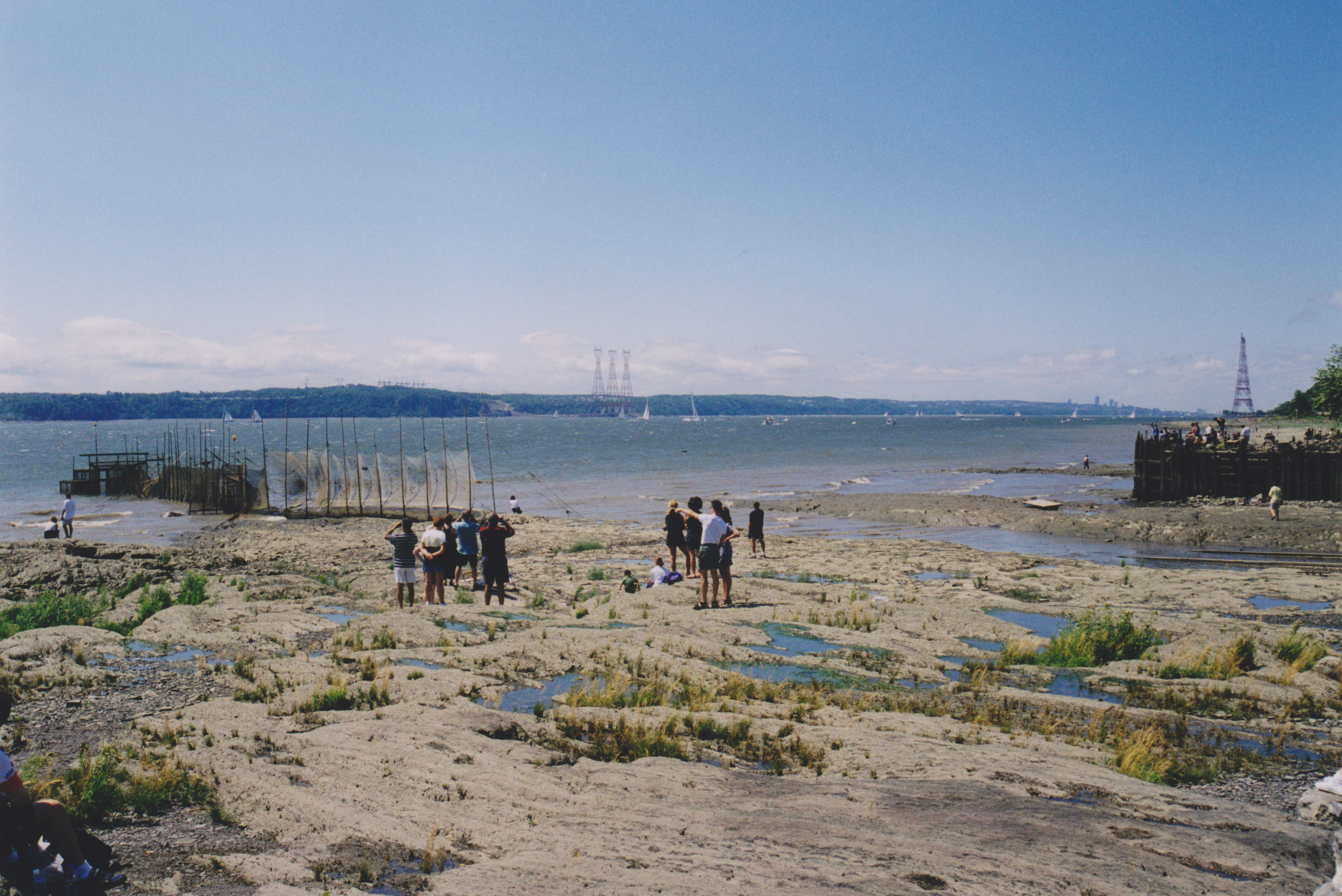
The St. Lawrence River (, ) is a large international river in the middle latitudes of North America connecting the Great Lakes to the North Atlantic Ocean. Its waters flow in a northeasterly direction from Lake Ontario to the Gulf of St. Lawrence, traversing Ontario and Quebec in Canada and New York (state), New York in the United States. A section of the river demarcates the Canada–United States border, Canada–U.S. border. As the primary Discharge (hydrology), drainage outflow of the Great Lakes Basin, the St. Lawrence has the List of rivers by discharge, second-highest discharge of any river in North America (after the Mississippi River) and the 16th-highest in the world. The estuary of St. Lawrence, estuary of the St. Lawrence is often cited by scientists as the largest in the world. Significant natural landmarks of the river and estuary include the 1,864 river islands of the Thousand Islands, the endangered whales of Saguenay–St. Lawrence Marine Park, and the limestone ... [...More Info...] [...Related Items...] OR: [Wikipedia] [Google] [Baidu] |


