|
Minnesota State Highway 322
Minnesota State Highway 322 (MN 322) was a state highway in the city of Brainerd. It ran for two blocks along Oak Street providing a short connection between Minnesota State Highway 371 (now Highway 371 - Business) and Minnesota State Highway 18. It existed until after the completion of the Highway 371 Brainerd bypass in 2000, when it was turned back, along with portions of Highways 18 and 25, to local jurisdiction in order to compensate for the additional mileage of state highway resulting from the new bypass. Route description Before the turnback of state highways resulting from the opening of the Brainerd bypass, Highway 18 ran west of its current terminus at Highway 25 along Oak Street to 8th Street. It then turned north and ran along 8th Street for just under a half mile to its former terminus at Highway 210. Highway 322 continued west on Oak Street from 8th Street for two blocks until Highway 371 (6th Street). The function of Highway 322 as a very short connecting route ... [...More Info...] [...Related Items...] OR: [Wikipedia] [Google] [Baidu] |
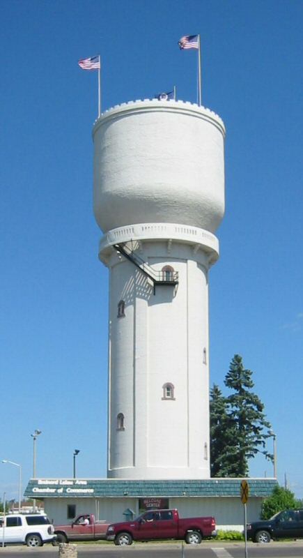
Brainerd, Minnesota
Brainerd is a city in Crow Wing County, Minnesota, United States. Its population was 14,395 at the 2020 census. It is the county seat of Crow Wing County. Brainerd straddles the Mississippi River several miles upstream from its confluence with the Crow Wing River, having been founded as a site for a railroad crossing above the confluence. Brainerd is the principal city of the Brainerd Micropolitan Area, a micropolitan area covering Cass and Crow Wing counties and with a combined population of 96,189 at the 2020 census. The city is well known for being the partial setting of the 1996 film ''Fargo''. History The area that is now Brainerd was formerly Ojibwe territory. Brainerd was first seen by European settlers on Christmas Day in 1805, when Zebulon Pike stopped there while searching for the headwaters of the Mississippi River. Crow Wing Village, a fur and logging community near Fort Ripley, brought settlers to the area in the mid-19th century. In those early year ... [...More Info...] [...Related Items...] OR: [Wikipedia] [Google] [Baidu] |
Minnesota State Highway 371
Minnesota State Highway 371 (MN 371) is a highway in central and north-central Minnesota. The route connects Minnesota's northern lakes region with the central part of the state. It runs south–north from U.S. Highway 10 (US 10) in Little Falls to US 2 in Cass Lake. MN 371 has become a heavily traveled arterial route that was once a two-lane roadway over almost all of its length, but has been widened to four lanes across most of its southern half. Much of the traffic utilizing the route is Twin Cities-based traffic heading to their cabins on one of the many northern lakes. Route description MN 371 serves as a south–north route in central and north-central Minnesota between Little Falls, Baxter, Brainerd, Nisswa, Pequot Lakes, Walker, and Cass Lake. Highway 371 departs from US 10 at Little Falls heading to the north, paralleling the Mississippi River on the east side of the river. MN 371 is a freeway-standard route coming ... [...More Info...] [...Related Items...] OR: [Wikipedia] [Google] [Baidu] |
Minnesota State Highway 18
Minnesota State Highway 18 (MN 18) is a highway in east-central Minnesota, which runs from its intersection with State Highway 25 in Brainerd and continues east to its eastern terminus at its intersection with State Highway 23 in Finlayson Township near Askov and Sandstone. The eastern terminus of Highway 18 is less than 1/2 mile west of an interchange with Interstate Highway 35 along Highway 23. For part of its route (5 miles), Highway 18 runs concurrent with U.S. Highway 169 in Crow Wing and Aitkin counties around the northwest side of Mille Lacs Lake. Highway 18 also runs together with State Highway 47 for in Aitkin and Mille Lacs counties around the northeast side of Mille Lacs Lake. Route description State Highway 18 serves as an east–west route between Brainerd, Garrison, Mille Lacs Lake, and Finlayson in east-central Minnesota. The route passes around the north end of Mille Lacs Lake, which is a popular fishing and recreational destination in Mi ... [...More Info...] [...Related Items...] OR: [Wikipedia] [Google] [Baidu] |
Minnesota State Highway 25
Minnesota State Highway 25 (MN 25) is a highway in Minnesota, which runs from its interchange with U.S. Highway 169 in Belle Plaine and continues north to its intersection with State Highway 210 in Brainerd. Route description State Highway 25 serves as a north–south route in central Minnesota between Belle Plaine, Norwood Young America, Watertown, Buffalo, Monticello, Big Lake, Becker, Foley, and Brainerd. The route travels east–west between Belle Plaine and Green Isle for 15 miles. Highway 25 crosses the Minnesota River at Belle Plaine. The route crosses the Highway 25 Bridge at the Mississippi River between Monticello and Big Lake. History State Highway 25 was authorized November 2, 1920 from Belle Plaine to Big Lake. The roadway was fully graveled by 1928. It was paved in stages from north to south throughout the 1930s: from Big Lake to Buffalo in 1931, Buffalo to Montrose in 1932, Montrose to Watertown in 1933, and Watertown to Norwood in 1934. Pavin ... [...More Info...] [...Related Items...] OR: [Wikipedia] [Google] [Baidu] |
Minnesota State Highway 210
Minnesota State Highway 210 (MN 210) is a state highway in west-central, central, and northeast Minnesota, which runs from North Dakota Highway 210 (ND 210) at the North Dakota state line (at Breckenridge), and continues east to its eastern terminus at its intersection with MN 23 in Duluth near the Saint Louis River. The route runs across Minnesota from west-central to northeast; connecting Fergus Falls, Brainerd, and Duluth. At the western terminus of MN 210, upon crossing the Red River, the roadway becomes ND 210 and feeds into ND 13. MN 210 is in length. Route description MN 210 serves as an east–west route in west-central, central, and northeast Minnesota between Breckenridge, Fergus Falls, Staples, Baxter, Brainerd, Carlton, and Duluth. For part of its route (), MN 210 is concurrent with US Highway 10 (US 10) between Motley and Staples in central Minnesota. The highway crosses the Washington S ... [...More Info...] [...Related Items...] OR: [Wikipedia] [Google] [Baidu] |


