|
Milstead
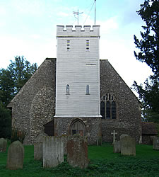
Milstead is a village and civil parish in the borough of Swale in Kent, England. It is surrounded by the villages of Frinsted, Wichling, Doddington and Lynsted in Kent, England. It is the southernmost parish in the Sittingbourne area, and is approximately from Sittingbourne town centre, just south of the M2 motorway. According to Edward Hasted in 1798, "the parish is but small, containing about of land, of which about acres are woodland." He refers to it as 'Milsted'. The parish was under the dominion of the Manor of Milton Regis in the reign of Edward I. In 1870-72, according to John Marius Wilson's Imperial Gazetteer of England and Wales, the parish comprised . Its population was 245 and it had 43 houses. Within the village is the Grade II listed In the United Kingdom, a listed building is a structure of particular architectural or historic interest deserving of special protection. Such buildings are placed on one of the four statutory lists maintained by Hist ... [...More Info...] [...Related Items...] OR: [Wikipedia] [Google] [Baidu] |
Milstead Village Sign On Village Hall - Geograph
Milstead is a village and civil parish in the borough of Borough of Swale, Swale in Kent, England. It is surrounded by the villages of Frinsted, Wichling, Doddington, Kent, Doddington and Lynsted in Kent, England. It is the southernmost parish in the Sittingbourne area, and is approximately from Sittingbourne town centre, just south of the M2 motorway (Great Britain), M2 motorway. According to Edward Hasted in 1798, "the parish is but small, containing about of land, of which about acres are woodland." He refers to it as 'Milsted'. The parish was under the dominion of the Manor of Milton Regis in the reign of Edward I. In 1870-72, according to John Marius Wilson's Imperial Gazetteer of England and Wales, the parish comprised . Its population was 245 and it had 43 houses. Within the village is the Grade II listed Church of St Mary and the Holy Cross, within the diocese of Canterbury, and deanery of Sittingborne. The village now contains around 80 houses and cottages of ... [...More Info...] [...Related Items...] OR: [Wikipedia] [Google] [Baidu] |
Frinsted
Frinsted or FrinsteadYoungs, F., Local Administrative Units: Southern England (London: Royal Historical Society, 1979), p. 271 is a small village and civil parish in the ecclesiastical parish of Wormshill and in the Maidstone District of Kent, England. and has been a recorded settlement (under the name Fredenestede) as far back as the Domesday Book and indeed was the only settlement in the surrounding area to be described at the time to have a church.Frinsted entry in the Domesday Book of 1086, at the NationalArchives.gov,uk The village exists in the of Eyhorne (and has been mentioned as such dating back to the |
Borough Of Swale
Swale is a Non-metropolitan district, local government district with Borough status in the United Kingdom, borough status in Kent, England. The council is based in Sittingbourne, the borough's largest town. The borough also contains the towns of Faversham, Queenborough and Sheerness, along with numerous villages and surrounding rural areas. It includes the Isle of Sheppey and is named after The Swale, the narrow channel which separates Sheppey from the mainland part of the borough. Some southern parts of the borough lie within the Kent Downs, a designated Area of Outstanding Natural Beauty. The borough borders the Medway unitary authority area to the west, the Borough of Maidstone to the south-west, the Borough of Ashford to the south-east, and the City of Canterbury to the east. Under proposed reorganisation in either April 2027 or 2028 the borough will face abolition and will join with one or more adjoining councils to form a new Unitary Authority. Details of such proposals ar ... [...More Info...] [...Related Items...] OR: [Wikipedia] [Google] [Baidu] |
Doddington, Kent
Doddington is a village and civil parish in the district of Swale in Kent, England. The Syndale Valley shelters the central part in the Kent Downs Area of outstanding natural beauty. Today the village is notable for Doddington Place Gardens, for its remarkably well kept buildings and its house prices show higher prices than the home counties average. History Within the parish at Sharsted Court, earthworks excavated were believed remains of an Iron Age Belgic Fort (100 BC – 43 AD). However the current village settlement dates from the 11th century. Of particular note is Doddington Church with the unusual dedication of "The (decollation) Beheading of St. John the Baptist". The dedication dates from at least 1467 when it is referenced in a will. Other notable buildings within the parish are: ''Doddington Place'' built in 1870 for the Croft family (of 'Croft original sherry' fame) who owned it until 1906 when the Jeffreys and Oldfied families jointly purchased it. It is s ... [...More Info...] [...Related Items...] OR: [Wikipedia] [Google] [Baidu] |
Villages In Kent ...
See also * List of settlements in Kent by population * List of civil parishes in Kent * :Civil parishes in Kent * :Towns in Kent * :Villages in Kent * :Geography of Kent * List of places in England {{Kent Places Kent Kent is a Ceremonial counties of England, ceremonial county in South East England. It is bordered by Essex across the Thames Estuary to the north, the Strait of Dover to the south-east, East Sussex to the south-west, Surrey to the west, and Gr ... [...More Info...] [...Related Items...] OR: [Wikipedia] [Google] [Baidu] |
Wichling
Wichling (otherwise Wychling) is a village and civil parish within the local government district of Maidstone, in England. The parish lies approximately to the east of Maidstone. It lies near the top of the ridge of the North Downs and consists mainly of isolated farms and houses: the population is therefore small in number. A small settlement was recorded in Domesday Book as "Winchelsmere". The Lord of the manor was Hugh, nephew of Herbert ("the same Hugh") who held the land from the Bishop of Bayeux, at that time Odo of Bayeux. There was ploughed land of around (half a " sulung"), there was enough woodland for 5 pigs and the church is mentioned. Before the Norman Conquest it had been worth 100 shillings (£5), but after the conquest was only worth 40 shillings (£2). The parish church dedicated to St Margaret was begun in the 12th century and restored 1882–3 by Clarke. The church has two bells set for swing chiming by lever, the earliest of which is from 1430 by John ... [...More Info...] [...Related Items...] OR: [Wikipedia] [Google] [Baidu] |
Canterbury
Canterbury (, ) is a City status in the United Kingdom, city and UNESCO World Heritage Site, in the county of Kent, England; it was a county borough until 1974. It lies on the River Stour, Kent, River Stour. The city has a mild oceanic climate. Canterbury is a popular tourist destination, with the city's economy heavily reliant upon tourism, alongside higher education and retail. As of 2011, the city's population was over 55,000, including a substantial number of students and one of the highest student-to-permanent-resident ratios in Britain. The site of the city has been occupied since Paleolithic times and served as the capital of the Celtic Cantiaci and Jutes, Jute Kingdom of Kent. Many historical structures fill the area, including a city wall founded in Roman Britain, Roman times and rebuilt in the 14th century, the Westgate Towers museum, the ruins of St Augustine's Abbey, the Norman Canterbury Castle, and the List of the oldest schools in the world, oldest extant schoo ... [...More Info...] [...Related Items...] OR: [Wikipedia] [Google] [Baidu] |
Remembrance Day
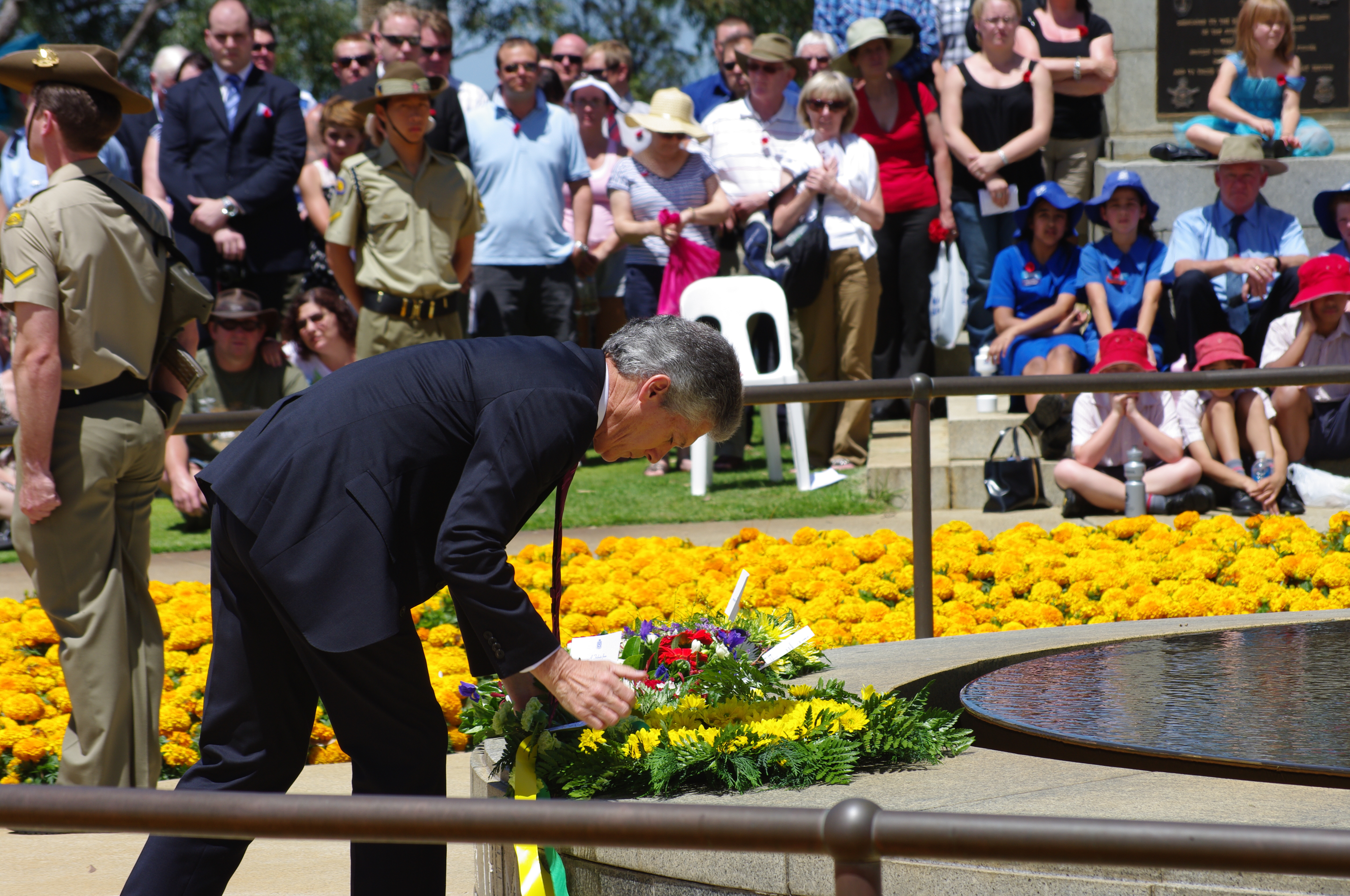
Remembrance Day (also known as Poppy Day owing to the tradition of wearing a remembrance poppy) is a memorial day observed in Commonwealth of Nations, Commonwealth member states since the end of the First World War to honour armed forces members who have died in the line of duty. The day is also marked by war remembrances in several other non-Commonwealth countries. In most countries, Remembrance Day is observed on 11 November to recall the end of First World War hostilities. Hostilities ended "at the 11th hour of the 11th day of the 11th month" of 1918, in accordance with Armistice with Germany (Compiègne), the armistice signed by representatives of Germany and the Entente between 5:12 and 5:20 that morning. ("At the 11th hour" refers to the ''passing'' of the 11th hour, or 11:00 am.) The First World War formally ended with the signing of the Treaty of Versailles on 28 June 1919. The tradition of Remembrance Day evolved out of Armistice Day. The initial Armistice Day ... [...More Info...] [...Related Items...] OR: [Wikipedia] [Google] [Baidu] |
Swanage
Swanage () is a coastal town and civil parish in the south east of Dorset, England. It is at the eastern end of the Isle of Purbeck and one of its two towns, approximately south of Poole and east of Dorchester, Dorset, Dorchester. In the United Kingdom Census 2011, 2011 census the civil parish had a population of 9,601. Nearby are Ballard Down and Old Harry Rocks, with Studland Bay and Poole Harbour to the north. Within the parish are Durlston Bay and Durlston Country Park to the south of the town. The parish also includes the areas of Herston, Dorset, Herston, just to the west of the town, and Durlston, just to the south. The town, originally a small port and fishing village, flourished in the Victorian era, when it first became a significant quarrying port and later a seaside resort for the rich of the day. Today the town remains a popular tourist resort, this being the town's primary industry, with many thousands of visitors coming to the town during the peak summer season, ... [...More Info...] [...Related Items...] OR: [Wikipedia] [Google] [Baidu] |
Douglas Bader
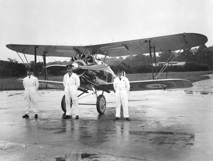
Group Captain Sir Douglas Robert Steuart Bader, (; 21 February 1910 – 5 September 1982) was a Royal Air Force flying ace during the Second World War. He was credited with 22 aerial victories, four shared victories, six probables, one shared probable and 11 enemy aircraft damaged. Bader joined the RAF in 1928, and was commissioned in 1930. In December 1931, while attempting aerobatics, he crashed and lost the lower part of both his legs. Having been on the brink of death, he recovered, retook flight training, passed his check flights and then requested reactivation as a pilot. Although there were no regulations applicable to his situation, he was retired against his will on medical grounds. After the outbreak of the Second World War in 1939, however, Bader returned to the RAF and was accepted as a pilot. He scored his first victories over Dunkirk during the Battle of France in 1940. He then took part in the Battle of Britain and became a friend and supporter of Air Vice Marsh ... [...More Info...] [...Related Items...] OR: [Wikipedia] [Google] [Baidu] |
RAF Duxford
Duxford is a village in Cambridgeshire, England, about south of Cambridge. It is part of the Hundred Parishes area. History The village formed on the banks of the River Cam, a little below its emergence from the hills of north Essex. One of the more populous settlements in its hundred, it was split into two ecclesiastical parishes in medieval times until they were united in 1834. Originally known as ''Duxworth'' and listed as ''Dukeswrthe'' in the 10th century, and ''Dochesuuorde'' in the Domesday Book of 1086, the village's name comes from "Worth (enclosure) of a man called Duc". Churches The village has two Grade I listed medieval parish churches, St John's Church and St Peter's Church. The two parishes were combined in 1874, services being held thereafter at St Peter's; St John's remained a chapel of ease and finally declared redundant. Still consecrated, it is now in the care of The Churches Conservation Trust. The churchyard has been cleared of headstones and is maint ... [...More Info...] [...Related Items...] OR: [Wikipedia] [Google] [Baidu] |
Messerschmitt Bf 109
The Messerschmitt Bf 109 is a monoplane fighter aircraft that was designed and initially produced by the Nazi Germany, German aircraft manufacturer Messerschmitt#History, Bayerische Flugzeugwerke (BFW). Together with the Focke-Wulf Fw 190, the Bf 109 formed the backbone of the ''Luftwaffe's'' fighter force during the World War II. It was commonly called the Me 109 by Allied aircrew and some German aces/pilots, even though this was not the official model designation. The Bf 109 was designed by Willy Messerschmitt and Robert Lusser, who worked at BFW during the early to mid-1930s. It was conceived as an interceptor aircraft, interceptor. However, later models were developed to fulfill multiple tasks, serving as Escort fighter, bomber escort, fighter-bomber, day fighter, day-, night fighter, night-, all-weather fighter, ground-attack aircraft, and aerial reconnaissance aircraft. It was one of the most advanced fighters when the fighter first appeared, being furnished with an all-me ... [...More Info...] [...Related Items...] OR: [Wikipedia] [Google] [Baidu] |


